Install
Central 14th Street / WMATA Northern Bus Barn, DC Weather
Current conditions
Observed at Washington/Reagan National Airport, DC · 31 min ago
Forecast
10-day-
Tonight
Mostly clear, with a low around 50. Northwest wind around 6 mph.
-
Tuesday
Sunny, with a high near 69. Northeast wind 3 to 7 mph.
-
Tuesday Night
Partly cloudy, with a low around 50. East wind around 5 mph.
National Weather Service forecast updated 4 hrs ago.
Hourly
Hourly forecast- Now57°
- 10 PM56°
- 11 PM55°
- Tue12 AM54°
- 1 AM54°
- 2 AM53°
- 3 AM52°
- 4 AM51°
- 5 AM51°
- 6 AM51°
- 7 AM51°
- 8 AM50°
- 9 AM54°
- 10 AM59°
- 11 AM62°
- 12 PM64°
- 1 PM66°
- 2 PM67°
- 3 PM68°
- 4 PM68°
- 5 PM67°
- 6 PM65°
- 7 PM63°
- 8 PM58°
Daily forecast
Details- TonightOct 26Mostly Clear50°
- TueOct 27Sunny50°69°
- WedOct 28Mostly Sunny51°68°
- ThuOct 29Mostly Sunny52°72°
- FriOct 30Sunny53°77°
- SatOct 31Partly Sunny53°71°
- SunNov 1Mostly Cloudy18%56°69°
- MonNov 2Slight Chance Rain Showers18%70°
- TueNov 3Light rain0.20 in53°68°
Days after the National Weather Service's seven are MET Norway's outlook, a computer model with no forecaster's review.
Radar
Full mapWeather news in District of Columbia
More weather news-
 Boston Weather: ‘Perfect autumn weather’ with dry, mildly cool days through to Halloween
“Really it’s a great time to do any outdoor autumn activities, like going to corn mazes, checking out the foliage, apple picking,” said NWS lead meteorologist Andrew Loconto. “It’s an ideal time of year, ideal weather…
- Cyclone Arnab Alert: Several States May Be Affected, Check the Latest Weather Update
According to the Meteorological Department's latest bulletin, the low pressure area over the Bay of Bengal is likely to persist in the same region and intensify into a depression on Saturday.
- Cyclone Arnab: Storm with Winds of Up to 140 km/h! States on Alert
The storm is expected to move toward the coasts of northern Andhra Pradesh and southern Odisha within the next four days, around October 28th. Cyclone Arnab: A cyclonic storm is expected to form in the Bay of Bengal…
-
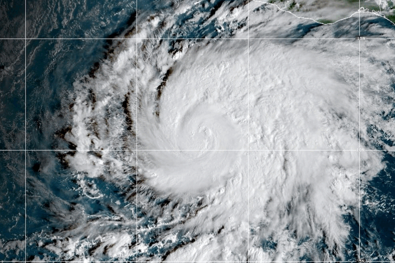 Vance Intensifies Rapidly and Could Become a Major Category 3 Hurricane Off Mexico’s Pacific Coast
MIAMI—Hurricane Vance rapidly strengthened into a Category 2 storm Friday as it neared Mexico’s Pacific Coast, the National Hurricane Center said. Vance had maximum sustained winds of 105 mph (170 kph) as it churned…
-
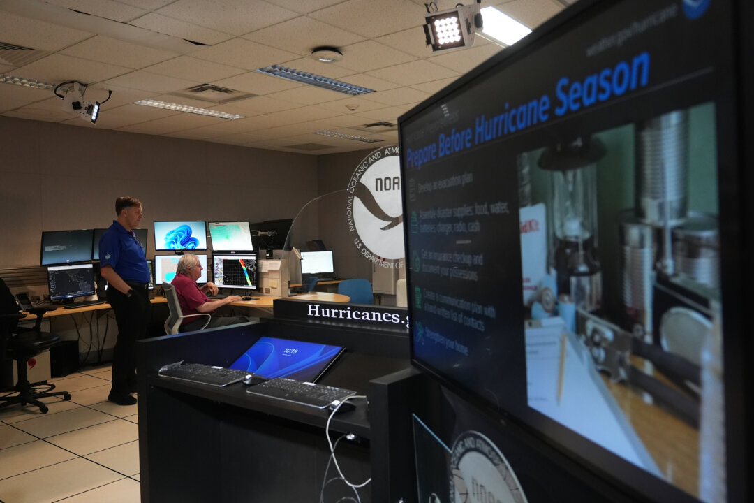 With Hurricane Off Mexico Sharing Name With Vice President JD Vance, the Social Media Memes Fly
As Vice President JD Vance travels the U.S. supporting Republican candidates in next month’s election, another Vance is on a whirlwind tour off Mexico’s Pacific Coast. The storm named Vance that strengthened into a…
-
 How Should I Adjust My Fall Home Maintenance Plans When the Weather Doesn’t Follow the Calendar?
NOAA is forecasting a strengthening El Niño this fall and winter so homeowners may be wondering whether their usual seasonal maintenance routine needs a change. How Should I Adjust My Fall Home Maintenance Plans When…
-
 Vance could be a major Category 3 hurricane Friday as it nears Mexico
Vance was a Category 1 hurricane with maximum sustained winds of 85 mph as it churned about 440 miles south-southwest of Acapulco, and could become a major Category 3 hurricane before the end of ... Vance was a Category…
- Cyclone Threat Looms Over Bay of Bengal, Heavy Rain Alert Issued in Several States
The Meteorological Department has released heavy rain alerts across numerous regions nationwide. Cyclone Alert: A developing low pressure system in the Bay of Bengal is creating concerns about potential cyclone…
-
 Tropical Storm Vance has formed in the Pacific Ocean
Vance was located about 520 miles south of Acapulco, Mexico, on Wednesday afternoon. The center of the cyclone was at sea and posed no threat to land. Vance was located about 520 miles south of Acapulco, Mexico. Maximum…
Air quality
Acceptable. Unusually sensitive people should consider limiting prolonged outdoor exertion.
Forecast
- MonGood (50)
- TueModerate (53)
- WedModerate (53)
Northern Virginia and DC, DC reporting area · 1 hr ago. Data from AirNow (EPA and its state, local and tribal partners); preliminary and subject to change.
Sun & moon
Almanac
MonthlyWashington Area, records since 1871. Normals 1991–2020. Data from NOAA's Regional Climate Centers (ACIS).
Nearby
- Washington 6 km
- Arlington 9 km
- Alexandria 16 km
- Columbia 37 km
- Germantown 33 km
- Silver Spring 5 km
- Centreville 36 km
- Waldorf 37 km
- Glen Burnie 43 km
- Gaithersburg 26 km
- Rockville 19 km
- Dale City 42 km
Forecasters' discussion
From the National Weather Service office in LWX, issued 2 hrs ago
What Has Changed
The benign weather pattern continues on with seasonable to above normal temperatures through the remainder of the workweek.
Key Messages
- 1) Benign weather continues through the remainder of October with near to above normal temperatures expected.
- 2) Precipitation chances return in early November.
Discussion
KEY MESSAGE 1...Benign weather continues through the remainder of October with near to above normal temperatures expected.
Surface high pressure will continue to build south and west toward the central Appalachians and Mid-South tonight. Meanwhile, low pressure over the Canadian Maritimes will drive a weakened cold front into the region from the north and west Tuesday. The front will cross the area Tuesday morning before stalling/washing out to the south/east Tuesday afternoon. By Wednesday morning, the same front will retreat back to the north as a warm front with another large area of high pressure building to the north Thursday through Saturday. As a result, expect passing high clouds and a series of wind shifts with each of the frontal passages. Winds will remain light out of the north and northwest this evening through Tuesday. Winds will change to the south and southwest late Wednesday through Friday. This will yield seasonable to above normal temperatures for the remainder of the workweek. Highs will generally range from the mid 60s and low 70s though Wednesday with low to mid 70s Thursday and mid to upper 70s Friday. This is thanks to the position of the high to the north leading to increased southeast to southwest winds across the region. Overnight lows will remain warm as well in the mid 40s and low 50s.
Dry conditions will continue through Saturday although this will be a day of transition as the pattern begins to loosen. Upper level ridging will buckle with an incoming trough from the Midwest region. This trough will ultimately bring an end to the dry conditions with increasing cloud cover and precipitation chances heading into the first few days of November. Despite the increased cloud cover, expect highs Saturday back in the upper 60s and low 70s.
KEY MESSAGE 2...Precipitation chances return in early November.
Upper-level ridging overhead breaks down into zonal flow beginning Saturday into Sunday. Conditions likely start to become cloudier throughout the day Saturday as troughing develops over the Ohio River Valley before heading east Sunday into Monday. This likely brings the first chances for precipitation over the Mid- Atlantic in over a week, although overall breadth and total rainfall from this system remain uncertain at this time.
Temperatures likely drop back to the low-70s over the weekend in the wake of another weak front. With overnight lows generally remaining in the 40s and 50s, this ranges somewhat above normal for the beginning of November. Looking ahead, model guidance hints at a second, potentially more potent upper-level trough approaching the area that could bring additional chances for precipitation sometime next week.
Aviation
Prevailing VFR conditions are expected through Tuesday night. Winds will remain light out of the west and northwest this evening before becoming northerly late tonight into Tuesday morning as a dry cold front pushes through. Patchy fog remains possible, but does not appear as prevalent this morning outside of sheltered valley locations west of Blue Ridge and those directly along the water. Milder temperatures combined with subtle mixing along the front will yield the lower confidence for fog tonight across the terminals.
Winds will change from the north Tuesday to the northeast Tuesday night into Wednesday ahead of an incumbent warm frontal boundary. This will leads to the potential for low clouds and fog, especially at CHO and MRB given the marine influence /increased surface moisture banking along the eastern side of the Blue Ridge mountains. Confidence in this is low although hi-res models have shown some consistency in recent cycles. VFR conditions are expected Wednesday night through Saturday as high pressure builds along the coast. Winds will turn south to southwesterly Thursday before becoming easterly Saturday. The next chance for rain showers occurs Sunday with an incoming cold front, but uncertainty remains high at this time.
Forecasts, observations and alerts in the United States come from the National Weather Service (NOAA); radar from NOAA's Multi-Radar Multi-Sensor system; satellite imagery from NASA's Global Imagery Browse Services (GIBS) and NOAA's GOES satellites; the map from the U.S. Geological Survey's National Map; air quality from AirNow (EPA and its partners); hurricane information from the National Hurricane Center; climate normals and records from NOAA's Regional Climate Centers (ACIS). Forecasts outside the United States and the UV index: MET Norway (CC BY 4.0); observations outside the U.S.: airport reports via NOAA's Aviation Weather Center. Place names: GeoNames (CC BY 4.0). Data are copied on a schedule and may lag the sources; for warnings that affect your safety, follow your local National Weather Service office and emergency officials. Weather news is drawn from the 4Conservative index and reflects what the press published. Terms of use. How to use Weather