Install
Center, CO Weather
Current conditions
Forecast for this hour (no station report in the last two hours)
Forecast
10-day-
Thursday Night
Showers and thunderstorms. Mostly cloudy, with a low around 42. South southeast wind 10 to 15 mph. Chance of precipitation is 90%. New rainfall amounts between a quarter and half of an inch possible.
-
Friday
A chance of showers and thunderstorms before noon, then a slight chance of showers and thunderstorms. Mostly sunny, with a high near 60. South southwest wind 10 to 20 mph. Chance of precipitation is 30%.
-
Friday Night
A slight chance of rain showers after midnight. Mostly clear, with a low around 32. West southwest wind 5 to 10 mph. Chance of precipitation is 20%.
National Weather Service forecast updated 2 days ago.
Hourly
Hourly forecast- Now49°93%
- 1 AM48°93%
- 2 AM47°93%
- 3 AM46°93%
- 4 AM44°93%
- 5 AM43°93%
- 6 AM42°31%
- 7 AM42°31%
- 8 AM44°31%
- 9 AM46°31%
- 10 AM49°31%
- 11 AM53°31%
- 12 PM56°10%
- 1 PM59°10%
- 2 PM60°10%
- 3 PM60°10%
- 4 PM59°10%
- 5 PM57°10%
- 6 PM53°11%
- 7 PM49°11%
- 8 PM46°11%
- 9 PM43°11%
- 10 PM41°11%
- 11 PM39°11%
10-day forecast
Details- TueOct 20Slight Chance Rain Showers then Mostly Sunny16%34°64°
- WedOct 21Partly Sunny then Slight Chance Showers And Thunderstorms52%43°64°
- ThuOct 22Showers And Thunderstorms93%42°65°
- TodayOct 23Chance Showers And Thunderstorms then Slight Chance Showers And Thunderstorms31%32°60°
- SatOct 24Slight Chance Rain Showers then Slight Chance Showers And Thunderstorms26%30°54°
- SunOct 25Mostly Sunny31°55°
- MonOct 26Mostly Sunny31°55°
- TueOct 27Cloudy0.02 in34°49°
- WedOct 28Cloudy29°48°
- ThuOct 29Cloudy31°51°
Days after the National Weather Service's seven are MET Norway's outlook, a computer model with no forecaster's review.
Radar
Full mapWeather news near Center
More weather news-
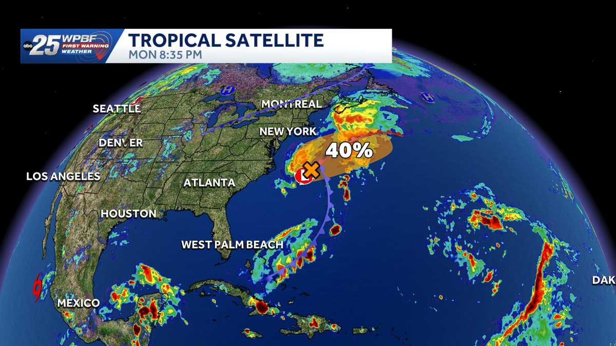 National Hurricane Center tracks Invest 93-L off U.S. East Coast
The National Hurricane Center is monitoring Invest 93-L off the coast of the United States. The NHC said in its Tropical Weather Outlook on Monday night that a storm-force non-tropical low-pressure area is attached to…
-
 National Hurricane Center eyes subtropical development near Carolinas, off SWFL coast
WINK News A new outlook was just released from the National Hurricane Center tonight, not only increasing potential tropical formation chances but giving us our latest area of investigation This spin is present near due…
-
 Hurricane center continues to track system off US East Coast
The National Hurricane Center continued Monday to keep an eye on a system off the U.S. East Coast with the potential to develop into a more dangerous storm. As of the NHC’s 8 a.m. tropical outlook, a nontropical area of…
-
 Hurricane center tracks system off East Coast
ORLANDO, Fla. — The National Hurricane Center continued Monday to keep an eye on a system off the U.S. East Coast with the potential to develop into a more dangerous storm. ORLANDO, Fla. — The National Hurricane Center…
-
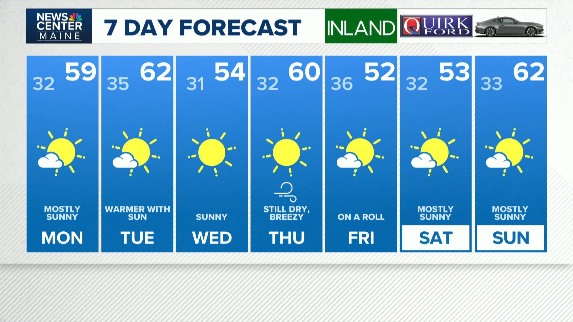 NEWS CENTER Maine Weather Video Forecast
newscentermaine.com NEWS CENTER Maine Weather Video Forecast To stream NCM on your phone, you need the NCM app. Download the NCM app Next up in 5 Example video title will go here for this video Before You Leave, Check…
-
 Hurricane center tracking system off US East Coast
The National Hurricane Center continued Sunday to forecast a system could develop off the U.S. East Coast that has the potential to develop into a more dangerous storm. As of the NHC’s 8 a.m. tropical outlook, a…
-
 Code Blue shelters open across Southern Tier as temperatures drop
JOHNSON CITY, N.Y. (WBNG) -- As temperatures drop across the Southern Tier, Code Blue shelters are providing warm places to stay. In Broome County, the overnight warming center at United Presbyterian Church in…
-
 Super Typhoon Champi churns across Pacific as another tropical threat begins to take shape
☔ 🌊 TRACKING CHAMPI: Super Typhoon Champi continues to churn in the Pacific basin and has reached strength equivalent to a Category 5 Atlantic Hurricane, with wind gusts expected to exceed 160 mph this week. The Pacific…
- Hurricane center in Florida tracking expected storm off US East Coast
The National Hurricane Center in Miami, Florida is tracking a system off the U.S. East Coast Sunday, Oct. 18, according to the agency's 8 a.m. advisory. The system could become a nor'easter or even a tropical storm…
-
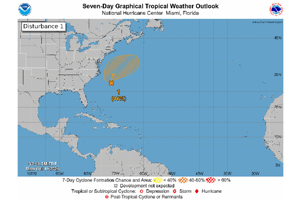 Tropical Weather Outlook For the North Atlantic...Caribbean Sea and the Gulf of America:
www.thedailyherald.sx NWS National Hurricane Center Miami FL 800 AM EDT Mon Oct 19 2026 Off the East Coast of the United States: A storm-force non-tropical low pressure area is located along a frontal boundary a few…
Air quality
Air quality is satisfactory, and air pollution poses little or no risk.
Forecast
- FriGood
San Luis Valley, CO reporting area · 1 hr ago. Data from AirNow (EPA and its state, local and tribal partners); preliminary and subject to change.
Sun & moon
Almanac
MonthlyDel Norte 3ene, records since 1893. Normals 1991–2020. Data from NOAA's Regional Climate Centers (ACIS).
Nearby
- Alamosa 38 km
- Monte Vista 20 km
Forecasters' discussion
From the National Weather Service office in PUB, issued 6 hrs ago
Key Messages
- Flood Watch remains through the day Friday for the eastern San Juan mountains and the Upper Rio Grande Valley, with areal stream/river flooding and rock/mud slides possible.
- Periods of moderate to heavy rain for the Continental Divide, tonight into early Friday, with strong to severe storms possible across the southern tier.
- Cooler and wetter weather area wide this weekend, with gradual warming and drying early next week.
Short Term
Issued at 207 PM MDT Thu Oct 22 2026
Current water vapor imagery and upper air analysis has moderate southwest aloft across the region, with upper level ridging translating the Southern and Central High Plains, as a deep upper trough continues to dig across the West Coast. Water vapor imagery is also indicating several embedded short waves lifting out across the Desert Southwest and Great Basin at this time, with GOES Total Blended Precipitable Water imagery indicating ample sup- tropical moisture (PWATs 200-250 percent of normal) embedded within the flow across Desert Southwest through the Southern and Central Rockies at this time.
Latest model data supports increasing southwest flow aloft across the region through the day Friday, as embedded short waves lift out ahead of the West Coast upper trough lifting out across the Intermountain West and Great Basin overnight. This supports one round of showers and embedded thunderstorms, lifting out across the region this afternoon and evening, with another round associated with the translating system across the Great Basin later this evening into early Friday morning. With the ample moisture in place, moderate to heavy rainfall remains the main concern, especially across the eastern San Juan Mtns into the San Luis Valley, where 1 to 2 inches of precipitation has already fallen, with another 1 to 2 inches possible by early Friday morning. Along with the heavy rain threat, there remains the potential for a few strong to severe storms across the southern tier tonight, the ample moisture supporting CAPE of 500-1000 j/kg combined with increasing shear of 40-60 kts. The main threat from these stronger storms would be strong winds up to 60 mph and hail up to an inch in diameter, with an isolated tornado not out of the question, as latest cams continuing to indicate some updraft helicity swaths lifting out across the Southwest Mtns into the San Luis Valley.
For Friday, strong west to southwest flow continues aloft, as the main upper system continues to lift out across the Northern Rockies, with models continuing to indicate secondary energy digging across the Great Basin and developing another closed upper low across the Desert Southwest by Friday night. This supports breezy southwest winds across the higher terrain through the day, with gusty south to southwest winds of 20 to 40 mph mixing across the lower elevations Friday morning and afternoon. Precipitation winds down across the area through the morning hours, with scattered showers and thunderstorms expected to develop once again, especially across the Southern Mtns into the Southeast Plains Friday afternoon and evening. With strong shear remaining in place, some of these storms could be strong to marginally severe once again, with hail and strong winds being the main threats. Temperatures warm into the 70s to low 80s across the plains, with highs mainly in the 50s and 60s across the higher terrain, save for 40s at the peaks.
Long Term
Issued at 207 PM MDT Thu Oct 22 2026
Saturday into Sunday...The southern low from the aforementioned split will begin to deepen over AZ and help moisture return to CO. This moisture along with WAA and good synoptic forcing will support more widespread precipitation across the region. Light to moderate rain is expected, but a locally heavy shower cannot be ruled out. WPC's Day 3 (Sat) Excessive Rain Outlook includes parts of SE CO in the SLGT risk area and was updated to include western CO in a MRGL risk earlier today. Day 4 (Sun) also has part of the region in a SLGT risk, but a much smaller area in far SE CO. There is the potential for flash flooding in areas which experience locally higher rainfall totals for both Saturday and Sunday. QPFs of 1.5-2 inches are expected across SE CO over the weekend, with locally higher totals possible. Given this system's pattern of producing severe weather across the Desert Southwest, it is not out of the realm of possibility for a low end severe threat to exist on Saturday. This will depend on the position of the instability axis, its strength, and its northern extent. The northern low will help push a cold front into CO on Saturday faster and further south than previous guidance showed. High temperatures will drop into the 50s and 60s across the high valleys and plains. With colder temperatures, snow levels will drop to 9,500ft. It is possible that a few inches of snow could accumulate on terrain above 10,000ft. These colder temps will persist through the weekend and into Monday.
Monday through Wednesday...Residual isolated showers are possible Monday from the outgoing weekend system. Late Monday, the low will move out of CO into NE, taking the moisture in the area with it. Broad upper level ridging will develop over the region for Tuesday and Wednesday. Gradual warming begins Tuesday, with generally dry and more seasonably type temperatures in place by midweek.
Aviation
Issued at 543 PM MDT Thu Oct 22 2026
A line of showers and thunderstorms will move across the TAF sites through 02z with rounds of showers continuing overnight into Friday morning, though on a decreasing trend. Although conditions will stay VFR at KCOS and KPUB, ALS could see some brief MVFR conditions at times when heavier showers move through. A decreasing trend in the coverage and intensity of rainfall will occur Friday morning with improving conditions and a return of gusty southwest winds up to 25 kts in the afternoon.
Forecasts, observations and alerts in the United States come from the National Weather Service (NOAA); radar from NOAA's Multi-Radar Multi-Sensor system; satellite imagery from NASA's Global Imagery Browse Services (GIBS) and NOAA's GOES satellites; the map from the U.S. Geological Survey's National Map; air quality from AirNow (EPA and its partners); hurricane information from the National Hurricane Center; climate normals and records from NOAA's Regional Climate Centers (ACIS). Forecasts outside the United States and the UV index: MET Norway (CC BY 4.0); observations outside the U.S.: airport reports via NOAA's Aviation Weather Center. Place names: GeoNames (CC BY 4.0). Data are copied on a schedule and may lag the sources; for warnings that affect your safety, follow your local National Weather Service office and emergency officials. Weather news is drawn from the 4Conservative index and reflects what the press published. Terms of use.