Install
Templeton, CA Weather
Current conditions
Observed at Paso Robles Municipal Airport · 47 min ago
Forecast
10-day-
Tonight
A chance of rain after 5am. Mostly cloudy, with a low around 46. South wind 0 to 5 mph. Chance of precipitation is 50%. New rainfall amounts less than a tenth of an inch possible.
-
Wednesday
A chance of rain before 11am, then rain and a slight chance of thunderstorms. Cloudy, with a high near 67. South southeast wind 0 to 10 mph, with gusts as high as 25 mph. Chance of precipitation is 100%. New rainfall amounts between a half and three quarters of an inch possible.
-
Wednesday Night
Rain and a slight chance of thunderstorms. Cloudy, with a low around 46. Northeast wind 0 to 5 mph, with gusts as high as 20 mph. Chance of precipitation is 100%. New rainfall amounts between a quarter and half of an inch possible.
National Weather Service forecast updated 16 hrs ago.
Hourly
Hourly forecast- Now48°52%
- 6 AM47°52%
- 7 AM47°52%
- 8 AM49°52%
- 9 AM51°52%
- 10 AM54°52%
- 11 AM58°72%
- 12 PM62°72%
- 1 PM65°72%
- 2 PM66°72%
- 3 PM66°72%
- 4 PM67°72%
- 5 PM64°96%
- 6 PM63°96%
- 7 PM61°96%
- 8 PM59°96%
- 9 PM58°96%
- 10 PM57°96%
- 11 PM56°82%
- Thu12 AM53°82%
- 1 AM52°82%
- 2 AM51°82%
- 3 AM50°82%
- 4 AM49°82%
10-day forecast
Details- TueOct 20Mostly Cloudy52%46°74°
- TodayOct 21Rain96%46°67°
- ThuOct 22Light Rain81%44°68°
- FriOct 23Sunny44°72°
- SatOct 24Sunny43°77°
- SunOct 25Sunny43°78°
- MonOct 26Sunny42°78°
- TueOct 27Sunny51°82°
- WedOct 28Cloudy54°84°
- ThuOct 29Cloudy57°78°
Days after the National Weather Service's seven are MET Norway's outlook, a computer model with no forecaster's review.
Radar
Full mapWeather news in California
More weather news-
 California's rainy season to arrive with flood threat, tornado risk and Sierra snow
California's wet season is starting off with a bang. The first significant storm of the season is forecast to bring heavy rain to vulnerable burn scars near Big Sur, coastal tornado risk to the Los Angeles area, and a…
-
 Waterspouts possible off Southern California amid stormy weather
Southern California's stormy forecast includes a chance of isolated waterspouts offshore. They may look like tornadoes, but they're not. Our latest explainer breaks down what waterspouts are, how they form over the…
-
 Storms descend on Southern California, raising risk of dangerous surf, flooding, debris flows
Rain is anticipated for Southern California on Wednesday into Thursday as the National Weather Service cautioned about potential beach hazards and thunderstorms from Oxnard to the Mexico border. The weather service's…
-
 Southern California's wild weather swings continue. Next up, rain
Southern California is likely in for a solid dose of rain this week, just days after heat and Santa Ana winds helped fuel several wildfires across the region. Forecasters expect the bulk of the rain to roll into the Los…
-
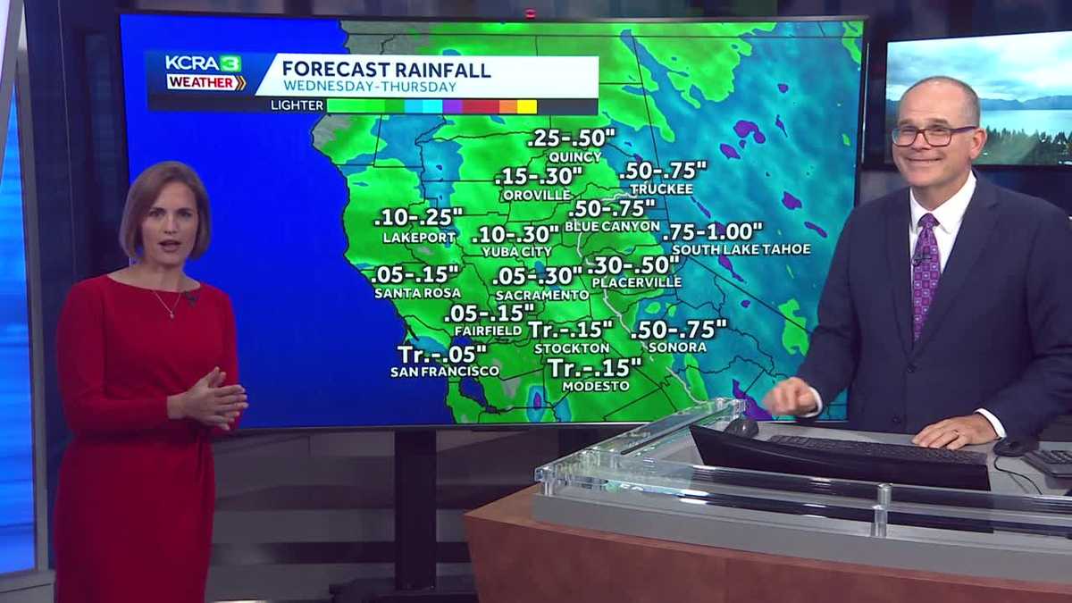 California weather with Dirk & Heather: Showers, thunderstorms and snow
Wednesday and Thursday will be cool and unsettled with scattered downpours. The first rain chances of the new water year are coming up quickly in Northern California! Wednesday and Thursday will be cool, cloudy and at…
-
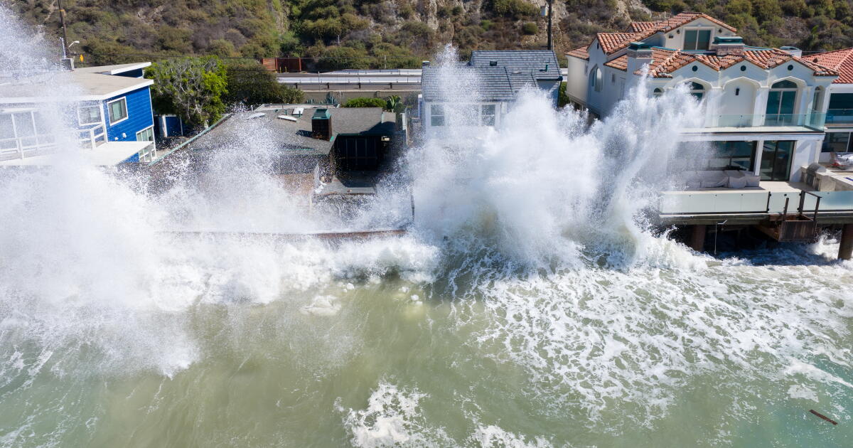 Rain and Thunderstorms Expected in Southern California with Beach Hazard Warnings
At SSBCrack News, our dedicated editorial team brings you the latest and most reliable updates on Defence, Geopolitics, Military Affairs, Science, and Technology. Driven by a passion for national security and strategic…
- Flash-flood risk rises in Southern California, severe storms threaten Arizona
Satellite image of southwest U.S. at 17:20 UTC on October 20, 2026. Credit: NOAA/GOES-19, Zoom Earth, The Watchers The WPC Excessive Rainfall Discussion issued at 15:33 UTC on October 20 places portions of Southern…
-
 Mid-October Santa Ana winds rapidly spread wildfires in Southern California
Several fires have erupted recently amid strong, dry winds known as the Santa Anas. The name is commonly linked way back in the 1800s to Santa Ana Canyon in Orange County, through which these warm winds were known to…
- Winter weather advisory for California for Wednesday and Thursday
The NWS Hanford CA released a winter weather advisory at 12:51 p.m. on Tuesday valid from Wednesday 11 a.m. until Thursday 11 a.m. The advisory is for Yosemite, Upper San Joaquin River, Kaiser to Rodgers Ridge, Kings…
-
 California Will Turn Clocks Back on November 1
California residents will turn their clocks back one hour on Sunday, November 1, 2026, when daylight saving time ends across most of the United States. The change will provide an additional hour overnight but bring…
Air quality
Air quality is satisfactory, and air pollution poses little or no risk.
Forecast
- WedGood
- ThuGood
- FriGood
Atascadero, CA reporting area · 1 hr ago. Data from AirNow (EPA and its state, local and tribal partners); preliminary and subject to change.
Sun & moon
Almanac
MonthlySan Luis Obispo Poly, records since 1927. Normals 1991–2020. Data from NOAA's Regional Climate Centers (ACIS).
Nearby
- San Luis Obispo 30 km
- Atascadero 7 km
- Paso Robles 9 km
- Arroyo Grande 49 km
- Los Osos 29 km
- Grover Beach 48 km
- Morro Bay 24 km
- Pismo Beach 46 km
- Oceano 51 km
- Cambria 34 km
- Cayucos 21 km
- Lake Nacimiento 25 km
Forecasters' discussion
From the National Weather Service office in LOX, issued 2 hrs ago
Synopsis
21/227 AM.
Widespread rain will develop later today and continue into Thursday with a chance of thunderstorms. A weak Santa Ana will develop in the storm's wake by the weekend for dry and warmer conditions.
Long Term (sat-tue)
21/227 AM.
Weak ridging and weak (1 to 3 mb) offshore flow from both the east and north will be in place for the entire xtnd period. The best upper level support will be on Saturday when there will be 30 to 40 mph gusts csts/vlys and as high as 50 mph in the mtns. The winds will be weaker starting Sunday.
High pressure and offshore flow should keep the skies clear.
There will be decent warming on Saturday (4 to 6 degrees) and then 1 or 2 degrees of extra warming Sun and Mon. Tuesday will cool some as the ridge and offshore flow weaken substantially. Cst/Vly temps will be a little above normal while the interior will be several degrees blo normal.
A quick look at the AI long range models shows dry conditions through the end of the month.
Aviation
21/0858Z.
At 0832Z at KLAX, there was no marine layer nor an inversion.
High confidence in VFR TAFs at KPMD and KWJF.
Moderate confidence in non desert TAFs through 17Z with a 30 percent chc of intermittent MVFR cigs.
Moderate confidence in all non desert TAFs after 17Z. Rain timing could be off by +/- 2 hours. There is a 40 percent chc that there will be MVFR cigs/vis with the rain.
There is a 10-20 percent chance of TSRA KSBA and north starting around 18Z. The chc of TSRA will then spread to KOXR and KCMA Wednesday afternoon, and into LA County after 03Z.
Marine
21/230 AM.
Expecting showers to continue moving into the coastal waters this morning as the low approaches from the west. Boaters can expect rain and a chance of thunderstorms and isolated waterspouts spreading from western waters to southeast. With any thunderstorm there is also the threat of lightning, gusty and erratic winds, small hail, and choppy seas. Winds still do not look too impactful, there is a good chance for periods of Small Craft Advisory (SCA) level (including the nearshore waters) southerly winds this morning through this evening. As the system leaves the area Thursday, fairly widespread west to northwest SCA winds will impact much of the coastal waters, creating steep, choppy wind waves.
Then a weak to locally moderate Santa Ana Wind event is likely this weekend, with some localized SCA level gusts possible nearshore in favored areas nearshore adjacent to Ventura and LA Counties.
Forecasts, observations and alerts in the United States come from the National Weather Service (NOAA); radar from NOAA's Multi-Radar Multi-Sensor system; satellite imagery from NASA's Global Imagery Browse Services (GIBS) and NOAA's GOES satellites; the map from the U.S. Geological Survey's National Map; air quality from AirNow (EPA and its partners); hurricane information from the National Hurricane Center; climate normals and records from NOAA's Regional Climate Centers (ACIS). Forecasts outside the United States and the UV index: MET Norway (CC BY 4.0); observations outside the U.S.: airport reports via NOAA's Aviation Weather Center. Place names: GeoNames (CC BY 4.0). Data are copied on a schedule and may lag the sources; for warnings that affect your safety, follow your local National Weather Service office and emergency officials. Weather news is drawn from the 4Conservative index and reflects what the press published. Terms of use.