Install
Cave Creek, AZ Weather
Current conditions
Forecast for this hour (no station report in the last two hours)
Forecast
10-day-
Saturday Night
Clear, with a low around 56. North wind 0 to 5 mph.
-
Sunday
Sunny, with a high near 74. East wind 0 to 5 mph.
-
Sunday Night
Mostly clear, with a low around 57. North wind 0 to 10 mph.
National Weather Service forecast updated 2 days ago.
Hourly
Hourly forecast- Now63°
- 8 PM61°
- 9 PM60°
- 10 PM60°
- 11 PM59°
- Sun12 AM59°
- 1 AM58°
- 2 AM58°
- 3 AM58°
- 4 AM57°
- 5 AM57°
- 6 AM58°
- 7 AM59°
- 8 AM60°
- 9 AM64°
- 10 AM67°
- 11 AM71°
- 12 PM72°
- 1 PM73°
- 2 PM74°
- 3 PM73°
- 4 PM72°
- 5 PM71°
- 6 PM68°
10-day forecast
Details- TonightOct 22Slight Chance Showers And Thunderstorms then Mostly Clear12%59°
- FriOct 23Sunny12%57°72°
- TodayOct 24Sunny12%56°71°
- SunOct 25Sunny57°74°
- MonOct 26Sunny59°77°
- TueOct 27Sunny60°78°
- WedOct 28Mostly Sunny60°78°
- ThuOct 29Partly Sunny then Chance Rain Showers28%74°
- FriOct 30Cloudy63°77°
- SatOct 31Light rain0.13 in57°77°
Days after the National Weather Service's seven are MET Norway's outlook, a computer model with no forecaster's review.
Radar
Full mapWeather news near Cave Creek
More weather news-
 Heavy rain, strong storms across Phoenix area expected later this week
Wednesday and Thursday are First Alert Weather Days as several rounds of thunderstorms are forecast to move through the Valley. Heavy rain, strong storms across Phoenix area expected later this week Arizona mom accused…
-
 Tracking weather changes on tap for Arizona this week
AZ Family Tracking weather changes on tap for Arizona this week Mountain View outlasts Red Mountain in OT Battle of Brown Road ShinBay brings Arizona's only true omakase to Old Town Scottsdale 1 critically hurt after…
- Phoenix Weather Sunny Thursday Windy Friday
The distinction matters because the National Weather Service describes haboobs as dust storms driven by thunderstorm outflow winds. Friday’s forecast calls for strong east winds; it does not establish that a haboob is…
-
 Tracking heavy wind blowing into Arizona's forecast
AZ Family Tracking heavy wind blowing into Arizona's forecast Who wore the hard hat best? Reporters take on construction jobs Colorado Avalanche assistant replaces longtime ASU hockey head coach Rafi look-a-like contest…
-
 Strong winds to blow through parts of Arizona Friday
AZ Family Strong winds to blow through parts of Arizona Friday Sedona cracks top 5 trending travel destinations for 2027 Locally-owned Scottsdale shop caters to knitters, crocheters of all skill levels Phoenix's Uptown…
-
 Rain moves through Phoenix area as temps cool down
AZ Family Rain moves through Phoenix area as temps cool down How Scottsdale is cracking down on rental house parties Arizona man duct-taped on flight could face 20 years in prison Nearly 40 victims ID'd in Tempe school…
-
 MOST ACCURATE FORECAST: Cooler, drier air settles into Arizona
PHOENIX — The powerful fall storm that brought severe weather to Arizona this week has moved out of the state. The storm system triggered 16 Tornado Warnings across Arizona on Wednesday and Thursday. A likely tornado…
-
 Severe weather is leaving Arizona. Here’s what to expect next
After several days of severe weather across Arizona, mainly quiet conditions return for Friday and the weekend. Ian Schwartz has your First Alert forecast. PHOENIX (AZFamily) — After several days of severe weather…
-
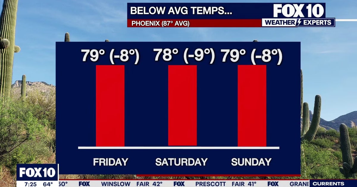 Arizona weather forecast: Cooler highs and sunny weekend skies in Phoenix
PHOENIX - Friday morning temperatures across Phoenix show most residents starting in the mid-to-upper 50s or low 60s. Wickenburg recorded upper 40s, while temperatures reached 59 degrees in Mesa, Phoenix-Mesa Gateway…
-
 MOST ACCURATE FORECAST: Tornado Watch for much of Arizona
PHOENIX — A powerful fall storm is moving through Arizona. Strong to severe storms are impacting parts of the state again Thursday. The storm threat shifts into eastern Arizona this afternoon before clearing out…
Air quality
Air quality is satisfactory, and air pollution poses little or no risk.
McDowell, AZ reporting area · 1 hr ago. Data from AirNow (EPA and its state, local and tribal partners); preliminary and subject to change.
Sun & moon
Almanac
MonthlyBartlett Dam, records since 1940. Normals 1991–2020. Data from NOAA's Regional Climate Centers (ACIS).
Nearby
Forecasters' discussion
From the National Weather Service office in PSR, issued 9 hrs ago
Updated
18Z Aviation Discussion...
Key Messages
- Below normal temperatures will continue through the weekend before readings warm back closer to the seasonal average for the bulk of next week.
- Aside from a few showers mainly over the mountains of Arizona today, dry and tranquil weather conditions will grace the region through the middle of next week.
- A return to inclement weather with increased rainfall chances is possible towards the end of next week.
Short Term
Analysis early this morning showed a recently closed off low pressure system across the Southwest with a prominent vorticity center rounding the base of the low and moving east across SoCal with some light showers in Imperial County and southern Yuma County. This low will slowly track across AZ today through Sunday and exit through the Four Corners by Monday. As the cold-core pushes into AZ this afternoon it will be enough, combined with surface heating, to generate scattered showers and isolated storms across the northern AZ high terrain, including portions of Gila County. A few showers may also develop across Maricopa and Pinal Counties this afternoon as the vorticity center passes overhead, but with low mixing ratios around 4-6 g/kg any showers will likely be inconsequential and not lead to much in the way of rainfall. A brief thunderstorm cannot be completely ruled out as mid-level lapse rates increase to around 7 C/km, with chances better in the foothills north and northeast of Phoenix. Maybe even a cold-air funnel. H5 heights around 565-572 dam this weekend will keep temperatures 3-6 degrees below normal, with lower desert highs in the upper 70s to middle 80s and lows in the 50s to lower 60s. With light winds and the below normal temperatures it should be a comfortable Fall weekend.
Long Term
Gradually warming temperatures and overall tranquil weather is expected through at least the first half of the next workweek with quasi-zonal flow in the wake of the weekend low. An increase in H5 heights up to 579-582 dam by Monday will support the gradual warming of temperatures, with afternoon highs reaching the middle 80s and lows in the upper 50s to lower 60s across the lower deserts, which is right around normal for the time of year. Dry mostly clear skies will prevail under this pattern as well. Model uncertainty grows later next week as there are hints at some moisture return into the region from the southeast, then a potential atmospheric river approaching by next weekend. Either, or both of these moisture sources may eventually help to bring a return to rain chances at some point before the end of the month, but it is too early to have a good idea on timing and/or placement for any weather feature this far in advance.
Forecasts, observations and alerts in the United States come from the National Weather Service (NOAA); radar from NOAA's Multi-Radar Multi-Sensor system; satellite imagery from NASA's Global Imagery Browse Services (GIBS) and NOAA's GOES satellites; the map from the U.S. Geological Survey's National Map; air quality from AirNow (EPA and its partners); hurricane information from the National Hurricane Center; climate normals and records from NOAA's Regional Climate Centers (ACIS). Forecasts outside the United States and the UV index: MET Norway (CC BY 4.0); observations outside the U.S.: airport reports via NOAA's Aviation Weather Center. Place names: GeoNames (CC BY 4.0). Data are copied on a schedule and may lag the sources; for warnings that affect your safety, follow your local National Weather Service office and emergency officials. Weather news is drawn from the 4Conservative index and reflects what the press published. Terms of use.