Install
Palmer, AK Weather
Current conditions
Observed at Palmer, Palmer Municipal Airport · 1 hr ago
Forecast
10-day-
Tuesday
Snow before 4pm, then rain and snow. Cloudy, with a high near 38. South wind 0 to 5 mph. Chance of precipitation is 90%. New snow accumulation of 3 to 5 inches possible.
-
Tuesday Night
Rain and snow. Cloudy, with a low around 29. Southwest wind around 0 mph. Chance of precipitation is 90%.
-
Wednesday
A chance of snow before 1pm, then scattered rain and snow showers. Mostly cloudy, with a high near 35. West wind 0 to 5 mph. Chance of precipitation is 30%.
National Weather Service forecast updated 7 hrs ago.
Hourly
Hourly forecast- Now34°93%
- 10 AM34°91%
- 11 AM35°91%
- 12 PM35°91%
- 1 PM36°88%
- 2 PM36°88%
- 3 PM36°88%
- 4 PM37°93%
- 5 PM37°93%
- 6 PM38°93%
- 7 PM37°70%
- 8 PM37°70%
- 9 PM37°70%
- 10 PM36°32%
- 11 PM36°32%
- Wed12 AM35°32%
- 1 AM33°42%
- 2 AM33°42%
- 3 AM32°42%
- 4 AM32°29%
- 5 AM32°29%
- 6 AM31°29%
- 7 AM31°25%
- 8 AM30°25%
10-day forecast
Details- TonightOct 19Light Snow100%32°
- TodayOct 20Light Snow3.7 in snow94%29°38°
- WedOct 21Chance Light Snow29%24°35°
- ThuOct 22Mostly Sunny23°35°
- FriOct 23Mostly Sunny20%29°38°
- SatOct 24Slight Chance Rain And Snow39%32°42°
- SunOct 25Chance Rain And Snow<0.1 in snow39%32°43°
- MonOct 26Slight Chance Rain And Snow23%43°
- TueOct 27Mostly sunny31°37°
- WedOct 28Cloudy36°42°
Days after the National Weather Service's seven are MET Norway's outlook, a computer model with no forecaster's review.
Radar
Full mapWeather news near Palmer
More weather news-
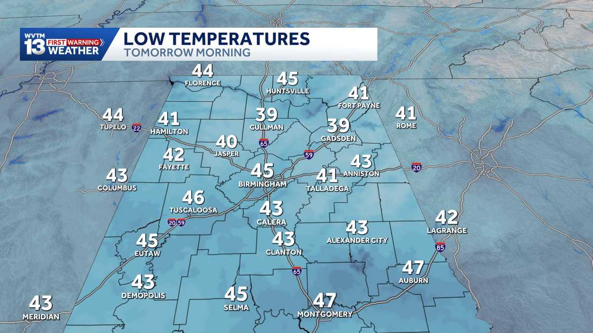 Chilly mornings and sunny, warm days in Alabama's weather forecast this week
MONDAY: Chilly morning lows down in the 40s. Warming up to the 70s with full sunshine in the afternoon. Rain chance: 0%. TUESDAY: Another chilly start in the 40s. Warming to the mid-70s in the afternoon with a light…
-
 Cold front brings coolest air of the season so far to Midstate
Alaska's News Source Cold front brings coolest air of the season so far to Midstate Pearl car show raises money for Palmer Home for Children Capital City Pride festival focused on visibility, acceptance for LGBTQ…
-
 First Alert weather on The Breakfast Show 10/18
KOLN | Nebraska Local News, Weather, Sports | Lincoln, NE First Alert weather on The Breakfast Show 10/18 Pearl car show raises money for Palmer Home for Children Capital City Pride festival focused on visibility…
-
 Drought, heat wave leaves Mount Hood barren by early fall
On Oct. 8, 2026, the Palmer Snowfield below the Palmer Express chairlift was almost completely bare. Timber Lodge had to close the lift on July 19, its earliest closing day. Cameron Nielsen / OPB A towering white Mount…
- Pressurized irrigation season to end Monday in Twin Falls
TWIN FALLS, Idaho (KMVT/KSVT) — Pressurized irrigation season is set to end Monday for Twin Falls residents. As the weather gets colder, the Twin Falls Canal Company will close its irrigation gates at Milner Dam…
-
 Cooler than average temperatures continue with showers and high-country snow
Thursday stays colder than averages with a few early morning showers for some. - Freeze warnings and watches for the coming days WEDNESDAY NIGHT: In the San Luis Valley there is a freeze warning active for Wednesday…
-
 Showers move through Wednesday, with thunderstorms possible in some areas
WPXI Mother, son charged in young university student-athleteâs murder plead ânot guiltyâ Neighbors hear nonprofitâs preliminary testing results amid concerns about odors near paint plant Skill games carted out…
-
 Denver weather: Cooler with showers
DENVER (KDVR) — Cloudy skies and cooler temperatures are here today as rain and snow could fall at higher elevations; showers push over the state. Today will be a big change as highs stay chilly around the 50-degree…
-
 Cool and gloomy Wednesday
KKTV WEDNESDAY: Cloudy and cool with highs in the 40s and 50s. Drizzle this morning, showers in the afternoon and early evening with snow above 9,000′. Minor accumulations possible. THURSDAY: Still cool with showers…
-
 Recently chilly Bay Area about to get warm again
The Bay Area’s back-and-forth pendulum of hotter weather followed by a significant cooldown followed by more heat followed by more cool is about to swing back to the warmer end of the scale. But this heat-up might be…
Sun & moon
Almanac
MonthlyPalmer Airport, records since 1997. Normals 1991–2020. Data from NOAA's Regional Climate Centers (ACIS).
Nearby
- Anchorage 60 km
- Eagle River 39 km
- Knik-Fairview 27 km
- Wasilla 17 km
- Lakes 10 km
- Tanaina 17 km
- Meadow Lakes 26 km
- Elmendorf Air Force Base 47 km
- Gateway 7 km
- Fishhook 17 km
- Big Lake 45 km
- Butte 8 km
Forecasts, observations and alerts in the United States come from the National Weather Service (NOAA); radar from NOAA's Multi-Radar Multi-Sensor system; satellite imagery from NASA's Global Imagery Browse Services (GIBS) and NOAA's GOES satellites; the map from the U.S. Geological Survey's National Map; air quality from AirNow (EPA and its partners); hurricane information from the National Hurricane Center; climate normals and records from NOAA's Regional Climate Centers (ACIS). Forecasts outside the United States and the UV index: MET Norway (CC BY 4.0); observations outside the U.S.: airport reports via NOAA's Aviation Weather Center. Place names: GeoNames (CC BY 4.0). Data are copied on a schedule and may lag the sources; for warnings that affect your safety, follow your local National Weather Service office and emergency officials. Weather news is drawn from the 4Conservative index and reflects what the press published. Terms of use.