Install
Beaverton, OR 97076 Weather
Current conditions
Observed at Portland-Hillsboro Airport · 1 hr ago
Forecast
10-day-
Overnight
Mostly clear. Low around 46, with temperatures rising to around 48 overnight. Northwest wind around 1 mph.
-
Thursday
Mostly sunny. High near 66, with temperatures falling to around 62 in the afternoon. North northwest wind 0 to 7 mph.
-
Thursday Night
Partly cloudy. Low around 40, with temperatures rising to around 42 overnight. West northwest wind 1 to 7 mph.
National Weather Service forecast updated 2 hrs ago.
Hourly
Hourly forecast- Now50°
- 4 AM48°
- 5 AM48°
- 6 AM48°
- 7 AM46°
- 8 AM46°
- 9 AM48°
- 10 AM53°
- 11 AM57°
- 12 PM61°
- 1 PM63°
- 2 PM64°
- 3 PM65°
- 4 PM64°
- 5 PM62°
- 6 PM60°
- 7 PM56°
- 8 PM53°
- 9 PM51°
- 10 PM49°
- 11 PM47°
- Fri12 AM46°
- 1 AM45°
- 2 AM44°
10-day forecast
Details- TonightOct 21Mostly Clear46°
- TodayOct 22Mostly Sunny40°66°
- FriOct 23Patchy Fog then Sunny39°63°
- SatOct 24Areas Of Fog then Partly Sunny28%41°63°
- SunOct 25Chance Light Rain35%43°64°
- MonOct 26Chance Light Rain33%42°64°
- TueOct 27Chance Light Rain26%42°64°
- WedOct 28Mostly Sunny12%63°
- ThuOct 29Cloudy47°63°
- FriOct 30Cloudy45°62°
Days after the National Weather Service's seven are MET Norway's outlook, a computer model with no forecaster's review.
Radar
Full mapWeather news near Beaverton
More weather news-
 Nearly 90% of Oregon is in drought as rain year begins
PORTLAND, Ore. (KATU) — Rain has started trickling into the Pacific Northwest for the season. October 1 marks the beginning of the new rain year, and in Portland, we’ve seen about 0.1” so far through the month, which is…
-
 Tropical development possible over the next few days
KOLN | Nebraska Local News, Weather, Sports | Lincoln, NE Tropical development possible over the next few days Atkinson leads Oregon State’s high-flying offense to 48-30 win over Washington State Dogs take over…
-
 Drought, heat wave leaves Mount Hood barren by early fall
On Oct. 8, 2026, the Palmer Snowfield below the Palmer Express chairlift was almost completely bare. Timber Lodge had to close the lift on July 19, its earliest closing day. Cameron Nielsen / OPB A towering white Mount…
-
 Back to reality, much cooler this weekend
KPTV We ended up much cooler this morning than originally thought but ample sunshine and a very light east wind should help push temperatures into the mid to upper 70s. FEW SHOWERS + COOLER THIS WEEKEND Hopefully you’ve…
-
 When should Central Oregon drivers switch to winter tires? What to know before the cold arrives
BEND, Ore. (KTVZ) — Fall is just getting underway, but now is a good time for Central Oregon drivers to start thinking about getting their vehicles ready for winter.Les Schwab says drivers planning to travel in snow…
-
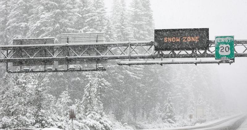 Oregon may see Cascade snow as record-warm October turns cooler
Light snow could fall on Cascade Mountain roads next weekend — Oct. 24 to 25. After one of the warmest and driest Octobers on record, it should start to feel like autumn late this week and next weekend. The Cascade…
-
 Southern Oregon Opens the Week in Sunshine as Cooler Nights and Rain Chances Follow
Cooler air will lower Medford’s high to about 66 and Klamath Falls to 61. Grants Pass is forecast near 73, Roseburg near 64 and Brookings near 59. Clouds will be more prominent across the region, with isolated showers…
-
 Central Oregon will see mixed sun and clouds through Monday
BEND, Ore. — Central Oregon will see a mix of clouds and sunshine Sunday, with afternoon temperatures reaching the low 60s, followed by another mostly cloudy and mild day Monday. For Bend, the National Weather Service…
Air quality
Acceptable. Unusually sensitive people should consider limiting prolonged outdoor exertion.
Beaverton, OR reporting area · 2 hrs ago. Data from AirNow (EPA and its state, local and tribal partners); preliminary and subject to change.
Sun & moon
Almanac
MonthlyHillsboro Area, records since 1929. Normals 1991–2020. Data from NOAA's Regional Climate Centers (ACIS).
Nearby
- Portland 11 km
- Vancouver 20 km
- Gresham 29 km
- Hillsboro 15 km
- Tigard 7 km
- Aloha 5 km
- Lake Oswego 13 km
- Keizer 58 km
- Oregon City 21 km
- McMinnville 44 km
- Tualatin 12 km
- West Linn 20 km
Forecasters' discussion
From the National Weather Service office in PQR, issued 5 hrs ago
Synopsis
Dry and cooling temperatures will occur through the work week before weak storm systems return chances for beneficial rain over the weekend and early next week.
Discussion
Now through Tuesday...Ensembles are in good agreement shortwave ridging will give way to a weak shortwave trough traversing the region Thursday. Some moisture and weak instability will result in a 20-30% chance for light showers across the Cascades Thursday afternoon and evening.
A weak front, currently well offshore, is currently associated with the shortwave trough, but models are in good agreement it will dissipate before reaching our forecast area, and thus have few impacts aside from bringing an increase in cloud cover and cooler temperatures to the region. On that note, models generally agree skies will clear Thursday and Friday nights away from the Cascades in the Willamette Valley, which will allow temperatures to drop to some of the coldest values so far this year. It appears increasingly likely we will need a Freeze Watch for at least the southern Willamette Valley and Coast Range Valleys with a more expansive threat of a freeze on Friday night per NBM probabilities.
The next shortwave trough or cutoff low is forecast to drop towards the Pacific Northwest over the weekend into early next week. There remains quite a bit of uncertainty around whether or not this storm system will cutoff, clip the region and then hang well offshore for 24-48 hours before pushing inland, hover over or close enough to the region to bring a couple bouts of rain over 48-72 hours, or if the entire storm system will remain an open shortwave trough that slides southeastward across the Rockies and keeps the area largely dry.
Aviation
Through 06Z Thursday...High pressure over the region will lead to predominantly light winds and VFR conditions through the TAF period. The main exception to this will be between 09-18z Thursday when clear skies, light winds, and low level moisture will lead to pockets of fog and low clouds developing in inland valleys. The highest probabilities for IFR conditions developing at TAF sites are at KEUG between 09-18z Thursday where there is a 30-40% chance for these conditions occurring at any given hour during that timeframe. There is around a 15-25% chance of MVFR/IFR conditions developing at any given hour at any other inland terminal during this time period. In addition, IFR conditions were observed at KONP at 04z Thu, and there's a 50-60% chance of MVFR/IFR conditions continuing through 15-19z Thu.
Winds will be light and variable into the morning hours. Then a weak front will turn winds northwesterly and increase after 18z Thu along the coast to 12-15 kts with gusts up to 25 kts and after 20-22z inland to 8-12 kts.
KPDX AND APPROACHES...High pressure over the region will lead to light winds and predominantly VFR conditions. The main exception to this will be in the 11-18z Thursday time period when there is a 20- 30% chance for MVFR/IFR conditions developing at any given hour. Winds light and variable becoming northwest 8-10 kts after 20-22z Thu. -03
Marine
North winds will develop across the waters this evening and persist through at least Saturday. The winds strengthen tonight and Thursday as high pressure builds in the wake of a weak front with high confidence in small craft conditions. The persistent winds will increase seas. The seas are expected to become very steep Thursday night and Friday prompting a Hazardous Seas Warning.
A stronger low will approach the waters Friday. Model ensembles have been trending towards the low remaining further offshore this weekend. There is uncertainty on when and if the low will move closer to shore and a diminishing threat of gale conditions this weekend. ~11
Forecasts, observations and alerts in the United States come from the National Weather Service (NOAA); radar from NOAA's Multi-Radar Multi-Sensor system; satellite imagery from NASA's Global Imagery Browse Services (GIBS) and NOAA's GOES satellites; the map from the U.S. Geological Survey's National Map; air quality from AirNow (EPA and its partners); hurricane information from the National Hurricane Center; climate normals and records from NOAA's Regional Climate Centers (ACIS). Forecasts outside the United States and the UV index: MET Norway (CC BY 4.0); observations outside the U.S.: airport reports via NOAA's Aviation Weather Center. Place names: GeoNames (CC BY 4.0). Data are copied on a schedule and may lag the sources; for warnings that affect your safety, follow your local National Weather Service office and emergency officials. Weather news is drawn from the 4Conservative index and reflects what the press published. Terms of use.