Install
Orange, CA 92866 Weather
Current conditions
Forecast for this hour (no station report in the last two hours)
Forecast
10-day-
Friday Night
Mostly clear, with a low around 56. Southeast wind 0 to 5 mph.
-
Saturday
Sunny, with a high near 77. Northwest wind 0 to 10 mph.
-
Saturday Night
Mostly clear, with a low around 59. Northwest wind 0 to 5 mph.
National Weather Service forecast updated 1 day ago.
Hourly
Hourly forecast- Now59°
- 2 AM58°
- 3 AM57°
- 4 AM56°
- 5 AM56°
- 6 AM56°
- 7 AM56°
- 8 AM58°
- 9 AM62°
- 10 AM66°
- 11 AM68°
- 12 PM71°
- 1 PM76°
- 2 PM74°
- 3 PM76°
- 4 PM76°
- 5 PM74°
- 6 PM71°
- 7 PM68°
- 8 PM67°
- 9 PM65°
- 10 PM64°
- 11 PM63°
- Sun12 AM62°
10-day forecast
Details- TonightOct 22Chance Rain Showers30%57°
- FriOct 23Mostly Sunny14%56°71°
- TodayOct 24Sunny59°77°
- SunOct 25Sunny60°80°
- MonOct 26Sunny60°82°
- TueOct 27Mostly Sunny60°81°
- WedOct 28Mostly Sunny60°79°
- ThuOct 29Partly Sunny75°
- FriOct 30Cloudy56°75°
- SatOct 31Cloudy59°73°
Days after the National Weather Service's seven are MET Norway's outlook, a computer model with no forecaster's review.
Radar
Full mapWeather news in California
More weather news-
 California Weather: NHS Forecasts Clearning Skies, Light Showers, Strong Winds Across Sacramento, Sierra Foothills and Northern California – Check Forecast & Latest Updates
Northern California is forecast to see gradually clearing skies on Friday following recent unsettled weather. Read for more details. The post California Weather: NHS Forecasts Clearning Skies, Light Showers, Strong…
-
 Will it rain on Halloween in Southern California? Here’s what forecasters say
Southern California residents may want to keep an umbrella handy this Halloween, as forecasters monitor another potential round of rain that could arrive just in time for trick-or-treating. A low-pressure system…
-
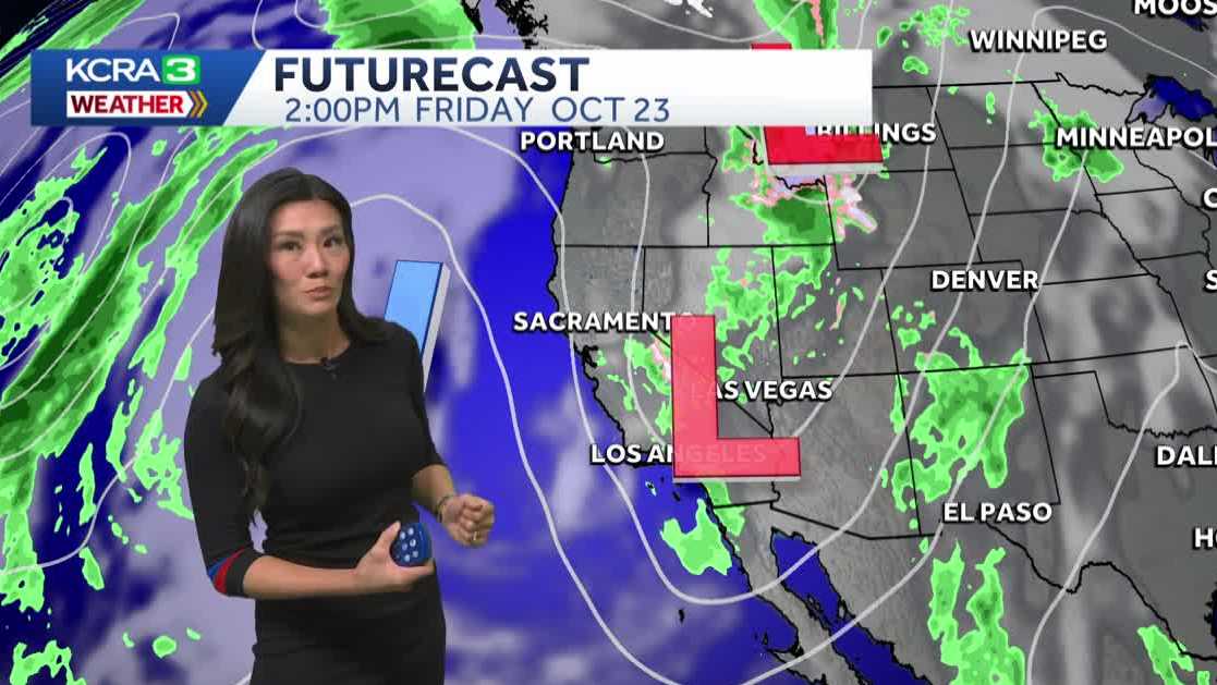 Northern California forecast: Warmer and breezy Friday as we dry out
Mist, sprinkles and light showers are lingering across Northern California this morning, but drier weather and sunshine will return by the afternoon. Most of the region should be dry by noon, with clearing skies…
-
 California weather with Dirk & Heather: How much rain did we get?
KCRA California weather with Dirk & Heather: How much rain did we get? Scattered showers and thunderstorms have brought beneficial rain to many places across the state. Scattered showers and thunderstorms have brought…
-
 Southern California weather — Fall Storm Brings Thunderstorms and Flood Advisories
A recent Southern California weather system driven by an autumn storm is continuing to bring thunderstorms, lightning, and heavy rain to the region. With localized downpours expected, authorities have issued strict…
-
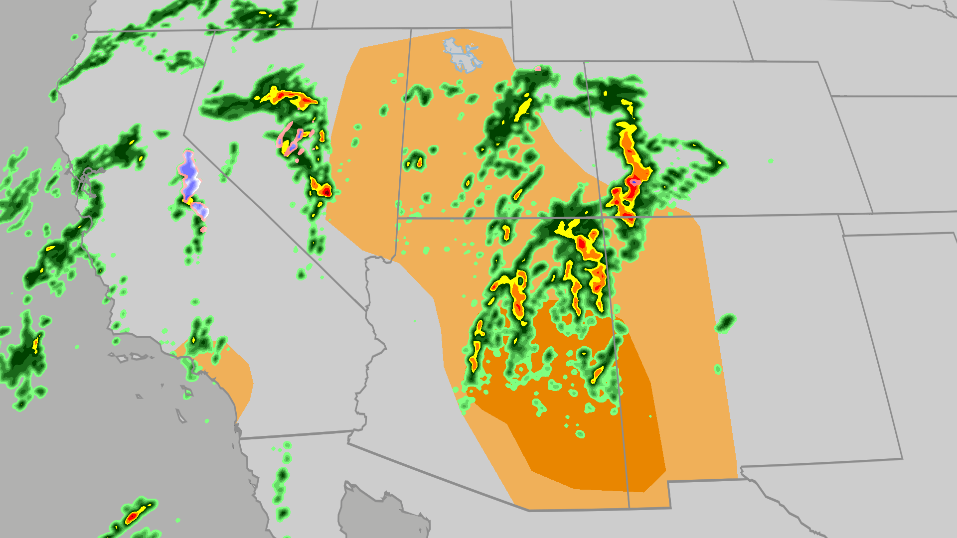 Severe weather, flood risk across Four Corners, California
The Weather Channel Tornadoes, flooding, large hail possible in Four Corners, California Parts of the Four Corners and Southern California face an elevated risk of severe weather on Thursday, which includes the…
- Air quality alert affecting Southern California Thursday
Sacramento Bee The creation of this content included the use of AI based on templates created, reviewed and edited by journalists in the newsroom. Read more on our AI policy here. On Thursday at 7:36 a.m. the NWS…
-
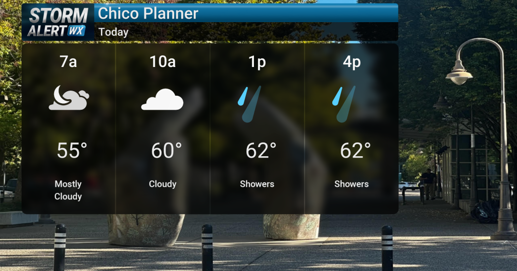 Showery conditions, possible thunderstorms impact Northern California today
Cloudy skies are expected across Northern California today, bringing periods of rain and a chance of thunderstorms later in the day. Highs will reach the mid-60s with winds from the south between 10 and 15 mph. Rain and…
-
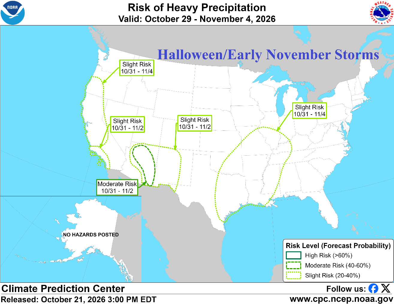 Prohibitive U.S. Storm Track; California/Southwest U.S. Primary Target
Early Season Advancing Snow Cover Climate Impact Company North America Medium Range Report Issued: Thursday October 22, 2026 Chart of the day: NOAA/CPC project prohibitive storm track for early November. Discussion…
- UPDATE: Wind advisory in place for Southern California until Thursday evening
On Thursday at 5:53 a.m. the NWS San Diego CA issued an updated wind advisory valid between 6 a.m. and 6 p.m. The advisory is for Riverside County Mountains, San Diego County Mountains, San Diego County Deserts and San…
Air quality
Air quality is satisfactory, and air pollution poses little or no risk.
Forecast
- SatGood (50)
North Orange CO, CA reporting area · 2 hrs ago. Data from AirNow (EPA and its state, local and tribal partners); preliminary and subject to change.
Sun & moon
Nearby
- Los Angeles 47 km
- Long Beach 32 km
- Anaheim 9 km
- Riverside 45 km
- Santa Ana 5 km
- Irvine 13 km
- Fontana 51 km
- Moreno Valley 59 km
- Huntington Beach 20 km
- Glendale 55 km
- Garden Grove 9 km
- Rancho Cucamonga 42 km
Forecasters' discussion
From the National Weather Service office in SGX, issued 2 hrs ago
Synopsis
Lingering scattered showers will bring light rain to areas west of the mountains today, becoming more confined to San Diego County this evening. Weak offshore flow expected Saturday and Sunday. Dry and warmer for the weekend through Monday, then gradually cooler for the middle of next week with a chance of precipitation for late next week. Tides will increase over the weekend, remaining elevated through much of next week.
Discussion
FOR EXTREME SOUTHWESTERN CALIFORNIA INCLUDING ORANGE... SAN DIEGO...WESTERN RIVERSIDE AND SOUTHWESTERN SAN BERNARDINO COUNTIES...
...UPDATED AVIATION DISCUSSION...
Radar imagery at 12 PM was showing scattered showers moving from north to south mainly across coastal areas. Over the past 6 hours, places north of San Diego County have received mainly less than 0.05", with totals ranging from 0.05 to 0.30" in San Diego County. Additional showers will continue at times through the day, most likely in San Diego County, eventually tapering off overnight.
By tonight, models are showing a closed upper level low moving south and east towards the border of California and Arizona. This will turn the pressure gradient weakly offshore, increasing north to northeasterly winds in wind prone locations. Peak wind gusts will be in the 30 to 45 mph range, strongest on the foothills of the San Bernardino mountains and just below the Cajon Pass. Given the unsettled weather quickly turning to offshore flow, marine layer low clouds and fog will largely be absent from the coast into early next week.
High temperatures over the weekend will warm. Highs Saturday are expected to be 5 to 10 degrees warmer than today, with additional warming along the coast on Sunday and a few degrees of cooling or no change further inland. By Monday, high temperatures in coastal areas will be 5 to 10 degrees above average, with temperatures closer to average further inland. Cooler conditions expected for the middle to end of next week.
Global ensembles are indicating the potential for unsettled weather for the end of next week. There remains a lot of spread in solutions and uncertainty in the details. Rain chances are in the forecast as early as Friday. NBM chances for 0.01 inch or more of rainfall for the coast to the mountains increases from 10 to 20 percent for next Friday to 35 to 45 percent on Saturday the 31st to 40 to 50 percent on Sunday November 1st. In addition to precipitation, cooler, cloudier, and windier conditions may develop.
Aviation
240530Z...Generally VFR conditions across the region, though -SHRA/SHRA will continue off and on for the next few hours in portions of San Diego County and in the Coachella Valley. Low clouds based 3-7 kft will slowly SCT overnight with SKC expected across the region by sunrise Sat. N/NE winds gusting 25-35 kts develop starting 06-09z through (and south of) the Cajon Pass and along south-facing mountain slopes. Winds weaken and eventually diminish Saturday afternoon and evening.
Marine
Scattered showers and isolated thunderstorms will continue through 07z. Any thunderstorm that forms will be capable of producing gusty, erratic winds, choppy seas, and lightning. Otherwise, no hazardous marine conditions are expected through Tuesday.
Forecasts, observations and alerts in the United States come from the National Weather Service (NOAA); radar from NOAA's Multi-Radar Multi-Sensor system; satellite imagery from NASA's Global Imagery Browse Services (GIBS) and NOAA's GOES satellites; the map from the U.S. Geological Survey's National Map; air quality from AirNow (EPA and its partners); hurricane information from the National Hurricane Center; climate normals and records from NOAA's Regional Climate Centers (ACIS). Forecasts outside the United States and the UV index: MET Norway (CC BY 4.0); observations outside the U.S.: airport reports via NOAA's Aviation Weather Center. Place names: GeoNames (CC BY 4.0). Data are copied on a schedule and may lag the sources; for warnings that affect your safety, follow your local National Weather Service office and emergency officials. Weather news is drawn from the 4Conservative index and reflects what the press published. Terms of use.