Install
Salt Lake City, UT 84170 Weather
Current conditions
Observed at Salt Lake City, Salt Lake City International Airport · 1 hr ago
Forecast
10-day-
Today
Sunny. High near 65, with temperatures falling to around 63 in the afternoon. South wind 9 to 13 mph.
-
Tonight
A slight chance of rain between 9pm and 3am. Partly cloudy, with a low around 43. South southwest wind 1 to 12 mph. Chance of precipitation is 20%.
-
Tuesday
Mostly sunny. High near 62, with temperatures falling to around 59 in the afternoon. South southwest wind 0 to 7 mph.
National Weather Service forecast updated 13 hrs ago.
Hourly
Hourly forecast- Now63°
- 3 PM65°
- 4 PM63°
- 5 PM63°
- 6 PM60°
- 7 PM58°
- 8 PM56°
- 9 PM55°15%
- 10 PM53°15%
- 11 PM51°15%
- Tue12 AM49°22%
- 1 AM47°22%
- 2 AM46°22%
- 3 AM46°
- 4 AM44°
- 5 AM44°
- 6 AM43°
- 7 AM43°
- 8 AM43°
- 9 AM45°
- 10 AM50°
- 11 AM53°
- 12 PM56°
- 1 PM58°
Daily forecast
Details- TodayOct 26Sunny22%43°65°
- TueOct 27Mostly Sunny38%42°62°
- WedOct 28Mostly Sunny43°61°
- ThuOct 29Partly Sunny13%47°66°
- FriOct 30Chance Light Rain60%45°62°
- SatOct 31Light Rain Likely65%44°61°
- SunNov 1Light Rain Likely67%41°57°
- MonNov 2Mostly sunny36°49°
- TueNov 3Partly cloudy36°53°
Days after the National Weather Service's seven are MET Norway's outlook, a computer model with no forecaster's review.
Radar
Full mapWeather news near Salt Lake City
More weather news- Salt Lake City Scores Sunny Sunday Before Late-Week Soaker
Salt Lake City is starting Sunday with cloudy skies and temperatures in the mid-40s, but the day should brighten into a partly sunny afternoon near 57 degrees. The calm weather is a brief pause, with a warmer Monday…
- Salt Lake City Sees Partly Cloudy Saturday Before Rain Returns
A 10 a.m. reading showed a temperature of about 48 degrees and sunny conditions at that hour, while the city-area forecast calls for partly cloudy skies and a high in the upper 50s. Northwest winds will stay light…
-
 Comeback Season
| The Wall Street Journal - newspaper Magzter SKY HIGH The Roundhouse, a restaurant at Idaho's Sun Valley Resort, sits at around 7,700 feet.LAST WINTER was one that many skiers would rather forget Unseasonably warm…
-
 US winter is likely to be wetter and warmer, forecasters say. If you want more snow, look south
El Niño is likely to shift weather patterns to bring more moisture, but with it higher temperatures. That should help erase persistent Western drought, but it won’t likely make Northern snow-lovers happy, the National…
-
 Parts of Utah emerge from moderate drought for first time in 7 months
SALT LAKE CITY — Storms that moved through Utah this week resulted in serious flooding in southern Utah, even leading to a disaster emergency in Hurricane. However, the wet weather has also pulled some parts of Utah out…
-
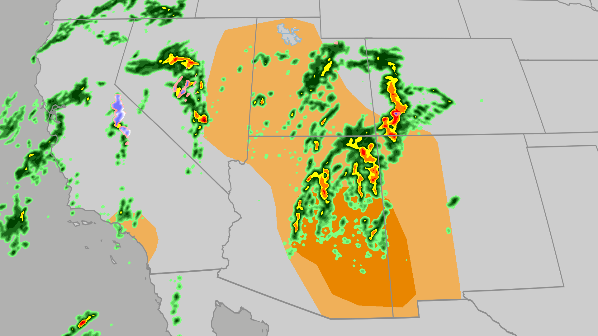 Severe weather, flood risk across Four Corners, California
The Weather Channel Tornadoes, flooding, large hail possible in Four Corners, California Parts of the Four Corners and Southern California face an elevated risk of severe weather on Thursday, which includes the…
-
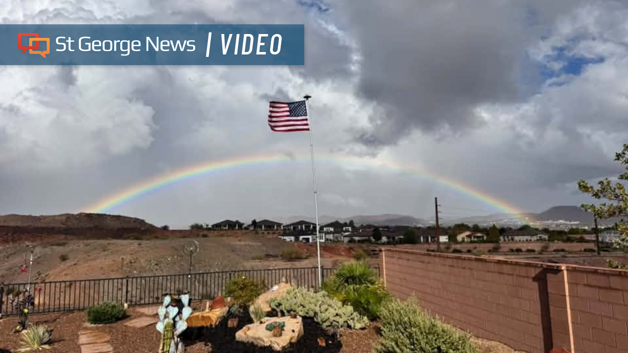 Photo Gallery: Fast-moving storms flood Southern Utah with heavy rain – and rainbows; more on the way
Fast-moving storms tracking north by northeast dropped hail and heavy rain across Southern Utah. The weather event also produced monstrous cloud formations and expansive rainbows. Monica Traphagan, senior meteorologist…
- Salt Lake City Sizzles, Then Soaks: One Last Warm Day Before Storms Slam Wasatch
Salt Lake City is starting Wednesday clear and mild, but the calm setup has an expiration date. The city could reach 71 this afternoon, with showers possible. Then the late-week forecast takes a distinctly wetter…
-
 U.S. winter is likely to be wetter and warmer, forecasters say
El Niño is likely to shift weather patterns to bring more moisture, but with it higher temperatures. That should help erase persistent Western drought, but it won’t likely make Northern snow-lovers happy, the National…
-
 Late-week storm could bring 3 to 6 inches of mountain snow
by Jill Margetts, KUTV SALT LAKE CITY (KUTV) — A few showers will continue to move through parts of southern and central Utah Monday. Some thunderstorms could develop in southeastern Utah by Monday afternoon. A few…
Air quality
Air quality is satisfactory, and air pollution poses little or no risk.
Forecast
- MonGood
- TueGood
- WedGood
Salt Lake City, UT reporting area · 1 hr ago. Data from AirNow (EPA and its state, local and tribal partners); preliminary and subject to change.
Sun & moon
Almanac
MonthlySalt Lake City Area, records since 1874. Normals 1991–2020. Data from NOAA's Regional Climate Centers (ACIS).
Nearby
- West Valley City 8 km
- Provo 53 km
- West Jordan 7 km
- Orem 45 km
- Sandy 9 km
- Layton 44 km
- South Jordan 12 km
- Millcreek 3 km
- Taylorsville 3 km
- Lehi 31 km
- Murray 2 km
- Draper 16 km
Forecasters' discussion
From the National Weather Service office in SLC, issued 1 hr ago
Key Messages
- A couple of weak systems brushing northern Utah through mid-week will keep temperatures seasonably cool, with mostly dry conditions prevailing.
- Two storm systems bring wetter weather back to the region Friday into the weekend, with widespread precipitation through this period resulting in an increased risk for flash flooding.
- Colder air moving in Saturday into early Monday will result in lowering snow levels, allowing for accumulating snowfall generally above 8500 feet.
Discussion
Generally benign conditions are expected for the first half of this week. While a couple weak systems are expected to brush northern Utah through mid-week -- the first moving through overnight tonight, and the second late Tuesday into Wednesday -- little impact is expected outside of a slight cooldown and some isolated showers near the Idaho border.
A more active pattern is expected late this week into the weekend as a couple stronger weather systems with more efficient moisture taps impact the region. The first system arrives Friday as a shortwave ejects around the eastern periphery of a deepening trough along the west coast. Increasing southerly flow aloft will bring an influx of tropical moisture to the region, with PWAT anomalies increasing to around 200-250% of normal across much of southern and central Utah on Friday into early Saturday. There is still quite a bit of spread on how much precipitation this system brings to the region, with the 25th percentile showing next to northing across much of Utah and southwest Wyoming, while the 75th percentile brings 0.3-0.5 inches to much of southern Utah except upwards of an inch across the southern mountains. Given recent rainfall across central and southern Utah, the flash flood risk is elevated Friday into Saturday despite this uncertainty. WPC currently highlights much of southern Utah under a Marginal Risk (Level 1 of 4) of excessive rainfall through this period.
Ensembles show good agreement on a brief lull on Saturday afternoon ahead of the second, more potent system. A strong atmospheric river is expected to make landfall along the southern California coast late Saturday, bringing a stream of very deep tropical moisture that will overspread much of Utah and southwest Wyoming on Sunday. Concurrently, an upper-level trough begins to dig southward into the Great Basin, resulting in substantial instability developing across the region. As such, ensembles are in good agreement on this portion of the storm bringing widespread moderate to heavy rainfall to the region. While heavy rain is likely across southern Utah, with a 75% chance to exceed 1" of rain across much of the area through Monday morning, models show quite a bit of spread in rainfall accumulations across central and northern Utah given some models indicate potential for a more southerly track of deepest moisture. Across these areas, the 25th percentile brings a widespread 0.2-0.5", while the 75th percentile indicates widespread accumulations of 1.0-1.5".
Cooler air moving in with the aforementioned trough on Sunday will result in snow levels dipping around 8000-8500 feet. As such, accumulating snowfall is expected for all Utah mountains into Monday morning. Current forecast indicates 3-6" of snow accumulations between Sunday and Monday morning for elevations above 8500 feet, with locally higher totals of 6-10" across the central and southern Utah mountains and the Uintas.
Aviation
KSLC...The SLC terminal will see VFR conditions throughout the day with increasing high clouds. Occasionally gusty southerly winds are expected to shift to the northwest between 03Z and 05Z with the passage of a mostly dry cold front before returning to southerly during the early morning.
REST OF UTAH AND SOUTHWEST WYOMING...VFR conditions are expected across the airspace through the evening with increasing clouds over northern portions of the airspace. A grazing storm system will bring a mostly dry cold front between 03Z and 08Z, bringing wind shifts to the northwest from about Provo northward. There is also a low chance of showers with the frontal passage for locations near the Utah/Idaho border as the system passing, bringing a low potential for gusty winds and brief mountain obscurations.
Forecasts, observations and alerts in the United States come from the National Weather Service (NOAA); radar from NOAA's Multi-Radar Multi-Sensor system; satellite imagery from NASA's Global Imagery Browse Services (GIBS) and NOAA's GOES satellites; the map from the U.S. Geological Survey's National Map; air quality from AirNow (EPA and its partners); hurricane information from the National Hurricane Center; climate normals and records from NOAA's Regional Climate Centers (ACIS). Forecasts outside the United States and the UV index: MET Norway (CC BY 4.0); observations outside the U.S.: airport reports via NOAA's Aviation Weather Center. Place names: GeoNames (CC BY 4.0). Data are copied on a schedule and may lag the sources; for warnings that affect your safety, follow your local National Weather Service office and emergency officials. Weather news is drawn from the 4Conservative index and reflects what the press published. Terms of use. How to use Weather