Install
Early, TX 76802 Weather
Current conditions
Forecast for this hour (no station report in the last two hours)
Forecast
10-day-
Tonight
Partly cloudy, with a low around 57. Southeast wind around 5 mph.
-
Friday
Mostly sunny, with a high near 82. South southeast wind 5 to 10 mph, with gusts as high as 20 mph.
-
Friday Night
Partly cloudy, with a low around 56. Southeast wind 5 to 10 mph, with gusts as high as 20 mph.
National Weather Service forecast updated 9 hrs ago.
Hourly
Hourly forecast- Now63°
- 1 AM62°
- 2 AM61°
- 3 AM60°
- 4 AM59°
- 5 AM58°
- 6 AM58°
- 7 AM57°
- 8 AM57°
- 9 AM61°
- 10 AM67°
- 11 AM72°
- 12 PM75°
- 1 PM79°
- 2 PM80°
- 3 PM81°
- 4 PM82°
- 5 PM81°
- 6 PM80°
- 7 PM76°
- 8 PM70°
- 9 PM67°
- 10 PM66°
- 11 PM64°
10-day forecast
Details- ThuOct 22Sunny57°83°
- TodayOct 23Mostly Sunny56°82°
- SatOct 24Mostly Sunny60°81°
- SunOct 25Partly Sunny56°78°
- MonOct 26Partly Sunny20%58°77°
- TueOct 27Chance Rain Showers34%55°73°
- WedOct 28Mostly Sunny11%55°75°
- ThuOct 29Cloudy0.02 in56°69°
- FriOct 30Cloudy0.09 in50°68°
- SatOct 31Light rain0.12 in56°67°
Days after the National Weather Service's seven are MET Norway's outlook, a computer model with no forecaster's review.
Radar
Full mapWeather news near Early
More weather news-
 Spotty rain showers early Wednesday morning give way to warmer afternoon temps
As you wake up Wednesday morning, you might notice slightly damp streets and sidewalks: we're expecting light, spotty rain showers to move through Eastern Idaho early this morning. This will give way to one final day of…
-
 EDITORIAL | Let There Be Lights: Orionid meteor shower peaks late tonight, early Thursday
Texarkana Gazette EDITORIAL | Let There Be Lights: Orionid meteor shower peaks late tonight, early Thursday
- Early evening weather update for Tuesday, Oct. 20
fox8live.com Early evening weather update for Tuesday, Oct. 20 Early evening weather update for Monday, Oct. 19
-
 Wisconsin 360 Top stories for Tuesday, Oct. 20th: Early voting begins Tuesday
WEAU WEAU Weather @ 12 - Our warm October continues this week with more sunny days ahead INTERVIEW: Shows Coming Up at The Pablo Center LIVE @6:45 - Haunted Hillside Funds Dunn Co. Humane Society LIVE @6:15 - Haunted…
-
 Early release from Hatteras Schools, conditions on NC 12 expected to worsen
Wednesday, October 21, 2026 October 21: Uncertainty about when NC12 will re-open on Hatteras/ Currituck Commissioners learn what SNAP changes will cost the county/ And a look at the amazing fall migration of birds…
-
 Seasonable today, showers likely early Thursday
Temps are looking pleasant and near seasonal norms through today, slightly cooler tomorrow with some changes of showers by late Wednesday into Thursday. Expect a lot of sunshine through tomorrow afternoon, then as we…
-
 Chicago weather: Dense fog early, then unseasonably warm temps today
Mike Caplan has your Chicago weather update! CHICAGO - Dry and warm to unseasonably-warm conditions persist through the weekend. The only bumps in the road will be some early-morning fog and a minor lake breeze each…
-
 Your First Alert Forecast from early Tue. morning, Oct. 20, 2026
WECT Your First Alert Forecast from early Tue. morning, Oct. 20, 2026 Your First Alert Forecast from Mon. evening, Oct. 19, 2026 Your First Alert Forecast from Mon. morning, Oct. 19, 2026 Your First Alert Forecast from…
-
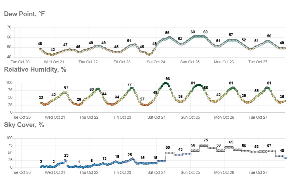 Sunny and dry in Texas, but wild weather across U.S. hits both coasts
Temperatures in Austin will climb to just a few degrees above our mid-October average of 82 degrees. Early-rising Texans might notice temperatures beginning to warm up over the next few mornings. Predawn temps will…
-
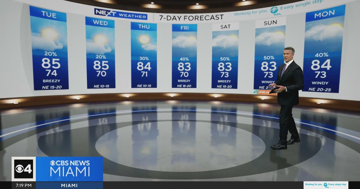 Temperatures lower to the early 80s and late 70s throughout South Florida
CBS News Miami is a local news organization that is part of CBS News and Stations. Also referred to as WFOR-TV and channel 4, CBS News Miami offers local breaking news, weather coverage and investigative reporting…
Sun & moon
Almanac
MonthlyBrownwood 2ne, records since 1893. Normals 1991–2020. Data from NOAA's Regional Climate Centers (ACIS).
Nearby
Forecasters' discussion
From the National Weather Service office in SJT, issued 7 hrs ago
Key Messages
- A gradual warming trend will continue through Friday, with temperatures 5-10 degrees above normal during the weekend.
- Increasing chances for showers and a few thunderstorms early next week.
Short Term
(This evening through Friday) Issued at 152 PM CDT Thu Oct 22 2026
Quiet weather continues for our area in the short term with an upper level ridge our dominant feature. This ridge is centered over Texas today, and will shift into East Texas on Friday. Skies will be mostly clear to partly cloudy tonight with light southeast to south winds. Overnight lows will range from the lower to mid 50s in our southeastern counties, to the upper 50s to around 60 in the Big Country. Temperatures will be warm again on Friday with mostly sunny to partly cloudy skies and afternoon highs 80-85 degrees. South to southeast winds will increase and become somewhat breezy. By afternoon expect wind speeds of 10-15 mph with gusts 20-25 mph.
Long Term
(Friday night through next Thursday) Issued at 152 PM CDT Thu Oct 22 2026
The aforementioned upper level ridge will slowly shift east and build over the Mississippi Valley this weekend, while an upper trough moves from the Southwest to the Four Corners area. With moistening low-level south-southeast flow, expect an increase in cloud cover during the weekend. Temperatures will be above normal, and the increase in low-level moisture and cloud cover will reduce to some extent the daily diurnal range in temperatures. Expect highs to be mostly in the upper 70s to lower 80s Saturday and mid 70s to around 80 on Sunday. Surface pressure gradient and nocturnal low- level jet development will support somewhat gusty south to southeast winds over the weekend.
The upper trough will move east across Colorado/New Mexico Sunday night and into the central/southern Plains on Monday. Expect showers associated with this trough to occur in western and northwestern parts of Texas Sunday, but a few showers may develop or move into our far western counties in the afternoon and evening. With some upper support with the aforementioned trough, the area generally west of a Haskell to San Angelo to Sonora line will have a low chance (15-30 percent) of showers and possibly a thunderstorm Monday afternoon. Isolated to scattered showers and a few storms will be possible across a larger/expanded part of our area Monday night and Tuesday. A weak cold front may move as far south as our northern counties by Tuesday. This would provide an additional focus for possible showers and a few storms. Daily highs should trend down into the mid to upper 70s Monday, and lower to mid 70s on Tuesday. Wednesday looks dry and a little warmer when a shortwave upper ridge is progged to move over Texas.
Aviation
(00Z TAFS) Issued at 530 PM CDT Thu Oct 22 2026
Mainly VFR conditions expected for the next 24 hours with southeast winds becoming light and variable overnight. There is a low chance (<20%) of some scattered MVFR to IFR ceilings west of Sonora, including Ozona, from 12Z to 15Z tomorrow morning. Otherwise, southerly to southeasterly winds will increase to 10-12KT by 18Z with gusts around 20 through 00Z.
Forecasts, observations and alerts in the United States come from the National Weather Service (NOAA); radar from NOAA's Multi-Radar Multi-Sensor system; satellite imagery from NASA's Global Imagery Browse Services (GIBS) and NOAA's GOES satellites; the map from the U.S. Geological Survey's National Map; air quality from AirNow (EPA and its partners); hurricane information from the National Hurricane Center; climate normals and records from NOAA's Regional Climate Centers (ACIS). Forecasts outside the United States and the UV index: MET Norway (CC BY 4.0); observations outside the U.S.: airport reports via NOAA's Aviation Weather Center. Place names: GeoNames (CC BY 4.0). Data are copied on a schedule and may lag the sources; for warnings that affect your safety, follow your local National Weather Service office and emergency officials. Weather news is drawn from the 4Conservative index and reflects what the press published. Terms of use.