Install
Enid, OK 73701 Weather
Current conditions
Forecast for this hour (no station report in the last two hours)
Forecast
10-day-
This Afternoon
Isolated rain showers. Mostly sunny, with a high near 72. South wind around 12 mph.
-
Tonight
Isolated rain showers. Partly cloudy, with a low around 54. South southeast wind 5 to 8 mph.
-
Wednesday
A slight chance of rain showers before 10am. Sunny, with a high near 77. South southeast wind 5 to 10 mph. Chance of precipitation is 20%.
National Weather Service forecast updated 4 hrs ago.
Hourly
Hourly forecast- Now72°11%
- 6 PM71°11%
- 7 PM68°11%
- 8 PM66°11%
- 9 PM62°11%
- 10 PM60°
- 11 PM59°
- Wed12 AM58°
- 1 AM57°10%
- 2 AM56°10%
- 3 AM55°10%
- 4 AM55°11%
- 5 AM55°11%
- 6 AM54°11%
- 7 AM54°16%
- 8 AM54°16%
- 9 AM57°16%
- 10 AM63°10%
- 11 AM67°10%
- 12 PM70°10%
- 1 PM72°
- 2 PM74°
- 3 PM76°
- 4 PM77°
10-day forecast
Details- TodayOct 20Isolated Rain Showers11%54°72°
- WedOct 21Slight Chance Rain Showers then Sunny16%55°77°
- ThuOct 22Sunny56°80°
- FriOct 23Mostly Sunny57°79°
- SatOct 24Partly Sunny28%57°77°
- SunOct 25Chance Rain Showers30%55°73°
- MonOct 26Slight Chance Rain Showers21%54°72°
- TueOct 27Cloudy55°62°
- WedOct 28Cloudy50°60°
- ThuOct 29Partly cloudy47°65°
Days after the National Weather Service's seven are MET Norway's outlook, a computer model with no forecaster's review.
Radar
Full mapWeather news near Enid
More weather news-
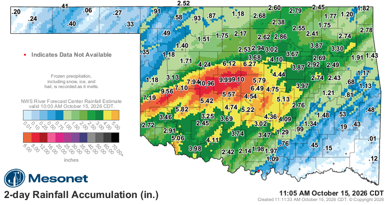 UPDATED: Rain expected to continue Thursday
According to National Weather Service, western and central Oklahoma could see up to 3-4 inches of rainfall through Friday. Parts of the state had received heavy rainfall as of mid-morning Wednesday, Oct. 14, 2026. ENID…
-
 Flooding rain in forecast for mid-week
Enidnews.com Flood Watch from WED 7:00 AM CDT until THU 1:00 PM CDT After a series of hot early fall days, a change is on the way that could involve flooding rains. According to National Weather Service, western and…
-
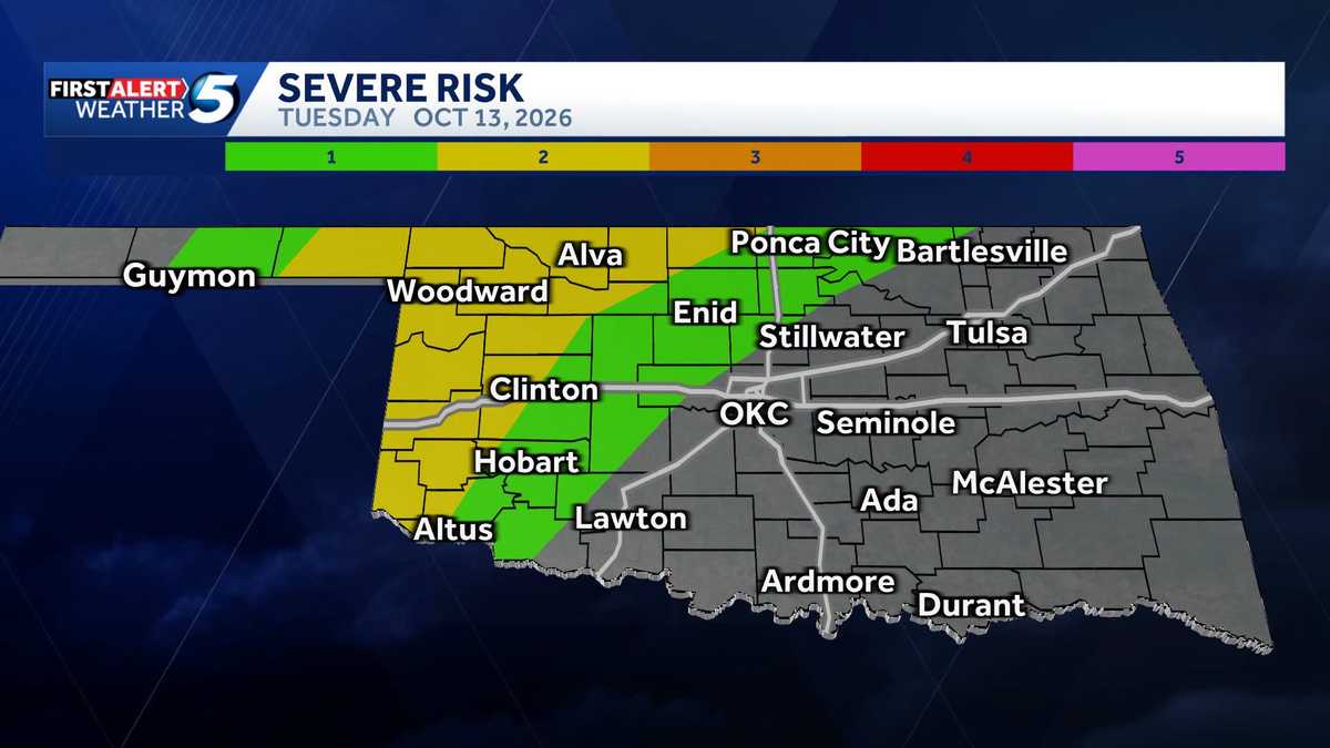 TIMELINE: Storms with severe weather and low tornado risk possible Tuesday in Oklahoma
It's an alert day, as storms bring a severe weather threat and a low tornado risk to Oklahoma on Tuesday. The main severe weather threat is in western, northwestern, and northern Oklahoma. KOCO 5 Meteorologist Jonathan…
-
 Temperate, wet winter expected for Northwest Oklahoma
People fish at Meadowlake Park on a warm autumn day on Monday, Oct. 19, 2026. ENID, Okla. — Summer has been over for about a month now, and what a summer it was. There were several series of 100-degree temperatures, and…
-
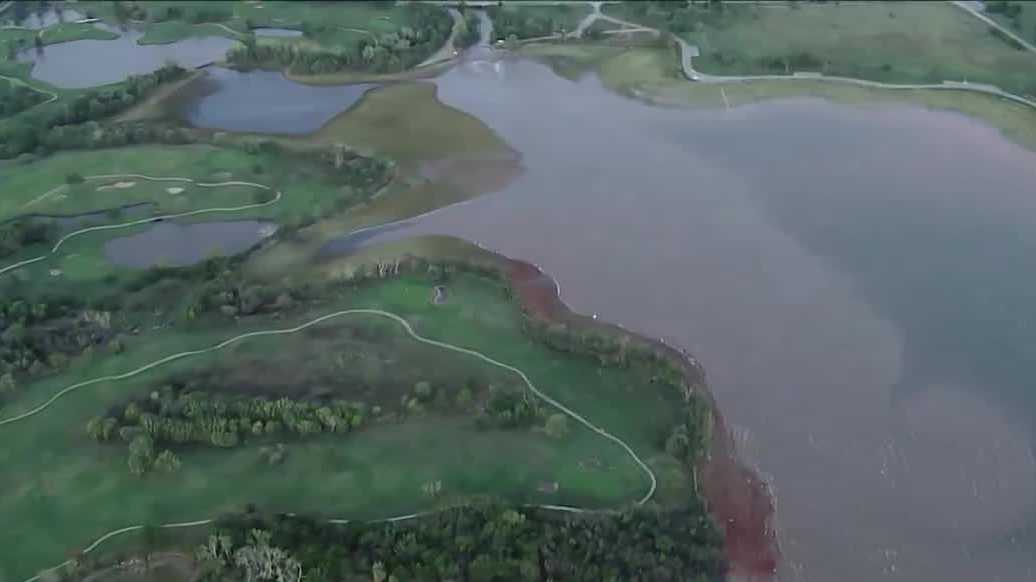 Heavy rain boosts Oklahoma lake levels but drought concerns remain
Recent rainfall in Oklahoma has improved lake levels and farm ponds, but the state remains in a significant drought and needs more rain for full recovery. Nearly a foot of rain in parts of Oklahoma last week brought…
-
 Oklahoma’s Winter Outlook Is In, And The Almanacs Disagree
We've been hearing about the upcoming winter for months now, with early predictions of a potentially brutal season sending meteorologists down the rabbit hole of what El Niño could mean for Oklahoma. The Farmers'…
-
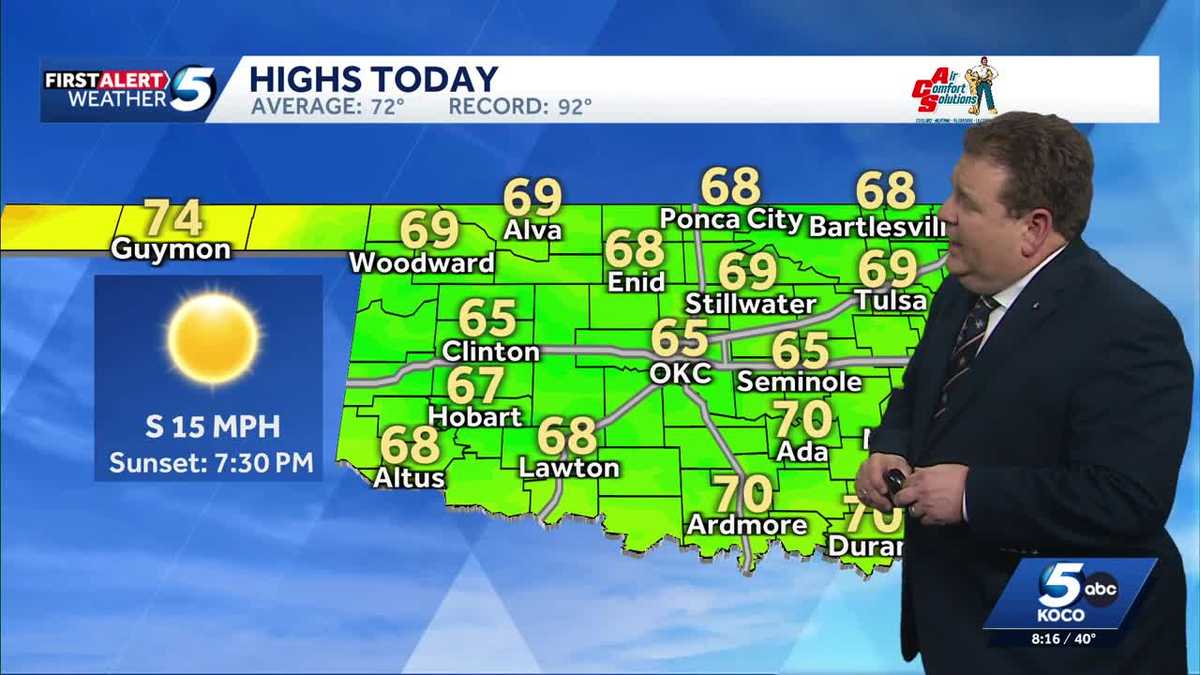 TIMELINE: Cool temperatures across Oklahoma before slight warmup
Oklahoma started Sunday with chilly temperatures in the 30s and 40s, but sunny skies and a light south wind are expected to bring highs of 65 degrees. Oklahoma residents experienced a cold start to Sunday, with…
-
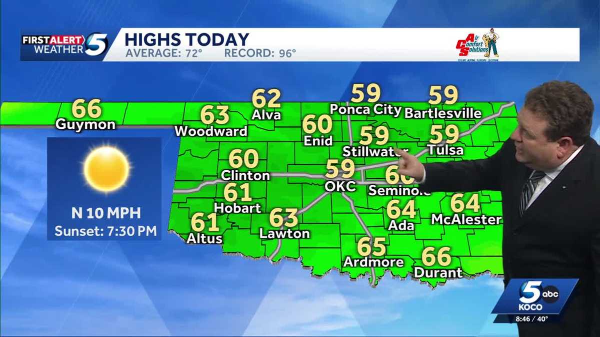 FORECAST: Cold start to weekend in Oklahoma
KOCO 5 Meteorologist Steve Carano shows you the cold start and the high temperatures Oklahoma will see on Saturday. >> Go to the KOCO weather page | Get KOCO on the Go | Subscribe to KOCO 5's YouTube channel | Sign up…
-
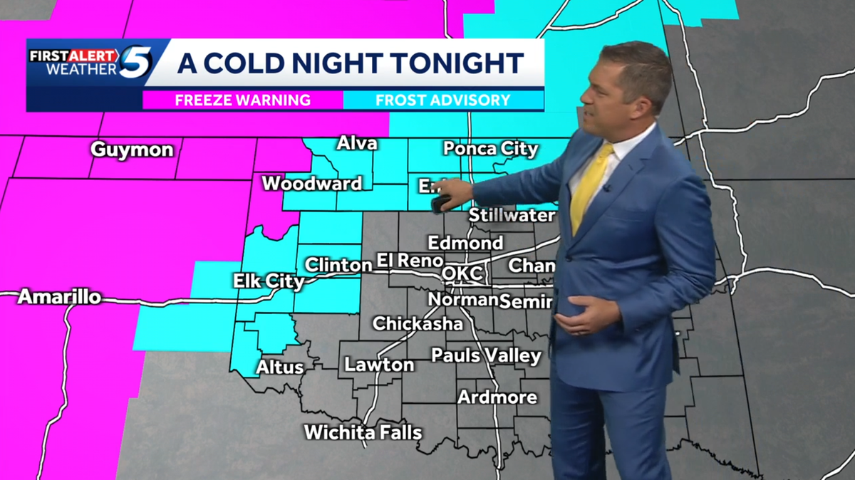 WEEKEND FORECAST: Colder temperatures across Oklahoma with frost advisory, freeze warnings issued
Northwestern Oklahoma is under frost advisories and freeze warnings Friday night, with temperatures potentially dropping to 32 degrees in some areas. A cold night is forecast across Oklahoma, with frost advisories and…
-
 Clearing skies this evening; patchy frost for parts of SW Oklahoma Saturday morning | 10/16 PM
KSWO 7News Clearing skies this evening; patchy frost for parts of SW Oklahoma Saturday morning | 10/16 PM A windy and cool Friday with below average temperatures | 10/16 AM More showers and storms possible ahead of a…
Sun & moon
Almanac
MonthlyEnid, records since 1894. Normals 1991–2020. Data from NOAA's Regional Climate Centers (ACIS).
Nearby
Forecasters' discussion
From the National Weather Service office in OUN, issued 10 hrs ago
Key Messages
Updated at 601 AM CDT Tue Oct 20 2026
- Mostly dry with a continuing warming trend.
- Sprinkles or light showers possible, mainly in north OK through early Wednesday.
- Rain chances return this weekend and continue into early next week.
Near Term
(Through Tuesday) Issued at 151 AM CDT Tue Oct 20 2026
Radar continues to show high based echoes across portions of northern and western OK into the eastern panhandles early this morning. Most of this activity is likely virga or sprinkles. However, some of the activity does look robust enough that more of it could reach the ground in the form of light rain showers. This activity is expected to continue off and on through the day as some isentropic lift occurs and a shortwave moves across the Rockies into the central Plains. Like now, most of the activity will likely not reach the ground (virga) or if it does make it to the ground it will be as sprinkles but a few light rain showers can not be completely ruled out.
Otherwise, south to southeast winds will continue today with highs expected to climb into the mid/upper 70s. These temperatures are at or a few degrees warmer compared to yesterday's highs. The forecast highs are right around normal for this time of year.
Short Term
(Tuesday night through Thursday night) Issued at 151 AM CDT Tue Oct 20 2026
The previously mentioned shortwave is forecast to continue to slowly move east across the central Plains Tuesday night into Wednesday morning continuing the low chance for sprinkles and/or a few light rain showers across portions of northern/central OK. However, most locations will continue to remain dry. Any chance for rain will end later in the day on Wednesday with a dry forecast continuing into Thursday as the upper ridge builds over the southern Plains and upper trough gradually shifts east across the western U.S.
With the ridge over the area, temperatures will continue to warm Wednesday and Thursday with a return to above normal highs across the area. The highs are expected to climb into the mid/upper 70s and low 80s. Lows will also be a bit warmer with temperatures in the mid to upper 50s across the area.
Long Term
(Friday through Monday) Issued at 151 AM CDT Tue Oct 20 2026
The upper ridge will gradually shift east late this week into the weekend as the upper trough continues to slowly approach and eventually move across the Plains. Models diverge on the timing/evolution of this trough over the weekend into next week. However, right now it looks like the trough will bring a chance for some more rain and maybe some storms over the weekend into early next week. Currently, rainfall totals do not look as high (3+ inches) as what occurred in some areas with the last couple of rain events but some locations, primarily in western parts of the fa, might see as much as an 1 to 1.5 inches. The uncertainties of the timing/evolution of this system will have an impact on when/where rain chances will occur which could also have an impact on amounts so will have to wait and see how things come together.
Temperatures are expected to remain near or above average for late October over the weekend into early next week although with maybe a slight cool down early next week.
Forecasts, observations and alerts in the United States come from the National Weather Service (NOAA); radar from NOAA's Multi-Radar Multi-Sensor system; satellite imagery from NASA's Global Imagery Browse Services (GIBS) and NOAA's GOES satellites; the map from the U.S. Geological Survey's National Map; air quality from AirNow (EPA and its partners); hurricane information from the National Hurricane Center; climate normals and records from NOAA's Regional Climate Centers (ACIS). Forecasts outside the United States and the UV index: MET Norway (CC BY 4.0); observations outside the U.S.: airport reports via NOAA's Aviation Weather Center. Place names: GeoNames (CC BY 4.0). Data are copied on a schedule and may lag the sources; for warnings that affect your safety, follow your local National Weather Service office and emergency officials. Weather news is drawn from the 4Conservative index and reflects what the press published. Terms of use.