Install
Jacksonville, AR 72076 Weather
Current conditions
Observed at Little Rock, Adams Field · 25 min ago
Forecast
10-day-
Tonight
Partly cloudy, with a low around 47. Northeast wind 0 to 5 mph.
-
Wednesday
Sunny, with a high near 80. Northeast wind 0 to 5 mph.
-
Wednesday Night
Clear, with a low around 48. Wind around 0 mph.
National Weather Service forecast updated 5 hrs ago.
Hourly
Hourly forecast- Now52°
- 3 AM51°
- 4 AM50°
- 5 AM49°
- 6 AM48°
- 7 AM48°
- 8 AM49°
- 9 AM55°
- 10 AM63°
- 11 AM68°
- 12 PM72°
- 1 PM77°
- 2 PM78°
- 3 PM79°
- 4 PM80°
- 5 PM78°
- 6 PM75°
- 7 PM70°
- 8 PM64°
- 9 PM61°
- 10 PM58°
- 11 PM57°
- Thu12 AM55°
- 1 AM54°
10-day forecast
Details- TonightOct 20Partly Cloudy47°
- TodayOct 21Sunny48°80°
- ThuOct 22Sunny49°81°
- FriOct 23Sunny48°80°
- SatOct 24Sunny48°79°
- SunOct 25Mostly Sunny49°77°
- MonOct 26Mostly Sunny51°78°
- TueOct 27Mostly Sunny74°
- WedOct 28Rain0.14 in55°63°
- ThuOct 29Sunny49°66°
Days after the National Weather Service's seven are MET Norway's outlook, a computer model with no forecaster's review.
Radar
Full mapWeather news near Jacksonville
More weather news-
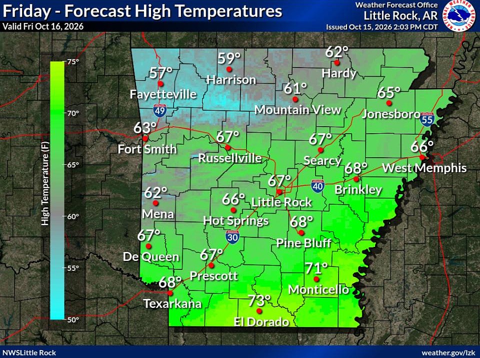 Cold front brings fall temperatures to Arkansas; forecasters warn of continued wildfire risk
The forecast holds good news for those ready for fall in Arkansas. Arkansans should feel some relief from warm temperatures Friday through next week as a cold front has brought cooler temperatures to the state. This…
-
 Northeast Arkansas Weather Update for October 16
| Live Stream | kjnbtv.com kjnbtv.com Cool and breezy Friday with a high of 66° and a low of 46°. A nice weekend is ahead. - Delta Symphony Orchestra to perform Pirates of the Caribbean live in Jonesboro - Jonesboro…
-
 Arkansas Storm Team Forecast: Still no rain in sight
While temperatures will steadily return to the 80s this week in Arkansas, rain chances won’t return in this forecast. That means the wildfire danger persists. Tuesday, October 20, expect partly to mostly sunny skies…
-
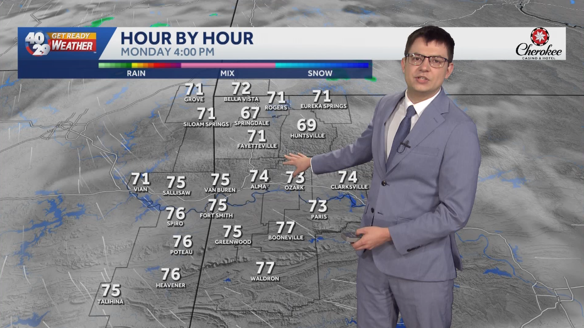 Seasonally warm to start the work week in Arkansas
Morning lows will remain in the 40s over the next few days. Afternoon highs will start to warm back into the 70s early in the work week. High temperatures will warm back into the 80s later in the week. Watch the…
-
 Northeast Arkansas Weather Update for October 15
| Weather | kjnbtv.com kjnbtv.com Mostly clear with a high of 91° and a low of 62°.
-
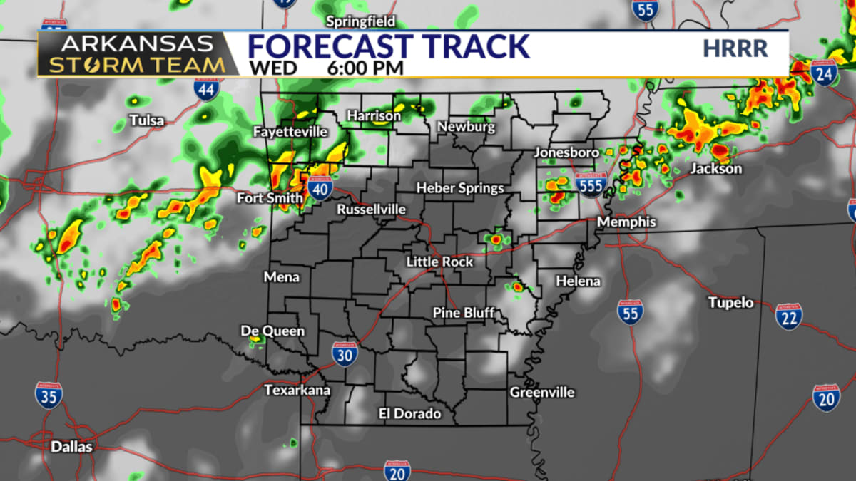 Arkansas Storm Team Forecast: Rain chances trend down Wednesday
While Wednesday was thought to be central Arkansas's best chance of rain in the next week, even those rain chances are trending down. Northern and western Arkansas have the best rain chances on Wednesday. There's still…
Air quality
Acceptable. Unusually sensitive people should consider limiting prolonged outdoor exertion.
Forecast
- WedModerate (60)
Little Rock-North Little Rock, AR reporting area · 1 hr ago. Data from AirNow (EPA and its state, local and tribal partners); preliminary and subject to change.
Sun & moon
Almanac
MonthlyLittle Rock Ap Adams Field, records since 1879. Normals 1991–2020. Data from NOAA's Regional Climate Centers (ACIS).
Nearby
- Little Rock 23 km
- North Little Rock 20 km
- Conway 33 km
- Benton 57 km
- Sherwood 14 km
- Cabot 13 km
- Searcy 52 km
- Bryant 48 km
- Maumelle 25 km
- Beebe 29 km
- East End 45 km
- Greenbrier 42 km
Forecasters' discussion
From the National Weather Service office in LZK, issued 9 hrs ago
Key Messages
Issued at 1220 AM CDT Tue Oct 20 2026
-Warming trend back to above normal levels are possible through the upcoming weekend and possibly longer.
-No significant rainfall is expected through the end of the work week with drought conditions continuing to worsen.
Discussion
Issued at 122 AM CDT Tue Oct 20 2026
Satellite imagery early this morning shows some high level cloudiness streaming over the state from the central and southern PLains. Winds across the state early this morning are light and variable with temperatures in the upper 40s and lower 50s. Temperatures across the state will bottom out in the 40s across the state this morning.
An analysis of upper air charts shows that the Natural state remains under the influence of ridging within northwest flow. Elsewhere,an upper trough was noted just off the Atlantic seaboard with a closed low, while a trough and closed low was digging and strengthen off the US west coast this evening.
Model and ensemble model analysis early this morning shows northwest flow will remaining in place across Arkansas through the latter part of this week. As we head into the latter part of the week into the weekend, the upper ridge will strengthen as it moves toward and over this state during the upcoming weekend. There is some variations in strength of the ridge and track of the upper trough as it moves through the central and southern Plains.
The aforementioned upper trough and closed low will come ashore along the US west coast sometime within the Wednesday night into Thursday morning. The upper trough/closed low moving northeast across southern California into Nevada Thursday and northern Rockies on Friday. On the heels of that trough will be another upper trough that will move into California Thursday night into Friday, then into the Desert southwest this weekend. The upper trough will progress into the southern Rockies by the end of this weekend dragging an attendant cold front with it.
The upper trough and cold front will move into the central this weekend into early next week. Both the ECMWF and GFS show the front moving through the state, but the front will have limited moisture to work with and the best chance for appreciable rainfall generally across north and northwest Arkansas. Temperatures through the period will run roughly 10 degrees above normal for late October for afternoon highs.
Aviation
(00Z TAFS) Issued at 530 PM CDT Tue Oct 20 2026
Expect the VFR conditions to persist through this TAF period.
Preliminary Point Temps
Batesville AR 45 78 47 79 / 0 0 0 0 Camden AR 44 81 45 83 / 0 0 0 0 Harrison AR 46 76 49 78 / 0 0 0 0 Hot Springs AR 46 81 48 82 / 0 0 0 0 Little Rock AR 48 80 49 81 / 0 0 0 0 Monticello AR 47 81 49 81 / 0 0 0 0 Mount Ida AR 43 80 44 83 / 0 0 0 0 Mountain Home AR 45 75 47 77 / 0 0 0 0 Newport AR 47 79 48 80 / 0 0 0 0 Pine Bluff AR 45 81 47 81 / 0 0 0 0 Russellville AR 46 79 47 81 / 0 0 0 0 Searcy AR 47 79 48 80 / 0 0 0 0 Stuttgart AR 47 81 48 81 / 0 0 0 0
Forecasts, observations and alerts in the United States come from the National Weather Service (NOAA); radar from NOAA's Multi-Radar Multi-Sensor system; satellite imagery from NASA's Global Imagery Browse Services (GIBS) and NOAA's GOES satellites; the map from the U.S. Geological Survey's National Map; air quality from AirNow (EPA and its partners); hurricane information from the National Hurricane Center; climate normals and records from NOAA's Regional Climate Centers (ACIS). Forecasts outside the United States and the UV index: MET Norway (CC BY 4.0); observations outside the U.S.: airport reports via NOAA's Aviation Weather Center. Place names: GeoNames (CC BY 4.0). Data are copied on a schedule and may lag the sources; for warnings that affect your safety, follow your local National Weather Service office and emergency officials. Weather news is drawn from the 4Conservative index and reflects what the press published. Terms of use.