Install
Norfolk, NE 68701 Weather
Current conditions
Observed at Norfolk, Stefan Memorial Airport · 1 hr ago
Forecast
10-day-
Today
Sunny, with a high near 76. South southwest wind around 7 mph.
-
Tonight
Mostly clear. Low around 50, with temperatures rising to around 52 overnight. South wind around 5 mph.
-
Thursday
Sunny, with a high near 77. South wind 1 to 13 mph, with gusts as high as 21 mph.
National Weather Service forecast updated 2 hrs ago.
Hourly
Hourly forecast- Now66°
- 1 PM70°
- 2 PM73°
- 3 PM74°
- 4 PM76°
- 5 PM75°
- 6 PM74°
- 7 PM69°
- 8 PM64°
- 9 PM62°
- 10 PM60°
- 11 PM58°
- Thu12 AM56°
- 1 AM55°
- 2 AM54°
- 3 AM54°
- 4 AM53°
- 5 AM52°
- 6 AM51°
- 7 AM50°
- 8 AM50°
- 9 AM53°
- 10 AM59°
- 11 AM65°
10-day forecast
Details- TodayOct 21Sunny50°76°
- ThuOct 22Sunny57°77°
- FriOct 23Mostly Sunny14%60°78°
- SatOct 24Chance Rain Showers53%46°70°
- SunOct 25Chance Rain Showers62%41°57°
- MonOct 26Rain Showers Likely62%37°53°
- TueOct 27Chance Rain Showers25%37°53°
- WedOct 28Mostly sunny46°66°
- ThuOct 29Sunny37°51°
- FriOct 30Sunny37°58°
Days after the National Weather Service's seven are MET Norway's outlook, a computer model with no forecaster's review.
Radar
Full mapWeather news near Norfolk
More weather news-
 Rainfall amounts for Oct. 16, 2026
Listed below is the 24-hour rainfall in inches as of 7 a.m. Atkinson 0.22 Roger Brink Beemer 0.45 Jake Ott Belden 0.50 Chuck Arduser Coleridge (2 miles north) 0.38 Sheryl Kalin Creighton 0.11 Norman Doerr Elgin 0.43 NWS…
-
 Fall at its finest in Nebraska: enjoy it while it lasts before more wind and weekend rain chances
LINCOLN, Neb. (KOLN) - A weak weather system passing south of the region will bring a small chance for spotty showers and sprinkles across southern Nebraska tonight, but don’t let that dampen your plans. The rain chance…
-
 Warming trend through the work week across Nebraska ends with more wind, fire danger
LINCOLN, Neb. (KOLN) - The pleasant pattern continues through the week. Highs will reach the mid 60s to low 70s Monday and Tuesday, with similar conditions Wednesday. By Thursday and Friday, temperatures will push into…
- Nebraska Winter Weather: First Snow Before Thanksgiving, Nov. 26?
Omaha, NE – Nebraska residents preparing for Thanksgiving travel have a historical snowfall date to watch this fall. Omaha typically records its first measurable snow nearly two weeks before the holiday, while freezing…
- First freeze of the season expected tonight for much of Nebraska
LINCOLN, Neb. (KOLN) - Grab your jackets and protect your plants. Nebraska is bracing for its coldest night of the season Friday into Saturday morning, with Freeze Warnings in place across most of the state as fall’s…
-
 First Hard Freeze and Frost Warnings Threaten Kansas and Southeast Nebraska
The Sunflower State Radio Network First Hard Freeze and Frost Warnings Threaten Kansas and Southeast Nebraska The first widespread autumn freeze is knocking on the door. The National Weather Service has issued a cascade…
-
 Freeze Watch in effect for central Nebraska for Saturday morning
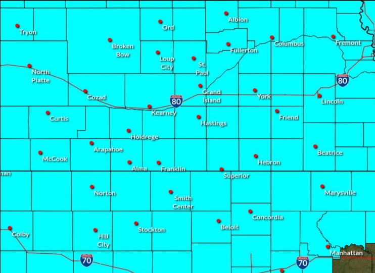
A Freeze Watch has been issued for central Nebraska through the morning of Saturday, Oct. 17, (NWS Hastings, Courtesy) HASTINGS — A Freeze Watch has been issued for all of central Nebraska from the evening of Friday…
-
 First Freeze Possible Saturday Morning Across Eastern Nebraska
KLIN First Freeze Possible Saturday Morning Across Eastern Nebraska Eastern Nebraska is in for a sharp change in weather, with gusty winds, much colder temperatures and a possible first freeze Saturday morning. “A…
-
 Nebraska Braces for Rain, Strong Winds and First Frost
According to WOWT, Omaha had experienced four consecutive days with temperatures in the 90s before the sharp transition to fall weather. Wednesday's high was expected to reach only 60 degrees, with a 30% chance of…
-
 Showers and gusty winds before a sunny weekend in Greater Nebraska
knopnews2 Showers and gusty winds before a sunny weekend in Greater Nebraska Fall Weather Whiplash: Rain, Gusty Winds and a Sunny Rebound Midweek Showers Give Way to a Sunny, Warmer Weekend
Air quality
Acceptable. Unusually sensitive people should consider limiting prolonged outdoor exertion.
WTN2, NE reporting area · 1 hr ago. Data from AirNow (EPA and its state, local and tribal partners); preliminary and subject to change.
Sun & moon
Almanac
MonthlyNorfolk Area, records since 1893. Normals 1991–2020. Data from NOAA's Regional Climate Centers (ACIS).
Nearby
Forecasters' discussion
From the National Weather Service office in OAX, issued 6 hrs ago
Key Messages
- Warmer weather is expected through Friday with highs in the 70s with a few areas approaching 80.
- Winds gusting to around 30-40mph on Friday will be a concern for some limited fire impacts in areas with cured fuels. However, the strongest winds will not be co-located with the lowest RH values.
- Expect a cool down heading into Sunday, as highs struggle to reach the 50s and 60s in many areas.
Discussion
Issued at 1131 PM CDT Tue Oct 20 2026
A weak shortwave trough continues to slide across the Great Plains tonight into Wednesday morning. A few showers have kicked off across northern Kansas and are slowly making their way up into southeastern Nebraska. They will be fighting some dry air, so not super confident in much measurable precipitation reaching the ground in many locations. A few sprinkles or a light shower may be possible (20% chance), mainly for those along and south of a line from David City to Wahoo to Council Bluffs.
Thursday, a mid-level ridge builds over the Central High Plains into the Dakotas, shifting over the Great Plains by Friday. Expect afternoon high temperatures to climb into the mid to upper 70s each day, with a few locations approaching 80. Friday will be a day to monitor for changes, which could result in some fire weather concerns. Minimum relative humidity values will be mainly in the mid- 30s to mid-40s. There will be some pockets of lower RH values (upper 20s to mid-30s) along the Kansas Nebraska border. Wind gusts in this area may approach 25mph. The areas of stronger winds are anticipated to stay near the Nebraska/South Dakota border where RH values will be higher. That being said we do have some areas with drier fuels. Should a fire spark, there may be some localized problems; however, widespread fire weather concerns are not currently expected.
Saturday, low pressure moves across Saskatchewan and Manitoba with an attendant cold front sweeping across Nebraska and the Dakotas. Expect a few showers and possibly a rumble of thunder across our northern Nebraska counties Friday evening as the front starts to move through. Better chances for showers are expected Saturday into Sunday. Additional shower activity is expected Monday as a mid-level trough drops into the region from the north.
Saturday high temperatures will be dependent on location as the front moves through. Areas in northern Nebraska may struggle to reach the 70s, while areas near the Kansas/Nebraska/Missouri border may approach 80 degrees. Cooler air settles in Sunday and Monday with highs in the 50s and 60s. Lows will be primarily in the 40s. Tuesday morning, portions of northern Nebraska may fall into the mid to upper 30s.
Aviation
Issued at 550 AM CDT Wed Oct 21 2026
VFR conditions favored through the period with passing mid to high clouds. Expect southwesterly to southerly winds to remain under 10 kts. A few pieces of guidance hint at fog development late in the period, but confidence in impacts at TAF sites this far out is too low to include mention at this time.
Oax Watches
NE...None. IA...None.
Forecasts, observations and alerts in the United States come from the National Weather Service (NOAA); radar from NOAA's Multi-Radar Multi-Sensor system; satellite imagery from NASA's Global Imagery Browse Services (GIBS) and NOAA's GOES satellites; the map from the U.S. Geological Survey's National Map; air quality from AirNow (EPA and its partners); hurricane information from the National Hurricane Center; climate normals and records from NOAA's Regional Climate Centers (ACIS). Forecasts outside the United States and the UV index: MET Norway (CC BY 4.0); observations outside the U.S.: airport reports via NOAA's Aviation Weather Center. Place names: GeoNames (CC BY 4.0). Data are copied on a schedule and may lag the sources; for warnings that affect your safety, follow your local National Weather Service office and emergency officials. Weather news is drawn from the 4Conservative index and reflects what the press published. Terms of use.