Install
Salina, KS 67401 Weather
Current conditions
Observed at Salina, Salina Municipal Airport · 28 min ago
Forecast
10-day-
Wednesday
A slight chance of rain showers before 10am. Sunny, with a high near 76. South southeast wind around 7 mph. Chance of precipitation is 20%.
-
Wednesday Night
Mostly clear, with a low around 53. South southeast wind around 5 mph.
-
Thursday
Sunny, with a high near 78. South southeast wind 3 to 13 mph, with gusts as high as 21 mph.
National Weather Service forecast updated 8 hrs ago.
Hourly
Hourly forecast- Now73°
- 2 PM74°
- 3 PM76°
- 4 PM76°
- 5 PM76°
- 6 PM74°
- 7 PM72°
- 8 PM67°
- 9 PM63°
- 10 PM61°
- 11 PM59°
- Thu12 AM58°
- 1 AM57°
- 2 AM56°
- 3 AM54°
- 4 AM54°
- 5 AM53°
- 6 AM53°
- 7 AM53°
- 8 AM53°
- 9 AM56°
- 10 AM61°
- 11 AM66°
- 12 PM70°
10-day forecast
Details- TonightOct 20Slight Chance Rain Showers22%55°
- TodayOct 21Slight Chance Rain Showers then Sunny22%53°76°
- ThuOct 22Sunny57°78°
- FriOct 23Mostly Sunny59°77°
- SatOct 24Partly Sunny55°77°
- SunOct 25Chance Rain Showers47%50°70°
- MonOct 26Chance Rain Showers52%45°63°
- TueOct 27Slight Chance Rain Showers23%60°
- WedOct 28Sunny34°51°
- ThuOct 29Sunny35°60°
Days after the National Weather Service's seven are MET Norway's outlook, a computer model with no forecaster's review.
Radar
Full mapWeather news near Salina
More weather news-
 Trudy strengthens to a hurricane as system nears Mexico’s coast with major storm expected
Trudy has intensified into a Category 1 hurricane as it approaches the Pacific coast of Mexico. Trudy was located about 300 miles (480 kilometers) southwest of Acapulco, Mexico, with maximum sustained winds of 75 mph…
-
 Forecast - North-Central 10-13-2026
County Name: Clark County County Name: Edwards County County Name: Kiowa County County Name: Pratt County County Name: Comanche County County Name: Stafford County County Name: Barber County Headline: Flood Watch from…
-
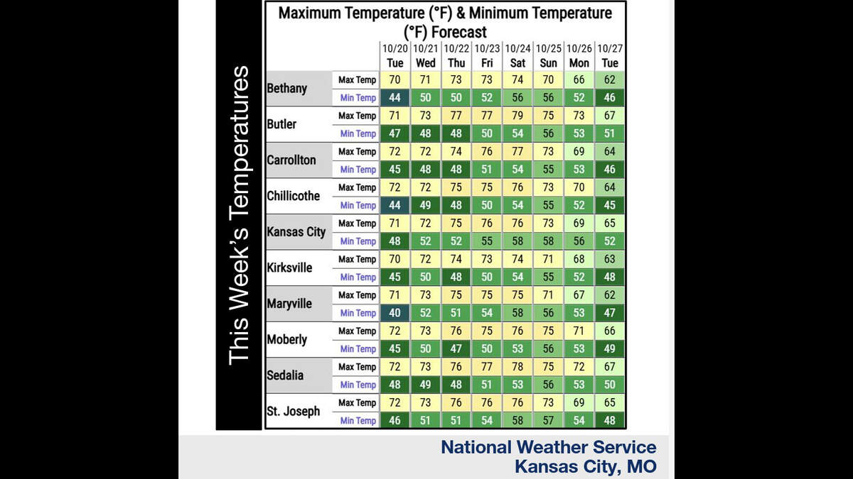 Kansas City’s warm, mostly dry stretch lasts through Sunday. What comes next?
Fall temperatures are climbing in Kansas City again Tuesday, with warmer-than-normal weather expected through the weekend, the National Weather Service says. Skies will become increasingly cloudy as metro temperatures…
-
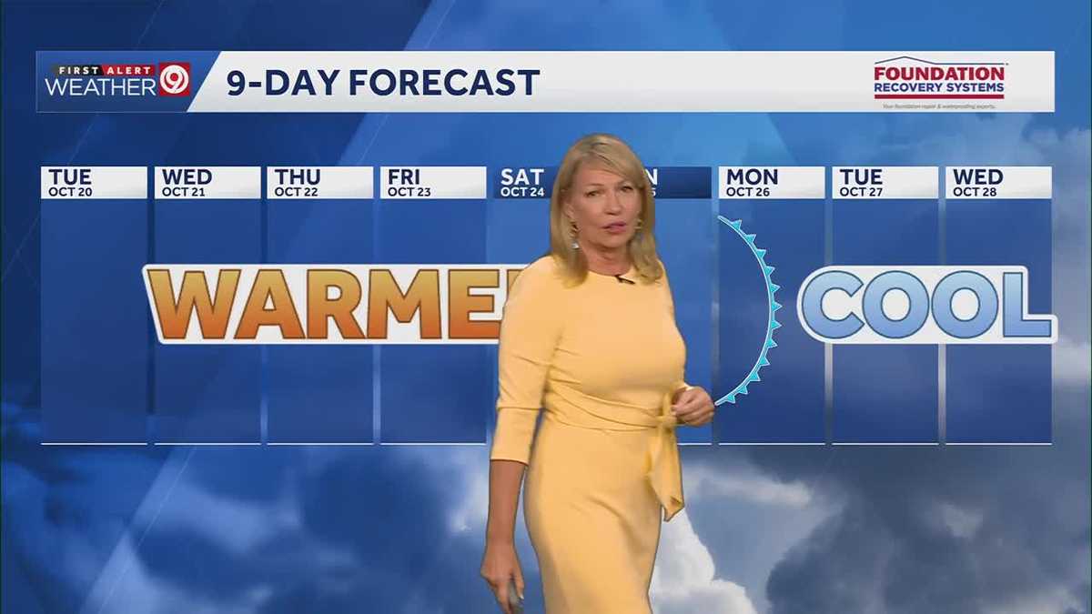 Warming trend continues for Kansas City
You may encounter a stray sprinkle but otherwise, we continue a warming trend KMBC Tuesday: mix sun and clouds. High 70, wind: S 5-10 mph Wed: Partly cloudy 51/73 Wind: S 5 mph Thu: Mostly sunny: 52/75 wind: SSE 5-10 mph
-
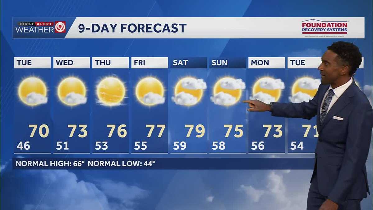 After a cool few days, warmer temperatures return starting Tuesday in Kansas City
After some cool and comfortable fall temperatures, things start to warm up once again for the rest of the week! Expect sunshine and dry conditions for the next few days. Tuesday will be partly cloudy with highs in the…
-
 KSHB 41 Weather | Sunshine and highs in the 60s Sunday in Kansas City
KSHB 41 Weather | Sunshine and highs in the 60s Sunday KSHB 41 Kansas City KSHB 41 Weather | Sunshine and highs in the 60s Sunday in Kansas City KANSAS CITY, Mo. — Hosting an event or gathering? Send your weather…
-
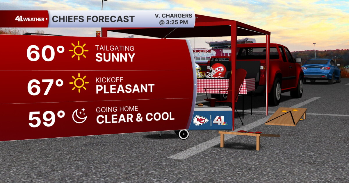 KSHB 41 Weather Blog | Pleasant stretch of weather in store for Kansas City
KANSAS CITY, Mo. — Pleasant, fall weather is sticking around for the next few days, before highs reach near 80° by the end of the week. Sunday is going to be the ideal fall day. Chilly in the morning, then reaching the…
- Kansas City Weather Forecast: Freeze Watch Before 80-Degree Warmup
Kansas City was expected to wake to temperatures in the lower 40s Friday morning, with skies possibly clear at first and stratus potentially moving through, and a sharp north wind making the October air feel colder than…
- Southwest Kansas Forecast | KAKE First Alert Weather
KAKE (1 of 5) : Freeze Warning from SAT 1:00 AM CDT until SAT 10:00 AM CDT (2 of 5) : Freeze Warning from SAT 12:00 AM MDT until SAT 9:00 AM MDT (3 of 5) : Freeze Warning from SAT 12:00 AM MDT until SAT 8:00 AM MDT (4…
-
 Severe Weather Alert: Heavy Rain and Flooding Expected Across Kansas
Home » Trending » Severe Weather Alert: Heavy Rain and Flooding Expected Across Kansas WICHITA, Kan. – Residents in south central and southeast Kansas are bracing for an ongoing weather pattern characterized by…
Sun & moon
Almanac
MonthlySalina Area, records since 1900. Normals 1991–2020. Data from NOAA's Regional Climate Centers (ACIS).
Nearby
- McPherson 50 km
- Abilene 39 km
- Lindsborg 28 km
- Ellsworth 52 km
- Minneapolis 34 km
Forecasters' discussion
From the National Weather Service office in ICT, issued 14 min ago
Key Messages
- Morning showers/sprinkles diminishing early with mild and dry conditions anticipated through much of the weekend.
- Increasing chances for showers will arrive late Sunday into Monday night while a cold front ushers in cooler air Mon and especially on Tuesday.
Discussion
Issued at 335 AM CDT Wed Oct 21 2026
A shortwave trough situated over the Central Plains will continue moving slowly eastward as we move into the day. Some lingering showers and sprinkles this morning will gradually diminish with clearing from west to east as we move into the late morning and early afternoon hours. Abundant afternoon insolation will result in above average temperatures with maximum temperatures climbing into the 70s areawide. Normal highs for late October are in the upper 60s.
Thu-Sat...a narrow mid/upper ridge will continue to impact the area through Saturday bringing above average temperatures and dry weather conditions. This ridge will gradually translate eastward into the Mississippi Valley area while a robust mid/upper trough just off the CA coast today will gradually build eastward into the Central Great Basin area and the Southwest. As we move into Saturday, the entrance region to the H25 jet will gradually build into the Central High Plains bringing increasing chances for showers to much of western and parts of central KS late in the period.
Higher probabilities for showers are expected to arrive Sunday night into Monday night as the pv anomaly accelerates over the Central Plains region and a cold front arrives ushering in cooler more seasonable air for Monday-Tuesday. Below average temperatures are expected in the wake of the front with highs on Tue struggling to climb out of the 50s over parts of central KS.
Aviation
Issued at 1252 PM CDT Wed Oct 21 2026
VFR conditions through the forecast period. Light southerly winds will turn southeasterly this evening. Clouds will continue to clear across southeast Kansas with only a few mid-level clouds through the end of the TAF time frame
Ict Watches
None.
Forecasts, observations and alerts in the United States come from the National Weather Service (NOAA); radar from NOAA's Multi-Radar Multi-Sensor system; satellite imagery from NASA's Global Imagery Browse Services (GIBS) and NOAA's GOES satellites; the map from the U.S. Geological Survey's National Map; air quality from AirNow (EPA and its partners); hurricane information from the National Hurricane Center; climate normals and records from NOAA's Regional Climate Centers (ACIS). Forecasts outside the United States and the UV index: MET Norway (CC BY 4.0); observations outside the U.S.: airport reports via NOAA's Aviation Weather Center. Place names: GeoNames (CC BY 4.0). Data are copied on a schedule and may lag the sources; for warnings that affect your safety, follow your local National Weather Service office and emergency officials. Weather news is drawn from the 4Conservative index and reflects what the press published. Terms of use.