Install
Anthony, KS 67003 Weather
Current conditions
Observed at Medicine Lodge, Medicine Lodge · 1 hr ago
Forecast
10-day-
Sunday
Mostly cloudy, with a high near 77. South southeast wind 2 to 10 mph.
-
Sunday Night
Mostly cloudy, with a low around 55.
-
Monday
A chance of rain showers after 7am. Mostly cloudy, with a high near 71. Chance of precipitation is 40%.
National Weather Service forecast updated 2 days ago.
Hourly
Hourly forecast- Now70°
- 1 PM73°
- 2 PM75°
- 3 PM76°
- 4 PM76°
- 5 PM76°
- 6 PM74°
- 7 PM72°
- 8 PM69°
- 9 PM66°
- 10 PM64°
- 11 PM63°
- Mon12 AM62°
- 1 AM61°
- 2 AM60°
- 3 AM59°
- 4 AM58°
- 5 AM57°
- 6 AM56°
- 7 AM56°39%
- 8 AM57°39%
- 9 AM59°39%
- 10 AM61°39%
- 11 AM63°39%
10-day forecast
Details- FriOct 23Mostly Sunny56°79°
- SatOct 24Partly Sunny55°78°
- TodayOct 25Mostly Cloudy55°77°
- MonOct 26Chance Rain Showers39%54°71°
- TueOct 27Chance Rain Showers26%54°70°
- WedOct 28Slight Chance Rain Showers41%55°74°
- ThuOct 29Chance Rain Showers41%53°72°
- FriOct 30Mostly sunny46°69°
- SatOct 31Mostly sunny0.08 in55°74°
- SunNov 1Partly cloudy56°75°
Days after the National Weather Service's seven are MET Norway's outlook, a computer model with no forecaster's review.
Radar
Full mapWeather news near Anthony
More weather news-
 Dog gets the zoomies among peak New England foliage
Adorable dog gets the zoomies among colorful New England leaves The Weather Channel Adorable dog gets the zoomies among colorful New England leaves Adorable footage shows a dog bounding through piles of vibrant leaves…
-
 Soggy weekend on the way for South Florida, but slightly cooler temps aren’t far behind
A rainy weekend is forecast for South Florida before drier air sweeps through the region early next week. This weekend is “really going to be characterized by an incoming cold front,” said Anthony Duarte, a…
-
 I’ll Take “What Is a Cold Front?” for $500, Anthony
My first day at KPRC 2 was July 15, 2003. That fall, I received my first email from a viewer explaining that the system moving through Southeast Texas couldn’t be a cold front because it wasn’t actually cold. You’ve…
-
 Trudy strengthens to a hurricane as system nears Mexico’s coast with major storm expected
Trudy has intensified into a Category 1 hurricane as it approaches the Pacific coast of Mexico. The U.S. National Hurricane Center reports Trudy is about 300 miles southwest of Acapulco, with maximum sustained winds of…
-
 Cobb climate summary & weather forecast for Wednesday, October 14, 2026
Tonight it is expected to be clear, with an overnight low of around 62 degrees. Sunny, with a high near 87. Calm wind becoming west around 5 mph in the afternoon. Clear, with a low around 62. Calm wind. Sunny, with a…
-
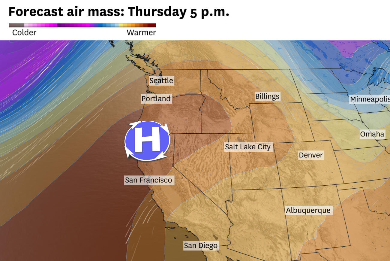 The Bay Area is about to get another flash of summer weather. Here’s how long it’ll last
A high-pressure system over Northern California and weak low-pressure system near Arizona will work in tandem to push warm continental air toward the coast on Thursday and Friday. San Francisco should surpass 80 degrees…
-
 Dangerous Freeze Warnings Issued for Nevada, Idaho and Utah as Temperatures Plummet
Freeze Warnings are in effect tonight across parts of Utah, Nevada and Idaho, with lows in the mid to upper 20s on the Snake River Plain around Idaho Falls and Pocatello, and 28 in Lincoln County, Nevada. The warnings…
-
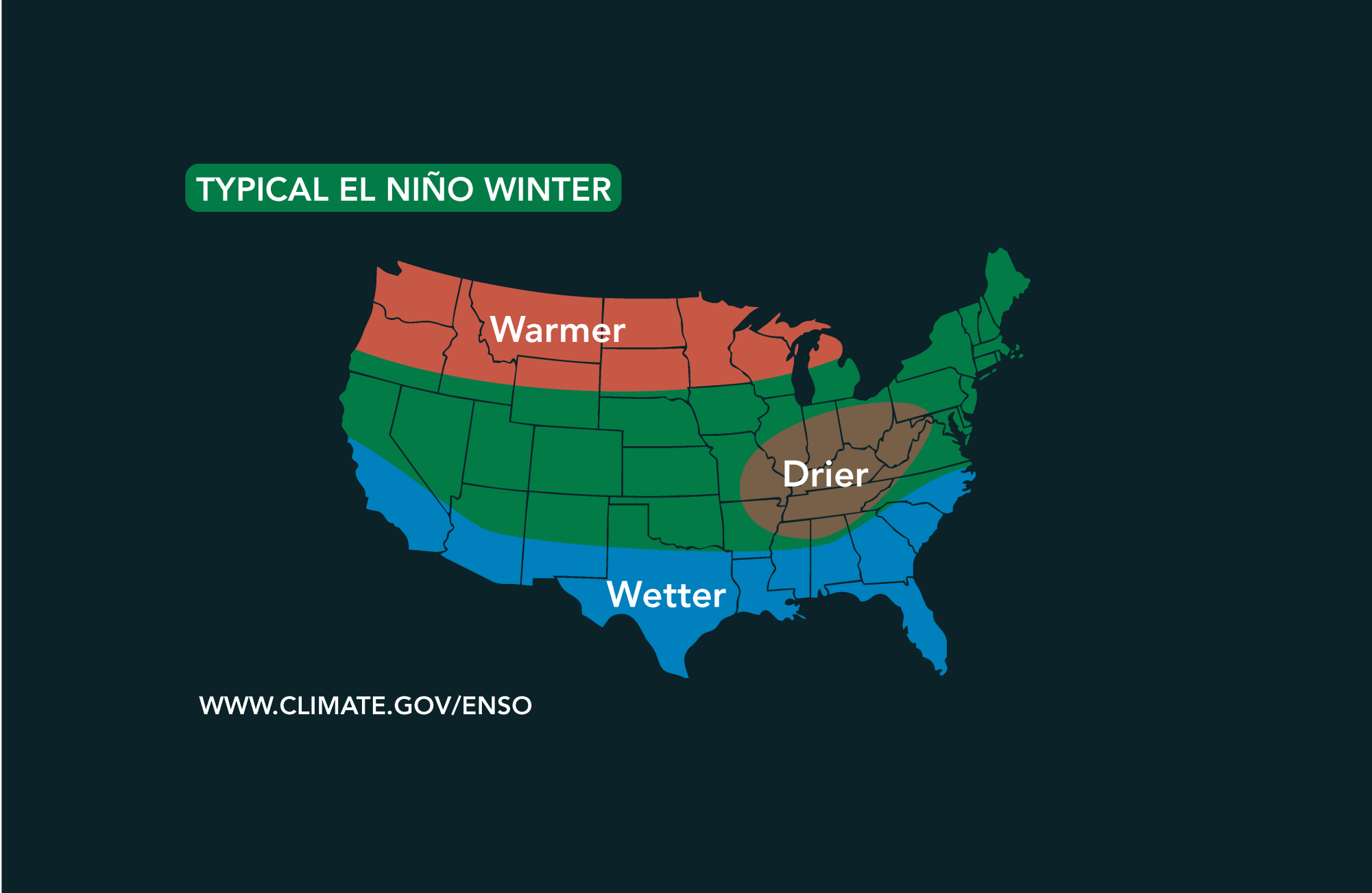 Potential El Niño to affect Kansas agriculture
Student critically injured after falling 70 feet in effort to avoid incoming vehicle • 2338 views College of Arts and Sciences to face future budget cuts • 2090 views K-State President Richard Linton to leave Wildcats…
-
 #Drought news October 22, 2026: Improvements occurred across portions of #Kansas, #Nebraska, #Colorado, #Wyoming, #Utah, #Arizona and #NewMexico
Drought news October 22, 2026: Improvements occurred across portions of #Kansas, #Nebraska, #Colorado, #Wyoming, #Utah, #Arizona and #NewMexico coyotegulch.blog Click on a thumbnail graphic to view a gallery of drought…
-
 30 years since ‘October Surprise’ snowstorm hit Kansas City
KANSAS CITY, Mo. -- The thought of snow this October seems far away with the first part of the month still feeling like summer with temperatures reaching 90 degrees and severe weather last week. Thursday marks 30 years…
Sun & moon
Almanac
MonthlyAnthony, records since 1897. Normals 1991–2020. Data from NOAA's Regional Climate Centers (ACIS).
Nearby
- Wellington 60 km
- Kingman 56 km
- Cheney 58 km
Forecasters' discussion
From the National Weather Service office in ICT, issued 8 hrs ago
Key Messages
- Near to above average temperatures over the upcoming week
- Rain chances increase this afternoon across central KS; chances spread into south-central KS by Monday night
- More rain chances by late next week into next weekend
Discussion
Issued at 315 AM CDT Sun Oct 25 2026
As of 230 AM Sunday morning, a slow-moving midlevel trough remains across the southwest US with ridging across the central and eastern CONUS. A northern stream midlevel shortwave trough was advancing across Ontario with an attendant surface trough bisecting KS from southwest to northeast. Widely scattered showers continue to reside across far western KS and CO within a broad zone of midlevel WAA and gentle height falls. The midlevel height falls will gradually spread eastward this afternoon and tonight. This will spread rain chances into portions of central KS late this afternoon into the evening. These widely scattered showers will continue tonight and into Monday with the best chances remaining across central and western KS. More- widespread rain shower activity is anticipated Monday afternoon as the main shortwave trough ejects into the central high Plains. Rain chances will extend to the I-135 corridor Monday afternoon and even towards southeast KS late Monday night into Tuesday morning a secondary weak shortwave trough lifts from west TX into the Ozarks. As far as rain amounts are concerns, areas generally along and southeast of the KS Turnpike will see the lightest amounts with totals near or less than 0.10". As we progress westward and into central KS, amounts up to 0.50" are possible, especially across Barton and Russell counties.
Transitioning into midweek, broad southwesterly midlevel flow will remain as another western CONUS trough deepens. Broad low and midlevel WAA may continue to yield isolated to scattered showers especially at night. By weeks-end and into next week, a series of weak perturbations may eject across the area, resulting in intermittent rain chances.
Aviation
Issued at 1028 PM CDT Sat Oct 24 2026
A frontal boundary will stall over central Kansas tonight then gradually lift back northward on Sunday with north winds behind the front switching back to the south. High clouds will stream across the region with VFR conditions expected over the next 24hrs.
Ict Watches
None.
Forecasts, observations and alerts in the United States come from the National Weather Service (NOAA); radar from NOAA's Multi-Radar Multi-Sensor system; satellite imagery from NASA's Global Imagery Browse Services (GIBS) and NOAA's GOES satellites; the map from the U.S. Geological Survey's National Map; air quality from AirNow (EPA and its partners); hurricane information from the National Hurricane Center; climate normals and records from NOAA's Regional Climate Centers (ACIS). Forecasts outside the United States and the UV index: MET Norway (CC BY 4.0); observations outside the U.S.: airport reports via NOAA's Aviation Weather Center. Place names: GeoNames (CC BY 4.0). Data are copied on a schedule and may lag the sources; for warnings that affect your safety, follow your local National Weather Service office and emergency officials. Weather news is drawn from the 4Conservative index and reflects what the press published. Terms of use. How to use Weather