Install
Rogersville, MO 65742 Weather
Current conditions
Forecast for this hour (no station report in the last two hours)
Forecast
10-day-
Today
Sunny. High near 76, with temperatures falling to around 74 in the afternoon. East wind around 1 mph.
-
Tonight
Mostly clear, with a low around 50. East wind 1 to 7 mph.
-
Friday
Sunny. High near 75, with temperatures falling to around 73 in the afternoon. Southeast wind around 8 mph.
National Weather Service forecast updated 5 hrs ago.
Hourly
Hourly forecast- Now71°
- 1 PM74°
- 2 PM75°
- 3 PM76°
- 4 PM76°
- 5 PM74°
- 6 PM71°
- 7 PM66°
- 8 PM59°
- 9 PM57°
- 10 PM56°
- 11 PM55°
- Fri12 AM54°
- 1 AM53°
- 2 AM53°
- 3 AM52°
- 4 AM51°
- 5 AM51°
- 6 AM50°
- 7 AM50°
- 8 AM51°
- 9 AM56°
- 10 AM63°
- 11 AM67°
10-day forecast
Details- TodayOct 22Sunny50°76°
- FriOct 23Sunny50°75°
- SatOct 24Mostly Sunny51°76°
- SunOct 25Partly Sunny50°76°
- MonOct 26Partly Sunny48°72°
- TueOct 27Partly Sunny45°68°
- WedOct 28Mostly Sunny47°68°
- ThuOct 29Cloudy0.13 in42°62°
- FriOct 30Partly cloudy36°58°
- SatOct 31Cloudy46°65°
Days after the National Weather Service's seven are MET Norway's outlook, a computer model with no forecaster's review.
Radar
Full mapWeather news in Missouri
More weather news-
 Freeze alerts stretch from Missouri to New York for Sunday
Temps drop for millions across the Central Plains, Midwest, Northeast The first real taste of fall is settling in for millions, including a few first frosts and freezes of the season for some in the Midwest and East…
-
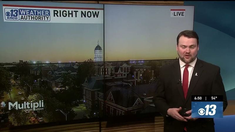 Saturday Evening Forecast: What Mid-Missouri Can Expect Next
Saturday evening's forecast from KRCG lays out what Mid-Missouri can expect as the weekend winds down. Forecasters break down temperatures, cloud cover,... - Saturday evening's forecast from KRCG lays out what…
-
 More vibrant fall colors are in the forecast this year in northeast Missouri
HANNIBAL (WGEM) - Fall color is just starting to show in northeast Missouri, but the Missouri Department of Conservation (MDC) expects a more vibrant season this year, with peak color still about two weeks away. MDC…
-
 Warm weather slows Missouri early antlerless deer harvest
Missouri hunters harvested 6,524 deer during the firearms Early Antlerless Portion of the deer season held Oct. 9-11, with warm weather contributing to lower totals than a year ago. The harvest figures were released by…
-
 Minnesota gets 3 more days in the 70s, then a cold front cuts the weekend in half | Oct. 22, 2026
Thursday and likely Friday and Saturday all reach the mid 70s, then a cold front moves through Saturday evening and night, dropping highs into the 50s Sunday and the lower 50s Monday through Wednesday, WCCO…
-
 Hail the size of golf balls pummels parts of Arizona as rare storm moves through the West
PHOENIX — Hail the size of golf balls and damaging wind gusts pounded northern and central Arizona in a rare storm blowing through, bringing with it tornado risks and possible flash floods. The National Weather Service…
-
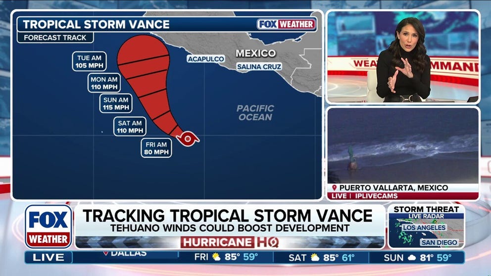 Tropical Storm Vance could intensify into a major hurricane, while Champi threatens Taiwan and Japan
Tropical Storm Vance is expected to strengthen into the 13th hurricane in the Pacific Basin this season as it approaches Mexico next week. Vance could intensify into a major hurricane, which would be the basin's 10th…
-
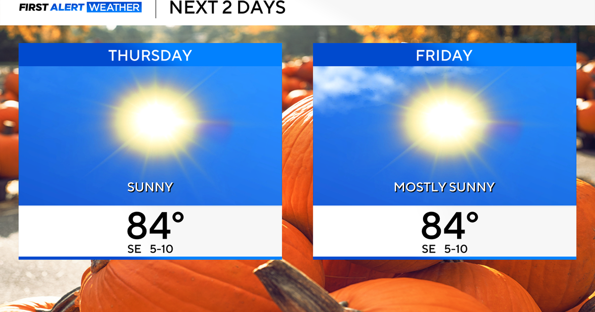 Temperatures to stay in 80s through weekend as clouds increase across North Texas
October 22, 2026 / 7:57 AM CDT / CBS Texas Temperatures are in the 50s and low 60s when you step outside to start your day. The forecast is almost identical to Wednesday, with sunshine and highs in the 80s in store for…
-
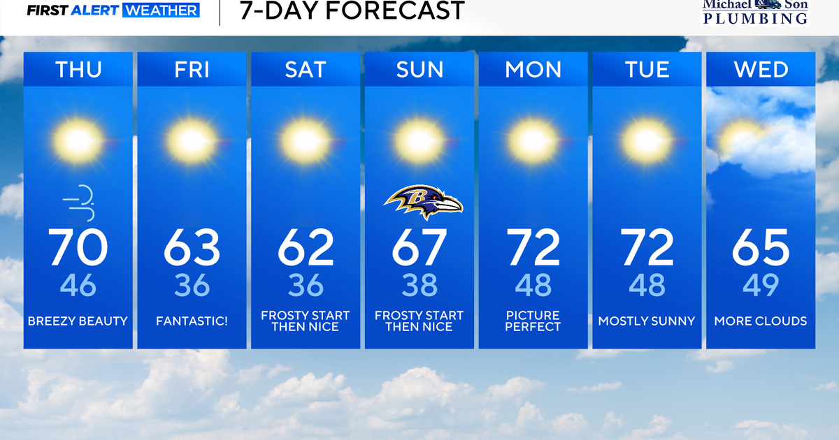 Classic fall weather for Maryland to enjoy through the weekend
Updated on: October 22, 2026 / 8:47 AM EDT / CBS Baltimore Subtropical Storm Josephine, which has been over 500 miles offshore, will continue its journey out to sea. This means rough surf, beach erosion, and coastal…
-
 Weather warning in place ahead of Storm Boelo
Strong winds of up to 75mph could cause disruption across parts of Northern Ireland this weekend as Storm Boelo moves in. A Met Office weather warning has been issued from 18:00 BST on Saturday until 15:00 GMT on…
Air quality
Acceptable. Unusually sensitive people should consider limiting prolonged outdoor exertion.
Springfield, MO reporting area · 1 hr ago. Data from AirNow (EPA and its state, local and tribal partners); preliminary and subject to change.
Sun & moon
Almanac
MonthlySpringfield Area, records since 1888. Normals 1991–2020. Data from NOAA's Regional Climate Centers (ACIS).
Nearby
- Springfield 20 km
- Nixa 20 km
- Ozark 16 km
- Republic 34 km
- Branson 55 km
- Aurora 58 km
- Marshfield 29 km
- Battlefield 24 km
- Willard 35 km
- Hollister 58 km
- Buffalo 57 km
- Ava 44 km
Forecasters' discussion
From the National Weather Service office in SGF, issued 6 hrs ago
Key Messages
- Above normal temperatures into early next week. Highs in the middle 70s to around 80 and dry weather are expected.
Short Term
Issued at 1111 PM CDT Wed Oct 21 2026
Ridging will continue to support dry and warmer than normal conditions today and tonight.
Look for highs in the mid 70s to around 80 today and lows in the mid 40s to low 50s tonight.
RH values will bottom out around 25-35% today, but winds will generally be 5 mph or less.
Long Term
Issued at 1111 PM CDT Wed Oct 21 2026
High pressure will continue to build through the weekend into early next week according to ensemble data, with high confidence in well above normal conditions (highs in the 70s to around 80). No precip is expected in this time frame.
Toward the middle of next week around 5-10% of ensembles are showing some light rain as a trough passes through the area, which is a decrease of around 5-10% from this time yesterday. While this time period has the greatest rain chances in the next 7 days, it is still far more likely to be dry than to wet. There remains quite a bit of uncertainty with temperatures due to model spread. For example, NBM 25-75th percentile MaxT spread increases to around 15 degrees on Tuesday and Wednesday next week.
Aviation
Issued at 632 AM CDT Thu Oct 22 2026
VFR conditions and light winds will persist through the TAF period.
Forecasts, observations and alerts in the United States come from the National Weather Service (NOAA); radar from NOAA's Multi-Radar Multi-Sensor system; satellite imagery from NASA's Global Imagery Browse Services (GIBS) and NOAA's GOES satellites; the map from the U.S. Geological Survey's National Map; air quality from AirNow (EPA and its partners); hurricane information from the National Hurricane Center; climate normals and records from NOAA's Regional Climate Centers (ACIS). Forecasts outside the United States and the UV index: MET Norway (CC BY 4.0); observations outside the U.S.: airport reports via NOAA's Aviation Weather Center. Place names: GeoNames (CC BY 4.0). Data are copied on a schedule and may lag the sources; for warnings that affect your safety, follow your local National Weather Service office and emergency officials. Weather news is drawn from the 4Conservative index and reflects what the press published. Terms of use.