Install
Hayti, MO 63851 Weather
Current conditions
Forecast for this hour (no station report in the last two hours)
Forecast
10-day-
Tonight
Mostly clear, with a low around 48. Northeast wind 0 to 5 mph.
-
Thursday
Sunny, with a high near 79. North northeast wind 0 to 10 mph.
-
Thursday Night
Clear, with a low around 49. Northeast wind 0 to 5 mph.
National Weather Service forecast updated 6 hrs ago.
Hourly
Hourly forecast- Now55°
- 1 AM54°
- 2 AM52°
- 3 AM51°
- 4 AM50°
- 5 AM49°
- 6 AM48°
- 7 AM48°
- 8 AM50°
- 9 AM57°
- 10 AM65°
- 11 AM70°
- 12 PM73°
- 1 PM76°
- 2 PM77°
- 3 PM78°
- 4 PM79°
- 5 PM77°
- 6 PM74°
- 7 PM69°
- 8 PM63°
- 9 PM61°
- 10 PM60°
- 11 PM58°
10-day forecast
Details- TonightOct 21Mostly Clear48°
- TodayOct 22Sunny49°79°
- FriOct 23Sunny48°78°
- SatOct 24Sunny49°79°
- SunOct 25Mostly Sunny48°77°
- MonOct 26Partly Sunny48°77°
- TueOct 27Partly Sunny49°77°
- WedOct 28Mostly Sunny77°
- ThuOct 29Partly cloudy50°74°
- FriOct 30Partly cloudy56°82°
Days after the National Weather Service's seven are MET Norway's outlook, a computer model with no forecaster's review.
Radar
Full mapWeather news near Hayti
More weather news-
 Freeze Warning Issued for Parts of South Dakota and Minnesota
Forecasters say sub‑freezing temperatures could dip to around 30 degrees, bringing the first significant freeze of the season to the region. Areas in the warning in South Dakota include Codington, Deuel, Grant, and…
-
 Freeze alerts stretch from Missouri to New York for Sunday
Temps drop for millions across the Central Plains, Midwest, Northeast The first real taste of fall is settling in for millions, including a few first frosts and freezes of the season for some in the Midwest and East…
-
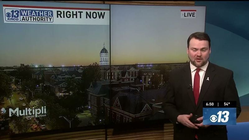 Saturday Evening Forecast: What Mid-Missouri Can Expect Next
Saturday evening's forecast from KRCG lays out what Mid-Missouri can expect as the weekend winds down. Forecasters break down temperatures, cloud cover,... - Saturday evening's forecast from KRCG lays out what…
-
 More vibrant fall colors are in the forecast this year in northeast Missouri
HANNIBAL (WGEM) - Fall color is just starting to show in northeast Missouri, but the Missouri Department of Conservation (MDC) expects a more vibrant season this year, with peak color still about two weeks away. MDC…
-
 Warm weather slows Missouri early antlerless deer harvest
Missouri hunters harvested 6,524 deer during the firearms Early Antlerless Portion of the deer season held Oct. 9-11, with warm weather contributing to lower totals than a year ago. The harvest figures were released by…
-
 Forecast: Passing showers and storms before cooler air returns to mid-Missouri
Cloudy with showers. Highs in the mid 70s.. Cloudy. Lows in the middle 40s. Forecast from KOMU 8 News Today on 10/15/2026 Happy Thursday! Keep those umbrellas and raincoats handy, as we will see another round of showers…
-
 Damaging Winds Possible in Illinois and Missouri Thursday
Parts of Missouri and most of Illinois are likely to experience the type of thunderstorm you'd expect to see during the Spring months. Forecasters are warning of a possible damaging wind event that will likely leave…
Air quality
Air quality is satisfactory, and air pollution poses little or no risk.
Dyersburg, TN reporting area · 1 hr ago. Data from AirNow (EPA and its state, local and tribal partners); preliminary and subject to change.
Sun & moon
Almanac
MonthlyBlytheville Municipal Ap, records since 1998. Normals 1991–2020. Data from NOAA's Regional Climate Centers (ACIS).
Nearby
- Dyersburg 39 km
- Blytheville 37 km
- Kennett 27 km
- Ripley 58 km
- Caruthersville 10 km
- Tiptonville 30 km
- Malden 41 km
- Manila 54 km
- Piggott 43 km
- Newbern 46 km
- Portageville 22 km
- New Madrid 44 km
Forecasters' discussion
From the National Weather Service office in MEG, issued 12 hrs ago
Key Messages
Issued at 1202 PM CDT Wed Oct 21 2026
- Dry weather continues, with a general warming trend back into the upper 70s to low 80s through the end of the week.
- Elevated fire danger concerns will continue each afternoon through much of this week. Obey any local burn bans and properly dispose of cigarettes and matches.
Discussion
(This evening through next Tuesday) Issued at 1202 PM CDT Wed Oct 21 2026
Dry conditions and slightly above normal temperatures continue. The 12z sounding out of LZK depicts a stout dry level between 850- 500mb. The drier air aloft will continue to mix down to the surface and lower dewpoints and relative humidity (RH) values through the afternoon. Due to the expected drop of RH values with 10 hour fuel moisture forecasts around 10%, a Fire Danger Statement is in effect from noon until 7 PM.
While we remain under surface high pressure and northwest flow aloft, expect stagnant conditions to persist for much of the forecast period. An omega blocking pattern will keep the synoptic pattern on hold through early next week. We will be monitoring the trough on the west side of the block and its evolution for next week. The LREF and its ensemble members are not too keen on impacts across the Mid-South with a gradual breakdown of the ridge and the energy heading towards the upper Midwest. Some of the longer range deterministic models are following closely behind the ensembles. In the meantime, expect dry conditions, slightly above normal temperatures, and elevated fire danger to persist.
DNM
Aviation
(18Z TAFS) Issued at 1202 PM CDT Wed Oct 21 2026
VFR and light northeast winds will continue under a persistent upper level high pressure ridge.
Fire Weather
Issued at 1202 PM CDT Wed Oct 21 2026
Elevated fire weather conditions will continue again on Thursday. Low surface moisture will lead to minimum relative humidity values dropping below 30% across the entire region. 10-hour fuels are expected to remain at or around 10 percent fuel moisture. Light 20-foot winds, likely peaking at only 10 mph throughout the afternoon, will preclude the need for Red Flag Warnings. Similar conditions will continue through the remainder of the period, likely necessitating additional Rangeland Fire Danger Statements through this week.
Forecasts, observations and alerts in the United States come from the National Weather Service (NOAA); radar from NOAA's Multi-Radar Multi-Sensor system; satellite imagery from NASA's Global Imagery Browse Services (GIBS) and NOAA's GOES satellites; the map from the U.S. Geological Survey's National Map; air quality from AirNow (EPA and its partners); hurricane information from the National Hurricane Center; climate normals and records from NOAA's Regional Climate Centers (ACIS). Forecasts outside the United States and the UV index: MET Norway (CC BY 4.0); observations outside the U.S.: airport reports via NOAA's Aviation Weather Center. Place names: GeoNames (CC BY 4.0). Data are copied on a schedule and may lag the sources; for warnings that affect your safety, follow your local National Weather Service office and emergency officials. Weather news is drawn from the 4Conservative index and reflects what the press published. Terms of use.