Install
Normal, IL 61761 Weather
Current conditions
Forecast for this hour (no station report in the last two hours)
Forecast
10-day-
Saturday
Mostly sunny, with a high near 75. South southeast wind around 8 mph.
-
Saturday Night
Mostly clear, with a low around 50. South southeast wind around 6 mph.
-
Sunday
Mostly sunny, with a high near 77. South wind around 6 mph.
National Weather Service forecast updated 13 hrs ago.
Hourly
Hourly forecast- Now66°
- 12 PM69°
- 1 PM72°
- 2 PM73°
- 3 PM74°
- 4 PM75°
- 5 PM73°
- 6 PM70°
- 7 PM65°
- 8 PM61°
- 9 PM59°
- 10 PM58°
- 11 PM57°
- Sun12 AM56°
- 1 AM55°
- 2 AM54°
- 3 AM54°
- 4 AM52°
- 5 AM52°
- 6 AM51°
- 7 AM50°
- 8 AM52°
- 9 AM57°
- 10 AM64°
10-day forecast
Details- TonightOct 23Partly Cloudy50°
- TodayOct 24Mostly Sunny50°75°
- SunOct 25Mostly Sunny52°77°
- MonOct 26Partly Sunny51°76°
- TueOct 27Partly Sunny52°73°
- WedOct 28Mostly Sunny53°75°
- ThuOct 29Mostly Sunny15%47°73°
- FriOct 30Slight Chance Rain Showers then Mostly Sunny15%68°
- SatOct 31Cloudy57°75°
- SunNov 1Heavy rain1.97 in62°71°
Days after the National Weather Service's seven are MET Norway's outlook, a computer model with no forecaster's review.
Radar
Full mapWeather news near Normal
More weather news-
 Cooler than normal into the weekend
A cool front brought clouds and rain across SoCal, and behind that system we'll enjoy some great weekend weather! Highs will be running well below seasonal averages, today in particular. The front departing the region…
-
 Houston winter forecast: El Niño may bring wetter-than-normal weather
NOAA's latest winter outlook favors above-normal precipitation across Texas as a strong El Niño continues, while temperatures remain less certain. El Niño is already making its presence felt, and NOAA's latest winter…
-
 Delhi wakes up to 'poor' air, above-normal minimum temperature
Delhi woke up to 'poor' air Friday morning as a layer of smog hung over the city, with the average Air Quality Index (AQI) at 225 at 9 am, according to official data. The minimum temperature was recorded at 19 degrees…
-
 Plenty of sunshine with above normal temperatures
East Texas (KLTV/KTRE) - Happy Thursday, East Texas! Another quiet and warm day across the area featuring sunny skies and above normal afternoon highs. Expect to be in the low 80’s by this afternoon, with a light…
-
 Maharashtra heatwave: Dry spell continues as Amravati records Maharashtra's highest temperature at 37.4 degrees Celsius
Updated On: 23 October, 2026 08:43 PM IST | Mumbai | mid-day online correspondent Mumbai City recorded a maximum temperature of 37 degrees Celsius, 3.3 degrees above normal, while the Santacruz observatory…
-
 Telangana In Grip of Drought Creep, Hyderabad Among 3 Fully Deficient Districts
Hyderabad:All 16 mandals in the city are now in the rain deficient category for the year as on Friday, compared to 13 that were deficient and three which were in the normal rainfall category when the southwest monsoon…
-
 Another day of sunshine and warmer than normal temperatures
Afternoon temperatures move into the upper 60s this afternoon, just like the past few days. Overnight lows dip to the low 40s. We'll see just a bit more cloud cover on Friday, with mid 60s very popular across…
-
 Hopes for rain dampen as Oregon faces historically dry October
Hopes for relief from one of the driest Octobers on record have been scaled back again, as this weekend's storm is no longer expected to produce much precipitation. The National Weather Service in Portland says there's…
-
 Old Farmer’s Almanac predicts Thanksgiving weather in Michigan for 2026
The Old Farmer's Almanac released their 2026 Thanksgiving Day weather outlook. The Old Farmer’s Almanac, known for its long-range weather forecasts, has released its Thanksgiving weather outlook for 2026, and it’s…
-
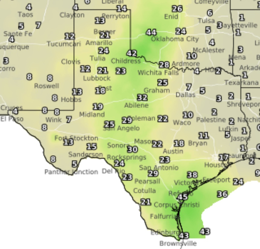 Highs in the 80s and an end to the drought projected in Laredo's forecast
A map of Texas shows a 21% chance of rain in Laredo between 7 a.m. and 7 p.m. Tuesday, Oct. 27, 2026. Laredo has limited chances of rain in the forecast over the next week and is projected to stay below 90 degrees as…
Air quality
Air quality is satisfactory, and air pollution poses little or no risk.
Forecast
- SatModerate
- SunModerate
- MonModerate
Bloomington and Normal, IL reporting area · 1 hr ago. Data from AirNow (EPA and its state, local and tribal partners); preliminary and subject to change.
Sun & moon
Almanac
MonthlyNormal 4ne, records since 1893. Normals 1991–2020. Data from NOAA's Regional Climate Centers (ACIS).
Nearby
- Peoria 55 km
- North Peoria 55 km
- Bloomington 3 km
- Pekin 55 km
- East Peoria 53 km
- Washington 41 km
- Morton 41 km
- Lincoln 52 km
- Pontiac 51 km
- Clinton 40 km
- Bartonville 58 km
- Peoria Heights 56 km
Forecasters' discussion
From the National Weather Service office in ILX, issued 6 hrs ago
Key Messages
- Sunny, mild days and cool nights persist across central and southeast Illinois through the next week, with highs in the 70s and lows in the upper 40s to low 50s.
- Tranquil weather will continue for several more days, with the only meaningful chance of rain toward next weekend.
Discussion
Issued at 150 AM CDT Sat Oct 24 2026
The blocking pattern continues over the eastern half of the United States. A low pressure system is moving well off to the north of central IL, up in Canada, this weekend. The only change this has on our forecast is some increased high cloud cover at times. The main focus of this forecast continues to be the above normal temperatures and lack of rain.
Temperatures will continue to be above normal as we move into the next week. Highs will be in the low to upper 70s. Normals for this time of year is around 62-66 degrees across central and southeastern IL. The CPC's 6-10 day, 8-14 day, and Week 3-4 outlooks all show above normal temperatures. Dry weather will last through much of the extended period as well.
A weak shortwave passage on Wednesday morning may bring some light sprinkles to central IL but is looking more likely to pass without any activity due to how dry our airmass is. The next best chance for any rain has been pushed off into next weekend, just in time for Halloween. A stronger shortwave appears to pulse through late Friday into Saturday, bringing a 30-50% chance for showers. Amounts are forecast to be pretty minimal, but we are a week out still, so there is time for this forecast to change.
Aviation
Issued at 458 AM CDT Sat Oct 24 2026
High pressure ridging will keep VFR conditions in place through the TAF period. Winds will be light, generally out of the south- southeast.
Ilx Watches
None.
Forecasts, observations and alerts in the United States come from the National Weather Service (NOAA); radar from NOAA's Multi-Radar Multi-Sensor system; satellite imagery from NASA's Global Imagery Browse Services (GIBS) and NOAA's GOES satellites; the map from the U.S. Geological Survey's National Map; air quality from AirNow (EPA and its partners); hurricane information from the National Hurricane Center; climate normals and records from NOAA's Regional Climate Centers (ACIS). Forecasts outside the United States and the UV index: MET Norway (CC BY 4.0); observations outside the U.S.: airport reports via NOAA's Aviation Weather Center. Place names: GeoNames (CC BY 4.0). Data are copied on a schedule and may lag the sources; for warnings that affect your safety, follow your local National Weather Service office and emergency officials. Weather news is drawn from the 4Conservative index and reflects what the press published. Terms of use.