Install
Bradley, IL 60915 Weather
Current conditions
Observed at Joliet Regional Airport · 1 hr ago
Forecast
10-day-
Tonight
Patchy fog after 3am. Mostly clear, with a low around 45. Wind around 0 mph.
-
Thursday
Patchy fog before 9am. Sunny. High near 74, with temperatures falling to around 72 in the afternoon. North wind around 0 mph.
-
Thursday Night
Mostly clear, with a low around 44. East wind 0 to 5 mph.
National Weather Service forecast updated 7 hrs ago.
Hourly
Hourly forecast- Now51°
- Thu12 AM49°
- 1 AM49°
- 2 AM48°
- 3 AM48°
- 4 AM46°
- 5 AM46°
- 6 AM45°
- 7 AM45°
- 8 AM47°
- 9 AM52°
- 10 AM60°
- 11 AM65°
- 12 PM69°
- 1 PM72°
- 2 PM73°
- 3 PM74°
- 4 PM74°
- 5 PM72°
- 6 PM68°
- 7 PM62°
- 8 PM57°
- 9 PM54°
- 10 PM53°
10-day forecast
Details- TonightOct 21Mostly Clear then Patchy Fog45°
- ThuOct 22Patchy Fog then Sunny44°74°
- FriOct 23Sunny46°74°
- SatOct 24Mostly Sunny47°73°
- SunOct 25Partly Sunny49°76°
- MonOct 26Partly Sunny47°73°
- TueOct 27Partly Sunny10%44°66°
- WedOct 28Mostly Sunny10%67°
- ThuOct 29Partly cloudy37°60°
- FriOct 30Cloudy42°60°
Days after the National Weather Service's seven are MET Norway's outlook, a computer model with no forecaster's review.
Radar
Full mapWeather news near Bradley
More weather news-
 Technical Discussion: Bright and seasonable week ahead
Our dry and bright trend will continue through next weekend, great weather for some leaf-peeping with foliage peaking soon! Temperatures will run at or slightly below average for the two-day period. Click to download…
-
 Technical Discussion: A beautiful day ahead, after that morning chill!
After a chilly start, temperatures will rebound nicely today with plenty of sunshine. Expect highs a bit warmer than yesterday, in the upper 50s to around 60. Overall, a nice afternoon for any outdoor activities! Click…
-
 Technical Discussion: A freeze likely tomorrow morning
Leaf peeping this weekend? While we’ll likely be seeing moderate to peak color here in CT, especially away from the immediate coastline. Keep in mind the wind today will cause some of the leaves to fly off the trees!…
-
 Technical Discussion: A freeze likely early Sunday morning
Click to download the WFSB Weather App for Android The First Alert Weather Team FIRST FROST OF THE 26-27 SEASON… Temperatures for many locations across CT bottomed out in the low to mid-30s on Wednesday, October 7th…
- Technical Discussion: A Severe Thunderstorm Watch in effect for parts of CT
Click to download the WFSB Weather App for Android The First Alert Weather Team FIRST FROST OF THE 26-27 SEASON… Temperatures for many locations across CT bottomed out in the low to mid-30s on Wednesday, October 7th…
-
 New El Niño forecasts show high chance for California rainfall at 150%-200% of normal
100th Anniversary Sale! Get 2 years of digital access for only $100/year County crews remove sediment to help maximize capacity ahead of the expected flooding of the San Gabriel River reservoir from an expected El Niño…
-
 Cold front brings fall temperatures, wind advisory to Houston region
Daisy Espinoza / Houston Public MediaAccording to the National Weather Service (NWS), temperatures will drop over the weekend across the Greater Houston area, with lows in the 50s and highs in the 70s . "It'll actually…
-
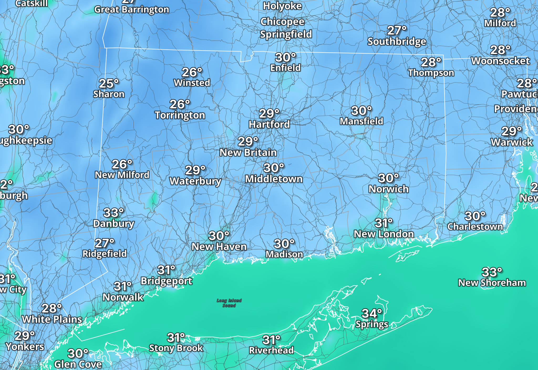 Temperatures could plunge 30 degrees in Connecticut after Friday storms
Connecticut is in for a jolt: After near-record warmth just two days ago, temperatures are set to plunge behind a cold front, dropping from the upper 60s and low 70s Friday afternoon to the 30s and 40s by Saturday…
-
 Technical Discussion: A Severe Storm Threat Prompts a First Alert Weather Day
Temps bottom out in the 40s and low 50s this morning. It’s cloudy and there are some showers in NW/SW CT. The showers are light, but more are on the way for later this morning. Behind the cold front, a shot of chilly…
-
 Technical Discussion: Rounds of showers before a weekend chill
While not quite as mild as yesterday, temps are in the 50s across the state. The typical overnight low for this time of year is 43, so we’re doing pretty good, maybe just a light jacket required. There’s no fog to greet…
Air quality
Acceptable. Unusually sensitive people should consider limiting prolonged outdoor exertion.
Forecast
- WedModerate
- ThuModerate
- FriModerate
Joliet and Will County, IL reporting area · 1 hr ago. Data from AirNow (EPA and its state, local and tribal partners); preliminary and subject to change.
Sun & moon
Almanac
MonthlyKankakee Wwtp, records since 1887. Normals 1991–2020. Data from NOAA's Regional Climate Centers (ACIS).
Nearby
- Joliet 46 km
- Hammond 57 km
- Orland Park 54 km
- Tinley Park 48 km
- Romeoville 59 km
- Calumet City 59 km
- Merrillville 58 km
- Chicago Heights 44 km
- Crown Point 51 km
- Schererville 50 km
- Lansing 54 km
- Oak Forest 52 km
Forecasters' discussion
From the National Weather Service office in LOT, issued 4 hrs ago
Key Messages
- The dry and unseasonably mild weather will continue through the upcoming weekend.
Discussion
Issued at 136 PM CDT Wed Oct 21 2026
An anomalously strong mid-level ridge over the central CONUS will anchor omega blocking across much of North America over the next several days. Meanwhile, an elongated surface ridge extending from the Lower Mississippi River Valley to the Canadian Maritimes is in the processes of congealing with another expansive high pressure shifting toward the Upper Great Lakes. As a result, quiet weather with unseasonably warm conditions will continue through the upcoming weekend. As was observed the past few mornings, generally clear skies and light/calm winds should promote shallow fog across primarily interior northern Illinois late tonight through sunrise Thursday.
The blocking pattern will slowly break down early next week as the ridge flattens and a southwestern upper-level low begins to meander toward the central CONUS. A series of smaller troughs on the periphery of a developing longwave trough across the north Pacific and western Canada will eventually pick up the southwestern low. Consensus guidance suggests that the influence of the low on our area could occur as early as Monday night, but more likely Tuesday and Wednesday. Cooler and more seasonable conditions would accompany this system.
Kluber
Aviation
Issued at 641 PM CDT Wed Oct 21 2026
Main aviation forecast concern is the potential for patchy IFR/LIFR fog to develop mainly northwest of Chicago early Thursday morning.
Surface high pressure ridge has shifted east of the area across lower MI/IN early this evening. Light south-southwest surface winds at the terminals are expected to quickly become light/variable or just calm early this evening, though there may be a brief (1-hour)period of light east winds at ORD/MDW/GYY as a weak lake breeze decays. The pressure gradient will remain weak into Thursday, keeping winds light/variable through the morning before becoming light (5-6 kts) northeast and eventually east in the afternoon/evening.
Clear skies and light/calm winds tonight will allow for ideal radiative cooling conditions, allowing shallow fog to develop in spots once again. This appears most likely across southern WI/northeast IA and far northern/northwest IL KRFD) where surface dew points remained in the mid-upper 40s during peak mixing Wednesday afternoon. While guidance is not too aggressive with lower visibilities, have maintained a 2SM IFR tempo and MIFG in the KRFD TAF, and will monitor overnight for tactical lower vsbys. The drier low-level airmass to the southeast looks to be less conducive to fog development with southeastward extent. Have maintained a 3SM MIFG tempo at DPA, with VFR conditions for the other Chicago area terminals.
Ratzer
Lot Watches
IL...None. IN...None. LM...None.
Forecasts, observations and alerts in the United States come from the National Weather Service (NOAA); radar from NOAA's Multi-Radar Multi-Sensor system; satellite imagery from NASA's Global Imagery Browse Services (GIBS) and NOAA's GOES satellites; the map from the U.S. Geological Survey's National Map; air quality from AirNow (EPA and its partners); hurricane information from the National Hurricane Center; climate normals and records from NOAA's Regional Climate Centers (ACIS). Forecasts outside the United States and the UV index: MET Norway (CC BY 4.0); observations outside the U.S.: airport reports via NOAA's Aviation Weather Center. Place names: GeoNames (CC BY 4.0). Data are copied on a schedule and may lag the sources; for warnings that affect your safety, follow your local National Weather Service office and emergency officials. Weather news is drawn from the 4Conservative index and reflects what the press published. Terms of use.