Install
Appleton, WI 54912 Weather
Current conditions
Observed at Appleton-Outagamie · 1 hr ago
Forecast
10-day-
Tonight
Areas of fog after midnight. Mostly clear, with a low around 44. South wind around 6 mph.
-
Wednesday
Areas of fog before 10am. Sunny. High near 69, with temperatures falling to around 67 in the afternoon. Southwest wind 3 to 7 mph.
-
Wednesday Night
Patchy fog between midnight and 3am. Mostly clear, with a low around 47. North wind 0 to 3 mph.
National Weather Service forecast updated 1 hr ago.
Hourly
Hourly forecast- Now50°
- 10 PM50°
- 11 PM49°
- Wed12 AM49°
- 1 AM48°
- 2 AM47°
- 3 AM46°
- 4 AM45°
- 5 AM45°
- 6 AM44°
- 7 AM44°
- 8 AM46°
- 9 AM49°
- 10 AM55°
- 11 AM59°
- 12 PM63°
- 1 PM66°
- 2 PM67°
- 3 PM68°
- 4 PM69°
- 5 PM67°
- 6 PM64°
- 7 PM61°
- 8 PM57°
10-day forecast
Details- TonightOct 20Mostly Clear then Areas Of Fog44°
- WedOct 21Areas Of Fog then Sunny47°69°
- ThuOct 22Sunny46°66°
- FriOct 23Mostly Sunny53°66°
- SatOct 24Partly Sunny15%54°68°
- SunOct 25Partly Sunny then Slight Chance Rain Showers19%44°65°
- MonOct 26Slight Chance Rain Showers19%38°56°
- TueOct 27Mostly Sunny53°
- WedOct 28Partly cloudy30°49°
- ThuOct 29Partly cloudy33°54°
Days after the National Weather Service's seven are MET Norway's outlook, a computer model with no forecaster's review.
Radar
Full mapWeather news near Appleton
More weather news-
 Dangerous Freeze Warnings Issued for Iowa, Wisconsin, Minnesota and Illinois as Temperatures Drop
Freeze Warnings take effect early Saturday across much of Iowa, Wisconsin, southeast and central Minnesota and northern Illinois, with lows as cold as 26 degrees expected. Seven National Weather Service offices issued…
-
 First Santa Ana winds of the season spark wildfire fears in California | CNN
As Southern California braces for its first Santa Ana winds of the season, CNN meteorologist Ali Van Fleet gives an outlook on the region’s wildfire season. An astronaut aboard SpaceX Dragon and a videographer beside a…
-
 Will Super El Niño hit your house? Scientists unpack the myths and misconceptions | CNN
CNN Climate and Weather spoke to five climate scientists about this year’s intense El Niño and the misconceptions they’re hearing. Editor Maggie Koerth and Senior Reporter Andrew Freedman recount what they learned. An…
-
 Orange haze from wildfires blankets Indonesia | CNN
A thick orange haze has blanketed parts of Indonesia and air pollution has reached dangerous levels due to ongoing wildfires. An astronaut aboard SpaceX Dragon and a videographer beside a lake in Canada share two…
-
 Water thunders over Iguazu Falls thanks to El Niño | CNN
The Argentinian-Brazilian waterfall peaked Monday at 11.8 million liters per second, the highest flow recorded this year. An astronaut aboard SpaceX Dragon and a videographer beside a lake in Canada share two amazing…
-
 Watch fall bloom from space | CNN
Take a cross-country tour via satellite imagery that lets us glimpse the spectacular transition to fall colors. An astronaut aboard SpaceX Dragon and a videographer beside a lake in Canada share two amazing views of…
-
 SpaceX launch creates glowing ‘jellyfish’ plume over Florida | CNN
On Tuesday, a SpaceX Falcon 9 launch created eerie streaks of light, known as the “jellyfish” effect, in the predawn skies over Florida. An astronaut aboard SpaceX Dragon and a videographer beside a lake in Canada share…
-
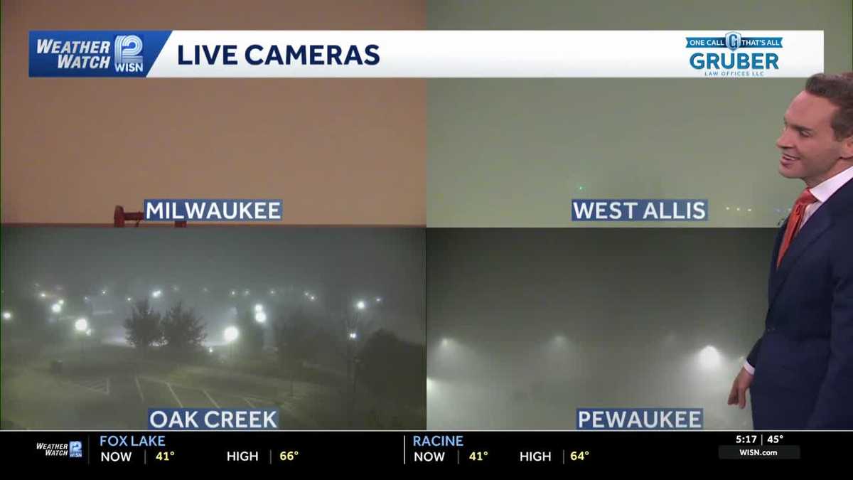 Impact Day: Dense fog in southeast Wisconsin
Dense fog will give way to sunny and comfortable conditions Tuesday across southeast Wisconsin. Areas of dense fog are creating visibility problems across southeastern Wisconsin Tuesday morning, especially for drivers…
- Wisconsin Winter 2026-27: Milwaukee, 55.8-Inch Snow History
NOAA historical maps covering 1950–2009 show that strong El Niño winters have generally favored below-average snowfall across Wisconsin and the broader Upper Midwest. However, those maps do not establish a comparable…
-
 Can Minnesota, Wisconsin Still Get Big Snowstorms During an El Niño Winter?
If you've been paying attention to the winter forecasts lately, you've probably heard the same message over and over: warm, mild, and maybe not much snow. For a lot of people across Minnesota and Wisconsin, that sounds…
Air quality
Air quality is satisfactory, and air pollution poses little or no risk.
Forecast
- TueGood
- WedModerate
- ThuModerate
Green Bay and Fox Cities, WI reporting area · 1 hr ago. Data from AirNow (EPA and its state, local and tribal partners); preliminary and subject to change.
Sun & moon
Almanac
MonthlyGreen Bay Area, records since 1886. Normals 1991–2020. Data from NOAA's Regional Climate Centers (ACIS).
Nearby
Forecasters' discussion
From the National Weather Service office in GRB, issued 9 hrs ago
Key Messages
- Patchy dense fog will develop late tonight into Wednesday morning across east-central Wisconsin and areas west of Green Bay, locally dropping visibilities below 1/2 mile.
- Dry and mild conditions across the region through Saturday afternoon with inland high temperatures warming into the middle 60s to lower 70s.
- A 20 to 30 percent chance of light rain showers Saturday night into Sunday across central and northern Wisconsin.
- Cooler air filters for early next week, dropping daytime high temperatures into the 50s on Monday and Tuesday.
Discussion
Issued at 1147 AM CDT Tue Oct 20 2026
Current surface analysis shows strong high pressure centered over northern Ontario and Quebec, maintaining large-scale subsidence and light winds across northern Wisconsin. Upper-air analysis displays broad mid-level ridging over the central United States flanked by troughs over the western and eastern CONUS. Morning fog and low stratus have been slow to erode across portions of northeast Wisconsin, but further daytime heating will support clearing through early this afternoon. High pressure will linger through Wednesday before a weak, moisture- starved cold front crosses the region late Wednesday into Wednesday night.
Patchy Dense Fog Tonight And Wednesday Morning: Clear skies and light winds will create good radiational cooling conditions late tonight into Wednesday morning across east-central Wisconsin and areas west of Green Bay. Boundary layer relative humidity will approach saturation after 10 PM this evening, promoting fog development that will persist through mid- Wed morning. High confidence exists in fog dissipation by 10-11 AM Wednesday as diurnal solar heating drives boundary layer mixing.
Prolonged Mild and Dry Late Week Pattern: Persistent atmospheric ridging and deep-layer subsidence will lock in tranquil weather across north- central and northeast Wisconsin through Saturday afternoon. Daily high temperatures inland will warm into the upper 60s and lower 70s, while onshore lake breezes hold shoreline communities in the lower 60s. NBM temperature percentiles show exceptionally tight 10th to 90th percentile spreads of 2 to 4 degrees F, reflecting high forecast confidence.
Weak Weekend Front Rain Probabilities: A weak shortwave trough moving across southern Canada will push a trailing cold front into the Upper Mississippi Valley Saturday night into Sunday. Weak dynamic forcing and limited moisture transport ahead of the boundary will restrict precipitation coverage, yielding low-end 20 to 30 percent rain chances across central and northern Wisconsin. NBM probabilistic guidance shows 90th percentile 24-hour liquid accumulations remaining under 0.25 inches across the forecast area so not expecting a potential soaker. The chance of showers will taper off Sunday afternoon with partly sunny skies returning by Sunday evening.
Early Next Week Cooling Trend: Post-frontal cold advection will usher in a cooler and more seasonable airmass for Monday and Tuesday as surface high pressure builds south from Manitoba. Daytime high temperatures will fall into the lower to mid-50s across north-central Wisconsin and upper 50s across the Fox Valley. Clear skies and light winds beneath the building high will promote radiational cooling at night, dropping low temperatures into the low to mid-30s.
Aviation
for 18Z TAF Issuance Issued at 1147 AM CDT Tue Oct 20 2026
Low visibilities and ceilings have been slow to lift this morning over east-central WI, but expect improvements in both departments to accelerate prior to the start of the 18Z taf period.
High pressure will be shifting east over the next 24 hours providing mostly clear skies and light winds through the evening once the low stratus lifts or burns off.
Another round of ground fog is anticipated to develop late this evening through mid-Wednesday morning. Confidence is highest for impacts over east-central WI (KMTW, KGRB, KATW), but lower further west. LIFR to VLIFR will be possible between 08-14Z Wed. Some indications that ground fog will develop as early as 03-04Z at KMTW.
Besides the fog, scattered mid and high clouds will pass across the region at times.
Grb Watches
None.
Forecasts, observations and alerts in the United States come from the National Weather Service (NOAA); radar from NOAA's Multi-Radar Multi-Sensor system; satellite imagery from NASA's Global Imagery Browse Services (GIBS) and NOAA's GOES satellites; the map from the U.S. Geological Survey's National Map; air quality from AirNow (EPA and its partners); hurricane information from the National Hurricane Center; climate normals and records from NOAA's Regional Climate Centers (ACIS). Forecasts outside the United States and the UV index: MET Norway (CC BY 4.0); observations outside the U.S.: airport reports via NOAA's Aviation Weather Center. Place names: GeoNames (CC BY 4.0). Data are copied on a schedule and may lag the sources; for warnings that affect your safety, follow your local National Weather Service office and emergency officials. Weather news is drawn from the 4Conservative index and reflects what the press published. Terms of use.