Install
Cadillac, MI 49601 Weather
Current conditions
Forecast for this hour (no station report in the last two hours)
Forecast
10-day-
Thursday
Patchy fog before 10am. Sunny. High near 69, with temperatures falling to around 65 in the afternoon. North wind 0 to 5 mph.
-
Thursday Night
Patchy fog between 9pm and 11pm. Partly cloudy. Low around 40, with temperatures rising to around 43 overnight. East wind 0 to 5 mph.
-
Friday
Mostly sunny, with a high near 66. Southeast wind around 5 mph.
National Weather Service forecast updated 2 hrs ago.
Hourly
Hourly forecast- Now42°
- 7 AM42°
- 8 AM41°
- 9 AM44°
- 10 AM53°
- 11 AM58°
- 12 PM61°
- 1 PM64°
- 2 PM67°
- 3 PM66°
- 4 PM67°
- 5 PM65°
- 6 PM64°
- 7 PM59°
- 8 PM52°
- 9 PM49°
- 10 PM48°
- 11 PM46°
- Fri12 AM46°
- 1 AM45°
- 2 AM45°
- 3 AM44°
- 4 AM43°
- 5 AM43°
10-day forecast
Details- TonightOct 21Patchy Fog36°
- TodayOct 22Patchy Fog then Sunny40°69°
- FriOct 23Mostly Sunny40°66°
- SatOct 24Mostly Sunny47°66°
- SunOct 25Partly Sunny42°67°
- MonOct 26Mostly Cloudy20%35°57°
- TueOct 27Slight Chance Rain Showers20%33°55°
- WedOct 28Slight Chance Rain Showers then Partly Sunny19%55°
- ThuOct 29Rain0.05 in38°47°
- FriOct 30Cloudy37°52°
Days after the National Weather Service's seven are MET Norway's outlook, a computer model with no forecaster's review.
Radar
Full mapWeather news in Michigan
More weather news-
 Sunshine and Mild Temperatures Continue Across Southeast Michigan
ClickOnDetroit | WDIV Local 4 Trader Joe’s is expanding nationwide, including new Metro Detroit store Sunshine and Mild Temperatures Continue Across Southeast Michigan Oakland County Little League umpire shared child…
-
 How El Niño could impact the coming Michigan winter
The National Oceanic and Atmospheric Administration's seasonal weather outlook for winter 2026-27 is here, and it suggests the current El Niño could have a significant impact on Michigan. The NOAA predicts…
-
 Your WTOL 11 weather impact forecast: What to expect in northwest Ohio, southeast Michigan
WTOL Your WTOL 11 weather impact forecast: What to expect in northwest Ohio, southeast Michigan To stream WTOL on your phone, you need the WTOL app. Download the WTOL app Next up in 5 Example video title will go here…
-
 Powerful Fall Storm Expected to Bring Heavy Winds and Waterspouts to Lake Michigan
At SSBCrack News, our dedicated editorial team brings you the latest and most reliable updates on Defence, Geopolitics, Military Affairs, Science, and Technology. Driven by a passion for national security and strategic…
- NOAA: El Niño will bring milder, drier late fall, winter for Michigan
Subfreezing morning temperatures and gusty conditions gave way to a calm, quiet weekend across Lower Michigan, while long-range forecasters point to a warmer and drier late autumn and winter ahead across the Great Lakes…
-
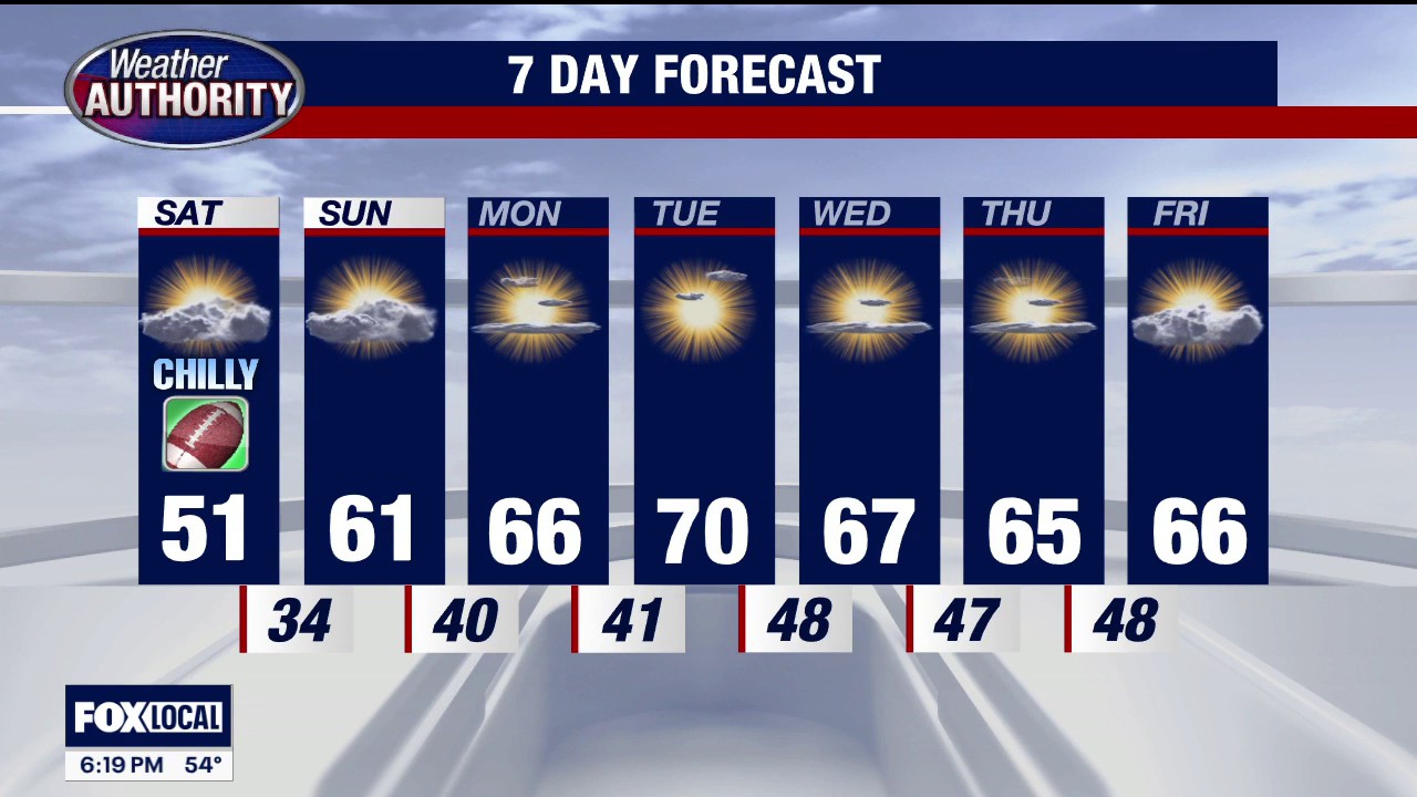 Frost advisory in Southeast Michigan
FOX 2 Detroit Temps could dip as low as 33 degrees from 3 a.m. - 8 a.m. on Saturday, with the potential to result in frost formation in the early morning hours of Saturday, Oct. 17.
-
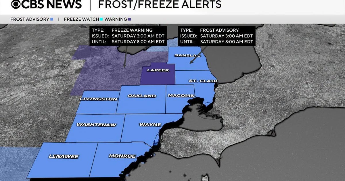 Frost advisory issued for Southeast Michigan early Saturday morning
October 16, 2026 / 3:30 PM EDT / CBS Detroit If you are holding onto the last of your outdoor plants, it is time to take action on Friday night. The National Weather Service has issued a combination of freeze warnings…
-
 Justin Liles: After a good freeze, warmer weather returns to Wisconsin, Minnesota, and Michigan this weekend
Scattered light showers across north-central Wisconsin will quickly fade this afternoon, with winds diminishing as high pressure moves overhead tonight. A hard freeze is expected across northwest Wisconsin, where lows…
-
 Dangerous Freeze Watch for Parts of Indiana and Michigan as Temperatures Drop
A Freeze Watch is in effect for northern, east central and southeast Indiana from late Saturday night through Sunday morning, with lows as cold as 31 degrees possible. A Frost Advisory comes first, for parts of northern…
- Blustery Blast Hits Milwaukee: Lake Michigan Winds, Saturday Frost Possible
Milwaukee is facing chilly temperatures and a blustery Friday, with showers expected mainly before noon. The high is expected to reach about 53 degrees, with blustery winds and peak gusts of 35 to 40 mph. The National…
Air quality
Air quality is satisfactory, and air pollution poses little or no risk.
Forecast
- ThuModerate
- FriModerate
Ludington, MI reporting area · 1 hr ago. Data from AirNow (EPA and its state, local and tribal partners); preliminary and subject to change.
Sun & moon
Almanac
MonthlyCadillac Wexford County Ap, records since 1909. Normals 1991–2020. Data from NOAA's Regional Climate Centers (ACIS).
Nearby
- Traverse City 59 km
- Houghton Lake 53 km
- Reed City 42 km
- Harrison 57 km
- Kalkaska 57 km
Forecasters' discussion
From the National Weather Service office in APX, issued 16 hrs ago
Key Messages
- Areas of fog tonight, locally dense.
- Seasonably mild and dry through the first half of the weekend.
Discussion
Issued at 131 PM EDT Wed Oct 21 2026
Weak sfc boundary shifts low level winds off to the northwest and /north tonight into Thursday, as sfc high pressure slides across Ontario. Another moist night with calming sfc winds and light northwest low level flow will result in more fog, especially across northwest lower and eastern upper Michigan downwind of the lakes. This is highlighted well in the SREF and HREF probs for visibility <2 SM. Fog may linger a little longer, slowly dissipating through the morning hours. A couple of degrees of cooling is anticipated on Thursday, due to the high pressure building to the north and the northeast sfc winds coming off Lake Huron.
High pressure departs to the east later in the week and first half of the weekend as heights build aloft. Temperatures will moderate back into the 60s most areas, mid-upper 60s for some, with precipitation free weather anticipated.
By Sunday, deep trough/upper low across Ontario and vicinity will beat down the ridging over northern Michigan to some extent, allowing for a trailing frontal boundary to push eastward and southward across northern MI with time. There will be the potential for some showers along this boundary, especially across the eastern UP. Probs are generally low to medium (10-60%) for 0.1" of rain during this time. Cooler, more seasonably so, air behind this frontal boundary will try to filter in early next week, especially Tuesday. The degree of the cooldown is a little in question, with some ensemble guidance suggesting near normal temperatures and others a few degrees below. There is the potential for a quick rebound to above normal temperatures, however, after that.
Rumblings of a significant cooldown later this month into early November making its rounds. Tough to say at this point, but what can be said is significant ridging will build across Alaska (-EPO) which generally correlates (but not always) to cooler air eventually spilling into the lower 48 and Great Lakes region. This to say, most ensemble guidance means suggest warmer than normal temperatures during this time frame, with a few individual outliers showing a more substantial cool down. Let's watch the trends.
Aviation
Issued at 131 PM EDT Wed Oct 21 2026
VFR conditions remain through the afternoon and evening hours with SKC-SCT250. Southwest winds today at about 5 to 15 knots for most. Another round of BR/FG tonight (potential for 1/4SM to 1SM VSBYs), with most terminals at play as the focus will shift to northwest lower into eastern upper Michigan. BR/FG may linger a little longer into the morning hours on Thursday for some, dissipating around the 14 to 15Z time frame.
Apx Watches
MI...None. MARINE...None.
Forecasts, observations and alerts in the United States come from the National Weather Service (NOAA); radar from NOAA's Multi-Radar Multi-Sensor system; satellite imagery from NASA's Global Imagery Browse Services (GIBS) and NOAA's GOES satellites; the map from the U.S. Geological Survey's National Map; air quality from AirNow (EPA and its partners); hurricane information from the National Hurricane Center; climate normals and records from NOAA's Regional Climate Centers (ACIS). Forecasts outside the United States and the UV index: MET Norway (CC BY 4.0); observations outside the U.S.: airport reports via NOAA's Aviation Weather Center. Place names: GeoNames (CC BY 4.0). Data are copied on a schedule and may lag the sources; for warnings that affect your safety, follow your local National Weather Service office and emergency officials. Weather news is drawn from the 4Conservative index and reflects what the press published. Terms of use.