Install
Okemos, MI 48864 Weather
Current conditions
Observed at Capital Region International Airport · 52 min ago
Forecast
10-day-
Tonight
Mostly clear, with a low around 43. East northeast wind around 1 mph.
-
Friday
Areas of fog before 10am. Mostly sunny, with a high near 66. East southeast wind around 2 mph.
-
Friday Night
Mostly clear, with a low around 43. Southeast wind around 3 mph.
National Weather Service forecast updated 5 hrs ago.
Hourly
Hourly forecast- Now47°
- 1 AM45°
- 2 AM44°
- 3 AM44°
- 4 AM43°
- 5 AM43°
- 6 AM43°
- 7 AM43°
- 8 AM43°
- 9 AM45°
- 10 AM49°
- 11 AM54°
- 12 PM58°
- 1 PM62°
- 2 PM64°
- 3 PM66°
- 4 PM66°
- 5 PM66°
- 6 PM64°
- 7 PM61°
- 8 PM56°
- 9 PM52°
- 10 PM50°
- 11 PM48°
10-day forecast
Details- TonightOct 22Mostly Clear43°
- TodayOct 23Areas Of Fog then Mostly Sunny43°66°
- SatOct 24Sunny44°68°
- SunOct 25Mostly Sunny47°70°
- MonOct 26Partly Sunny41°65°
- TueOct 27Partly Sunny40°59°
- WedOct 28Partly Sunny15%44°63°
- ThuOct 29Slight Chance Rain Showers15%64°
- FriOct 30Cloudy33°51°
- SatOct 31Sunny31°54°
Days after the National Weather Service's seven are MET Norway's outlook, a computer model with no forecaster's review.
Radar
Full mapWeather news near Okemos
More weather news-
 Hyperlocal elevation snow accumulation forecast Friday night into Saturday
BURLINGTON, Vt. (WCAX) - Today’s strong blustery winds and rainfall have tapered a bit and that is due to the passage of a strong cold front. This will be our first significant autumn cold front that brings more…
-
 Early Halloween forecast points to mild, mostly dry weather for Michigan
With Halloween set to take place next weekend, initial forecast projections are beginning to be made for the region. While forecasts are generally inaccurate this far out, initial outlooks are showing a solid day for…
-
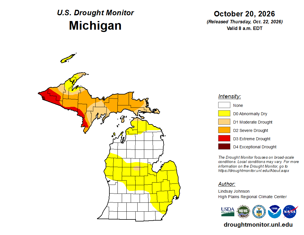 Mid-Michigan turns abnormally dry after a relatively dry October
Minor drought conditions are being observed in Mid-Michigan after a dry month. Minor drought conditions have been noted across the Mid-Michigan area as October has been notably dry. Currently, much of the Lower…
-
 Sunshine and Mild Temperatures Continue Across Southeast Michigan
ClickOnDetroit | WDIV Local 4 Trader Joe’s is expanding nationwide, including new Metro Detroit store Sunshine and Mild Temperatures Continue Across Southeast Michigan Oakland County Little League umpire shared child…
-
 How El Niño could impact the coming Michigan winter
The National Oceanic and Atmospheric Administration's seasonal weather outlook for winter 2026-27 is here, and it suggests the current El Niño could have a significant impact on Michigan. The NOAA predicts…
-
 Your WTOL 11 weather impact forecast: What to expect in northwest Ohio, southeast Michigan
WTOL Your WTOL 11 weather impact forecast: What to expect in northwest Ohio, southeast Michigan To stream WTOL on your phone, you need the WTOL app. Download the WTOL app Next up in 5 Example video title will go here…
-
 Powerful Fall Storm Expected to Bring Heavy Winds and Waterspouts to Lake Michigan
At SSBCrack News, our dedicated editorial team brings you the latest and most reliable updates on Defence, Geopolitics, Military Affairs, Science, and Technology. Driven by a passion for national security and strategic…
- NOAA: El Niño will bring milder, drier late fall, winter for Michigan
Subfreezing morning temperatures and gusty conditions gave way to a calm, quiet weekend across Lower Michigan, while long-range forecasters point to a warmer and drier late autumn and winter ahead across the Great Lakes…
-
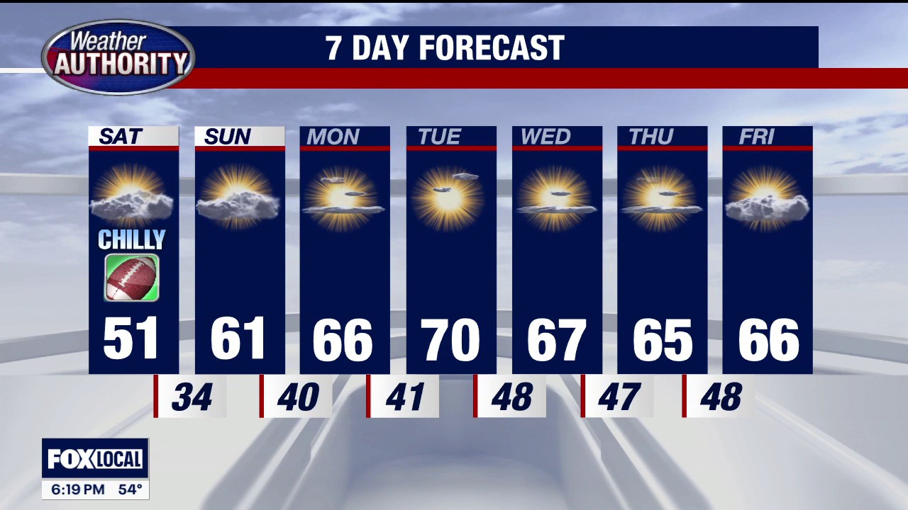 Frost advisory in Southeast Michigan
FOX 2 Detroit Temps could dip as low as 33 degrees from 3 a.m. - 8 a.m. on Saturday, with the potential to result in frost formation in the early morning hours of Saturday, Oct. 17.
-
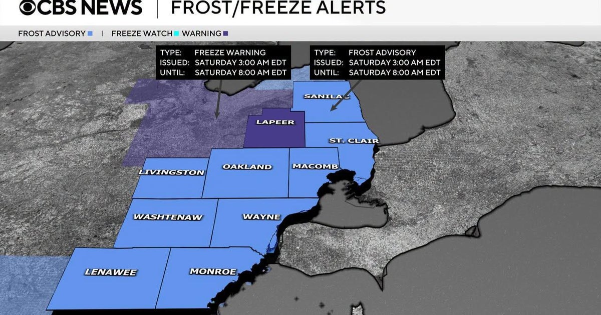 Frost advisory issued for Southeast Michigan early Saturday morning
October 16, 2026 / 3:30 PM EDT / CBS Detroit If you are holding onto the last of your outdoor plants, it is time to take action on Friday night. The National Weather Service has issued a combination of freeze warnings…
Air quality
Acceptable. Unusually sensitive people should consider limiting prolonged outdoor exertion.
Forecast
- FriModerate
Lansing, MI reporting area · 1 hr ago. Data from AirNow (EPA and its state, local and tribal partners); preliminary and subject to change.
Sun & moon
Almanac
MonthlyLansing Area, records since 1863. Normals 1991–2020. Data from NOAA's Regional Climate Centers (ACIS).
Nearby
Forecasters' discussion
From the National Weather Service office in GRR, issued 5 hrs ago
Key Messages
- Mild and dry weather with morning fog through the weekend
- Cooler temperatures and modest rain chances return next week
Discussion
Issued at 209 PM EDT Thu Oct 22 2026
- Mild and dry weather with morning fog through the weekend
Our extended stretch of pleasant fall weather continues for a few more days, thanks to a building ridge of high pressure and the return of southerly low level flow. Before we get to the next few days though, there is yet another potential for overnight and early morning fog in several areas tonight, with perhaps a slight increase in coverage as well. Light northeasterly winds are expected to carry increased low level moisture into the area this evening, and this should boost the potential for fog as radiative cooling commences under clear nighttime skies. High resolution model guidance (RRFS to be specific) continues to produce a convincing signal for fog locally, and when combined with the pattern and repeated fog development over the past few days, another round is expected tonight, likely with an increase in coverage.
From tomorrow through Sunday, the aforementioned upper ridge will continue to steadily build overhead, while a deep low pressure system across the Canadian Prairie drives southerly low level winds. This will produce consecutive days of well above average temperatures across lower Michigan (roughly 8-12 degrees above seasonal averages), equating to highs in the mid 60s to near 70s. Meanwhile, precipitation chances remain near zero throughout the weekend.
- Cooler temperatures and modest rain chances return next week
Between Sunday night and Monday afternoon, a weak back-door cold front will sink into lower Michigan as a shortwave passes well to our north. This will drive a steady cooling trend that will persist through mid-week, bringing temperatures back to near seasonal averages (highs in the upper 50s to low 60s / lows in the mod 30s to low 40s). Confidence in the temperature forecast is a bit lower overall on Monday, owing to ensemble member variation in the timing of the cold front and trailing cold air advection. This uncertainty is highlighted by increasing temperature forecast spreads on Monday in particular, with decreasing spreads Tuesday onward as a low-variance high pressure pattern becomes established.
Aviation
Issued at 702 PM EDT Thu Oct 22 2026
VFR conditions this evening deteriorate Friday morning as LIFR fog is favored to develop, potentially as low as 1/4SM at times. Best chance for dense fog is LAN/JXN where prevailing flow suggests moisture enhancement off of Lake Huron/Saginaw Bay/Lake Erie. Model guidance tends to underestimate fog intensity in these scenarios so have maintained the inherited forecast there. Some question of how far AZO/BTL/GRR deteriorate depending on inland penetration of moisture so observational trends will need to be monitored into the overnight hours. MKG is also not favored to see restrictions at this time given forecast high pressure placement, but that may change if wind direction does. Any fog that develops is forecast to mix out mid to late Friday morning.
Marine
Issued at 209 PM EDT Thu Oct 22 2026
Light winds and very low wave heights of 1 foot or less persist through tonight. Sustained south-southeast winds increase to near 10 kt tomorrow, and to 15 to 20 kt tomorrow, causing wave heights to increase to between 2 to 3 feet by Saturday afternoon, mainly north of Whitehall. These conditions largely continue through Sunday, but a cold front will bring a quick transition to northerly winds with similar speeds by Monday.
Forecasts, observations and alerts in the United States come from the National Weather Service (NOAA); radar from NOAA's Multi-Radar Multi-Sensor system; satellite imagery from NASA's Global Imagery Browse Services (GIBS) and NOAA's GOES satellites; the map from the U.S. Geological Survey's National Map; air quality from AirNow (EPA and its partners); hurricane information from the National Hurricane Center; climate normals and records from NOAA's Regional Climate Centers (ACIS). Forecasts outside the United States and the UV index: MET Norway (CC BY 4.0); observations outside the U.S.: airport reports via NOAA's Aviation Weather Center. Place names: GeoNames (CC BY 4.0). Data are copied on a schedule and may lag the sources; for warnings that affect your safety, follow your local National Weather Service office and emergency officials. Weather news is drawn from the 4Conservative index and reflects what the press published. Terms of use.