Install
Port Salerno, FL 34992 Weather
Current conditions
Forecast for this hour (no station report in the last two hours)
Forecast
10-day-
Friday
A chance of rain showers. Mostly sunny. High near 82, with temperatures falling to around 77 in the afternoon. North northeast wind 5 to 15 mph, with gusts as high as 25 mph. Chance of precipitation is 30%. New rainfall amounts less than a tenth of an inch possible.
-
Friday Night
Partly cloudy, with a low around 71. Northeast wind 5 to 15 mph, with gusts as high as 25 mph.
-
Saturday
A slight chance of rain showers after 3pm. Mostly sunny, with a high near 82. North northeast wind 10 to 15 mph, with gusts as high as 30 mph. Chance of precipitation is 20%.
National Weather Service forecast updated 8 hrs ago.
Hourly
Hourly forecast- Now76°20%
- 11 AM78°21%
- 12 PM80°24%
- 1 PM80°27%
- 2 PM79°30%
- 3 PM80°26%
- 4 PM80°22%
- 5 PM77°17%
- 6 PM77°14%
- 7 PM76°11%
- 8 PM75°
- 9 PM74°
- 10 PM73°10%
- 11 PM73°11%
- Sat12 AM73°10%
- 1 AM73°
- 2 AM72°
- 3 AM72°
- 4 AM72°
- 5 AM72°
- 6 AM71°
- 7 AM72°
- 8 AM72°
- 9 AM75°
10-day forecast
Details- TonightOct 22Slight Chance Rain Showers20%69°
- TodayOct 23Chance Rain Showers30%71°82°
- SatOct 24Mostly Sunny then Slight Chance Rain Showers66%71°82°
- SunOct 25Showers And Thunderstorms80%72°82°
- MonOct 26Showers And Thunderstorms Likely68%72°83°
- TueOct 27Chance Rain Showers44%72°83°
- WedOct 28Chance Rain Showers38%72°83°
- ThuOct 29Chance Showers And Thunderstorms44%83°
- FriOct 30Rain0.16 in73°81°
- SatOct 31Partly cloudy0.03 in73°82°
Days after the National Weather Service's seven are MET Norway's outlook, a computer model with no forecaster's review.
Radar
Full mapWeather news in Florida
More weather news-
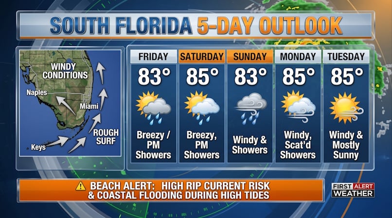 South Florida Forecast: Breezy Conditions, Persistent Beach Hazards, and Rising High Tides
Donna Thomas has studied hurricanes for two decades. She holds a PhD in history when her experience with Hurricane Andrew ultimately led her to earn a degree in broadcast meteorology from Mississippi State University…
-
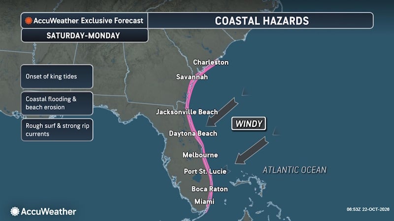 Rough Seas and Tropical Threat Loom Over Florida Coast, Risking Cruise Disruptions and Dangerous Surf
Persistent onshore winds could bring dangerous surf, rip currents and coastal disruptions from Jacksonville to Miami, with another tropical development threat looming this weekend into early next week. A slow-moving…
-
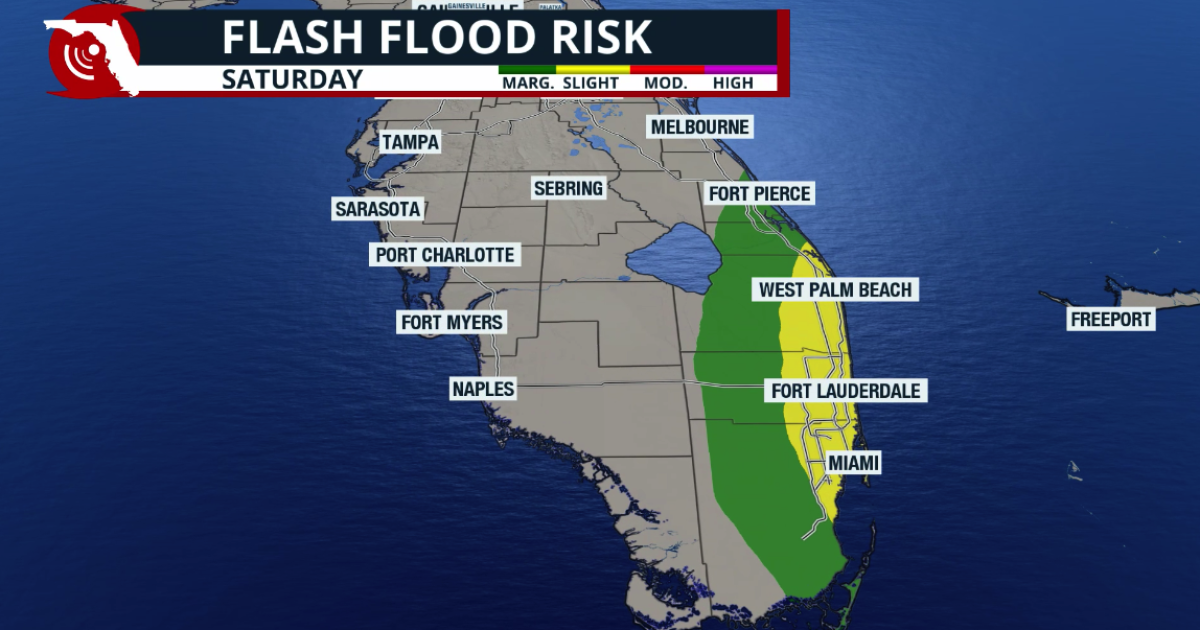 Josephine is born, moving away from the US; King Tides take over Florida
As Josephine moves away, South Florida will see a surge of tropical moisture from the south (unrelated to Josephine), increasing the chance of heavy rain that could cause flash floods. The rain could worsen coastal…
-
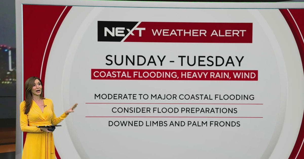 South Florida sees spotty showers ahead of weekend flooding, strong wind threats
October 22, 2026 / 7:30 AM EDT / CBS Miami South Florida will see warmer temperatures and spotty afternoon showers Thursday as the region prepares for a stretch of wet and windy weather that could bring heavy downpours…
-
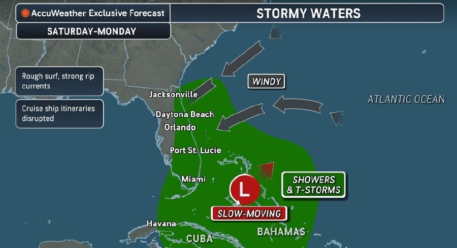 Rough Seas, Dangerous Rip Currents Threaten Florida Coast Ahead Of Possible Tropical Development
Persistent onshore winds and a slow-moving area of low pressure near the Bahamas are expected to bring hazardous surf, strong rip currents, and marine travel disruptions along Florida’s Atlantic coast starting this…
-
 Atlantic storms churn up dangerous, rough seas from Florida coast to Northeast
Subtropical Storm Josephine is expected to become a strong extratropical cyclone with hurricane-force winds as it churns in the mid-Atlantic off the U.S. East Coast, forecasters said. Josephine is bringing high winds…
-
 Another beautiful day Thursday before a big weather change arrives in Central Florida
ORLANDO, Fla. — Central Florida is in for another beautiful day, with cool temperatures to start the morning and warm, mostly sunny conditions expected this afternoon. However, changes are on the way as windy weather…
- Tropical trouble: Weather woes to plague Hawaii, Florida this week
If you're headed to Hawaii or Florida this week for spring break, be sure to pack the rain gear. Two of the USA's prime vacation spots are forecast to see a very wet, stormy week ahead, with flooding rains in both…
- Hurricane Center tracking Josephine, system off Bermuda. Florida impacts?
Subtropical Storm Josephine became the 10th named storm of the 2026 Atlantic hurricane season Oct. 21, two weeks after Tropical Storm Isaias formed in the Gulf. Josephine is forecast to move northeast into the northern…
-
 Central Florida has low chances for rain and temperatures peaking at lower 80s
Thursday is dry with a low chance of showers along the Treasure Coast. Temperatures will peak around 81 degrees and skies will be sunny, according to NWS Melbourne. Winds are blowing north to northeast at 10-15 mph with…
Air quality
Air quality is satisfactory, and air pollution poses little or no risk.
Forecast
- FriGood
- SatGood
- SunGood
Fort Pierce, FL reporting area · 1 hr ago. Data from AirNow (EPA and its state, local and tribal partners); preliminary and subject to change.
Sun & moon
Almanac
MonthlyStuart, records since 1936. Normals 1991–2020. Data from NOAA's Regional Climate Centers (ACIS).
Nearby
- Port Saint Lucie 22 km
- West Palm Beach 50 km
- Jupiter 26 km
- Wellington 54 km
- Palm Beach Gardens 36 km
- Fort Pierce 36 km
- The Acreage 39 km
- Royal Palm Beach 49 km
- Lake Worth Beach 60 km
- Riviera Beach 43 km
- Greenacres City 58 km
- Palm City 7 km
Forecasts, observations and alerts in the United States come from the National Weather Service (NOAA); radar from NOAA's Multi-Radar Multi-Sensor system; satellite imagery from NASA's Global Imagery Browse Services (GIBS) and NOAA's GOES satellites; the map from the U.S. Geological Survey's National Map; air quality from AirNow (EPA and its partners); hurricane information from the National Hurricane Center; climate normals and records from NOAA's Regional Climate Centers (ACIS). Forecasts outside the United States and the UV index: MET Norway (CC BY 4.0); observations outside the U.S.: airport reports via NOAA's Aviation Weather Center. Place names: GeoNames (CC BY 4.0). Data are copied on a schedule and may lag the sources; for warnings that affect your safety, follow your local National Weather Service office and emergency officials. Weather news is drawn from the 4Conservative index and reflects what the press published. Terms of use.