Install
Savannah, GA 31418 Weather
Current conditions
Forecast for this hour (no station report in the last two hours)
Forecast
10-day-
Today
Sunny, with a high near 76. North wind 5 to 8 mph.
-
Tonight
Clear, with a low around 48. North wind 0 to 3 mph.
-
Thursday
Sunny, with a high near 76. Northeast wind 0 to 3 mph.
National Weather Service forecast updated 1 hr ago.
Hourly
Hourly forecast- Now61°
- 11 AM66°
- 12 PM69°
- 1 PM72°
- 2 PM73°
- 3 PM76°
- 4 PM76°
- 5 PM76°
- 6 PM73°
- 7 PM67°
- 8 PM64°
- 9 PM63°
- 10 PM60°
- 11 PM57°
- Thu12 AM55°
- 1 AM54°
- 2 AM52°
- 3 AM51°
- 4 AM51°
- 5 AM49°
- 6 AM48°
- 7 AM48°
- 8 AM48°
- 9 AM53°
10-day forecast
Details- TodayOct 21Sunny48°76°
- ThuOct 22Sunny53°76°
- FriOct 23Sunny55°71°
- SatOct 24Sunny55°71°
- SunOct 25Sunny55°73°
- MonOct 26Sunny55°74°
- TueOct 27Mostly Sunny57°75°
- WedOct 28Cloudy58°78°
- ThuOct 29Partly cloudy61°78°
- FriOct 30Mostly sunny62°81°
Days after the National Weather Service's seven are MET Norway's outlook, a computer model with no forecaster's review.
Radar
Full mapWeather news near Savannah
More weather news-
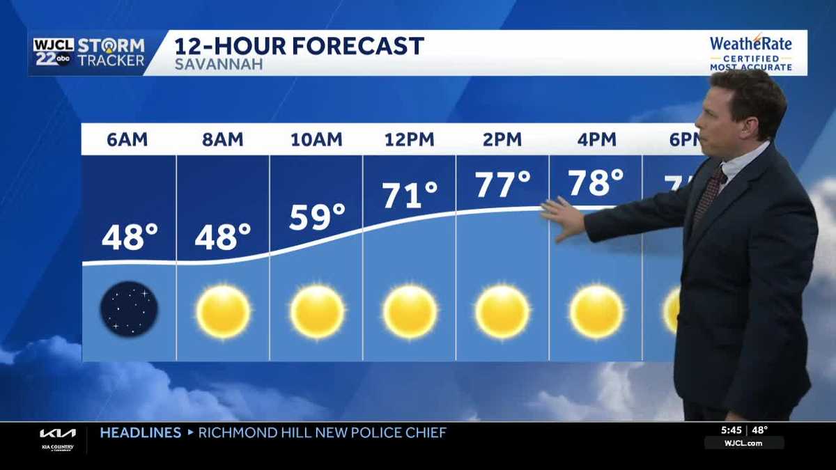 Sunny skies and pleasant fall weather continue across Southeast Georgia and the Lowcountry
Sunshine and pleasantly mild temperatures through the end of the workweek Savannah, Ga. (WJCL)- There will be sunny skies throughout the day with temperatures a few degrees milder this afternoon. Highs will be in the…
-
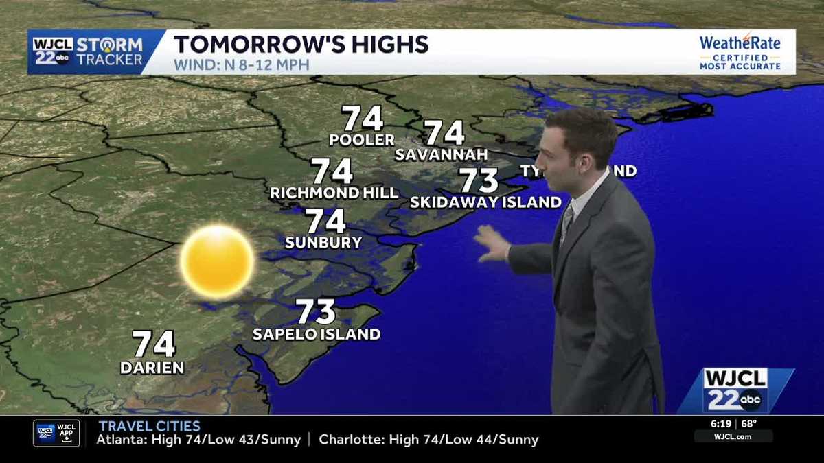 Sunshine stays in the forecast for Southeast Georgia & the Lowcountry this week
WJCL Tuesday morning will feature a clear & cold start with lows in the 40s across Southeast Georgia & the Lowcountry Similar to the start of the work week, there will be plenty of sunshine during the day, but a light…
-
 Chilly mornings ahead, dry weather continues!
SAVANNAH, Ga. (WTOC) - It’s a chilly start to our morning, grab a jacket before heading out for the day! More of us are waking up to temperatures in the 40s compared to yesterday. Coastal communities are slightly…
-
 Cool mornings stick around all week!
SAVANNAH, Ga. (WTOC) - Below average temperatures will remain with us as we begin a new work and school week. Highs will be a little bit warmer compared to yesterday, topping out near 70 degrees. Monday Beach…
- Much cooler today, feeling like November!
SAVANNAH, Ga. (WTOC) - Good Sunday morning! We are waking up to much cooler air! Temperatures are in the 40s and 50s this morning, about 10 to 20 degrees cooler than this time yesterday. Factor in the wind and it feels…
-
 StormTeam3: Chilly, Breezy end to our weekend
SAVANNAH, Ga. (WSAV) — A chill is coming behind a strong cold front, dropping temperatures to their lowest areawide since May. Lows Sunday morning will fall into the mid to upper 40s, while coastal locations will bottom…
-
 Cold mornings, cool days this weekend
ABC57 News in South Bend, Ind. covers all of Michiana including St. Joseph, Elkhart, Kosciusko, LaPorte and Marshall counties in Indiana and Berrien, Cass, Van Buren and St. Joseph counties in Mich. Cold mornings, cool…
-
 FROSTY morning for Michiana
ABC57 News in South Bend, Ind. covers all of Michiana including St. Joseph, Elkhart, Kosciusko, LaPorte and Marshall counties in Indiana and Berrien, Cass, Van Buren and St. Joseph counties in Mich. FROSTY morning for…
-
 Do clocks fall back this weekend in Georgia? When to change time in GA
The annual fall clock change is scheduled for Sunday, Nov. 1, when clocks in Georgia will move back one hour from 2 a.m. to 1 a.m. local time. That means most Georgians will gain an extra hour of sleep that night. But…
-
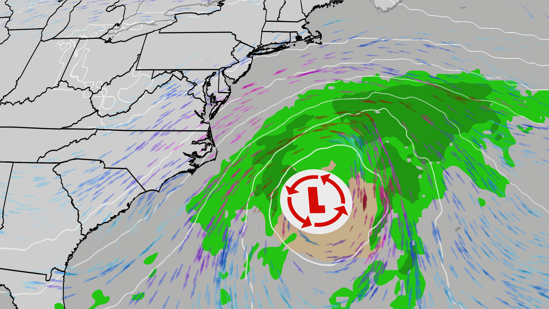 East Coast on alert; High surf, 50 mph gusts possible
The Weather Channel Nor’easter could bring beach erosion, gusty winds to East Coast An area off the East Coast is worth watching this weekend. Increased wave action and beach erosion are possible along areas already hit…
Air quality
Acceptable. Unusually sensitive people should consider limiting prolonged outdoor exertion.
Savannah, GA reporting area · 1 hr ago. Data from AirNow (EPA and its state, local and tribal partners); preliminary and subject to change.
Sun & moon
Almanac
MonthlySavannah Area, records since 1874. Normals 1991–2020. Data from NOAA's Regional Climate Centers (ACIS).
Nearby
- Hilton Head Island 40 km
- Hilton Head 41 km
- Hinesville 51 km
- Pooler 23 km
- Bluffton 36 km
- Wilmington Island 10 km
- Port Royal 58 km
- Richmond Hill 22 km
- Georgetown 15 km
- Rincon 39 km
- Garden City 18 km
- Skidaway Island 5 km
Forecasters' discussion
From the National Weather Service office in CHS, issued 4 hrs ago
What Has Changed
The Aviation section was updated for the 12z TAFs.
Key Messages
- 1) Below normal temperatures will continue this week as high pressure prevails and a powerful nor'easter gradually pulls away from the Mid-Atlantic coast.
- 2) Risk for minor coastal flooding through Thursday along coastal areas of Charleston and Colleton Counties. The highest astronomical tides of 2026, combined with near gale force northeast winds, will bring a multi-day coastal flooding and coastal hazards threat Friday into early next week.
Discussion
KEY MESSAGE 1: Below normal temperatures will continue this week as high pressure prevails and a powerful nor'easter gradually pulls away from the Mid-Atlantic coast.
Through Daybreak: The boundary layer has mostly decoupled inland away from the coastal corridor with calm to light/variable winds being reported across most observation platforms. Strong radiational cooling is in progress with clear skies, calm/light winds and a very dry airmass in place. A small patch of cirrostratus associated with a passing shortwave is moving across parts of the Charleston Tri-County, but no meaningful impacts to temperature have been observed so far. 21/05z temperatures were running about 3-7 degrees colder than the 21/01z NBM, which is not surprising given NBM's well documented warm bias in radiational cooling regimes. Early morning lows were adjusted closer to a blend of the H3R and RAP which yields mid-upper 40s inland to the upper 50s/near 60 at the beaches.
Today and Tonight: Large high pressure will maintain its influence across the region through tonight. Other than a few patches of thin high clouds moving through, mostly clear skies will prevail. Low-level thickness schemes support highs in the mid-upper 70s, which is pretty much in line with the various guidance packages. The 21/01z NBM looks a tad too cool based on highs observed over the past several afternoons and temperatures at or just a degree or so above the third quartile in the interquartile range (IQR) were favored based on a blend of the latest high-res guidance.
The boundary layer will decouple quickly this evening resulting in another round of calm/light winds. These winds combined with ongoing clear skies and a continued dry airmass will support strong radiational cooling. The NBM low temperature forecast again looks too warm given how strong radiative processes will be. Lows were heavily adjusted down as a result with another blend closer to the H3R and RAP favored. Lows will range from the lower-mid 40s inland to the upper 50s at the beaches. Some spotty upper 30s can not be ruled out, especially in some of the typical colder spots such as the Francis Marion National Forest.
Thursday: A nor'easter will be located well off the Northeast U.S. coast in the morning, while High pressure will be north of the Great Lakes region, with it's periphery stretching well into the Southeast U.S. The nor'easter will quickly accelerate away during the day, followed by the periphery of the High building southwards into our region. This will bring our area dry conditions with sunny skies. High temperatures are forecasted to be in the middle to maybe upper 70s. However, the dry conditions, clear skies, and light to calm winds at night will cause decent radiational cooling. This will lead to low temperatures that are several degrees below overnight.
Friday through Sunday: High pressure will strengthen over the Mid- Atlantic States Friday while a coastal trough develops along the Southeast U.S. coast, persisting through the weekend. This will cause NE winds to increase and become gusty, especially closer to the coast. While the High is expected to prevail and keep it dry, there is the potential some showers could make a run for the immediate coast before dissipating. These details will get refined in future forecast. Otherwise, temperatures may be several degrees below normal.
Aviation
21/12z TAFs: KCHS/KJZI/KSAV: VFR through 22/12z.
Extended Aviation Outlook: Gusty northeast winds upwards of 25 kt are expected this weekend.
Forecasts, observations and alerts in the United States come from the National Weather Service (NOAA); radar from NOAA's Multi-Radar Multi-Sensor system; satellite imagery from NASA's Global Imagery Browse Services (GIBS) and NOAA's GOES satellites; the map from the U.S. Geological Survey's National Map; air quality from AirNow (EPA and its partners); hurricane information from the National Hurricane Center; climate normals and records from NOAA's Regional Climate Centers (ACIS). Forecasts outside the United States and the UV index: MET Norway (CC BY 4.0); observations outside the U.S.: airport reports via NOAA's Aviation Weather Center. Place names: GeoNames (CC BY 4.0). Data are copied on a schedule and may lag the sources; for warnings that affect your safety, follow your local National Weather Service office and emergency officials. Weather news is drawn from the 4Conservative index and reflects what the press published. Terms of use.