Install
Clayton, GA 30525 Weather
Current conditions
Forecast for this hour (no station report in the last two hours)
Forecast
10-day-
Tonight
Clear, with a low around 42. North wind 1 to 5 mph.
-
Friday
Sunny, with a high near 67. East wind around 5 mph.
-
Friday Night
Clear, with a low around 39. East wind 1 to 5 mph.
National Weather Service forecast updated 12 hrs ago.
Hourly
Hourly forecast- Now70°
- 7 PM63°
- 8 PM56°
- 9 PM53°
- 10 PM51°
- 11 PM49°
- Fri12 AM48°
- 1 AM46°
- 2 AM45°
- 3 AM44°
- 4 AM43°
- 5 AM42°
- 6 AM42°
- 7 AM42°
- 8 AM42°
- 9 AM45°
- 10 AM52°
- 11 AM57°
- 12 PM61°
- 1 PM63°
- 2 PM65°
- 3 PM66°
- 4 PM66°
- 5 PM66°
10-day forecast
Details- TodayOct 22Sunny42°74°
- FriOct 23Sunny39°67°
- SatOct 24Sunny36°66°
- SunOct 25Sunny36°66°
- MonOct 26Sunny41°70°
- TueOct 27Mostly Sunny43°73°
- WedOct 28Mostly Sunny41°70°
- ThuOct 29Cloudy50°67°
- FriOct 30Sunny49°71°
- SatOct 31Cloudy46°62°
Days after the National Weather Service's seven are MET Norway's outlook, a computer model with no forecaster's review.
Radar
Full mapWeather news near Clayton
More weather news-
 Sunny, dry, and more seasonable potentially right through all of next weekend
headline: Frost Advisory from MON 1:00 AM EDT until MON 9:00 AM EDT TONIGHT: Clear and cold with areas of frost again. Low: 33 MONDAY: Ample sunshine gradually mixing with some high clouds during the afternoon; more…
-
 Frost and freeze conditions tonight; finally a sunny and dry Sunday...just cool
Wall-to-wall sunshine but a frosty start. Still cool in the afternoon, but much lighter winds compared to Saturday. . headline: Freeze Warning until SUN 9:00 AM EDT headline: Freeze Warning from SUN 1:00 AM EDT until…
- Cleveland Weather Forecast: Rain, Gusty Winds And Weekend Frost
Cleveland is starting Friday under cloudy skies with showers and gusty winds on the way, though the threat for stronger showers or storms is low. Temperatures may reach the upper 60s early, then fall into the upper 50s…
-
 Farmers prepare for first widespread freeze of fall
LUZERNE COUNTY, Pa. — Growers are preparing for the incoming freeze on Sunday morning. Temperatures are expected to be below the freezing mark. It'll be the coldest some have been since mid-May. "Today, tomorrow…
-
 Despite recent rain, drought has reached all areas of Maine
Conditions already affecting the fall harvest for farmers The latest precipitation across the state still was not enough to alleviate Maine’s statewide drought, according to the Maine Drought Task Force. The task force…
-
 Tracking the potential for some severe thunderstorms later Friday
Becoming mostly cloudy with some scattered showers mainly after midnight. Some thunder and lightning is also possible. . After some unseasonable warmth the last couple of days, temperatures returned to more typical…
-
 High wind warning and freeze alert issued for New Mexico Thursday night
ALBUQUERQUE, N.M. – A strong cold front will bring a significant east wind event across New Mexico, with potentially damaging gusts and the coldest air of the season so far. The front is pushing south and west across…
-
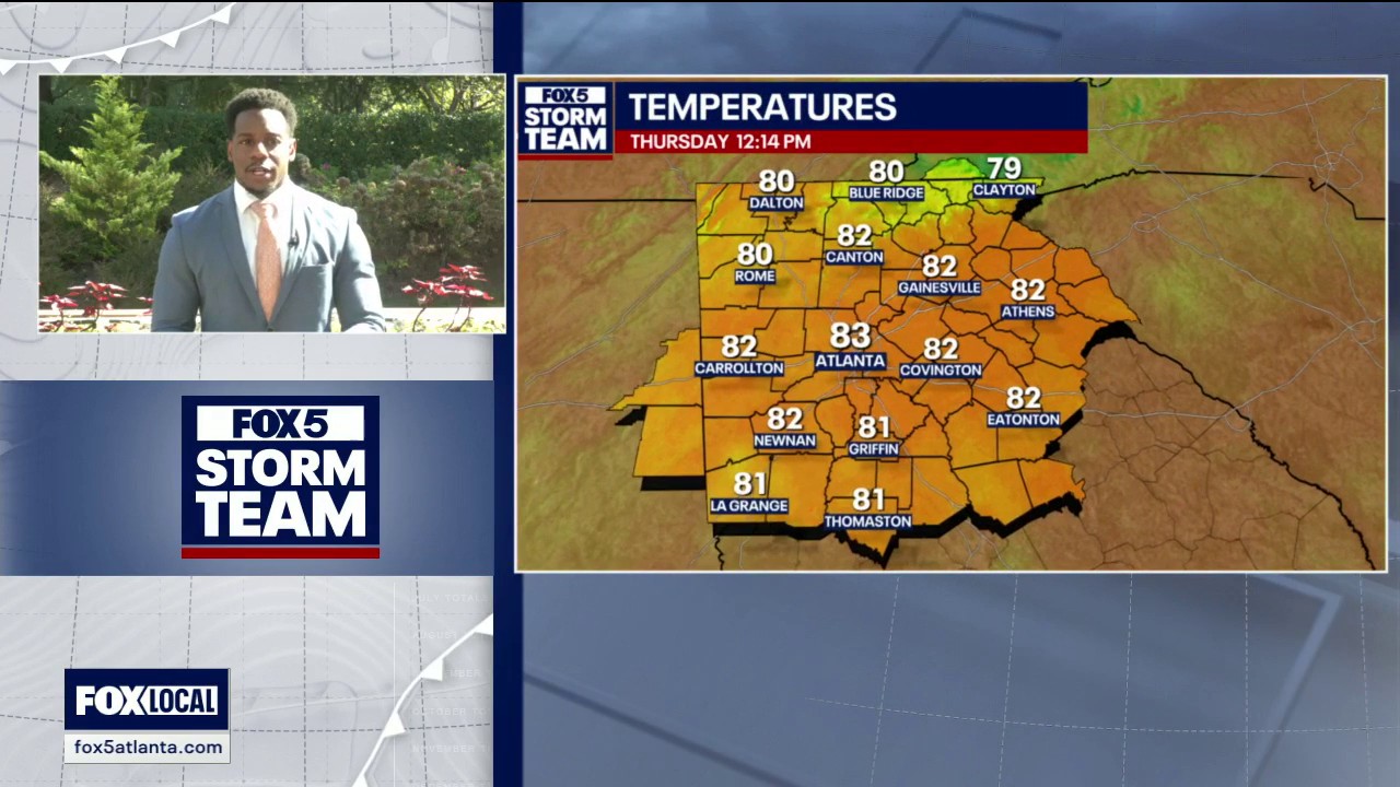 Thursday midday weather forecast
North Georgia is in for a sharp swing from summer heat to fall chill. Sunshine could push highs into the mid- to upper 80s today, with some areas reaching the 90s and record warmth possible again tomorrow. An air…
-
 Freeze warning issued for northern and central New Mexico valleys
ALBUQUERQUE, N.M. – A freeze warning covers the Upper Rio Grande Valley Wednesday night, while a stronger cold front could bring 50 to 55 mph wind gusts to parts of New Mexico on Thursday. Northwest winds will continue…
-
 High fire danger in Cobb and much of Georgia Thursday
The National Weather Service issued a special weather statement for north and central Georgia for Thursday, Oct. 22. Weather reports can be packed with unfamiliar terms. Our plain-English guide to understanding weather…
Air quality
Air quality is satisfactory, and air pollution poses little or no risk.
Forecast
- ThuGood (42)
- FriGood (42)
- SatGood (38)
Macon County, NC reporting area · 1 hr ago. Data from AirNow (EPA and its state, local and tribal partners); preliminary and subject to change.
Sun & moon
Almanac
MonthlyClayton 1 Ssw, records since 1893. Normals 1991–2020. Data from NOAA's Regional Climate Centers (ACIS).
Nearby
Forecasters' discussion
From the National Weather Service office in GSP, issued 4 hrs ago
What Has Changed
No major changes.
Key Messages
1. A Special Weather Statement for Increased Fire Danger remains in effect for Northeast Georgia until 7 PM this evening. 2. Dry through the middle of next week. Near to below normal highs develop Friday into the weekend before above normal highs return next week.
Discussion
Key message 1: A Special Weather Statement for Increased Fire Danger remains in effect for Northeast Georgia until 7 PM this evening.
A Special Weather Statement for Increased Fire Danger remains in effect through 7 PM this evening across northeast Georgia as critical RH (dropping to 25% or less) will combine with dry vegetation and low fine fuel moisture to increase the danger of wildfires. Elsewhere, minimum RH should drop to 25-30% thanks to the return of above normal high temperatures and dry air aloft mixing down to the surface.
Please refer to your local burn permitting authority on whether you can burn today. If you do burn, use extreme caution since fires can quickly get out of hand under these conditions.
Key message 2: Dry through the middle of next week. Near to below normal highs develop Friday into the weekend before above normal highs return next week.
The beautiful albeit dreadfully quiet weather pattern lingers through at least the middle of next week thanks to surface high pressure remaining the dominate feature over the eastern United States. The most "exciting" part of the forecast will be a dry and clear cold air damming wedge building over the GSP forecast area Friday into the weekend, allowing for the return of near normal to just below normal highs. Patchy frost is possible in the North Carolina mountains on both Saturday night and Sunday night thanks to great radiational cooling conditions and cooler lows. Slightly above normal highs return for next week.
Aviation
At KCLT and elsewhere: Dry and VFR through the 18Z TAF period outside of the potential for patchy mountain valley fog, mainly in the Little TN Valley overnight into early Friday morning. Winds east of the mountains will remain NE through the period. Winds in the mountains will be mainly WNW/NW through tonight before gradually toggling more E/ESE Friday. Wind speeds at KAVL will range from 8-11 kts with low-end gusts up to 20 kts through late this afternoon or early this evening. Wind speeds will range mostly from 5-8 kts east of the mountains today and Friday. Lighter wind speeds should develop briefly this evening into tonight, especially at KAVL.
Outlook: Dry and VFR through the middle of next week outside of the potential for mountain valley fog and low stratus each morning.
Forecasts, observations and alerts in the United States come from the National Weather Service (NOAA); radar from NOAA's Multi-Radar Multi-Sensor system; satellite imagery from NASA's Global Imagery Browse Services (GIBS) and NOAA's GOES satellites; the map from the U.S. Geological Survey's National Map; air quality from AirNow (EPA and its partners); hurricane information from the National Hurricane Center; climate normals and records from NOAA's Regional Climate Centers (ACIS). Forecasts outside the United States and the UV index: MET Norway (CC BY 4.0); observations outside the U.S.: airport reports via NOAA's Aviation Weather Center. Place names: GeoNames (CC BY 4.0). Data are copied on a schedule and may lag the sources; for warnings that affect your safety, follow your local National Weather Service office and emergency officials. Weather news is drawn from the 4Conservative index and reflects what the press published. Terms of use.