Install
Travelers Rest, SC 29690 Weather
Current conditions
Observed at Greenville Downtown Airport · 1 hr ago
Forecast
10-day-
Monday
Sunny, with a high near 70.
-
Monday Night
Mostly clear, with a low around 42.
-
Tuesday
Sunny, with a high near 73.
National Weather Service forecast updated 2 days ago.
Hourly
Hourly forecast- Now55°
- 11 AM60°
- 12 PM64°
- 1 PM66°
- 2 PM68°
- 3 PM69°
- 4 PM70°
- 5 PM69°
- 6 PM65°
- 7 PM60°
- 8 PM59°
- 9 PM55°
- 10 PM52°
- 11 PM50°
- Tue12 AM48°
- 1 AM48°
- 2 AM47°
- 3 AM46°
- 4 AM45°
- 5 AM44°
- 6 AM43°
- 7 AM42°
- 8 AM44°
- 9 AM50°
10-day forecast
Details- TonightOct 23Mostly Clear47°
- SatOct 24Sunny45°65°
- SunOct 25Sunny43°66°
- TodayOct 26Sunny42°70°
- TueOct 27Sunny48°73°
- WedOct 28Mostly Sunny47°70°
- ThuOct 29Mostly Sunny48°73°
- FriOct 30Sunny76°
- SatOct 31Cloudy50°72°
- SunNov 1Partly cloudy52°70°
Days after the National Weather Service's seven are MET Norway's outlook, a computer model with no forecaster's review.
Radar
Full mapWeather news near Travelers Rest
More weather news-
 NWS: Snow spotted in North Carolina
FOX Carolina News NWS: Snow spotted in North Carolina Dabo Swinney's opening statement after Clemson shuts out Charleston Southern 37-0 Deputies search for missing, endangered woman with dementia last seen in…
- Festive fall weather weekend across Middle TN- Part 1
WCAX Festive fall weather weekend across Middle TN- Part 1 Protester removed from President Trump rally in Northern Kentucky Man found shot dead inside Nashville apartment. Here’s what we know Festive fall weather…
-
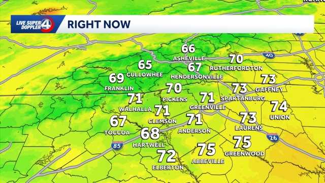 Workweek warmup ahead in South Carolina: October 25 forecast
Highs return to the 70s in most hometowns This week will feature warm temperatures and more cloud cover in the Upstate of South Carolina, Western North Carolina and Northeast Georgia. The school and workweek will kick…
- Temperatures warm up later this week in South Carolina: October 26 forecast
Temperatures heat up ahead of Halloween weekend in the Upstate. Seasonable temperatures are expected for the majority of this week with highs in the 70s! By Friday, we will see temperatures above average before clouds…
- Staying cool and dry Saturday in South Carolina: October 24 forecast
Cool morning ahead, breezy at times with highs in the 70s. Staying dry this weekend. Sunshine lingers into the Sunday. Expect highs in the 60s and lows in the 30s and 40s. Clouds are expected to increase just a bit by…
- Cooler weekend ahead in South Carolina: October 23 forecast
Highs top out in the 60s Expect slightly cooler temperatures on Friday in the Upstate of South Carolina, Western North Carolina and Northeast Georgia. Highs will top out in the upper 60s to low 70s under plenty of…
- Staying sunny, seasonable in South Carolina: October 22 forecast
Sunshine lingers with highs in the 60s and 70s Thursday will feature sunny and seasonable weather in the Upstate of South Carolina, Western North Carolina and Northeast Georgia. After a cool to chilly start, highs will…
- Cold Mornings with Warmer Afternoons in South Carolina: October 20 forecast
Cooler mornings with warm afternoons ahead. Sunshine and comfortable temperatures expected this week in the Upstate. The forecast remains quiet this week as a high pressure keeps the area dry. Highs sit in the 70s with…
Air quality
Air quality is satisfactory, and air pollution poses little or no risk.
Greenville-Spartanburg, SC reporting area · 2 hrs ago. Data from AirNow (EPA and its state, local and tribal partners); preliminary and subject to change.
Sun & moon
Almanac
MonthlyGreenville Downtown Ap, records since 1884. Normals 1991–2020. Data from NOAA's Regional Climate Centers (ACIS).
Nearby
- Greenville 17 km
- Spartanburg 46 km
- Greer 20 km
- Anderson 59 km
- Mauldin 27 km
- Taylors 15 km
- Easley 25 km
- Simpsonville 34 km
- Wade Hampton 14 km
- Clemson 52 km
- Berea 13 km
- Gantt 23 km
Forecasters' discussion
From the National Weather Service office in GSP, issued 1 hr ago
What Has Changed
Precipitation chances have trended higher for the coming weekend.
Updated the aviation discussion for the recent 06z TAF issuance.
Key Messages
1. Dry high pressure is expected to persist over our region through at least Friday with temperatures climbing back above normal. Rain chances increase this weekend.
Discussion
Key message 1: Dry high pressure is expected to persist over our region through at least Friday with temperatures climbing back above normal. Rain chances increase this weekend.
The dry weather is expected to continue through the work week across our area. A stout upper ridge remains nearly stationary over the MS River Valley to our west. The resulting blocking pattern is expected to gradually dissipate over the next few days, however the Southeast will remain under broad upper ridging through the end of the week. At the surface, broad high pressure continues to linger over the Southeast as profiles reflect a fairly deep dry layer of air across the region. On Tuesday, another cP airmass will settle over the NE, reinforcing the low-level dry air and bringing marginally cooler temperatures for Wednesday. Nonetheless, temperatures are expected to climb back above normal by the end of the week as the high shifts eastward and off the Atlantic Coast.
Another reinforcing/back-door cold front is expected to arrive over the weekend and possibly re-establish some amount of cold-air damming across our area. This coupled with the breakdown of the upper blocking pattern mentioned above, may allow for an increase in low-lvl isentropic ascent across our area and produce some showers over the weekend.
Aviation
At KCLT and elsewhere: Very light N to NE winds this morning. Valley fog is evident from satellite around KAVL, so retained TEMPO there. KHKY appears a bit more removed from the fog so no longer including it there. Winds are expected to remain mainly in the 4-7 kt range today, still mainly N to NE. Periods of calm are expected around the area tonight, with only a few cirrus seen. Mountain valley fog can't be ruled out tonight, but confidence remains low so only went 6SM at KAVL.
Outlook: Mostly VFR conditions are expected through the work week. Mountain valley fog and low stratus will be possible each morning. Moisture appears likely to increase over the weekend.
Forecasts, observations and alerts in the United States come from the National Weather Service (NOAA); radar from NOAA's Multi-Radar Multi-Sensor system; satellite imagery from NASA's Global Imagery Browse Services (GIBS) and NOAA's GOES satellites; the map from the U.S. Geological Survey's National Map; air quality from AirNow (EPA and its partners); hurricane information from the National Hurricane Center; climate normals and records from NOAA's Regional Climate Centers (ACIS). Forecasts outside the United States and the UV index: MET Norway (CC BY 4.0); observations outside the U.S.: airport reports via NOAA's Aviation Weather Center. Place names: GeoNames (CC BY 4.0). Data are copied on a schedule and may lag the sources; for warnings that affect your safety, follow your local National Weather Service office and emergency officials. Weather news is drawn from the 4Conservative index and reflects what the press published. Terms of use. How to use Weather