Install
Pittsburgh, PA 15267 Weather
Current conditions
Forecast for this hour (no station report in the last two hours)
Forecast
10-day-
Tonight
Mostly clear, with a low around 43. North wind 1 to 6 mph.
-
Friday
Mostly sunny, with a high near 64. Northeast wind 1 to 5 mph.
-
Friday Night
Clear, with a low around 39. East wind around 5 mph.
National Weather Service forecast updated 4 hrs ago.
Hourly
Hourly forecast- Now60°
- 8 PM54°
- 9 PM52°
- 10 PM49°
- 11 PM48°
- Fri12 AM46°
- 1 AM46°
- 2 AM45°
- 3 AM45°
- 4 AM44°
- 5 AM43°
- 6 AM43°
- 7 AM43°
- 8 AM43°
- 9 AM45°
- 10 AM49°
- 11 AM54°
- 12 PM57°
- 1 PM60°
- 2 PM62°
- 3 PM63°
- 4 PM64°
- 5 PM63°
- 6 PM61°
10-day forecast
Details- TodayOct 22Sunny43°66°
- FriOct 23Mostly Sunny39°64°
- SatOct 24Sunny37°66°
- SunOct 25Sunny40°67°
- MonOct 26Sunny45°69°
- TueOct 27Mostly Sunny43°66°
- WedOct 28Partly Sunny45°66°
- ThuOct 29Partly cloudy0.10 in49°68°
- FriOct 30Partly cloudy38°51°
- SatOct 31Partly cloudy35°55°
Days after the National Weather Service's seven are MET Norway's outlook, a computer model with no forecaster's review.
Radar
Full mapWeather news near Pittsburgh
More weather news- Pittsburgh Weather Forecast: Frost Advisory And Chilly Nights
Pittsburgh faces a chilly stretch, with overnight cold bringing a distinctly October feel. The National Weather Service’s latest Pittsburgh forecast also lists a Frost Advisory for early Thursday. An observation…
-
 Crisp autumn morning breaks across the West Hills with clear skies ahead
Looking beyond tonight’s dip to 35 degrees, our stretch of quiet, dry autumn weather holds firm across western Allegheny County. High pressure will keep our skies clear and conditions pleasant as we round out the middle…
-
 Old Farmer’s Almanac Forecasts Rain, Snow Showers for Northeast on Thanksgiving
With autumnal foliage colors and cooler temperatures settling in across the Philadelphia region, it’s time to start our attentions to the upcoming holiday and winter season. Take a look at… The Almanac's Thanksgiving…
-
 AccuWeather's Pittsburgh Winter Forecast Revealed: Warm/Wet
With October already over halfway over, the colder weather will soon be here. For the next week or so, Pittsburgh is expecting sunshine and highs in the low to mid 60s through at least this weekend. But how is winter…
-
 Beautiful fall weather continues on Tuesday, with a cool start to the day
WPXI Beautiful fall weather continues on Tuesday, with a cool start to the day PITTSBURGH â Picture-perfect fall weather continues with crisp, cool nights and warmer, sun-filled days. Temperatures will swing more than…
-
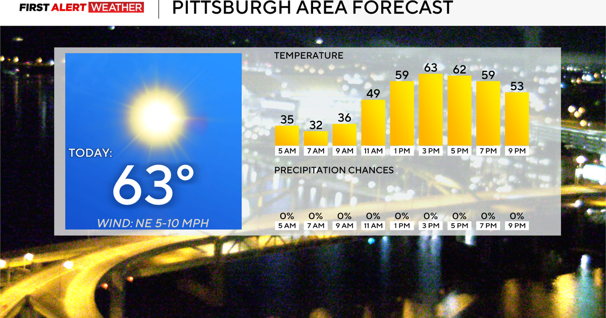 It's going to be a dry week without rain throughout the Pittsburgh area
October 19, 2026 / 7:13 AM EDT / CBS Pittsburgh It's going to be a dry week without rain in the Pittsburgh area. Any alert days ahead? Nope. There are freeze warnings in place for a couple of counties this morning…
-
 Another frosty night in the Pittsburgh area
WPXI PITTSBURGH — It will be another frosty night across the entire area, with temperatures dropping back down into the 30s tonight. A Frost Advisory is in effect for much of the area from Allegheny County south and…
-
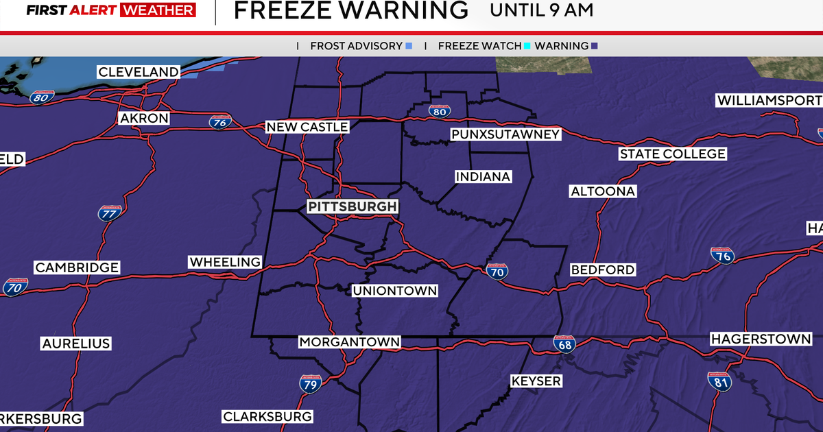 Sunday begins with colder temperatures in Pittsburgh, but sunshine and seasonable weather follows
October 18, 2026 / 7:32 AM EDT / CBS Pittsburgh We are in First Alert Weather mode until 9 a.m. with a Freeze Warning for everyone. Some areas dipped into the upper 20s! Average first fall frost for Pittsburgh is…
-
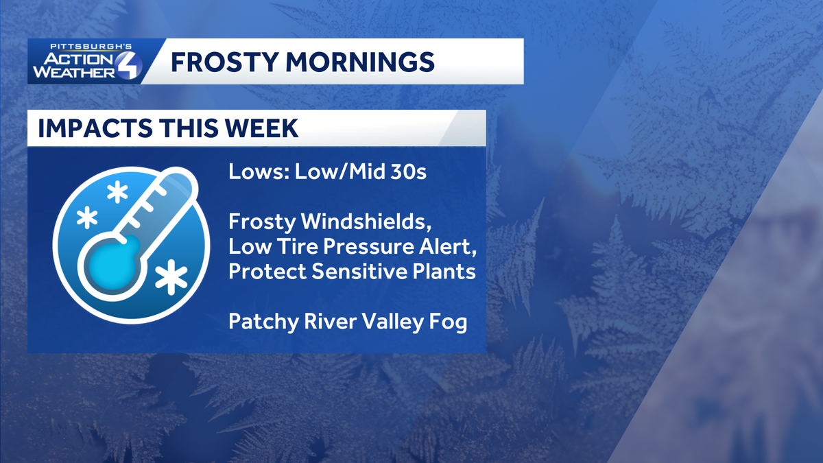 Pittsburgh: A stunning stretch of fall weather
It's only sunshine and seasonal temperatures this week. The Freeze Warning is set to expire at 9 a.m. Frosty mornings and mild afternoons with sunshine are in our future. It is shaping up to be a glorious fall week. A…
-
 Coldest morning since spring gives way to warmer, dry week
Once the sun rises, weâll warm up in a hurry with highs pushing into the low 60s. Coldest morning since spring gives way to warmer, dry week PITTSBURGH â Itâs the coldest morning since spring with temperatures…
Air quality
Air quality is satisfactory, and air pollution poses little or no risk.
Forecast
- ThuGood (50)
- FriGood (35)
- SatGood (35)
Pittsburgh, PA reporting area · 1 hr ago. Data from AirNow (EPA and its state, local and tribal partners); preliminary and subject to change.
Sun & moon
Almanac
MonthlyPittsburgh Area, records since 1875. Normals 1991–2020. Data from NOAA's Regional Climate Centers (ACIS).
Nearby
- Mount Lebanon 9 km
- Bethel Park 12 km
- Monroeville 20 km
- Cranberry Township 29 km
- Plum 24 km
- Allison Park 15 km
- Murrysville 28 km
- West Mifflin 16 km
- Baldwin 11 km
- McKeesport 17 km
- Weirton Heights 44 km
- Upper Saint Clair 12 km
Forecasters' discussion
From the National Weather Service office in PBZ, issued 6 hrs ago
What Has Changed
No significant changes to the forecast.
Key Messages
1) Quiet, dry weather continues through late next week
Discussion
KEY MESSAGE 1... Broad surface high pressure will maintain dry and mostly sunny conditions through early next week. The potential for frost and freeze products remains low over the next few days as a flux of low-level moisture returns to the region; overnight lows will range from the low-40s to upper-30s.
The probability of precipitation remains low (below 10%) through next Thursday with little to no change in our large-scale weather pattern.
Aviation
High confidence VFR conditions continue through the weekend. Clear skies continue with light northerly wind today. Tonight, winds will become variable with the chance for a scattered cloud deck to move in. Due to the scattered deck, valley fog is not expected tomorrow morning. During the day, a light northeasterly wind is expected with mostly clear skies.
Outlook... Outside of any morning river valley fog, VFR is highly likely through Monday under high pressure.
Forecasts, observations and alerts in the United States come from the National Weather Service (NOAA); radar from NOAA's Multi-Radar Multi-Sensor system; satellite imagery from NASA's Global Imagery Browse Services (GIBS) and NOAA's GOES satellites; the map from the U.S. Geological Survey's National Map; air quality from AirNow (EPA and its partners); hurricane information from the National Hurricane Center; climate normals and records from NOAA's Regional Climate Centers (ACIS). Forecasts outside the United States and the UV index: MET Norway (CC BY 4.0); observations outside the U.S.: airport reports via NOAA's Aviation Weather Center. Place names: GeoNames (CC BY 4.0). Data are copied on a schedule and may lag the sources; for warnings that affect your safety, follow your local National Weather Service office and emergency officials. Weather news is drawn from the 4Conservative index and reflects what the press published. Terms of use.