Install
Westfield, NY 14787 Weather
Current conditions
Forecast for this hour (no station report in the last two hours)
Forecast
10-day-
Tonight
Clear, with a low around 37. East wind 5 to 8 mph.
-
Wednesday
Sunny, with a high near 61. East wind around 5 mph.
-
Wednesday Night
Mostly clear, with a low around 44. Northeast wind around 3 mph.
National Weather Service forecast updated 10 hrs ago.
Hourly
Hourly forecast- Now51°
- 9 PM48°
- 10 PM45°
- 11 PM44°
- Wed12 AM44°
- 1 AM43°
- 2 AM42°
- 3 AM40°
- 4 AM39°
- 5 AM38°
- 6 AM37°
- 7 AM37°
- 8 AM38°
- 9 AM41°
- 10 AM47°
- 11 AM51°
- 12 PM54°
- 1 PM56°
- 2 PM57°
- 3 PM59°
- 4 PM56°
- 5 PM56°
- 6 PM54°
- 7 PM47°
10-day forecast
Details- TodayOct 20Sunny37°64°
- WedOct 21Sunny44°61°
- ThuOct 22Sunny40°61°
- FriOct 23Sunny41°58°
- SatOct 24Sunny44°60°
- SunOct 25Sunny51°66°
- MonOct 26Mostly Sunny10%47°64°
- TueOct 27Cloudy41°52°
- WedOct 28Cloudy41°52°
- ThuOct 29Cloudy0.02 in46°53°
Days after the National Weather Service's seven are MET Norway's outlook, a computer model with no forecaster's review.
Radar
Full mapWeather news in New York
More weather news-
 Freeze alerts stretch from Missouri to New York for Sunday
Temps drop for millions across the Central Plains, Midwest, Northeast The first real taste of fall is settling in for millions, including a few first frosts and freezes of the season for some in the Midwest and East…
-
 First Alert Weather: Bright sunshine, crisp air for Sunday in New York - 10/17/26
CBS News Detroit Weekend 11pm CBS News Los Angeles Weekend 8pm CBS News Philadelphia Weekend KDKA News Weekend 11pm CBS News Texas Weekend 10pm
-
 First Alert Weather: Clear skies with chilly temps Sunday in New York - 10/17/26
CBS News Bay Area Evening Edition Weekend 6pm CBS News Detroit Weekend 6pm CBS News Los Angeles Weekend 6pm CBS News Philadelphia 7:30pm Health Watch on CBS News Sacramento CBS News Texas Saturday 5pm
-
 Dangerous Freeze Warnings for 7 Counties in New York as Temperatures Plummet
Freeze Warnings take effect tonight across parts of New York, with lows in the upper 20s to around 30 expected from the Hudson Valley to Buffalo. The warnings run into 9 a.m. EDT Sunday. Frost and freeze conditions…
-
 First Alert Weather: Feels like November Saturday in New York - 10/17/26
CBS News Bay Area Morning Edition Weekend 6am WBZ This Morning 8am CBS News Chicago Saturday 8am CBS Colorado Mornings Weekend CBS News Los Angeles Weekend 6am CBS News Miami This Morning 9am WCCO News Saturday Morning…
-
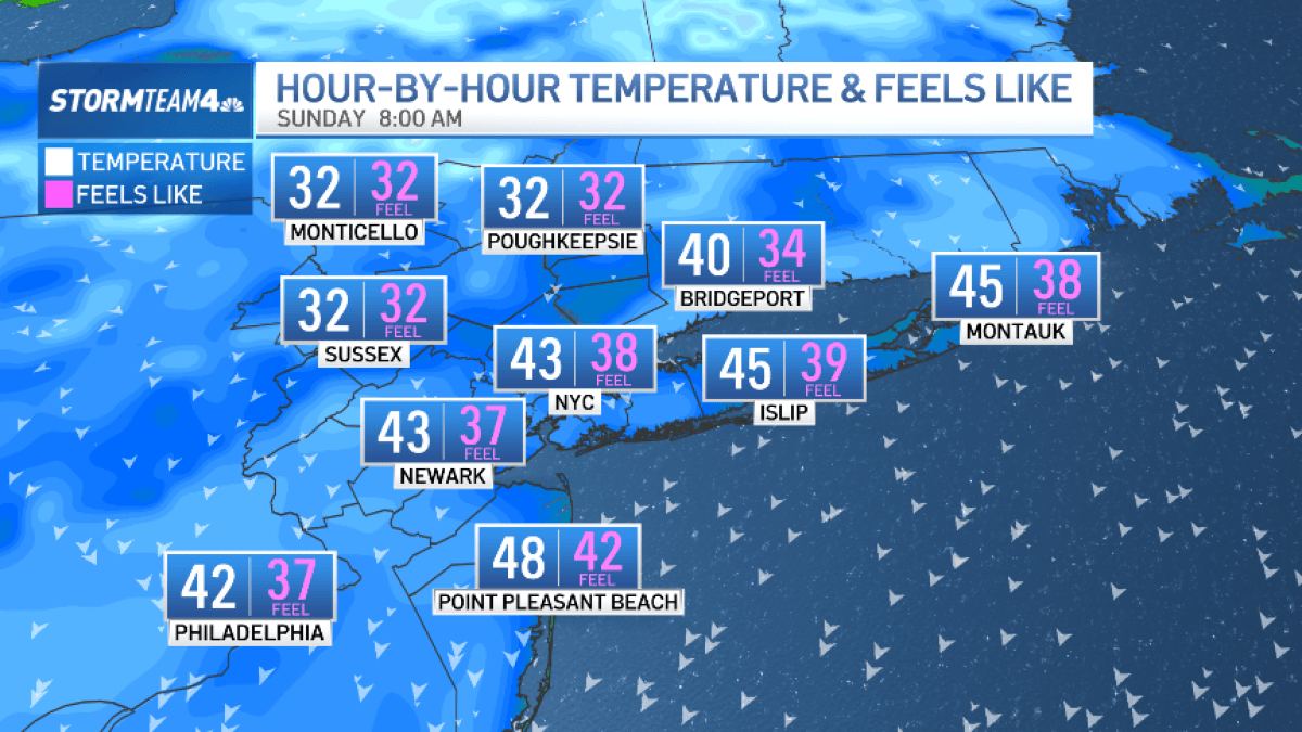 Bundle up! Cold snap hits New York City this weekend
The Friday night severe thunderstorm threat may have passed, but our weekend weather woes are not over quite yet. A surge of much colder air now sweeps across the region. Saturday is forecast to be windy and noticeably…
-
 Heavy rain, colder temps moving through New York City
CBS News - The 5:33 | Legacy of the LIRR Massacre - On The Dot with David Schechter: Wildfires & Climate Change Heavy rain, colder temps moving through New York City First Alert Weather: Severe thunderstorms Friday…
-
 Dangerous Freeze Watches Issued for Ohio, Pennsylvania and New York as Temperatures Plummet
Freeze Watches are in effect from late Saturday night through Sunday morning across Ohio, Pennsylvania, western New York, West Virginia, Maryland and Virginia, with lows as cold as 25 degrees possible. A strong cold…
-
 Rainy weather with possibly strong storms impacting New York, New Jersey area
October 16, 2026 / 8:19 AM EDT / CBS New York It is a stormy start to the weekend, with a rainy Friday that could bring severe weather to the New York area. Showers will move through the area during the day. But the…
-
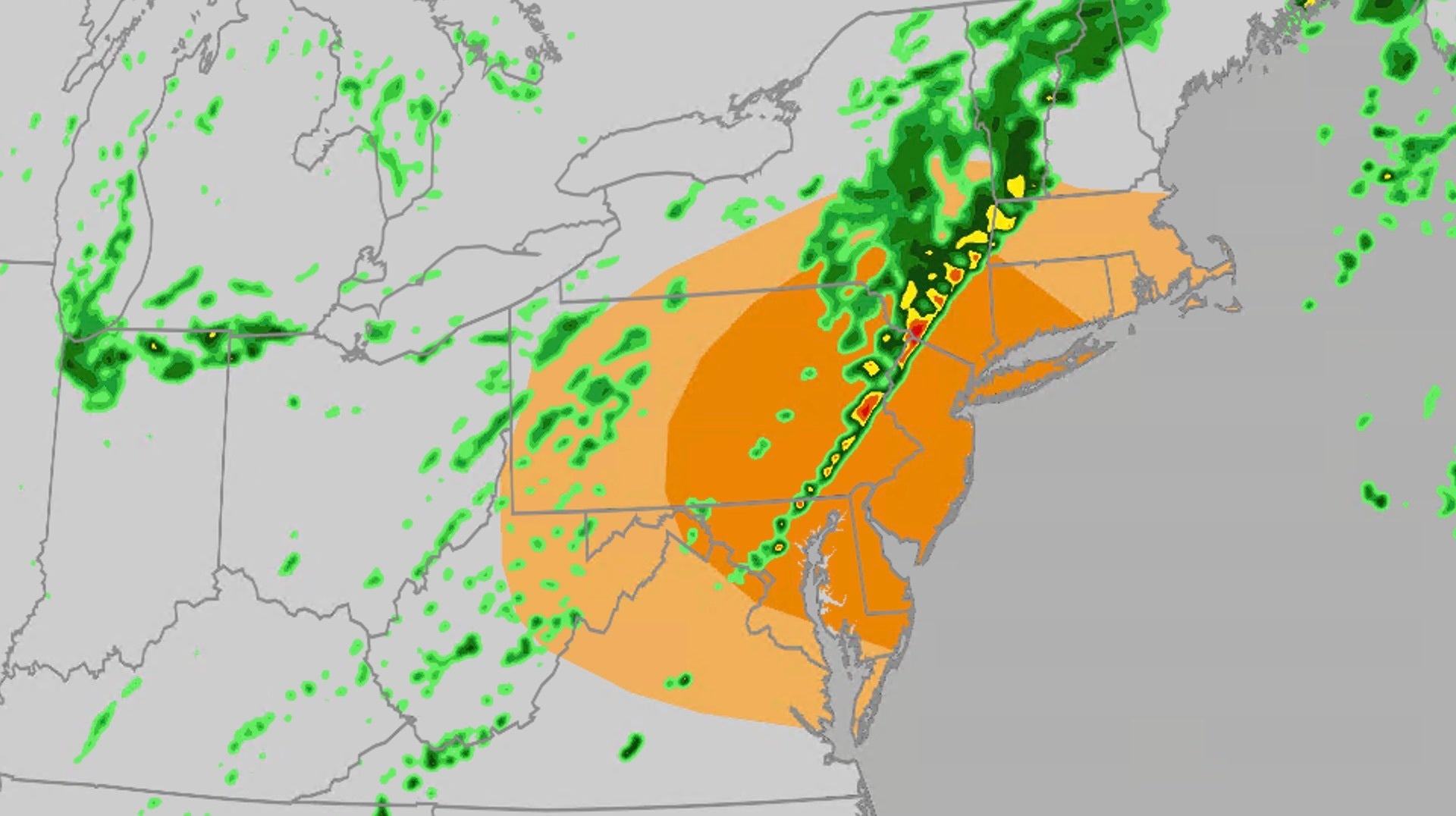 Severe storms target DC, Philadelphia, New York
The Weather Channel Severe storms bring damaging winds, tornado threat to Northeast Severe storms will take aim at parts of the mid-Atlantic and Northeast on Friday, including the risk for damaging winds and tornadoes…
Air quality
Air quality is satisfactory, and air pollution poses little or no risk.
Forecast
- TueGood (42)
- WedGood (30)
- ThuModerate (60)
Erie, PA reporting area · 1 hr ago. Data from AirNow (EPA and its state, local and tribal partners); preliminary and subject to change.
Sun & moon
Almanac
MonthlyDunkirk Chautauqua County Ap, records since 1945. Normals 1991–2020. Data from NOAA's Regional Climate Centers (ACIS).
Nearby
- Erie 47 km
- Jamestown 37 km
- Dunkirk 26 km
- Fredonia 24 km
- Northwest Harborcreek 40 km
- Corry 45 km
- Portland 11 km
- North East 25 km
- Lawrence Park 42 km
- Lake Erie Beach 53 km
- Wesleyville 42 km
- Union City 52 km
Forecasters' discussion
From the National Weather Service office in BUF, issued 7 hrs ago
What Has Changed
Minor changes to the forecast with this update.
Key Messages
1) Dry and tranquil weather will prevail through the weekend.
Discussion
KEY MESSAGE 1...Dry and tranquil weather will prevail through the weekend.
High pressure surface and aloft will remain in place across the Ohio Valley and eastern Great Lakes through Wednesday night, maintaining dry weather and clear skies. Some river valley fog will develop late tonight through Wednesday morning across the Southern Tier, and again late Wednesday night through Thursday morning.
A mid level trough will dig southeast across Quebec Thursday, with an associated cold front moving southeast across the eastern Great Lakes. The majority of the height falls and large scale ascent will be displaced well northeast of the area across Quebec, leaving a weakly forced and moisture starved cold front crossing our region. This front will bring some increase in cloud cover, but will likely move through dry. Cooler air aloft will bring some increase in lake induced instability, but the lack of synoptic scale moisture will likely only support a few lake effect and upslope clouds.
High pressure surface and aloft will build back into the eastern Great Lakes and New England Friday through the weekend with a continuation of dry weather and sunshine.
Aviation
A strong ridge of high pressure will remain in place across the Ohio Valley and eastern Great Lakes through Wednesday and beyond, with clear skies and VFR prevailing most of the time. The one exception will be river valley fog across the Southern Tier and Finger Lakes late tonight through Wednesday morning with local IFR. The setup does not appear favorable for the fog to reach KJHW.
Outlook...
Wednesday through Sunday...VFR with the exception of late night and morning river valley fog across the Southern Tier each day.
Forecasts, observations and alerts in the United States come from the National Weather Service (NOAA); radar from NOAA's Multi-Radar Multi-Sensor system; satellite imagery from NASA's Global Imagery Browse Services (GIBS) and NOAA's GOES satellites; the map from the U.S. Geological Survey's National Map; air quality from AirNow (EPA and its partners); hurricane information from the National Hurricane Center; climate normals and records from NOAA's Regional Climate Centers (ACIS). Forecasts outside the United States and the UV index: MET Norway (CC BY 4.0); observations outside the U.S.: airport reports via NOAA's Aviation Weather Center. Place names: GeoNames (CC BY 4.0). Data are copied on a schedule and may lag the sources; for warnings that affect your safety, follow your local National Weather Service office and emergency officials. Weather news is drawn from the 4Conservative index and reflects what the press published. Terms of use.