Install
South Burlington, VT 05403 Weather
Current conditions
Observed at Plattsburgh International Airport · 56 min ago
Forecast
10-day-
Monday
Mostly sunny, with a high near 60. Southwest wind 5 to 8 mph.
-
Monday Night
Partly cloudy, with a low around 35. North wind 6 to 10 mph.
-
Tuesday
Mostly sunny, with a high near 50. North wind around 10 mph.
National Weather Service forecast updated 3 days ago.
Hourly
Hourly forecast- Now59°
- 4 PM60°
- 5 PM59°
- 6 PM57°
- 7 PM55°
- 8 PM52°
- 9 PM50°
- 10 PM47°
- 11 PM45°
- Tue12 AM43°
- 1 AM42°
- 2 AM41°
- 3 AM39°
- 4 AM38°
- 5 AM37°
- 6 AM36°
- 7 AM36°
- 8 AM37°
- 9 AM39°
- 10 AM42°
- 11 AM44°
- 12 PM46°
- 1 PM47°
- 2 PM48°
10-day forecast
Details- TonightOct 22Mostly Clear32°
- FriOct 23Sunny29°54°
- SatOct 24Sunny30°59°
- SunOct 25Sunny39°62°
- TodayOct 26Mostly Sunny35°60°
- TueOct 27Mostly Sunny28°50°
- WedOct 28Mostly Sunny34°52°
- ThuOct 29Partly Sunny57°
- FriOct 30Light rain0.09 in47°59°
- SatOct 31Sunny42°51°
Days after the National Weather Service's seven are MET Norway's outlook, a computer model with no forecaster's review.
Radar
Full mapWeather news in Vermont
More weather news-
 Stunning photos capture October's Hunter's Moon around the world
A good view for the passengers of this plane flying over San Francisco Bay in California, US The October full Moon lit up skies around the world this weekend. Full Moons throughout the year have traditionally been given…
-
 Martin's Haven
For more information, please see FAQs. Contains ADMIRALTY ® data: © Crown copyright and database right BBC Weather in association with MeteoGroup, external Copyright © 2026 BBC. The BBC is not ... Right now, the tide in…
-
 More wet and windy weather to follow stormy weekend
Choppy seas and large waves crashing up onshore in Aberystwyth, Ceredigion Storm Boelo will continue to batter parts of the UK on Sunday but the fierce autumn weather shows no sign of clearing quickly. After two named…
-
 Before you crank up the thermostat, try these tips to keep your house warmer for longer
As the UK braces for a chilly weekend, with powerful winds and heavy rain hitting parts of the country, people are looking for ways to bring some warmth to their homes without cranking up the heating just yet. It is…
-
 Storm Boelo expected to bring more disruption as hundreds still grapple with Austen power cuts
Storm Boelo is expected to bring wet and windy weather across large swathes of the country on Saturday, with Scotland being hit the hardest Yellow and amber warnings have been given for Scotland, northern England and…
-
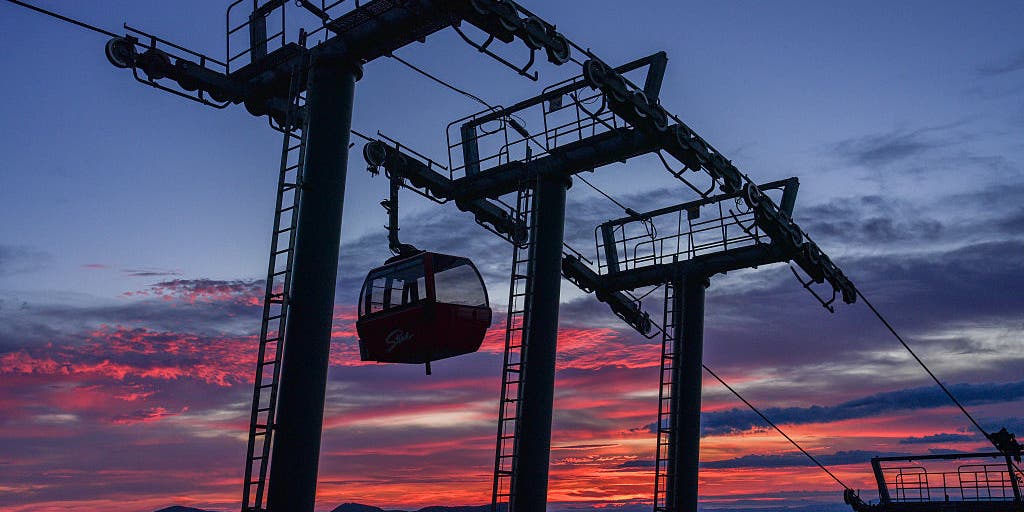 Vermont ski mountains prepare to open as winter weather looms
A ski resort in Colorado unveils preserved snow from last season to provide a rare opportunity for thousands, skiing in October. Chris Miller, the sustainability senior VP at Aspen One, joins FOX Weather to talk about…
-
 Trains cancelled and roads warnings as Scotland prepares for Storm Boelo
Train services have been cancelled and police have warned against unnecessary road journeys as Scotland prepares for the arrival of Storm Boelo. Heavy rain and strong winds are expected during the second named storm to…
-
 Second storm to hit UK with more wind and rain as thousands remain without power
Rough sea along the Dorset coastline on Friday A second storm in as many days is set to batter parts of the UK, as thousands remain without power following powerful winds and heavy rain on Friday. Storm Boelo is…
-
 Amber wind warning issued as storm sweeps in
An amber warning for wind has been issued for parts of Cumbria and the north-east of England as the region braces itself for Storm Boelo. High winds are expected to batter north and west Cumbria, including Carlisle…
-
 Stick season approaches, but a beautiful weekend ahead across Vermont
This year, VTDigger is teaming up with Henry’s Weather Channel to help answer the annual question of when and where peak foliage will make its appearance across the state. Though the best fall foliage is now behind us…
Air quality
Air quality is satisfactory, and air pollution poses little or no risk.
Forecast
- MonGood (45)
- TueGood (35)
Burlington, VT reporting area · 1 hr ago. Data from AirNow (EPA and its state, local and tribal partners); preliminary and subject to change.
Sun & moon
Almanac
MonthlyBurlington International Airport, records since 1940. Normals 1991–2020. Data from NOAA's Regional Climate Centers (ACIS).
Nearby
- Burlington 4 km
- Plattsburgh 35 km
- Colchester 11 km
- Essex Junction 7 km
- Williston 9 km
- Montpelier 53 km
- Winooski 4 km
- Saint Albans 41 km
- Middlebury (village) 48 km
- Morristown 46 km
- Hinesburg 15 km
- Stowe 39 km
Forecasters' discussion
From the National Weather Service office in BTV, issued 1 hr ago
What Has Changed
As of 243 PM EDT Monday...
No significant changes to the current forecast.
Key Messages
As of 243 PM EDT Monday...
1. Behind a weak cold front this afternoon, high pressure will return with sharply colder air towards mid week.
2. Light rain possible Thursday night as a frontal boundary moves through the region, then mostly dry and seasonably warm weather prevailing into the weekend.
Discussion
As of 243 PM EDT Monday...
KEY MESSAGE 1: GOES-19 visible satellite depicts a narrow moisture corridor associated with a weak cold front stretched across the region this afternoon. While most of the radar returns have ended up being virga, some locations in the St. Lawrence Valley have been able to pick up a few hundreths of an inch of rainfall. By and large however, many locations will remain dry with little to no measurable rain from this frontal system, especially those in Vermont where dewpoint depressions are 10-15 degrees. A few places along the northwest facing slopes of the Adirondacks and northern Greens, including Jay Peak, could a few sprinkles though due to orographic influences. Winds will turn to the north-northwest as the front moves through this afternoon advecting sharply colder air and some briefly gusty winds this evening from Canada. As nocturnal cooling begins after sunset this evening, winds will briefly increase in the northern Champlain Valley up to 25 MPH or so between 7-10 PM. Winds will weaken towards calm thereafter. Tonights lows will cool to the upper 20s for many locations with a few locations hovering around the freezing mark in the wider valleys; coldest locations will be across northern New York and the Northeast Kingdom. Tomorrow will feature sunny skies with continued cool high temperatures struggling to reach the upper 40s. The coldest night of the season arrives Tuesday night under strong radiational cooling. Overnight lows may approach some records for Montpelier and St. Johnsbury, with records elsewhere residing in the 10th percentile or lower. Temperatures will drop to the teens across the Adirondacks and low 20s elsewhere. Temperatures slowly rebound Wednesday as high pressure and south winds help to moderate our pattern. Temperatures will warm to the low to mid 50s.
KEY MESSAGE 2: Low chances for some showers on Thursday night as a front crosses our area. With center of the low passing well north of our area, not a lot of strong forcing with this frontal passage. If we have precipitation, it will be light. Then we once again expect mostly dry and seasonably warm weather for Friday and Saturday as a ridge of surface high pressure builds into the north country. Some models indicate increasing chances for showers early next week, but not a lot of model consistency in that timeframe at this point. .
Aviation
Through 18Z Tuesday...Mainly VFR conditions today with exception of brief MVFR ceilings as cold front drops across our area. Some light rainfall has been observed as well. All terminals will trend back to VFR by 00z and are expected to remain that way for the remainder of the forecast period. Winds tonight will generally be light and terrain influences, increasing out of the south/southwest towards morning. Behind the front, winds shift to become more northwesterly and may be gusty at BTV and PBG with channeled flow.
Outlook...
Tuesday Night: VFR. NO SIG WX. Wednesday: VFR. NO SIG WX. Wednesday Night: VFR. NO SIG WX. Thursday: VFR. NO SIG WX. Thursday Night: Mainly VFR, with areas MVFR possible. Chance SHRA. Friday: Mainly VFR, with local MVFR possible. Slight chance SHRA. Friday Night: VFR. NO SIG WX. Saturday: VFR. NO SIG WX.
Forecasts, observations and alerts in the United States come from the National Weather Service (NOAA); radar from NOAA's Multi-Radar Multi-Sensor system; satellite imagery from NASA's Global Imagery Browse Services (GIBS) and NOAA's GOES satellites; the map from the U.S. Geological Survey's National Map; air quality from AirNow (EPA and its partners); hurricane information from the National Hurricane Center; climate normals and records from NOAA's Regional Climate Centers (ACIS). Forecasts outside the United States and the UV index: MET Norway (CC BY 4.0); observations outside the U.S.: airport reports via NOAA's Aviation Weather Center. Place names: GeoNames (CC BY 4.0). Data are copied on a schedule and may lag the sources; for warnings that affect your safety, follow your local National Weather Service office and emergency officials. Weather news is drawn from the 4Conservative index and reflects what the press published. Terms of use. How to use Weather