Install
Old Orchard Beach, ME 04064 Weather
Current conditions
Observed at Portland, Portland International Jetport · 52 min ago
Forecast
10-day-
Saturday
Sunny, with a high near 56. West wind 0 to 5 mph.
-
Saturday Night
Clear, with a low around 32.
-
Sunday
Sunny, with a high near 59.
National Weather Service forecast updated 1 day ago.
Hourly
Hourly forecast- Now55°
- 2 PM56°
- 3 PM56°
- 4 PM56°
- 5 PM54°
- 6 PM50°
- 7 PM46°
- 8 PM42°
- 9 PM41°
- 10 PM39°
- 11 PM38°
- Sun12 AM37°
- 1 AM35°
- 2 AM34°
- 3 AM34°
- 4 AM33°
- 5 AM33°
- 6 AM33°
- 7 AM32°
- 8 AM35°
- 9 AM41°
- 10 AM47°
- 11 AM54°
- 12 PM57°
10-day forecast
Details- ThuOct 22Mostly Sunny35°62°
- FriOct 23Sunny29°54°
- TodayOct 24Sunny32°56°
- SunOct 25Sunny34°59°
- MonOct 26Sunny38°65°
- TueOct 27Sunny29°53°
- WedOct 28Sunny33°51°
- ThuOct 29Partly cloudy38°56°
- FriOct 30Light rain0.02 in34°57°
- SatOct 31Mostly sunny33°55°
Days after the National Weather Service's seven are MET Norway's outlook, a computer model with no forecaster's review.
Radar
Full mapWeather news in Maine
More weather news-
 Drought lowers well levels in northern Maine
AROOSTOOK COUNTY, Maine (WAGM) - About half the country relies on private wells for everyday water use. An ongoing drought is leaving some wells with record low levels, and with winter approaching, local officials say…
- Birders flock to southern Maine to see rare gray heron, documented in state for first time ever
NewsBreak: Local News & Alerts Local news from Maine Birders flock to southern Maine to see rare gray heron, documented in state for first time ever YOU MAY ALSO LIKE Iconic Frozen Pizza Discontinued Forever, After More…
-
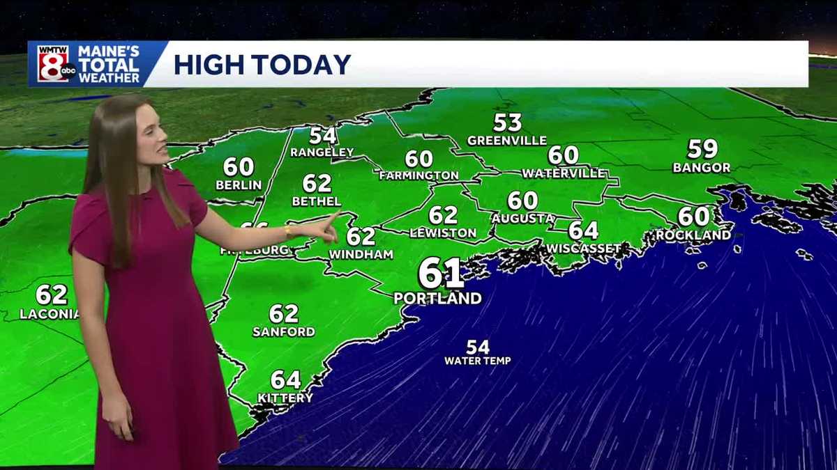 Dry weather ahead for Maine
WMTW Dry weather ahead for Maine How’s the weather looking for your Tuesday? Get your latest Maine’s Total Weather video forecast from Meteorologist Ann Badowsky. WATCH: Sheriff's deputy jumps into neck-deep pond to…
-
 Seasonable, sunny stretch continues this week in Maine
WGME Seasonable, sunny stretch continues this week in Maine
- New England Could Face Another Fall Nor’easter – Maine, New Hampshire, & Massachusetts Take Note
Even though we normally think of Nor'easters as being a winter weather event, they can happen at any time during the year. In fact, we have already had a Nor'easter this year. It rolled through New England in September…
-
 A look back at Maine's most extreme Octobers
Join the CBS13 I-Team on Wednesday in Lewiston for our Contractor Concerns Community Forum from 10 a.m. to 4 p.m. PORTLAND (WGME) -- In the heart of fall, cooler temperatures settle across Maine, bringing the first hard…
-
 Bright and seasonable conditions ahead this week in Maine
Join the CBS13 I-Team on Wednesday in Lewiston for our Contractor Concerns Community Forum from 10 a.m. to 4 p.m. PORTLAND (WGME) -- Lots of sunshine and high temperatures fluctuating between the 50s and 60s is on tap…
-
 Aurora forecast: Solar wind could spark northern lights in Maine and other U.S. states on October 19-20
Residents of many of the northern U.S. states, from Washington to Maine, could get a chance to see auroras around midnight. Aurora forecast: Solar wind could spark northern lights in Maine and other U.S. states on…
-
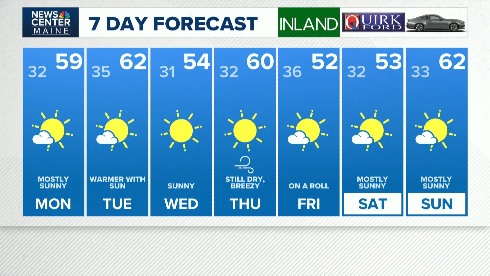 NEWS CENTER Maine Weather Video Forecast
newscentermaine.com NEWS CENTER Maine Weather Video Forecast To stream NCM on your phone, you need the NCM app. Download the NCM app Next up in 5 Example video title will go here for this video Before You Leave, Check…
Air quality
Air quality is satisfactory, and air pollution poses little or no risk.
Forecast
- SatGood
- SunGood
- MonGood
Southwest Coast, ME reporting area · 1 hr ago. Data from AirNow (EPA and its state, local and tribal partners); preliminary and subject to change.
Sun & moon
Almanac
MonthlyPortland Jetport, records since 1940. Normals 1991–2020. Data from NOAA's Regional Climate Centers (ACIS).
Nearby
- Portland 18 km
- Dover 54 km
- Rochester 53 km
- West Scarborough 5 km
- South Portland 18 km
- South Portland Gardens 14 km
- Portsmouth 58 km
- Biddeford 6 km
- Sanford 33 km
- Saco 5 km
- Westbrook 17 km
- Brunswick 55 km
Forecasters' discussion
From the National Weather Service office in GYX, issued 16 hrs ago
What Has Changed
No significant changes to the forecast with this update.
Key Messages
1. Cold tonight with lows in the teens and 20s. High pressure continues dry weather fore the foreseeable future.
Discussion
KEY MESSAGE 1 DESCRIPTION...
High pressure cresting overhead will provide optimal radiational cooling conditions tonight with lows dropping into the 20s and teens. Temperatures rebounds into the 50s to low 60s Saturday under sunny skies. Saturday night will not be as cold as tonight while most spots drop into the 20s. Temperatures warm Sunday into Monday as the high shifts offshore. A dry cold front crosses late Monday with another cool Canadian high pressure settling over the area for much of next week. Ensembles show little in the way of precipitation chances through the end of the month with the next signal for precipitation arriving around November 1st.
Aviation
Through Saturday: VFR expected through Saturday.
Outlook...
Saturday night-Wednesday...VFR prevails under high pressure. This should lead to light diurnal wind patterns.
Forecasts, observations and alerts in the United States come from the National Weather Service (NOAA); radar from NOAA's Multi-Radar Multi-Sensor system; satellite imagery from NASA's Global Imagery Browse Services (GIBS) and NOAA's GOES satellites; the map from the U.S. Geological Survey's National Map; air quality from AirNow (EPA and its partners); hurricane information from the National Hurricane Center; climate normals and records from NOAA's Regional Climate Centers (ACIS). Forecasts outside the United States and the UV index: MET Norway (CC BY 4.0); observations outside the U.S.: airport reports via NOAA's Aviation Weather Center. Place names: GeoNames (CC BY 4.0). Data are copied on a schedule and may lag the sources; for warnings that affect your safety, follow your local National Weather Service office and emergency officials. Weather news is drawn from the 4Conservative index and reflects what the press published. Terms of use.