Install
Lugu, Taiwan, Taiwan Weather
Current conditions
Forecast for this hour (no station report in the last two hours)
Forecast
10-day-
Friday
Heavy rain. High 25°. Precipitation 16.5 mm for the day.
-
Friday Night
Heavy rain. Low 20°. Precipitation 16.5 mm for the day.
-
Saturday
Heavy rain. High 22°. Precipitation 146.6 mm for the day.
MET Norway forecast updated 4 hrs ago.
Hourly
Hourly forecast- Now20°
- 08:0021°0.3
- 09:0022°0.7
- 10:0022°0.7
- 11:0023°0.6
- 12:0024°0.6
- 13:0025°0.3
- 14:0025°0.2
- 15:0025°0.3
- 16:0024°0.9
- 17:0023°1.8
- 18:0022°1.5
- 19:0022°1.6
- 20:0022°2.0
- 21:0021°1.9
- 22:0021°1.1
- 23:0021°0.4
- Sat00:0021°0.5
- 01:0022°0.8
- 02:0021°1.0
- 03:0022°1.2
- 04:0022°2.3
- 05:0021°1.2
- 06:0021°6.8
Daily forecast
DetailsRadar
Full mapWeather news near Lugu
More weather news-
 Creative work
Taipei Times - All Front Page Taiwan News Business Editorial & Opinion Sports World News Features Bilingual Pages The hand-built brick version of the CK124 “Formosa Express” steam locomotive at the rear plaza of…
-
 Super Typhoon Champi, one of the strongest storms this year, will impact Taiwan, China and Japan
Super Typhoon Champi made a close pass to Guam, tied for strongest storm of the year, and will now affect Taiwan, China and Japan. Published Oct 19, 2026 12:22 PM EDT | Updated Oct 22, 2026 12:45 PM EDT Depending on the…
-
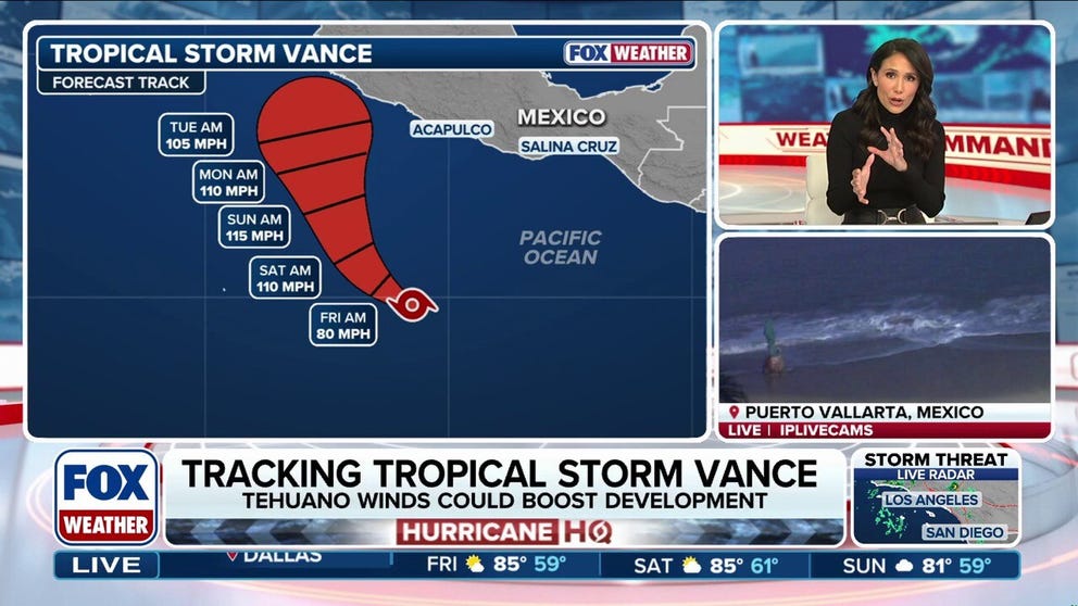 Tropical Storm Vance could intensify into a major hurricane, while Champi threatens Taiwan and Japan
Tropical Storm Vance is expected to strengthen into the 13th hurricane in the Pacific Basin this season as it approaches Mexico next week. Vance could intensify into a major hurricane, which would be the basin's 10th…
-
 Taiwan Halts Stock Trade, Shuts Schools as Typhoon Champi Nears
Taiwan will suspend trading on its stock exchange and shut schools in most areas on Friday as Typhoon Champi approaches the island, disrupting flights and threatening heavy rainfall. Champi is currently 713 kilometers…
-
 Extreme Weather Taiwan Storm
Goshen News A high wave hits ashore in Keelung, northern Taiwan, Thursday, Oct. 22, 2026, as typhoon Champi approaches the area. Tesla recently unveiled its new Roadster sports car, which can thrust itself in the air…
-
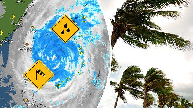 Severe weather in South-East Asia: A powerful typhoon is heading towards Taiwan
Weather News - Follow weather live - Weather & Radar Storms and heavy rain A massive typhoon heads for Taiwan Damaging winds, waves several feet high and torrential rain: Typhoon CHAMPI is heading for Taiwan. Although…
- Typhoon Champi Cancels Taiwan–Okinawa Flights as Ferry Services Stop
Typhoon Champi has triggered flight cancellations between Taiwan and Okinawa, disrupted domestic air services and forced the suspension of several ferry routes as authorities prepare for dangerous weather on October 22…
-
 Super Typhoon Champi Path: Will It Hit Taiwan? Forecast, Wind Speed, Warnings And Safety Measures
Super Typhoon Champi is moving across the western North Pacific towards waters east of Taiwan, raising concerns about heavy rainfall, powerful winds and possible travel disruptions. However, the latest forecasts suggest…
- Taiwan issues land warning ahead of arrival of powerful Typhoon Champi
A close up of the eye of Typhoon Champi swirling over the Philippine Sea, as seen from space on Oct 21, 2026 in a screengrab. (Image: CSU/CIRA and JMA/JAXA/Handout via Reuters) TAIPEI: Taiwan issued a land warning on…
- Taiwan cancels over 100 flights as Super Typhoon Champi churns towards island with 140mph winds
Strongest storm of the year is forecast to hit island the hardest before moving towards China The strongest storm of the year weakened slightly on Thursday as it barrelled towards the Philippines, Taiwan, and China…
Sun & moon
Nearby
Forecasts, observations and alerts in the United States come from the National Weather Service (NOAA); radar from NOAA's Multi-Radar Multi-Sensor system; satellite imagery from NASA's Global Imagery Browse Services (GIBS) and NOAA's GOES satellites; the map from the U.S. Geological Survey's National Map; air quality from AirNow (EPA and its partners); hurricane information from the National Hurricane Center; climate normals and records from NOAA's Regional Climate Centers (ACIS). Forecasts outside the United States and the UV index: MET Norway (CC BY 4.0); observations outside the U.S.: airport reports via NOAA's Aviation Weather Center. Place names: GeoNames (CC BY 4.0). Data are copied on a schedule and may lag the sources; for warnings that affect your safety, follow your local National Weather Service office and emergency officials. Weather news is drawn from the 4Conservative index and reflects what the press published. Terms of use.