Install
Guanshan, Taiwan, Taiwan Weather
Current conditions
Observed at Feng Nin Arpt · 40 min ago
Forecast
10-day-
Wednesday
Partly cloudy. High 30°.
-
Wednesday Night
Fog. Low 20°.
-
Thursday
Light rain. High 30°. Precipitation 1.8 mm for the day.
MET Norway forecast updated 2 hrs ago.
Hourly
Hourly forecast- Now30°
- 13:0030°
- 14:0030°
- 15:0029°
- 16:0027°
- 17:0026°
- 18:0023°
- 19:0023°
- 20:0022°
- 21:0021°
- 22:0020°
- 23:0020°
- Thu00:0020°
- 01:0021°
- 02:0021°
- 03:0020°
- 04:0020°
- 05:0020°
- 06:0021°
- 07:0023°
- 08:0026°
- 09:0028°
- 10:0029°
- 11:0030°
10-day forecast
Details- TodayOct 21Partly cloudy20°30°
- ThuOct 22Light rain1.8 mm20°30°
- FriOct 23Heavy rain54.0 mm23°27°
- SatOct 24Heavy rain17.2 mm24°28°
- SunOct 25Cloudy1.1 mm20°29°
- MonOct 26Showers5.7 mm19°31°
- TueOct 27Heavy showers8.2 mm20°29°
- WedOct 28Partly cloudy20°26°
- ThuOct 29Cloudy0.5 mm19°27°
- FriOct 30Partly cloudy19°27°
Radar
Full mapWeather news in Taiwan
More weather news- Thailand monitors Typhoon Champi as Taiwan travellers warned
The Thai Meteorological Department (TMD) is monitoring Typhoon Champi and has advised travellers heading to Taiwan from October 21 to 24 to closely follow weather and flight updates as the storm approaches the island…
-
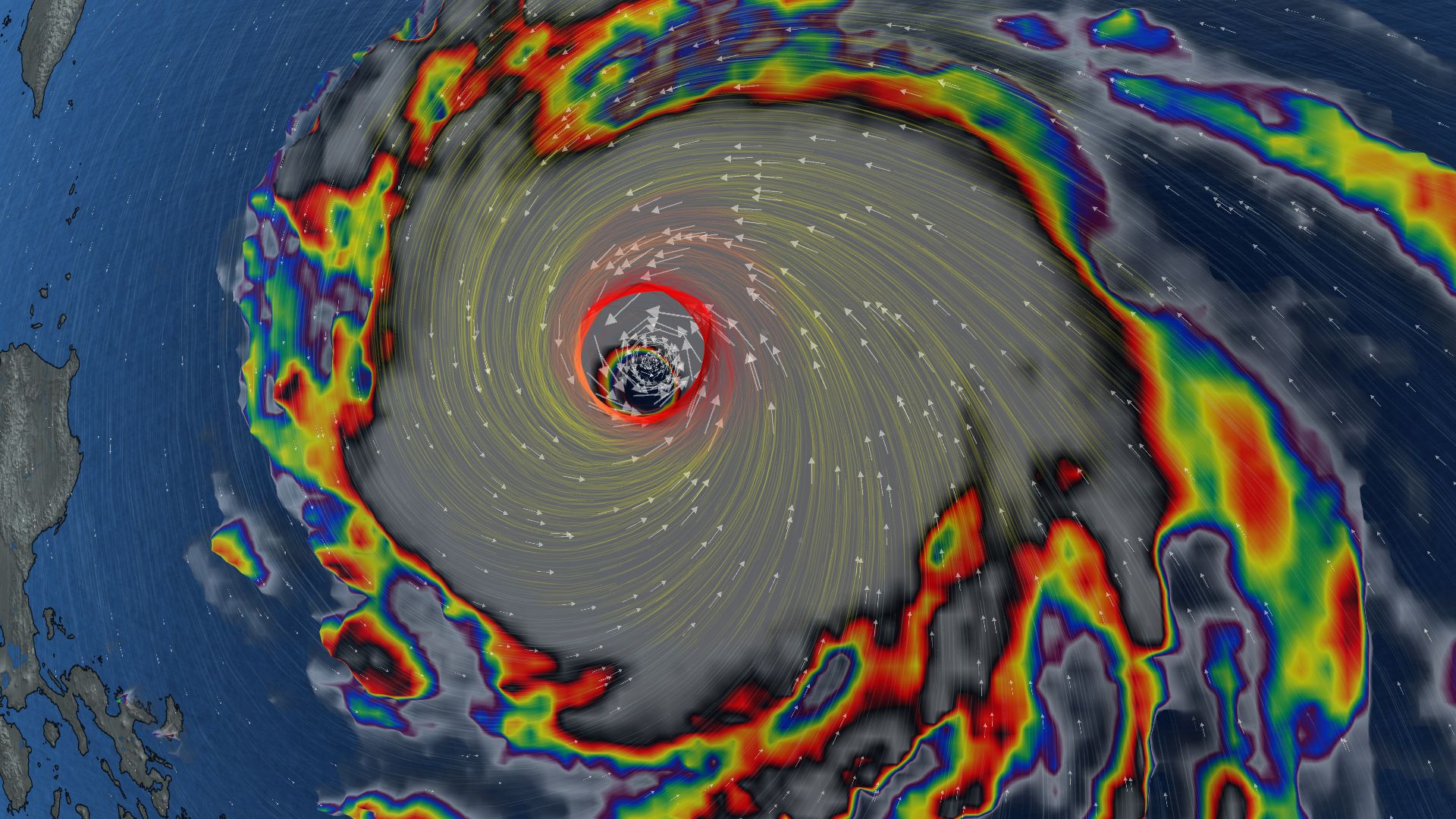 296 km/h: Super Typhoon Champi is now the strongest storm on Earth in 2026
In terms of wind speed, Super Typhoon Champi is the most powerful storm on Earth in 2026 so far, achieving the top storm spot with its peak winds of 296 km/h--the equivalent of a Category 5 storm Super Typhoon Champi…
-
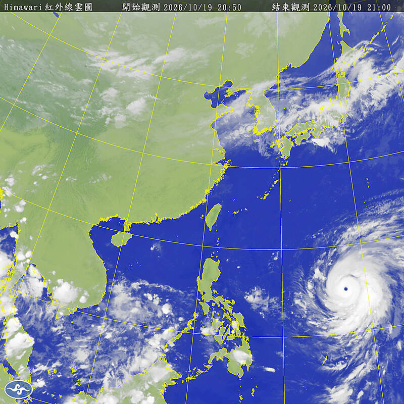 Typhoon Champi to turn away from Taiwan, will still bring heavy rain
Typhoon Champi will turn northward earlier than previously forecast, sparing Taiwan a direct hit but still bringing heavy rain to the north of the country on Friday and Saturday, according to the Central Weather…
-
 Sunny, dry fall weather sticks around as rain holds off
Our weather pattern looks pretty tranquil and pleasant for quite some time. High pressure will remain in control through the end of the week and into the weekend with plenty of sunshine, dry conditions and no major…
-
 Knoxville weather: Dry and pleasant stretch this week
Calm and seasonable weather will dominate the forecast this week Tomorrow: Just a few high clouds with near-average temperatures. High: 72°. Wednesday: Plenty of sunshine and staying calm. High: 73°. The fall weather is…
-
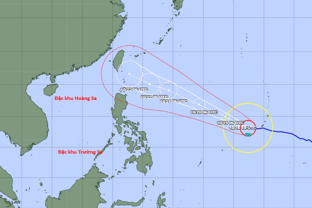 Super typhoon Champi forecast to hit Taiwan, China around October 23
The National Centre for Hydro-Meteorological Forecasting said on the afternoon of October 18 that Champi was a powerful storm over the north-western Pacific and the 30th storm to form in the region this year. Early that…
-
 Super Typhoon Champi is heading towards Taiwan (China), with a 10-20% chance of entering the South China Sea.
Super Typhoon Champi, with winds reaching level 16 and gusts exceeding level 17, is moving northwest towards Taiwan (China). Although unlikely to enter the South China Sea, the typhoon could bring winds of level 7…
- Super Typhoon Champi, a Category 16 storm, is heading towards Taiwan and is unlikely to enter the South China Sea.
Super typhoon Champi, with winds reaching level 16 and gusts exceeding level 17, is predicted to have little chance of entering the South China Sea, but its circulation could cause strong winds of level 6-7 in the…
- Super Typhoon Champi is heading towards Taiwan (China), with little chance of entering the South China Sea.
The National Center for Meteorological and Hydrological Forecasting predicts that Super Typhoon Champi is unlikely to enter the South China Sea. However, the storm's circulation may cause winds in the northern South…
Forecasts, observations and alerts in the United States come from the National Weather Service (NOAA); radar from NOAA's Multi-Radar Multi-Sensor system; satellite imagery from NASA's Global Imagery Browse Services (GIBS) and NOAA's GOES satellites; the map from the U.S. Geological Survey's National Map; air quality from AirNow (EPA and its partners); hurricane information from the National Hurricane Center; climate normals and records from NOAA's Regional Climate Centers (ACIS). Forecasts outside the United States and the UV index: MET Norway (CC BY 4.0); observations outside the U.S.: airport reports via NOAA's Aviation Weather Center. Place names: GeoNames (CC BY 4.0). Data are copied on a schedule and may lag the sources; for warnings that affect your safety, follow your local National Weather Service office and emergency officials. Weather news is drawn from the 4Conservative index and reflects what the press published. Terms of use.