Install
Cascade, Seychelles Weather
Current conditions
Observed at Seychelles Intl · 55 min ago
Forecast
10-day-
Wednesday
Light showers. High 28°. Precipitation 10.4 mm for the day.
-
Wednesday Night
Heavy showers. Low 27°. Precipitation 10.4 mm for the day.
-
Thursday
Heavy showers. High 28°. Precipitation 6.5 mm for the day.
MET Norway forecast updated 7 hrs ago.
Hourly
Hourly forecast- Now28°
- 13:0028°
- 14:0028°
- 15:0028°0.6
- 16:0027°0.2
- 17:0028°
- 18:0028°1.0
- 19:0027°7.2
- 20:0027°0.7
- 21:0028°
- 22:0028°0.2
- 23:0028°0.2
- Thu00:0027°0.5
- 01:0027°0.7
- 02:0027°1.2
- 03:0026°0.7
- 04:0027°0.2
- 05:0027°
- 06:0027°
- 07:0027°
- 08:0027°
- 09:0028°
- 10:0028°
- 11:0028°
Daily forecast
Details- TodayOct 21Light showers10.4 mm27°28°
- ThuOct 22Heavy showers6.5 mm26°28°
- FriOct 23Partly cloudy1.5 mm26°28°
- SatOct 24Light showers4.6 mm26°28°
- SunOct 25Rain4.4 mm27°28°
- MonOct 26Showers2.8 mm27°28°
- TueOct 27Light rain5.0 mm25°28°
- WedOct 28Heavy showers14.9 mm25°28°
- ThuOct 29Heavy showers13.1 mm25°28°
Radar
Full mapWeather news near Cascade
More weather news-
 Very warm through Wednesday
High pressure is holding firm and blocking most Pacific weather systems from moving inland. This setup continues through Friday with just one weak cold front passing through Thursday. A warm and dry east wind starts…
-
 A bomb cyclone and atmospheric river are developing in the Pacific. What does that mean for the West Coast?
Updated on: November 20, 2024 / 7:13 AM EST / CBS News The Northwest is bracing for a strong storm system that began moving onshore early Wednesday, bringing strong winds, heavy rain and mountain snow. Over 7 million…
-
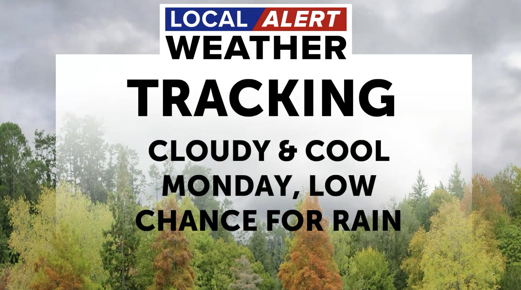 Mostly cloudy Monday with slight chance for rain
BEND, Ore. (KTVZ) - We're tracking cool and mostly cloudy conditions for your Monday. Highs will top out in the upper 50s to low 60s. We could see a brief shower in the area today, especially closer to the Cascades…
-
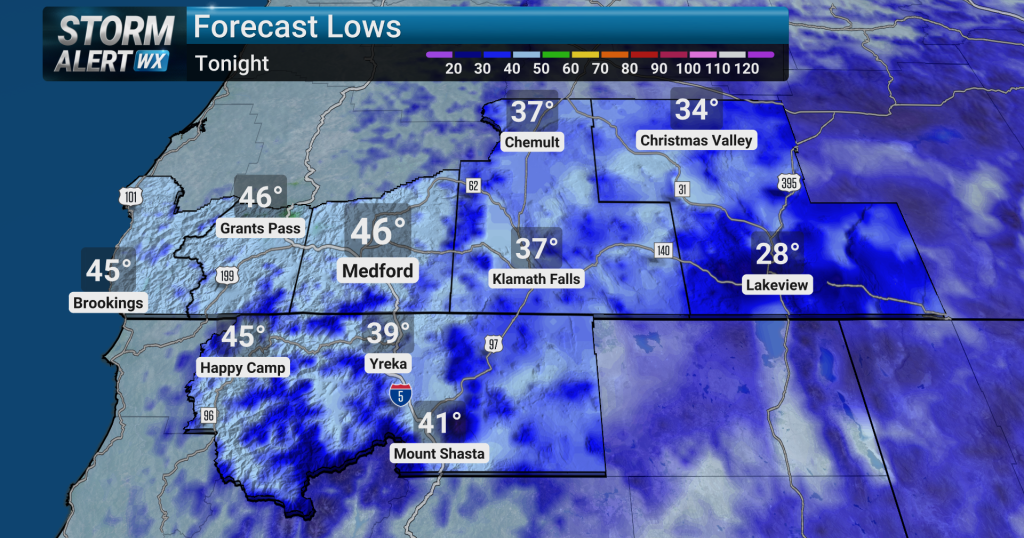 Mild, dry weather continues across the Rogue Valley today
KDRV Mild and dry weather is expected to continue across the region tonight Areas of morning low clouds are anticipated along the coast, within the Umpqua Basin, and in the Grants Pass area High temperatures today were…
-
 First Alert: Rain possible next weekend
What a nice fall day! Highs will end up in the upper 60s. Skies turn cloudy tonight as a low pressure system slides down the Pacific coastline. Lows will be in the 40s. As the low slides to our south, high pressure…
- Frost advisory for North Clark County Lowlands and South Cascades for Sunday
Tacoma News Tribune The creation of this content included the use of AI based on templates created, reviewed and edited by journalists in the newsroom. Read more on our AI policy here. At 5:21 p.m. on Saturday, the NWS…
- What experts are saying about the El Niño expected this winter
Whatcom News Support the advertisers who keep community news free for everyone What experts are saying about the El Niño expected this winter A strong El Niño is reportedly forming across the Pacific and is expected to…
-
 Staying warm and mainly dry for another week
Skies have cleared quite a bit after the scattered showers that fell this morning and midday. Portland only picked up .01″ of rain, just enough to wet the pavement and that’s it. Other than a slight shower chance Monday…
-
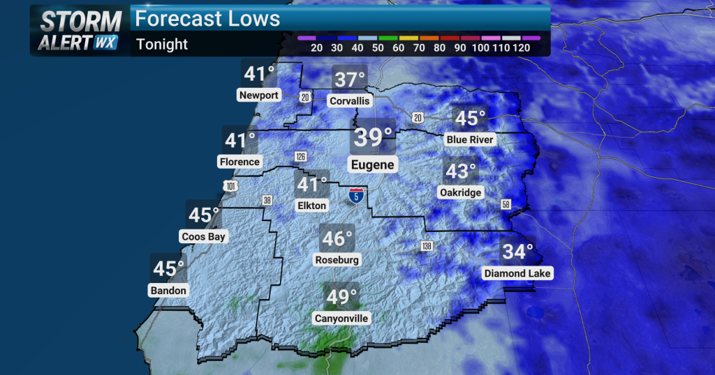 Mixed sun and clouds in Eugene today
Clear conditions are expected over the Willamette Valley tonight. Temperatures will cool, with overnight lows dipping into the mid-40s. Sunday will bring a mix of clouds and sunshine across the region, with high…
- Fall colors coming soon to Tri-Cities region, ETSU experts say
Johnson City Press Fall colors are reaching their peak in areas across the Southern Appalachians Vibrant oranges and yellows will cascade through lower elevations this weekend and into next week, according to East…
Sun & moon
Nearby
- Victoria 7 km
- Perseverance 8 km
- Baie Sainte Anne 48 km
- Baie Lazare 9 km
- Anse aux Pins 3 km
- Glacis 12 km
- Grand'Anse 45 km
- English River 8 km
- Anse Boileau 6 km
- Bel Ombre 11 km
- Beau Vallon 9 km
- Grand'Anse 4 km
Forecasts, observations and alerts in the United States come from the National Weather Service (NOAA); radar from NOAA's Multi-Radar Multi-Sensor system; satellite imagery from NASA's Global Imagery Browse Services (GIBS) and NOAA's GOES satellites; the map from the U.S. Geological Survey's National Map; air quality from AirNow (EPA and its partners); hurricane information from the National Hurricane Center; climate normals and records from NOAA's Regional Climate Centers (ACIS). Forecasts outside the United States and the UV index: MET Norway (CC BY 4.0); observations outside the U.S.: airport reports via NOAA's Aviation Weather Center. Place names: GeoNames (CC BY 4.0). Data are copied on a schedule and may lag the sources; for warnings that affect your safety, follow your local National Weather Service office and emergency officials. Weather news is drawn from the 4Conservative index and reflects what the press published. Terms of use.