Install
Ołbin, Lower Silesia, Poland Weather
Current conditions
Observed at Wrocław/Strachowice Arpt · 1 hr ago
Forecast
10-day-
Thursday
Heavy rain. High 12°. Precipitation 19.1 mm for the day.
-
Thursday Night
Heavy rain. Low 6°. Precipitation 19.1 mm for the day.
-
Friday
Cloudy. High 15°.
MET Norway forecast updated 5 hrs ago.
Hourly
Hourly forecast- Now12°1.7
- 03:0012°1.4
- 04:0010°1.6
- 05:0010°1.9
- 06:0010°2.1
- 07:009°2.2
- 08:009°1.5
- 09:0010°1.3
- 10:0010°1.4
- 11:0010°0.7
- 12:009°0.3
- 13:0010°
- 14:0010°
- 15:0011°
- 16:0011°
- 17:0011°
- 18:0010°
- 19:009°
- 20:008°
- 21:008°
- 22:007°
- 23:006°
- Fri00:006°
- 01:006°
Daily forecast
DetailsRadar
Full mapWeather news in Poland
More weather news- Poland is switching to standard time: when should Ukrainians set their clocks back?
On the night of Saturday, October 24, through Sunday, October 25, Poland will switch to standard time. Clocks will need to be set back one hour—from 3:00 a.m. to 2:00 a.m. The time change is carried out in accordance…
-
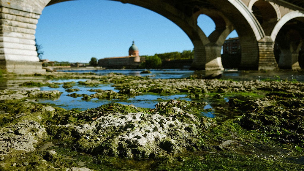 Weather Of The World: October 18
A view of the Garonne River at a historically low level due to a lack of rainfall, successive summer heat waves and the prefecture's low-water management policy in Toulouse, in southwestern France, on Oct. 14, 2026…
- Poland to switch clocks to winter time on the night of October 25 — RMF24
In Poland, clocks will be switched to winter time on the night from Saturday, October 24, to Sunday, October 25. At 3:00 a.m., the hands will need to be turned back to 2:00 a.m., so the night will last an hour longer…
- IMGW issues fog warnings for eight voivodeships — RMF24
UA.NEWS Poland’s Institute of Meteorology and Water Management (IMGW) has issued first-degree warnings for dense fog in parts of eight voivodeships. Reduced visibility is forecast overnight from Saturday to Sunday and…
- Weather today, forecast for Saturday, October 17: Cool, rain in the southeast
Oct 17, 2026 03:00 105 Cool weather with variable, more often significant cloudiness is expected in Bulgaria on Saturday, October 17. In the southeastern regions there will be rain, and the wind will be mainly from the…
- IMGW warns of dense fog in eight Polish voivodeships — Interia
Poland’s Institute of Meteorology and Water Management (IMGW) has issued first-level warnings due to dense and persistent fog in eight Polish voivodeships. As reported by Interia, visibility may drop below 200 metres in…
- Weather today, forecast for Thursday, October 15: Sunny start and clouds in the afternoon
Oct 15, 2026 03:00 76 The day will start with sunny hours in the western and central regions. In the eastern part of the country, it will be cloudier in the morning, but later the clouds will break and there will be…
Sun & moon
Nearby
- Wrocław 3 km
- Świdnica 50 km
- Brzeg 41 km
- Oleśnica 26 km
- Dzierżoniów 52 km
- Oława 26 km
- Karłowice-Różanka 2 km
- Pilczyce-Kozanów-Popowice Północne 5 km
- Psie Pole Zawidawie 5 km
- Bielawa 57 km
- Gądów-Popowice Południowe 6 km
- Osiedle Powstańców Śląskich 4 km
Forecasts, observations and alerts in the United States come from the National Weather Service (NOAA); radar from NOAA's Multi-Radar Multi-Sensor system; satellite imagery from NASA's Global Imagery Browse Services (GIBS) and NOAA's GOES satellites; the map from the U.S. Geological Survey's National Map; air quality from AirNow (EPA and its partners); hurricane information from the National Hurricane Center; climate normals and records from NOAA's Regional Climate Centers (ACIS). Forecasts outside the United States and the UV index: MET Norway (CC BY 4.0); observations outside the U.S.: airport reports via NOAA's Aviation Weather Center. Place names: GeoNames (CC BY 4.0). Data are copied on a schedule and may lag the sources; for warnings that affect your safety, follow your local National Weather Service office and emergency officials. Weather news is drawn from the 4Conservative index and reflects what the press published. Terms of use.