Install
Volcán, Chiriquí Province, Panama Weather
Current conditions
Forecast for this hour (no station report in the last two hours)
Forecast
10-day-
Tuesday
Heavy rain. High 22°. Precipitation 56.8 mm for the day.
-
Tuesday Night
Heavy rain. Low 18°. Precipitation 56.8 mm for the day.
-
Wednesday
Heavy rain. High 21°. Precipitation 39.6 mm for the day.
MET Norway forecast updated 6 hrs ago.
Hourly
Hourly forecast- Now21°8.1
- 15:0020°15.0
- 16:0019°15.1
- 17:0018°5.8
- 18:0019°1.7
- 19:0018°0.8
- 20:0018°0.2
- 21:0018°0.3
- 22:0019°0.4
- 23:0018°0.3
- Wed00:0018°
- 01:0018°
- 02:0018°
- 03:0018°
- 04:0017°
- 05:0017°
- 06:0017°
- 07:0018°
- 08:0019°
- 09:0021°0.8
- 10:0021°0.9
- 11:0021°1.6
- 12:0021°1.5
- 13:0020°2.5
10-day forecast
Details- TodayOct 20Heavy rain56.8 mm18°22°
- WedOct 21Heavy rain39.6 mm17°21°
- ThuOct 22Heavy rain12.6 mm17°23°
- FriOct 23Heavy showers26.4 mm17°21°
- SatOct 24Heavy showers22.6 mm17°21°
- SunOct 25Heavy rain25.0 mm16°23°
- MonOct 26Heavy showers23.2 mm17°22°
- TueOct 27Heavy rain8.4 mm15°23°
- WedOct 28Heavy rain15.5 mm16°23°
- ThuOct 29Rain2.3 mm15°23°
Radar
Full mapWeather news in Panama
More weather news- El Nino delays Magic: The Gathering trading cards
One of the unexpected consequences of the El Nino weather pattern causing drought at the Panama Canal has left Magic: The Gathering trading card enthusiasts hoping for better weather El Nino delays Magic: The Gathering…
-
 FIRST ALERT | A perfect fall-like week is ahead for NWFL
WJHG FIRST ALERT | A perfect fall-like week is ahead for NWFL PANAMA CITY, Fla. (WJHG/WECP) - Good Monday evening everyone! TOMORROW: Another perfect fall day is in store for our Tuesday as well with highs in the mid to…
-
 Coldest night of the week ahead
PANAMA CITY, Fla. (WJHG/WECP) - Good Monday afternoon everyone! REST OF TODAY: Abundant sunshine returns for the afternoon after just a few clouds showed up around sunrise. Winds slacken from 10-20mph in the morning to…
-
 FIRST ALERT| The sunny stretch continues
pleasant but breezy day is ahead, as the area is sandwiched between High and Low pressure. The counter and clockwise flow from each pressure system, is allowing for the breezy conditions to persist out of the northeast…
-
 Why was Hurricane Isaias only one day away from the anniversary of Hurricane Michael?
WJHG PANAMA CITY, Fla. (WJHG/WECP) - Hurricane season runs from June 1st to November 30th with its peak in mid-September. However, most of the Gulf storms take place in October. Think of Hurricane Opal (1995)…
-
 APTOPIX COP31 Climate Turkey
Bluefield Daily Telegraph Freeze Warning from SUN 1:00 AM EDT until SUN 9:00 AM EDT Flamingos feed at Lake Duden near the town of Kulu, in Konya province, Turkey, Tuesday, Oct. 13, 2026. - Tracy named as new director of…
-
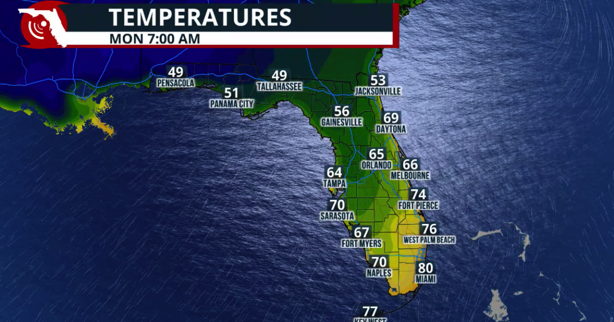 Fall arrives in Florida this weekend
www.fpren.org Update your Zip Code Fall arrives in Florida this weekend The cold front marks the leading edge of a cooler and drier air mass moving southward across the eastern United States. Behind the boundary, winds…
-
 FIRST ALERT | Eve of the fall-like weekend cooling off already...
The last day of warmth and summer-like feels for the next week or so. Cold front moves in overnight tonight, so bring that jacket! PANAMA CITY, Fla. (WJHG/WECP) - If you were outside at all today, you are probably well…
-
 FIRST ALERT| Cooler weather arrives Saturday
WJHG PANAMA CITY, Fla. (WJHG/WECP) - TODAY: Skies will be mostly sunny. Afternoon highs warm into the upper 80s, with winds out of the northeast at 5 mph. Towards the latter half of the day, clouds roll in giving us…
-
 KZN warned to prepare for heatwaves as El Niño risks loom
KwaZulu-Natal communities are being urged to prepare for potentially severe heatwaves, prolonged dry spells and water shortages, with below-normal rainfall forecast for the province in the coming months. The South…
Sun & moon
Nearby
- David 45 km
- La Concepción 29 km
- Pedregal 50 km
- Las Lomas 48 km
- Golfito 56 km
- Boquete 22 km
- San Pablo Viejo Abajo 39 km
- Alto Boquete 23 km
- Canoas 35 km
- El Palmar 58 km
- Los Algarrobos 39 km
- San Vito 37 km
Forecasts, observations and alerts in the United States come from the National Weather Service (NOAA); radar from NOAA's Multi-Radar Multi-Sensor system; satellite imagery from NASA's Global Imagery Browse Services (GIBS) and NOAA's GOES satellites; the map from the U.S. Geological Survey's National Map; air quality from AirNow (EPA and its partners); hurricane information from the National Hurricane Center; climate normals and records from NOAA's Regional Climate Centers (ACIS). Forecasts outside the United States and the UV index: MET Norway (CC BY 4.0); observations outside the U.S.: airport reports via NOAA's Aviation Weather Center. Place names: GeoNames (CC BY 4.0). Data are copied on a schedule and may lag the sources; for warnings that affect your safety, follow your local National Weather Service office and emergency officials. Weather news is drawn from the 4Conservative index and reflects what the press published. Terms of use.