Install
Alcalde Díaz, Panamá, Panama Weather
Current conditions
Forecast for this hour (no station report in the last two hours)
Forecast
10-day-
Saturday
Heavy rain. High 30°. Precipitation 11.8 mm for the day.
-
Saturday Night
Heavy rain. Low 24°. Precipitation 11.8 mm for the day.
-
Sunday
Heavy rain. High 28°. Precipitation 18.2 mm for the day.
MET Norway forecast updated 1 day ago.
Hourly
Hourly forecast- Now26°0.2
- 10:0027°0.4
- 11:0029°0.2
- 12:0029°0.2
- 13:0030°3.9
- 14:0025°0.7
- 15:0026°0.5
- 16:0026°0.3
- 17:0025°
- 18:0025°
- 19:0025°
- 20:0024°
- 21:0024°
- 22:0024°
- 23:0024°
- Sun00:0024°0.2
- 01:0024°
- 02:0024°
- 03:0024°0.3
- 04:0024°0.4
- 05:0024°
- 06:0024°
- 07:0024°
- 08:0025°0.2
Daily forecast
DetailsRadar
Full mapWeather news near Alcalde Díaz
More weather news-
 Sunny & more seasonal afternoons ahead
WJHG PANAMA CITY, Fla. (WJHG/WECP) - Good Wednesday afternoon everyone! It’s another beautiful day with highs even warming up a bit closer to seasonal average this afternoon. Not much has changed in the thinking for the…
-
 FIRST ALERT| Beautiful sunny skies return this afternoon
The weather pattern stays calm in Northwest Florida today. After a cool start, afternoon highs reach near 80 degrees across the Panhandle. Skies will be sunny and winds will be out of the northwest at 3 mph. PANAMA…
-
 Sunshine warms our afternoons after chilly mornings persist
PANAMA CITY, Fla. (WJHG/WECP) - Good Tuesday afternoon everyone! Our beautiful streak of fall weather continues, and you may notice a slightly warmer feel in the afternoons ahead. REST OF TODAY: Sunny skies with mild…
-
 FIRST ALERT| Fall-like stretch continues
The dry weather pattern continues today with beautiful sunny skies overhead, and afternoon highs into the upper 70s. Winds sustain out of the North at 5 to 10 mph, continuing to funnel in dry and cool weather into the…
-
 FIRST ALERT | A perfect fall-like week is ahead for NWFL
WJHG FIRST ALERT | A perfect fall-like week is ahead for NWFL PANAMA CITY, Fla. (WJHG/WECP) - Good Monday evening everyone! TOMORROW: Another perfect fall day is in store for our Tuesday as well with highs in the mid to…
-
 Coldest night of the week ahead
PANAMA CITY, Fla. (WJHG/WECP) - Good Monday afternoon everyone! REST OF TODAY: Abundant sunshine returns for the afternoon after just a few clouds showed up around sunrise. Winds slacken from 10-20mph in the morning to…
-
 FIRST ALERT| The sunny stretch continues
pleasant but breezy day is ahead, as the area is sandwiched between High and Low pressure. The counter and clockwise flow from each pressure system, is allowing for the breezy conditions to persist out of the northeast…
-
 More fall feels for the upcoming work week
PANAMA CITY, Fla. (WJHG/WECP) - Good Sunday evening everyone! TONIGHT: Expect it to cool off pretty quickly through sunset and with temperatures working their way through the 60s on down to overnight lows in the low to…
-
 Why was Hurricane Isaias only one day away from the anniversary of Hurricane Michael?
WJHG PANAMA CITY, Fla. (WJHG/WECP) - Hurricane season runs from June 1st to November 30th with its peak in mid-September. However, most of the Gulf storms take place in October. Think of Hurricane Opal (1995)…
-
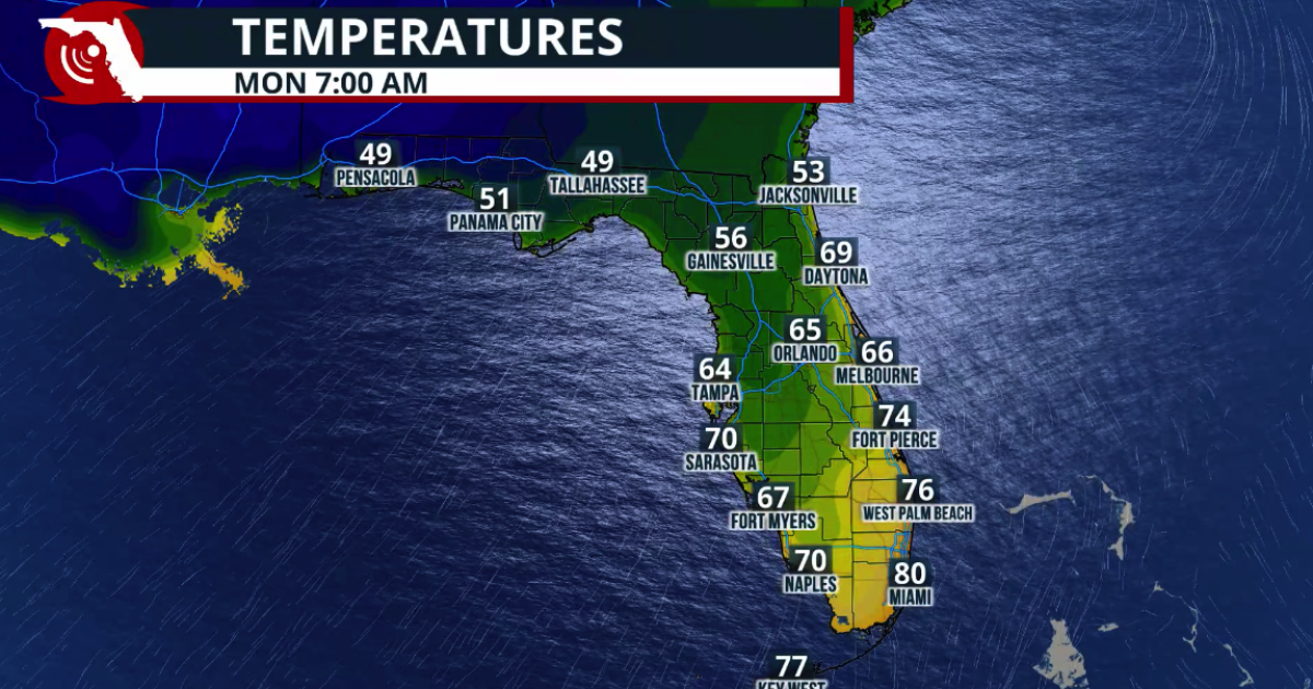 Fall arrives in Florida this weekend
www.fpren.org Update your Zip Code Fall arrives in Florida this weekend The cold front marks the leading edge of a cooler and drier air mass moving southward across the eastern United States. Behind the boundary, winds…
Sun & moon
Nearby
- Panama City 15 km
- San Miguelito 12 km
- Juan Díaz 16 km
- Colón 46 km
- Arraiján 22 km
- La Chorrera 37 km
- Tocumen 19 km
- Chilibre 8 km
- Cativá 40 km
- Ancón 18 km
- Veracruz 27 km
- Curundú 17 km
Forecasts, observations and alerts in the United States come from the National Weather Service (NOAA); radar from NOAA's Multi-Radar Multi-Sensor system; satellite imagery from NASA's Global Imagery Browse Services (GIBS) and NOAA's GOES satellites; the map from the U.S. Geological Survey's National Map; air quality from AirNow (EPA and its partners); hurricane information from the National Hurricane Center; climate normals and records from NOAA's Regional Climate Centers (ACIS). Forecasts outside the United States and the UV index: MET Norway (CC BY 4.0); observations outside the U.S.: airport reports via NOAA's Aviation Weather Center. Place names: GeoNames (CC BY 4.0). Data are copied on a schedule and may lag the sources; for warnings that affect your safety, follow your local National Weather Service office and emergency officials. Weather news is drawn from the 4Conservative index and reflects what the press published. Terms of use.