Install
Taumarunui, Manawatu-Wanganui, New Zealand Weather
Current conditions
Forecast for this hour (no station report in the last two hours)
Forecast
10-day-
Thursday
Fog. High 18°.
-
Thursday Night
Fog. Low 6°.
-
Friday
Fog. High 20°.
MET Norway forecast updated 13 hrs ago.
Hourly
Hourly forecast- Now6°
- 04:006°
- 05:006°
- 06:006°
- 07:007°
- 08:008°
- 09:0010°
- 10:0013°
- 11:0014°
- 12:0015°
- 13:0017°
- 14:0018°
- 15:0018°
- 16:0018°
- 17:0017°
- 18:0015°
- 19:0014°
- 20:0012°
- 21:0010°
- 22:009°
- 23:009°
- Fri00:008°
- 01:009°
- 02:009°
Daily forecast
DetailsRadar
Full mapWeather news near Taumarunui
More weather news-
 Cook Islands cyclone Wati forms as settled weather continues across New Zealand
MetService says a looming tropical cyclone brewing in Cook Islands waters is currently “unlikely” to strike New Zealand. MetService meteorologist Katie Lyons told the Herald the category one system Cook Islands locals…
-
 Weather: Temperatures tumble as cold snap grips New Zealand
Just days after several centres sweltered in near-30C heat, snow is forecast and temperatures are plunging towards freezing. NZ Transport Agency Waka Kotahi imposed restrictions on State Highway 73 between Otira and…
-
 Very heavy rain likely in Tamil Nadu; Kerala, Karnataka also under heavy rain watch
Very heavy rain is likely in Tamil Nadu, Puducherry and Karaikal on Wednesday, October 21, as a low-pressure area is expected to form over the southwest Bay of Bengal and adjoining Tamil Nadu coast within the next 24…
-
 Why this El Niño is set to be one of the strongest on record
A rapidly strengthening El Niño is set to become one of the strongest on record, bringing higher temperatures and shifting rainfall patterns across the globe, the World Meteorological Organisation says. The weather…
-
 Settled Weather And Warmer Temperatures Ahead
While many will be making the most of the fine, settled weather, the lack of rain may be less welcome for some, says MetService Meteorologist Sophie Huntington. 19/10/2026 Covering period of Monday 19th – Friday 23rd…
-
 Here comes the sun: Warm, fine weather ahead for much of NZ
Warmer temperatures and plenty of sunshine are on the way for much of New Zealand this week, with settled conditions expected to continue into the start of Labour Weekend. MetService said a slow-moving high-pressure…
-
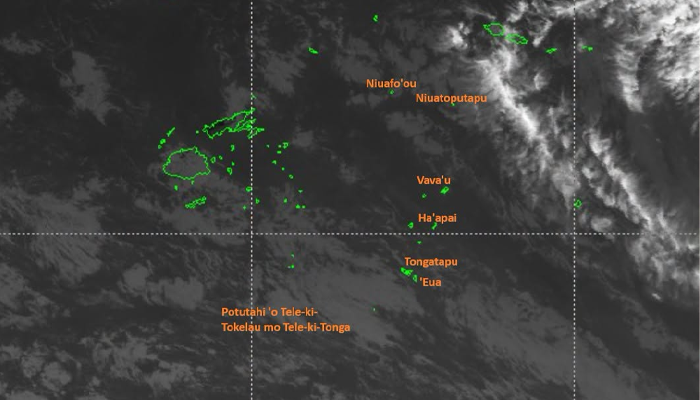 Cyclone Wati strengthens to Category 2 as strong wind warning remains in force across Tonga
A strong wind warning remains in force across Tonga as Tropical Cyclone Wati intensifies into a Category 2 system in the South Pacific, although meteorologists say the cyclone itself is not expected to threaten the…
-
 Developed near Samoa, Cyclone Wati is heading for the Cook Islands
Cyclone Wati, which developed east of Samoa on Saturday, is heading south-east directly through the Cook Islands. There is a low chance that the country will be directly affected, the Samoa Meteorological Service said…
-
 Tropical Cyclone Wati forms early in the Pacific, with heavy rain and strong winds possible
The first tropical cyclone of the season has formed in the Southwest Pacific weeks before the usual start of the cyclone season, prompting warnings for communities in parts of the region to prepare for potential severe…
- Aitutaki residents urged to heed updates as Wati approaches
RNZ / News / Pacific Tropical Cyclone Wati is moving southeast towards the Southern Cook Islands, with conditions expected to deteriorate over the coming days according to the Cook Islands Meteorological Service. Wati…
Sun & moon
Nearby
- Turangi 49 km
Forecasts, observations and alerts in the United States come from the National Weather Service (NOAA); radar from NOAA's Multi-Radar Multi-Sensor system; satellite imagery from NASA's Global Imagery Browse Services (GIBS) and NOAA's GOES satellites; the map from the U.S. Geological Survey's National Map; air quality from AirNow (EPA and its partners); hurricane information from the National Hurricane Center; climate normals and records from NOAA's Regional Climate Centers (ACIS). Forecasts outside the United States and the UV index: MET Norway (CC BY 4.0); observations outside the U.S.: airport reports via NOAA's Aviation Weather Center. Place names: GeoNames (CC BY 4.0). Data are copied on a schedule and may lag the sources; for warnings that affect your safety, follow your local National Weather Service office and emergency officials. Weather news is drawn from the 4Conservative index and reflects what the press published. Terms of use.