Install
Donaji, Oaxaca, Mexico Weather
Current conditions
Forecast for this hour (no station report in the last two hours)
Forecast
10-day-
Thursday
Heavy rain. High 25°. Precipitation 36.6 mm for the day.
-
Thursday Night
Heavy rain. Low 21°. Precipitation 36.6 mm for the day.
-
Friday
Rain. High 26°. Precipitation 4.0 mm for the day.
MET Norway forecast updated 1 day ago.
Hourly
Hourly forecast- Now25°5.5
- 16:0023°0.9
- 17:0024°4.0
- 18:0022°8.8
- 19:0022°2.2
- 20:0022°0.9
- 21:0023°0.4
- 22:0022°0.3
- 23:0022°
- Fri00:0022°
- 01:0021°
- 02:0021°0.4
- 03:0021°
- 04:0021°
- 05:0021°0.7
- 06:0021°0.5
- 07:0021°0.2
- 08:0022°0.3
- 09:0022°0.4
- 10:0023°
- 11:0024°0.2
- 12:0025°0.2
- 13:0026°0.2
- 14:0026°0.2
Daily forecast
DetailsRadar
Full mapWeather news in Mexico
More weather news-
 Flood watches issued as Arizona storms spill into New Mexico
Storms that brought heavy rain, egg-sized hail and tornadoes to Arizona on Wednesday struck western New Mexico by the afternoon, generating flood watches set to remain in effect through Friday. Forecasters told the…
-
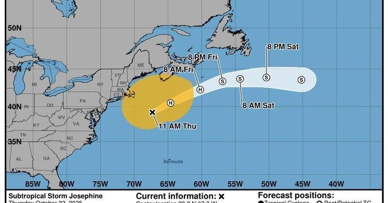 Storm Josephine spins out in Atlantic, Tropical Storm Vance heads to Mexico
The forecast track of Subtropical Storm Josephine shows it heading out into the North Atlantic Ocean as an extratropical storm over the next few days. Tropical Storm Vance is forecast to strengthen into a hurricane and…
-
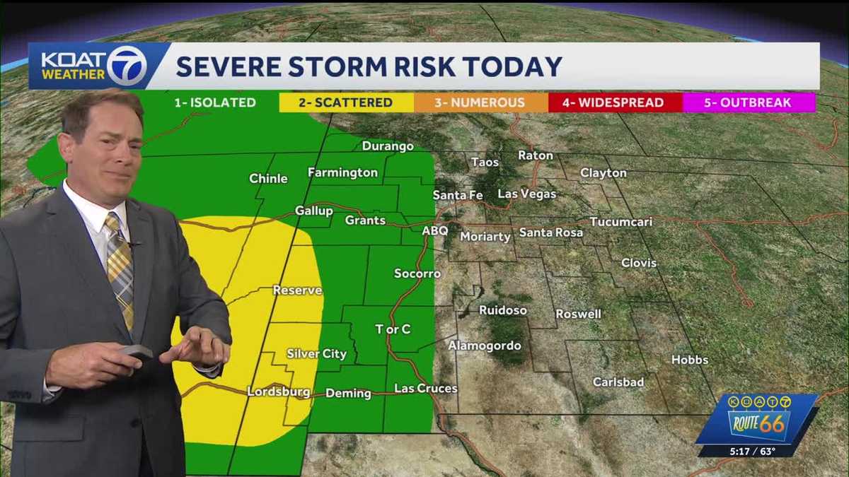 Flood Watches in effect for Western New Mexico, active Severe Thunderstorm Watch for Northeast Arizona
KOAT Flood Watches in effect for Western New Mexico, active Severe Thunderstorm Watch for Northeast Arizona Tropical moisture surge making a slow push eastward over next few days drenching the state, flood threat and…
-
 Tropical Storm Vance forms in eastern Pacific, to approach southwest Mexico Coast as a major hurricane
Following Polo, Simon, Rachel and Trudy, forecasters are tracking a new storm that could evolve into a major hurricane as it tracks toward Mexico. Published Oct 19, 2026 1:28 PM EDT | Updated Oct 21, 2026 5:16 PM EDT…
- Tuesday, May 19, 2026: Storms moving in from Mexico could reach the Valley overnight
The Storm Prediction Center has placed the Rio Grande Valley under a level 1 out of 5 risk for severe thunderstorms overnight, according to the First Warn 5 Weather Team. Isolated strong or severe thunderstorms could…
-
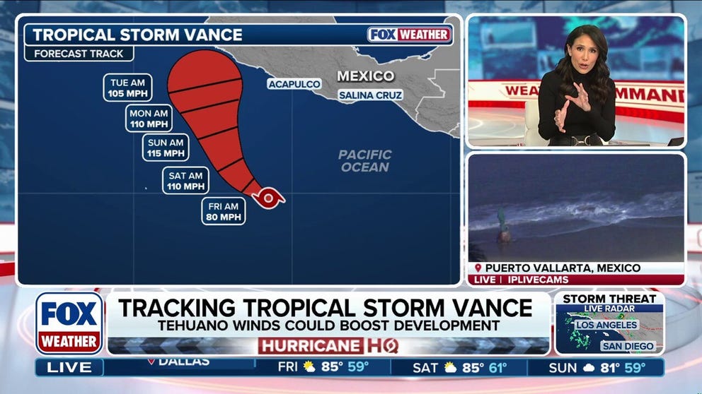 Tropical Storm Vance could intensify into a major hurricane, while Champi threatens Taiwan and Japan
Tropical Storm Vance is expected to strengthen into the 13th hurricane in the Pacific Basin this season as it approaches Mexico next week. Vance could intensify into a major hurricane, which would be the basin's 10th…
-
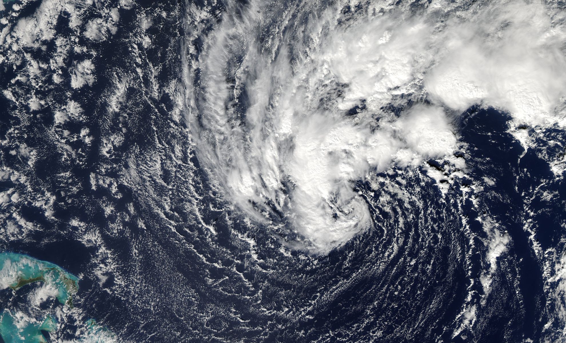 Vance Could Soon Become a Major Hurricane, Even as Its Exact Path Remains Uncertain
Tropical Storm Vance formed in the eastern Pacific Ocean on Wednesday, October 21, 2026, south of Mexico’s Pacific coast. The storm initially posed no direct threat to land, but forecasters have since warned that it…
-
 Storm Josephine brings high winds and possible coastal flooding to Eastern Seaboard
The storm had maximum sustained winds of 65 mph and was centered about 265 miles south of Nantucket, Massachusetts, and about 585 miles southwest of Halifax, Nova Scotia. The National Hurricane Center in Miami said…
-
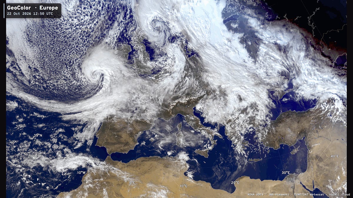 October 22, 2026 Thursday Morning Weather
This is Forecast Post number 1054 — Day 295 of 2026 Day 144 Atlantic Hurricane Season | YTD: 10 Named Storms, ACE = 19.2 NE Pacific Hurricane Season: YTD: 23 Named Storms, ACE = 344 Author: Dr. Ryan Maue (X @RyanWeather…
-
 Storm Josephine brings coastal flooding and strong winds to the Eastern Seaboard
Large swells that could create life-threatening surf and rip current conditions were possible along the coast up to Atlantic Canada, the U.S. National Hurricane Center said in an advisory. Josephine had maximum…
Sun & moon
Nearby
- Matías Romero Avendaño 39 km
- Colonia Rincón Viejo 38 km
- Santo Domingo Petapa 47 km
- San Juan Guichicovi 30 km
- Jesús Carranza 23 km
- María Lombardo de Caso 47 km
- Palomares 10 km
- Colonia Progreso 48 km
- Santa María Chimalapa 53 km
- Suchilapan del Río 19 km
- Llano Suchiapa 40 km
- El Barrio de la Soledad 48 km
Forecasts, observations and alerts in the United States come from the National Weather Service (NOAA); radar from NOAA's Multi-Radar Multi-Sensor system; satellite imagery from NASA's Global Imagery Browse Services (GIBS) and NOAA's GOES satellites; the map from the U.S. Geological Survey's National Map; air quality from AirNow (EPA and its partners); hurricane information from the National Hurricane Center; climate normals and records from NOAA's Regional Climate Centers (ACIS). Forecasts outside the United States and the UV index: MET Norway (CC BY 4.0); observations outside the U.S.: airport reports via NOAA's Aviation Weather Center. Place names: GeoNames (CC BY 4.0). Data are copied on a schedule and may lag the sources; for warnings that affect your safety, follow your local National Weather Service office and emergency officials. Weather news is drawn from the 4Conservative index and reflects what the press published. Terms of use.