Install
Malawi weather
Cities
| City | Now | Temp | High | Low | Precip |
|---|---|---|---|---|---|
| Lilongwe, Malawi | Forecast loading — check back in a minute. | ||||
| Blantyre, Malawi | Forecast loading — check back in a minute. | ||||
| Mzuzu, Malawi | Forecast loading — check back in a minute. | ||||
| Zomba, Malawi | Forecast loading — check back in a minute. | ||||
| Karonga, Malawi | Mostly clear | 26° | 33° | 25° | – |
| Kasungu, Malawi | Forecast loading — check back in a minute. | ||||
| Mangochi, Malawi | Clear | 27° | 33° | 26° | – |
| Salima, Malawi | Forecast loading — check back in a minute. | ||||
| Liwonde, Malawi | Forecast loading — check back in a minute. | ||||
| Balaka, Malawi | Forecast loading — check back in a minute. | ||||
| Dedza, Malawi | Forecast loading — check back in a minute. | ||||
| Nkhotakota, Malawi | Forecast loading — check back in a minute. | ||||
| Mchinji, Malawi | Forecast loading — check back in a minute. | ||||
| Nsanje, Malawi | Forecast loading — check back in a minute. | ||||
| Mzimba, Malawi | Forecast loading — check back in a minute. | ||||
| Mponela, Malawi | Forecast loading — check back in a minute. | ||||
| Rumphi, Malawi | Clear | 21° | 34° | 21° | – |
| Ntcheu, Malawi | Forecast loading — check back in a minute. | ||||
| Mwanza, Malawi | Clear | 25° | 35° | 22° | – |
| Chitipa, Malawi | Forecast loading — check back in a minute. | ||||
| Monkey Bay, Malawi | Clear | 27° | 27° | 26° | – |
| Mulanje, Malawi | Clear | 26° | 34° | 25° | – |
| Nkhata Bay, Malawi | Forecast loading — check back in a minute. | ||||
| Luchenza, Malawi | Forecast loading — check back in a minute. | ||||
| Chipeni, Malawi | Forecast loading — check back in a minute. | ||||
| Thyolo, Malawi | Clear | 25° | 28° | 25° | – |
| Dowa, Malawi | Forecast loading — check back in a minute. | ||||
| Ngabu, Malawi | Forecast loading — check back in a minute. | ||||
| Ntchisi, Malawi | Mostly clear | 19° | 30° | 19° | – |
| Likoma, Malawi | Forecast loading — check back in a minute. | ||||
Weather news
More-
 Malawi to roast in 42C heatwave as experts warn lives could be at risk
Malawi is set to swelter under a brutal heatwave this week, with temperatures predicted to soar to a scorching 42C in some areas, prompting urgent health warnings from authorities. The Department of Climate Change and…
-
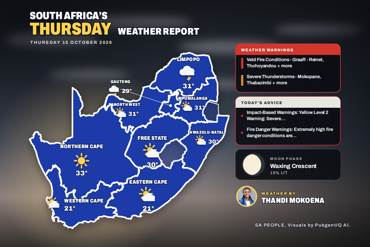 Here is today’s weather by province: Limpopo on alert as severe storms target Mokopane and Thabazimbi
Home » Here is today’s weather by province: Limpopo on alert as severe storms target Mokopane and Thabazimbi Kimberley is the hottest spot at 32°C, while Bloemfontein swings from a chilly 12°C to 30°C and Polokwane…
More places
Forecasts, observations and alerts in the United States come from the National Weather Service (NOAA); radar from NOAA's Multi-Radar Multi-Sensor system; satellite imagery from NASA's Global Imagery Browse Services (GIBS) and NOAA's GOES satellites; the map from the U.S. Geological Survey's National Map; air quality from AirNow (EPA and its partners); hurricane information from the National Hurricane Center; climate normals and records from NOAA's Regional Climate Centers (ACIS). Forecasts outside the United States and the UV index: MET Norway (CC BY 4.0); observations outside the U.S.: airport reports via NOAA's Aviation Weather Center. Place names: GeoNames (CC BY 4.0). Data are copied on a schedule and may lag the sources; for warnings that affect your safety, follow your local National Weather Service office and emergency officials. Weather news is drawn from the 4Conservative index and reflects what the press published. Terms of use.