Install
Greenville, Sinoe County, Liberia Weather
Current conditions
Forecast for this hour (no station report in the last two hours)
Forecast
10-day-
Wednesday
Heavy showers. High 83°. Precipitation 0.27 in for the day.
-
Wednesday Night
Rain. Low 74°. Precipitation 0.27 in for the day.
-
Thursday
Heavy rain. High 83°. Precipitation 0.41 in for the day.
MET Norway forecast updated 17 hrs ago.
Hourly
Hourly forecast- Now74°
- 8 AM76°
- 9 AM79°
- 10 AM82°
- 11 AM83°0.03
- 12 PM80°0.07
- 1 PM80°0.03
- 2 PM81°0.04
- 3 PM80°0.04
- 4 PM80°0.02
- 5 PM80°
- 6 PM80°
- 7 PM79°0.04
- 8 PM77°
- 9 PM77°
- 10 PM77°
- 11 PM76°
- Thu12 AM76°
- 1 AM75°
- 2 AM75°
- 3 AM75°
- 4 AM74°
- 5 AM74°
- 6 AM74°
Daily forecast
Details- TodayOct 21Heavy showers0.27 in74°83°
- ThuOct 22Heavy rain0.41 in74°83°
- FriOct 23Light showers0.13 in74°83°
- SatOct 24Showers0.26 in76°82°
- SunOct 25Showers0.19 in74°83°
- MonOct 26Light showers0.23 in76°84°
- TueOct 27Light showers0.09 in74°82°
- WedOct 28Heavy showers0.28 in74°83°
- ThuOct 29Heavy showers0.27 in74°82°
Radar
Full mapWeather news near Greenville
More weather news-
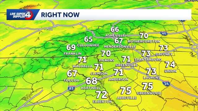 Quiet weather ahead this week in South Carolina: October 19 forecast
Sunshine and comfortable temperatures expected this week in the Upstate. The forecast remains quiet this week as a high pressure keeps the area dry. Highs sit in the 70s with lows in the 40s. The temperatures will be…
-
 First Snow of the Season Falls on Blue Ridge Parkway, Mt. Mitchell
Snow returned to the High Country’s highest elevations Saturday, Oct. 17, with the first flakes of the season falling along the Blue Ridge Parkway and on Mt. Mitchell. Andrea Crouch shot video Saturday morning, Oct. 17…
- UPDATE: Frost advisory for Western North Carolina for Sunday, says the NWS
On Saturday at 9 p.m. the NWS Greenville-Spartanburg SC released an updated frost advisory valid for Sunday between 1 a.m. and 9 a.m. The advisory is for Caldwell Mountains, Greater Caldwell, Burke Mountains, Greater…
-
 FIRST ALERT: Cooler air arrives tonight
GREENVILLE, S.C. (FOX Carolina) - Fall temperatures take over with dry conditions. Patchy frost is possible in the higher elevations through the start of the week. Sunshine rules, but a brisk northeast breeze keeps the…
-
 Freeze Warning Issued for Watauga, Ashe and Avery Counties Late Saturday Night Into Sunday Morning
A Freeze Warning is in effect from 1 AM to 9 AM Sunday, Oct. 18, for Watauga, Ashe and Avery counties, with lows as low as the upper 20s to lower 30s expected. The National Weather Service says frost and freeze…
-
 First freeze of fall expected in western North Carolina mountains Sunday morning
A Frost Advisory is in effect Sunday morning from 1 AM to 9 AM for the southern NC mountains, eastern foothills, Upstate SC, and NE Georgia. A Freeze Warning is in effect Sunday morning from 1 AM to 9 AM for counties…
-
 MI Grand Rapids MI Zone Forecast
for Saturday, October 17, 2026 278 FPUS53 KGRR 171822 Southwest Michigan Zone Forecast National Weather Service Grand Rapids MI Including the city of Grand Rapids Including the cities of Grand Haven and Jenison the…
- Frost advisory in place for Upstate SC for Sunday - temperatures at a low of 36
On Saturday at 1:21 a.m. a frost advisory was released by the NWS Greenville-Spartanburg SC valid for Sunday between 1 a.m. and 9 a.m. The advisory is for Oconee Mountains and Pickens Mountains as well as Greenville…
- Freeze warning in place for Western North Carolina for Sunday
At 1:21 a.m. on Saturday, the NWS Greenville-Spartanburg SC released a freeze warning valid for Sunday between 1 a.m. and 9 a.m. The warning is for Northern Jackson and Southern Jackson as well as Avery, Madison…
-
 Cold temperatures expected this weekend
WSPA 7News (WSPA) - A cold front passes through Friday night, dropping temperatures after a record-breaking high in the Greenville-Spartanburg area There are low chances for isolated light rain overnight into early…
Sun & moon
Forecasts, observations and alerts in the United States come from the National Weather Service (NOAA); radar from NOAA's Multi-Radar Multi-Sensor system; satellite imagery from NASA's Global Imagery Browse Services (GIBS) and NOAA's GOES satellites; the map from the U.S. Geological Survey's National Map; air quality from AirNow (EPA and its partners); hurricane information from the National Hurricane Center; climate normals and records from NOAA's Regional Climate Centers (ACIS). Forecasts outside the United States and the UV index: MET Norway (CC BY 4.0); observations outside the U.S.: airport reports via NOAA's Aviation Weather Center. Place names: GeoNames (CC BY 4.0). Data are copied on a schedule and may lag the sources; for warnings that affect your safety, follow your local National Weather Service office and emergency officials. Weather news is drawn from the 4Conservative index and reflects what the press published. Terms of use.