Install
Al Wafrah, Al Aḩmadī, Kuwait Weather
Current conditions
Forecast for this hour (no station report in the last two hours)
Forecast
10-day-
Sunday
Sunny. High 35°.
-
Sunday Night
Sunny. Low 23°.
-
Monday
Cloudy. High 33°.
MET Norway forecast updated 2 days ago.
Daily forecast
DetailsRadar
Full mapWeather news in Kuwait
More weather news-
 Kuwait to Experience Cooler Nights From October 29 as Seasonal Phase Begins
KUWAIT CITY, Oct 24: Kuwait is expected to experience cooler nights from October 29, when the second 13-day phase of the traditional Wasm season begins, the Al-Ojairi Scientific Center announced. The period, which runs…
-
 Scattered light rain, fog forecast for weekend
KUWAIT: Kuwait could see scattered light rain and fog over the weekend, the Meteorological Department said on Thursday. It forecast hot, humid days and mild nig... Scattered light rain, fog forecast for weekend KUWAIT…
-
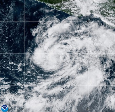 Tropical Storm Vance has formed in the Pacific Ocean
Arab Times Kuwait News Tropical Storm Vance has formed in the Pacific Ocean Vance was located about 520 miles (835 kilometers) south of Acapulco, Mexico. Maximum sustained winds were around 40 mph (65 kph), according to…
-
 Hot, humid day ahead with chance of drizzle
KUWAIT: Kuwait will see hot and relatively humid weather over coastal areas on Wednesday, with scattered clouds and a chance of drizzle, the Meteorological Depa... Hot, humid day ahead with chance of drizzle KUWAIT…
-
 Chance of drizzle on hot Tuesday, light fog possible at night
Kuwait Times Chance of drizzle on hot Tuesday, light fog possible at night KUWAIT: The weather will be hot and relatively humid over coastal areas on Tuesday, with partly cloudy skies and a chance of drizzle at times…
Sun & moon
Nearby
- Al Aḩmadī 51 km
- Al Faḩāḩīl 53 km
- Al Khafjī 59 km
- Ar Riqqah 59 km
- Al Manqaf 54 km
- Al Mahbūlah 60 km
Forecasts, observations and alerts in the United States come from the National Weather Service (NOAA); radar from NOAA's Multi-Radar Multi-Sensor system; satellite imagery from NASA's Global Imagery Browse Services (GIBS) and NOAA's GOES satellites; the map from the U.S. Geological Survey's National Map; air quality from AirNow (EPA and its partners); hurricane information from the National Hurricane Center; climate normals and records from NOAA's Regional Climate Centers (ACIS). Forecasts outside the United States and the UV index: MET Norway (CC BY 4.0); observations outside the U.S.: airport reports via NOAA's Aviation Weather Center. Place names: GeoNames (CC BY 4.0). Data are copied on a schedule and may lag the sources; for warnings that affect your safety, follow your local National Weather Service office and emergency officials. Weather news is drawn from the 4Conservative index and reflects what the press published. Terms of use.