Install
Utashinai, Hokkaido, Japan Weather
Current conditions
Forecast for this hour (no station report in the last two hours)
Forecast
10-day-
Thursday
Light sleet showers. High 7°. Precipitation 7.8 mm for the day.
-
Thursday Night
Showers. Low 2°. Precipitation 7.8 mm for the day.
-
Friday
Partly cloudy. High 13°.
MET Norway forecast updated 17 hrs ago.
Hourly
Hourly forecast- Now4°0.8
- 09:004°0.4
- 10:005°0.5
- 11:005°0.5
- 12:005°0.5
- 13:006°0.2
- 14:005°0.3
- 15:005°0.4
- 16:004°0.2
- 17:003°
- 18:002°
- 19:002°
- 20:002°
- 21:002°
- 22:002°
- 23:002°
- Fri00:002°
- 01:002°
- 02:002°
- 03:002°
- 04:002°
- 05:003°
- 06:003°
- 07:005°
Daily forecast
DetailsRadar
Full mapWeather news in Japan
More weather news-
 Japan prepares for 30th named storm of 2026 as Typhoon Champi approaches Okinawa
Typhoon Champi is forecast to reach Okinawa’s Sakishima Islands between Friday and Saturday, then affect parts of Kyushu from the weekend. Authorities are urging people to stay alert as Typhoon Champi moves from the…
-
 Japan braces for 30th named storm this year as Typhoon Champi heads for Okinawa
Typhoon Champi is moving in from the Pacific Ocean toward Okinawa Prefecture and the south of the country in the coming days, prompting authorities to urge people to be on alert. The Japan Meteorological Agency (JMA)…
-
 Super Typhoon Champi spares Taiwan direct hit, brings heavy rain to Japan and Philippines
Wed, Oct 21, 2026 | Jumada al-Awwal 9, 1448 | Fajr 05:02|DXB 31.8°C Super Typhoon Champi, the most powerful storm so far this year, with peak winds of 296 kph (the equivalent of a Category 5 storm) on Wednesday morning…
- Temperature reaches 30°C in central Tokyo – latest ‘midsummer day’ on record since 1875 - Japan Today
Temperature reaches 30°C in central Tokyo – latest ‘midsummer day’ on record since 1875 Japan Today Powered and protected by
-
 Tokyo breaks rainfall record with 34 straight days of rain
Tokyo has endured more than a month of uninterrupted wet weather, with central parts of the Japanese capital recording rain for a 34th consecutive day on Tuesday, September 29, setting a new record. Rain has been…
-
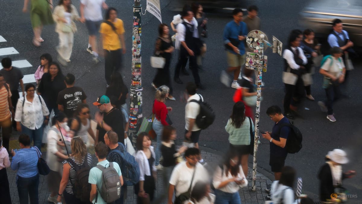 Tokyo, Osaka temperatures top 30°C later in year than ever before
Tokyo climbed above 30°C by early afternoon on Wednesday (Oct 21), the threshold the Japan Meteorological Agency classifies as a "midsummer day". TOKYO: Tokyo and Osaka topped 30°C on Wednesday (Oct 21), the latest in…
- Tokyo, Osaka record latest-ever day above 30 deg C
Published Oct 21, 2026, 05:10 PM TOKYO – Tokyo and Osaka topped 30 deg C on Oct 21, the latest in the year both cities have ever recorded such temperatures, a Japan weather official said. Warm, humid air from the south…
-
 Super typhoon Champi, the strongest storm of 2026, unexpectedly changes direction: What's happening?
Super Typhoon Champi is becoming the focus of attention as it is assessed to be one of the strongest storms in the Northwest Pacific in 2026. How significant is this storm's intensity, and what is its next trajectory?…
-
 Talking the Tropics w/Mike: Western Atlantic strong low pressure impacts some of U.S. east coast
104.5 WOKV The Atlantic hurricane season is June 1st through Nov. 30th. The peak of the season is September 10th. Strong wind shear has dominated much of the Atlantic Basin - especially south of about 20 degrees N. This…
-
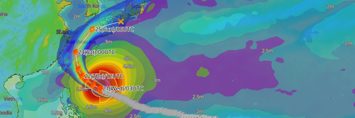 Update: Typhoon No. 30 (Champi) Reaches Peak Intensity, Tracking Toward Waters East of Taiwan and the Sakishima Islands
The one-stop platform to enhance your offshore wind operations The all-in-one platform solution to optimize your maritime operations The one-stop platform to enhance youroffshore wind operations Weathernews API &…
Sun & moon
Nearby
Forecasts, observations and alerts in the United States come from the National Weather Service (NOAA); radar from NOAA's Multi-Radar Multi-Sensor system; satellite imagery from NASA's Global Imagery Browse Services (GIBS) and NOAA's GOES satellites; the map from the U.S. Geological Survey's National Map; air quality from AirNow (EPA and its partners); hurricane information from the National Hurricane Center; climate normals and records from NOAA's Regional Climate Centers (ACIS). Forecasts outside the United States and the UV index: MET Norway (CC BY 4.0); observations outside the U.S.: airport reports via NOAA's Aviation Weather Center. Place names: GeoNames (CC BY 4.0). Data are copied on a schedule and may lag the sources; for warnings that affect your safety, follow your local National Weather Service office and emergency officials. Weather news is drawn from the 4Conservative index and reflects what the press published. Terms of use.