Install
St Lawrence, Jersey Weather
Current conditions
Observed at Jersey Arpt, , JE · 44 min ago
Forecast
10-day-
Tuesday
Cloudy. High 15°. Precipitation 1.6 mm for the day.
-
Tuesday Night
Rain. Low 13°. Precipitation 1.6 mm for the day.
-
Wednesday
Light showers. High 15°. Precipitation 8.2 mm for the day.
MET Norway forecast updated 1 hr ago.
Hourly
Hourly forecast- Now14°
- 17:0014°
- 18:0014°
- 19:0014°
- 20:0015°0.2
- 21:0014°0.5
- 22:0013°0.4
- 23:0013°0.5
- Wed00:0013°1.7
- 01:0013°1.2
- 02:0014°
- 03:0015°0.2
- 04:0014°0.4
- 05:0013°0.3
- 06:0014°
- 07:0014°
- 08:0014°
- 09:0014°
- 10:0013°
- 11:0013°
- 12:0013°0.4
- 13:0013°0.2
- 14:0014°
- 15:0014°0.4
10-day forecast
Details- TodayOct 20Cloudy1.6 mm13°15°
- WedOct 21Light showers8.2 mm13°15°
- ThuOct 22Heavy rain18.1 mm13°15°
- FriOct 23Heavy rain16.9 mm11°14°
- SatOct 24Heavy rain25.0 mm12°16°
- SunOct 25Showers2.3 mm13°15°
- MonOct 26Cloudy13°15°
- TueOct 27Rain3.7 mm14°16°
- WedOct 28Light showers2.2 mm14°16°
- ThuOct 29Partly cloudy15°16°
Radar
Full mapWeather news near St Lawrence
More weather news-
 Tranquil weather continues Tuesday with cool temps and plenty of sunshine
TONIGHT – Mostly Clear and Chilly Low 41°. Clear to partly cloudy skies overnight across Vermont and northern New York as high pressure sits to our northeast. Light northerly breezes will shift to the northeast after…
-
 Temperatures Drastically Plunge (as Low as 34°F) and Frost Warnings Issued in Three U.S. States
Home » Travel » Temperatures Drastically Plunge (as Low as 34°F) and Frost Warnings Issued in Three U.S. States It’s time to rummage your cupboards for scarves and boots! We all knew fall was around the corner, but many…
-
 Weather Forecast: Cold Front Sweeps Through This Afternoon; Much Colder Tonight
Rain and a few gusty winds continue across the Finger Lakes through early afternoon as a cold front sweeps southeast through the region. Showers taper off be... Our records show you're subscribed. Geneva is sitting at…
-
 Trudy strengthens to a hurricane as system nears Mexico’s coast with major storm expected
WWNY Trudy was located about 300 miles (480 kilometers) southwest of Acapulco, Mexico, with maximum sustained winds of 75 mph (120 kph), according to the U.S. National Hurricane Center in Miami. The hurricane was moving…
-
 Quick cold snap with storms and a bit of snow coming for some in Great Lakes, Northeast
In a span of a few days some areas from the Upper Midwest to the Northeast will experience three seasons--a bit of summer, autumn and even winter. Published Oct 14, 2026 2:01 PM EDT | Updated Oct 14, 2026 2:09 PM EDT…
-
 Record rainfall soaks parts of northern New York and Vermont Tuesday
BURLINGTON, Vt. (WCAX) - While recent memory reminds us that October can bring crisp dry fall days, Tuesday deviated with widespread steady rain across northern New York and Vermont. Rainfall was not just soggy — it was…
-
 Montreal weather: Rainfall warning calls for up to 60 mm of precipitation
Similar warnings have been issued for a large area south of the St. Lawrence River. Montreal and most of the South Shore are under yellow rainfall warnings, with up to 60 mm expected to fall throughout the day and into…
-
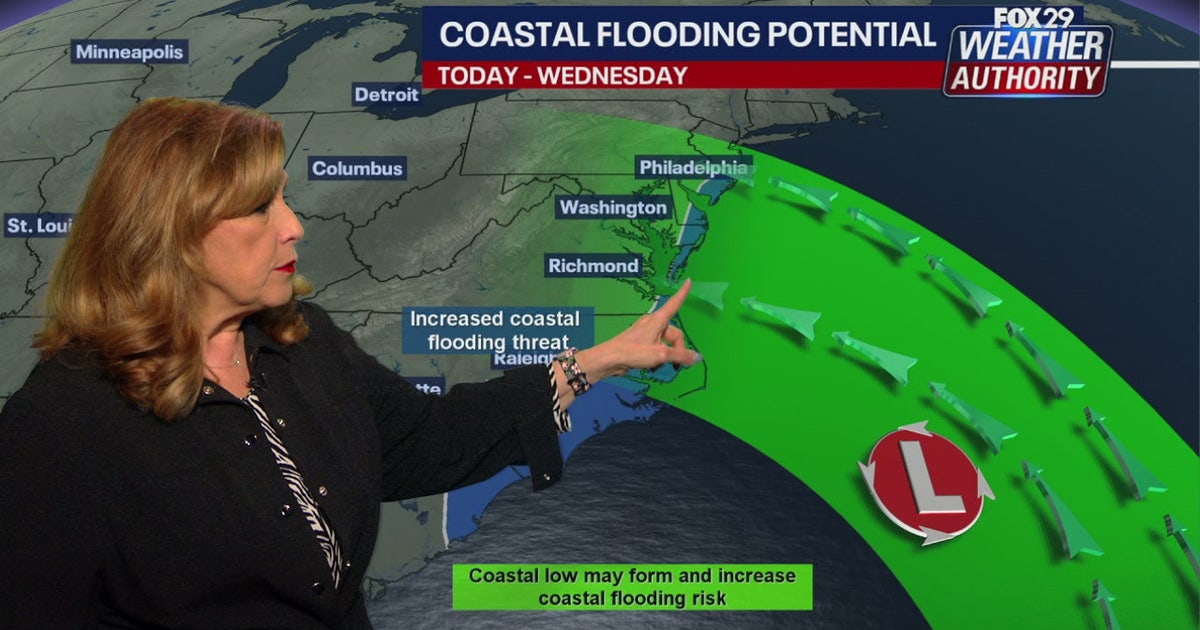 Coastal flooding threat looms for New Jersey, Delaware as nor'easter develops offshore
A developing nor'easter off the Carolina coast is expected to stay offshore but will still bring high winds, heavy surf, and possible coastal flooding along the Jersey Shore and Delaware beaches this week. PHILADELPHIA…
-
 Quiet weather for NJ this week, but an angry ocean along the Jersey Shore
A Coastal Flood Advisory has been issued for tidal waterways along the Jersey Shore starting Tuesday, as 2+ feet of surge could cause minor category flooding at high tide. The surf will become quite rough this week too…
-
 Another Nor’easter Is Brewing Off the Coast. Here’s What It Means for the Jersey Shore This Week.
If you thought the nor’easter from last month had us covered for a while, think again. There’s another storm forming off the coast. Here’s what you should know. The good news: this storm is not expected to follow the…
Sun & moon
Nearby
- Saint Helier 4 km
- Équeurdreville-Hainneville 60 km
- Octeville 58 km
- Saint Peter Port 39 km
- Granville 58 km
- Coutances 54 km
- Vale Parish 41 km
- Saint Sampson 41 km
- Valognes 58 km
- Querqueville 59 km
- La Glacerie 59 km
- Bricquebec 46 km
Forecasts, observations and alerts in the United States come from the National Weather Service (NOAA); radar from NOAA's Multi-Radar Multi-Sensor system; satellite imagery from NASA's Global Imagery Browse Services (GIBS) and NOAA's GOES satellites; the map from the U.S. Geological Survey's National Map; air quality from AirNow (EPA and its partners); hurricane information from the National Hurricane Center; climate normals and records from NOAA's Regional Climate Centers (ACIS). Forecasts outside the United States and the UV index: MET Norway (CC BY 4.0); observations outside the U.S.: airport reports via NOAA's Aviation Weather Center. Place names: GeoNames (CC BY 4.0). Data are copied on a schedule and may lag the sources; for warnings that affect your safety, follow your local National Weather Service office and emergency officials. Weather news is drawn from the 4Conservative index and reflects what the press published. Terms of use.