Install
Figline Valdarno, Tuscany, Italy Weather
Current conditions
Observed at Florence/Peretola Arpt · 22 min ago
Forecast
10-day-
Friday Night
Light showers. Low 14°. Precipitation 0.5 mm for the day.
-
Saturday
Heavy rain. High 17°. Precipitation 4.0 mm for the day.
-
Saturday Night
Rain. Low 9°. Precipitation 4.0 mm for the day.
MET Norway forecast updated 55 min ago.
Hourly
Hourly forecast- Now14°
- 23:0014°0.3
- Sat00:0013°0.2
- 01:0014°
- 02:0013°
- 03:0013°0.3
- 04:0013°0.4
- 05:0013°0.4
- 06:0013°0.9
- 07:0013°1.1
- 08:0012°0.5
- 09:0013°
- 10:0014°
- 11:0014°
- 12:0016°
- 13:0017°
- 14:0017°
- 15:0017°
- 16:0017°
- 17:0016°
- 18:0014°
- 19:0012°
- 20:0011°
- 21:0011°
10-day forecast
DetailsRadar
Full mapWeather news near Figline Valdarno
More weather news-
 More pleasant and dry weather ahead
WAFF More pleasant and dry weather ahead Alabama firefighters union sues Huntsville over records on contaminated breathing air Decatur police raid illegal gambling house, arrest 5 Muscle Shoals board unanimously upholds…
-
 Winter Weather Advisory for 7 Counties in California: First Snow of the Season
A Winter Weather Advisory is in effect above 8,000 feet in the Sierra Nevada from 11 a.m. Wednesday to 11 a.m. PDT Thursday, bringing the first snow of the season. There is an 80 percent chance of 4 inches or more along…
-
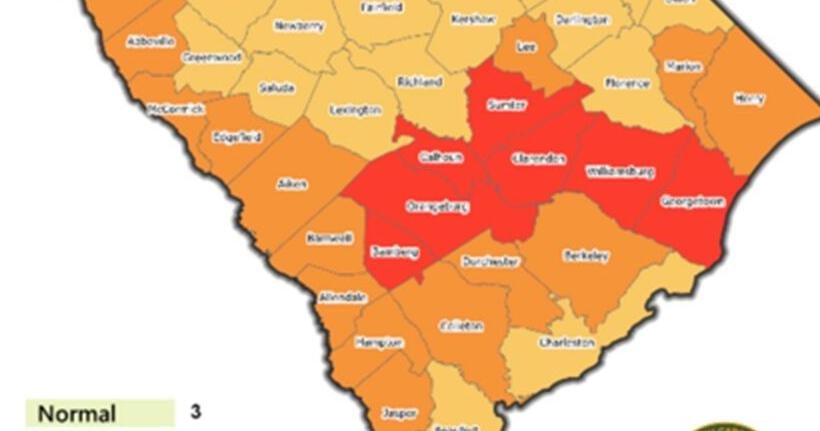 5 Things: Drought eases across Pee Dee after rain, cool temperatures
Rainfall and cooler weather have brought the Pee Dee its most significant drought relief in months, moving Florence and Marion counties into less severe categories while leaving residents with reason to remain cautious…
-
 Few use Singapore haze shelters, but visitors welcome respite from heat
CNA visited eight shelters across the island, finding most empty or locked, though the few who turned up welcomed the free air-conditioned refuge. SINGAPORE: Haze shelters across Singapore sat largely empty on Saturday…
-
 New El Niño forecasts show high chance for California rainfall at 150%-200% of normal
100th Anniversary Sale! Get 2 years of digital access for only $100/year County crews remove sediment to help maximize capacity ahead of the expected flooding of the San Gabriel River reservoir from an expected El Niño…
-
 Record warmth gives way to chilly, rainy weekend in the Carolinas
WPDE — The Carolinas will see one more day of summery warmth on Friday before a huge change heading into Saturday. High-temperature records were broken Thursday in Myrtle Beach (87 degrees) and Florence (91 degrees)…
-
 The spooky secret hiding inside Pacific Northwest Glaciers | CNN
Glacier ice worms look like monsters from a horror movie. But they could reveal clues to how life survives in extremes — if they survive human-made warming. An astronaut aboard SpaceX Dragon and a videographer beside a…
-
 First Alert Weather: Mild afternoons before weekend local nor’easter
Here's what the First Alert Weather Team said you can expect in the forecast: This evening will be dry and clear. Tomorrow morning, temperatures will drop to the lower to mid-50s around Jacksonville and upper 60s along…
- New security requirements disrupt travel at Copenhagen Airport
Strong winds, heavy rain and potentially elevated sea levels are forecast across parts of Denmark on Sunday, with the west coast of Jutland expected to experience the worst conditions. According to Danmarks…
- DMI warns of storm-force gusts and rain on Sunday
Strong winds, heavy rain and potentially elevated sea levels are forecast across parts of Denmark on Sunday, with the west coast of Jutland expected to experience the worst conditions. According to Danmarks…
Sun & moon
Nearby
- Florence 25 km
- Prato 42 km
- Arezzo 37 km
- Pistoia 56 km
- Siena 35 km
- Sesto Fiorentino 32 km
- Scandicci 27 km
- Empoli 44 km
- Campi Bisenzio 36 km
- San Miniato Basso 51 km
- Poggibonsi 31 km
- Montevarchi 13 km
Forecasts, observations and alerts in the United States come from the National Weather Service (NOAA); radar from NOAA's Multi-Radar Multi-Sensor system; satellite imagery from NASA's Global Imagery Browse Services (GIBS) and NOAA's GOES satellites; the map from the U.S. Geological Survey's National Map; air quality from AirNow (EPA and its partners); hurricane information from the National Hurricane Center; climate normals and records from NOAA's Regional Climate Centers (ACIS). Forecasts outside the United States and the UV index: MET Norway (CC BY 4.0); observations outside the U.S.: airport reports via NOAA's Aviation Weather Center. Place names: GeoNames (CC BY 4.0). Data are copied on a schedule and may lag the sources; for warnings that affect your safety, follow your local National Weather Service office and emergency officials. Weather news is drawn from the 4Conservative index and reflects what the press published. Terms of use.