Install
Bāzār Jom‘eh-ye Shānderman, Gilan Province, Iran Weather
Current conditions
Forecast for this hour (no station report in the last two hours)
Forecast
10-day-
Monday
Light showers. High 19°. Precipitation 0.2 mm for the day.
-
Monday Night
Fog. Low 15°. Precipitation 0.2 mm for the day.
-
Tuesday
Rain. High 21°. Precipitation 2.8 mm for the day.
MET Norway forecast updated 20 hrs ago.
Hourly
Hourly forecast- Now19°
- 13:3019°
- 14:3018°
- 15:3018°
- 16:3018°
- 17:3017°
- 18:3017°
- 19:3017°
- 20:3017°
- 21:3017°
- 22:3016°
- 23:3015°
- Tue00:3015°
- 01:3015°
- 02:3014°
- 03:3014°
- 04:3013°
- 05:3013°
- 06:3014°
- 07:3015°
- 08:3018°
- 09:3019°
- 10:3020°
- 11:3021°
Daily forecast
DetailsRadar
Full mapWeather news in Iran
More weather news-
 UAE records lowest temperature of 16.9°C in RAK's Merbeh Mountain
Mon, Oct 26, 2026 | Jumada al-Awwal 14, 1448 | Fajr 05:05|DXB 28.7°C Temperatures across the UAE continue to drop further below 20°C, bringing cooler and more pleasant weather that is ideal for outdoor activities across…
-
 Cyclone Arnab: Deep Depression Intensifies Into Cyclonic Storm; Check Origin Of Name And Meaning As Tamil Nadu Rains Continue
The state government of Odisha has become more prepared to handle the potential effects of the approaching Cyclone Arnab, which will have to be achieved by having zero casualty rate set as a goal by chief minister Mohan…
-
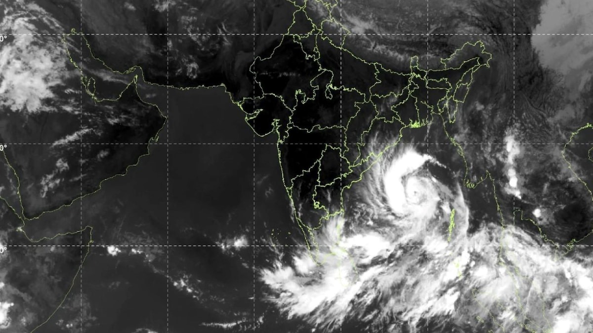 Cyclone Arnab: Who gave the name and how Andhra, Odisha governments are preparing for it
Cyclone Arnab intensified over the Bay of Bengal on October 26, with the India Meteorological Department (IMD) forecasting that the storm will move towards the Andhra Pradesh coast and could make landfall on October 28…
-
 Connecticut's Halloween forecast is taking shape. Here's what to expect
The National Weather Service has put out a forecast for the morning and afternoon of Halloween, with the holiday a little less than a week away. As of Sunday, the NWS shows the forecast for Oct. 31 in Connecticut as…
-
 Cyclone Arnab: Origin Of The Name And What You Need To Know
Cyclones can bring strong winds, heavy rainfall and flooding, making it important for states in their expected path to prepare in advance. As Cyclone Arnab approaches the eastern coast of India, Odisha and Andhra…
-
 UAE weather tomorrow: Rains likely; Abu Dhabi, Dubai temperatures to hit 36ºC
Sun, Oct 25, 2026 | Jumada al-Awwal 13, 1448 | Fajr 05:04|DXB 31.2°C Residents in the UAE can expect rainfall in some areas of the country on Monday, October 26, according to National Centre of Meteorology (NCM). The…
-
 Orlando weather: Strong Winds, scattered showers to conclude the weekend
Rain chances peak around 50–60% along the coast and hover around 30–40% across interior corridors. While individual showers will be moving fast, repeated bands could produce localized pockets of heavy downpours. Dew…
-
 First Alert Weather: Local nor’easter continues with strong winds and a few showers today
Here's what the First Alert Weather Team said you can expect for the forecast: RIGHT NOW: It's a dry and warmer start to Sunday with a few showers over the Atlantic and temperatures in the mid to upper 60s. There will…
-
 Beautiful weather for Panthers as dry conditions continue into next week
(PINPOINT WEATHER) -- Good evening and happy Saturday! It was yet another beautiful day across the Carolinas with more of the same ahead for Sunday. Next week looks to bring more sunny and beautiful weather for the…
-
 Gorgeous fall weather in NC, Oct. 24 update
A dry weekend with slightly below normal morning lows and highs is on tap for the rest of the weekend. The Piedmont Triad becomes less gusty late Sunday as wind speeds begin to relax. Highs area milder to start the week…
Sun & moon
Nearby
- Rasht 44 km
- Bandar-e Anzalī 31 km
- Khalkhāl 57 km
- Şowme‘eh Sarā 21 km
- Hashtpar 47 km
- Fūman 26 km
- Khomām 48 km
- Reẕvānshahr 16 km
- Māsāl 5 km
- Sangar 57 km
- Asālem 39 km
- Kūcheşfahān 59 km
Forecasts, observations and alerts in the United States come from the National Weather Service (NOAA); radar from NOAA's Multi-Radar Multi-Sensor system; satellite imagery from NASA's Global Imagery Browse Services (GIBS) and NOAA's GOES satellites; the map from the U.S. Geological Survey's National Map; air quality from AirNow (EPA and its partners); hurricane information from the National Hurricane Center; climate normals and records from NOAA's Regional Climate Centers (ACIS). Forecasts outside the United States and the UV index: MET Norway (CC BY 4.0); observations outside the U.S.: airport reports via NOAA's Aviation Weather Center. Place names: GeoNames (CC BY 4.0). Data are copied on a schedule and may lag the sources; for warnings that affect your safety, follow your local National Weather Service office and emergency officials. Weather news is drawn from the 4Conservative index and reflects what the press published. Terms of use. How to use Weather