Install
Kildare, Leinster, Ireland Weather
Current conditions
Observed at Casement Arpt · 1 hr ago
Forecast
10-day-
Tuesday
Partly cloudy. High 13°. Precipitation 2.7 mm for the day.
-
Tuesday Night
Heavy rain. Low 10°. Precipitation 2.7 mm for the day.
-
Wednesday
Light rain. High 11°. Precipitation 8.2 mm for the day.
MET Norway forecast updated 2 hrs ago.
Hourly
Hourly forecast- Now13°
- 14:0013°
- 15:0013°
- 16:0013°
- 17:0012°
- 18:0011°
- 19:0010°
- 20:0010°
- 21:0010°0.4
- 22:0010°0.9
- 23:0010°1.3
- Wed00:0010°1.5
- 01:0010°1.8
- 02:009°1.0
- 03:007°1.3
- 04:007°1.3
- 05:007°0.6
- 06:007°
- 07:006°
- 08:006°
- 09:007°
- 10:007°
- 11:008°
- 12:009°
Daily forecast
DetailsRadar
Full mapWeather news in Ireland
More weather news- Weather Today
Weather Forecast and Conditions for Irish Town, Magalia, California - The Weather Channel | Weather.com The Weather Channel Irish Town, Magalia, California Irish Town Daily Forecast
-
 Ireland Weather: Storm Austen incoming as 'bomb cyclone' with hurricane force winds
The storm is rapidly developing Ireland is braced for severe gales, heavy rain, and localized flooding later this week as meteorologists track a rapidly developing weather system that threatens to become the first named…
-
 Orionid meteor shower to peak in UK skies this week
The Orionid meteor shower, which is capable of producing bright fireball meteors, is set to peak in UK skies this week. While it has been active for most of October, the celestial spectacle will be at its best in the…
-
 Weather outlook for Northern Ireland as clocks set to go back and Halloween break looming
And with the clocks going back one hour on Sunday, and an extra hour in bed if you're lucky, we can expect temperatures to stay at a tolerable 12C with lows of 4C thanks to little cloud cover on Monday and early…
-
 Expect sunny, breezy Tuesday in Piedmont Triad
(WGHP) -- A quiet and seasonable week ahead as high pressure dominates the skies over the Piedmont Triad. A light north-northeast wind continues on Tuesday, and afternoon high temperatures reach the low 70s. Sunshine…
-
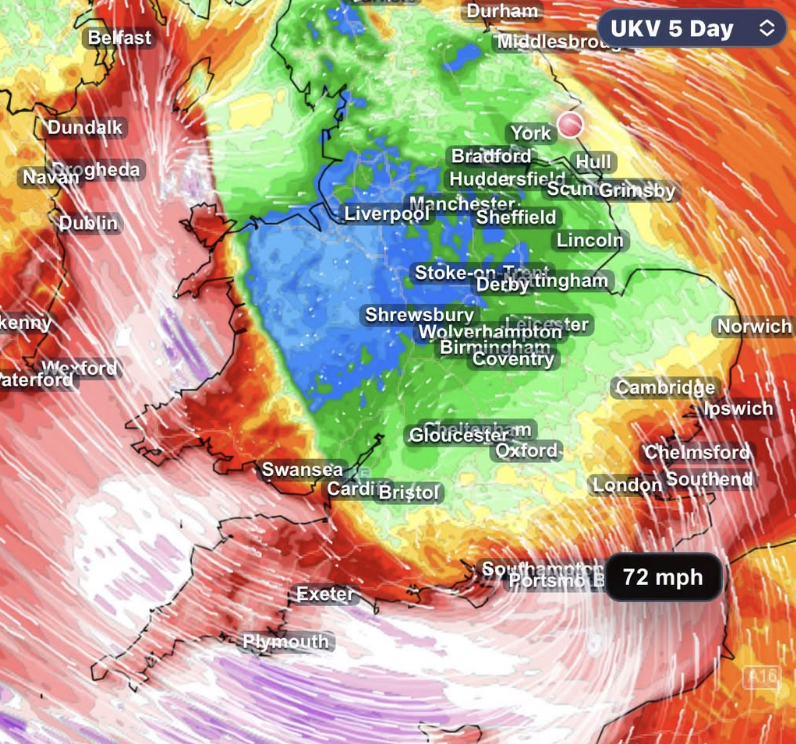 STORM AHEAD Atlantic storm threat grows as southern UK faces risk of damaging winds
Forecasters are closely monitoring a developing Atlantic low which could bring damaging winds and heavy rain to southern parts of the UK late on Thursday and into Friday. The latest forecast guidance continues to show…
-
 Exact date Storm Austen will hit UK with 70mph winds as Brits urged to secure bins, trampolines and garden furniture
BRITS are bracing for heavy rain and 70mph gusts as stormy conditions look set to sweep across the UK this week. The Met Office has issued a yellow wind warning covering 38 areas of England and Wales for Friday. Here’s…
-
 Met Office names 45 areas facing heavy rain on Tuesday as maps turn blue - full list
The Met Office's weather forecast for the week reads: "Through Monday showers in southwestern England and southern Wales will clear westwards, with further showers moving northwards across northern England and into…
-
 Ireland weather: Expert pinpoints exact day first named storm of season could batter country
A big storm is headed towards Ireland(Image: Getty) Ireland could see the first named storm of the 2026/2027 season later this week, with some weather models predicting that heavy rainfall and powerful gusts will batter…
-
 Ireland weather: 'Deepening' storm timeline and path after 'extreme' forecast
Heavy rain is being forecast(Image: WX Charts) There is growing consensus among leading weather models and experts over a powerful storm that's set to hit Ireland later this week. This powerful storm looks set to strike…
Sun & moon
Nearby
- Dublin 48 km
- Tallaght 39 km
- Swords 57 km
- Navan 57 km
- Bray 55 km
- Dún Laoghaire 54 km
- Carlow 35 km
- Portlaoise 29 km
- Droichead Nua 8 km
- An Muileann gCearr 50 km
- Sandyford 48 km
- Greystones 57 km
Forecasts, observations and alerts in the United States come from the National Weather Service (NOAA); radar from NOAA's Multi-Radar Multi-Sensor system; satellite imagery from NASA's Global Imagery Browse Services (GIBS) and NOAA's GOES satellites; the map from the U.S. Geological Survey's National Map; air quality from AirNow (EPA and its partners); hurricane information from the National Hurricane Center; climate normals and records from NOAA's Regional Climate Centers (ACIS). Forecasts outside the United States and the UV index: MET Norway (CC BY 4.0); observations outside the U.S.: airport reports via NOAA's Aviation Weather Center. Place names: GeoNames (CC BY 4.0). Data are copied on a schedule and may lag the sources; for warnings that affect your safety, follow your local National Weather Service office and emergency officials. Weather news is drawn from the 4Conservative index and reflects what the press published. Terms of use.