Install
St Austell, England, United Kingdom Weather
Current conditions
Forecast for this hour (no station report in the last two hours)
Forecast
10-day-
Saturday
Heavy rain. High 15°. Precipitation 25.7 mm for the day.
-
Saturday Night
Heavy rain. Low 11°. Precipitation 25.7 mm for the day.
-
Sunday
Cloudy. High 13°. Precipitation 0.5 mm for the day.
MET Norway forecast updated 13 hrs ago.
Hourly
Hourly forecast- Now12°
- 01:0011°
- 02:0011°
- 03:0011°
- 04:0011°
- 05:0011°
- 06:0012°0.3
- 07:0011°0.8
- 08:0011°1.2
- 09:0012°1.4
- 10:0012°1.2
- 11:0013°1.0
- 12:0013°3.3
- 13:0013°3.5
- 14:0014°2.4
- 15:0014°2.1
- 16:0015°0.4
- 17:0015°
- 18:0015°
- 19:0015°2.2
- 20:0015°4.1
- 21:0015°0.9
- 22:0013°0.5
- 23:0012°0.3
Daily forecast
DetailsRadar
Full mapWeather news near St Austell
More weather news-
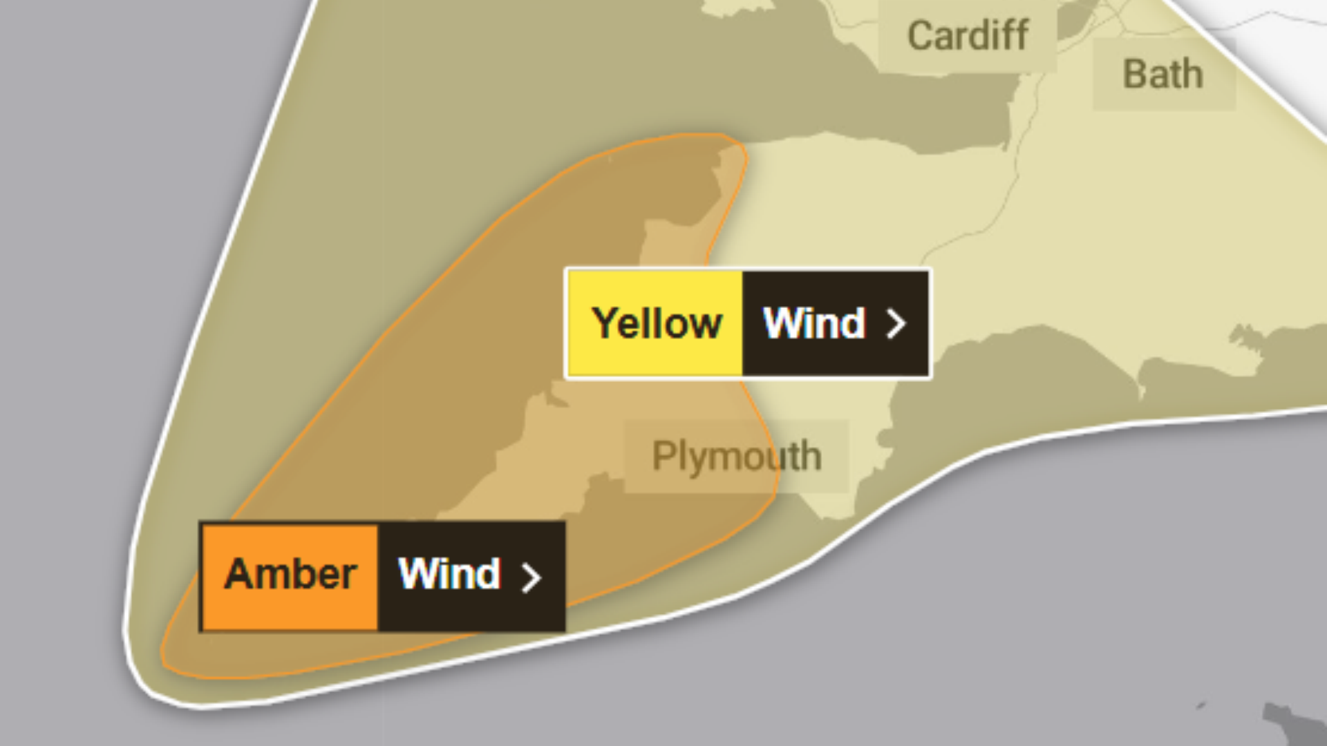 Storm Austen: Met Office upgrades Cornwall weather warning amid fears of disruption
Wednesday, 21 October 2026 at 10:48 The Met Office has upgraded its weather warning for Cornwall from yellow to amber ahead of the arrival of Storm Austen on Friday. Earlier this week, forecasters issued a yellow…
-
 Storm Austen Amber Alert Puts UK Travel on High Alert
Storm Austen is forecast to bring 80mph gusts, heavy rain and widespread disruption across southern UK, with rail, road, air and ferry travel already being adjusted. Storm Austen, the first named storm of the 2026–27…
-
 Cornwall trains cancelled as Storm Austen approaches
Trains on the main line to Cornwall have been cancelled as a storm approaches the region. CrossCountry trains have made some planned amendments to their services in the South West between Thursday and Saturday…
-
 Storm Austen: Travel disruption warning issued for Berkshire
Storm Austen is set to bring travel disruption as strong winds sweep across the region on Friday. A yellow weather warning for wind covers Reading, West Berkshire, Buckinghamshire and surrounding areas, with gusts of…
-
 Met Office Issues Amber Warning as Storm Austen Brings 80mph Winds to the UK
The Met Office has issued an amber wind warning for southwest England as Storm Austen approaches, threatening 80mph gusts and widespread disruption. The United Kingdom is bracing for severe weather disruption as the Met…
-
 Two storms in two days as Austen and Boelo target UK
The Met Office have named a new storm, Boelo, which is set to bring another round of stormy weather to the UK over the weekend. Amber wind warnings have been issued by the Met Office with gusts expected to reach…
-
 UK weather live: Storm Austen warnings for 108 areas before Boelo brings 80mph winds
Brits are being warned of travel disruption, power cuts and potentially damaging winds as the first warnings for Storm Austen come into force this evening. A yellow wind warning covering south-west England, the south…
-
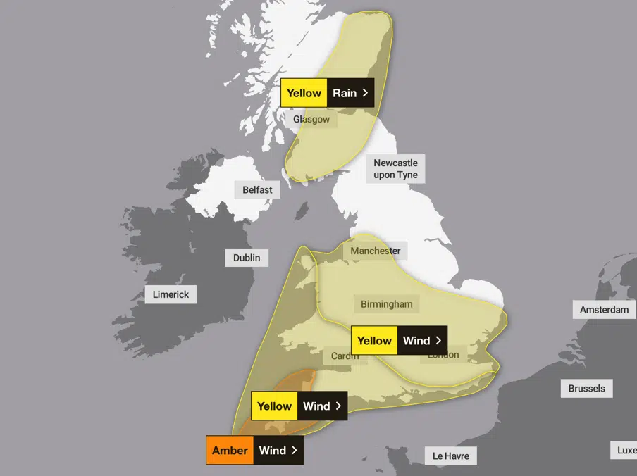 Storm Austen brings amber wind warning for south-west England
An amber wind warning runs from 03:00 to 10:00 BST on Friday 23 October, with gusts around 80mph possible on exposed headlands. An amber wind warning for Storm Austen has put parts of south-west England on notice for…
-
 Become an Independent member to bookmark this article
UK weather forecast for 20 October UK weather: Storm Austen to bring 80mph winds as weather warnings issued - Storm Austen, the first named storm of the season, is forecast to bring severe winds of up to 80mph alongside…
-
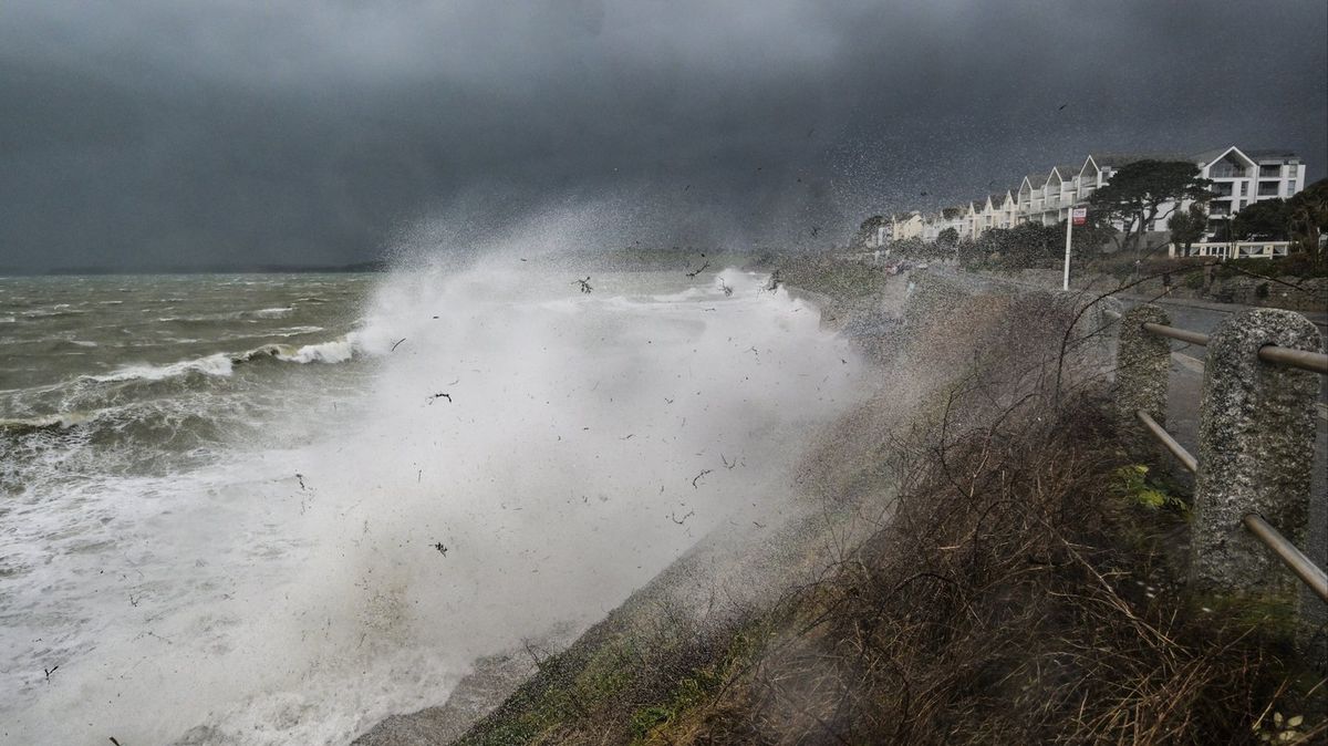 Storm Austen to hit UK within hours as Met Office issues amber warning over 'danger to life'
The Met Office has warned that Storm Austen could cause serious disruption when it hits the UK tonight Amber and yellow weather warnings are in place for parts of the UK as Storm Austen is set to hit. The storm is the…
Sun & moon
Nearby
Forecasts, observations and alerts in the United States come from the National Weather Service (NOAA); radar from NOAA's Multi-Radar Multi-Sensor system; satellite imagery from NASA's Global Imagery Browse Services (GIBS) and NOAA's GOES satellites; the map from the U.S. Geological Survey's National Map; air quality from AirNow (EPA and its partners); hurricane information from the National Hurricane Center; climate normals and records from NOAA's Regional Climate Centers (ACIS). Forecasts outside the United States and the UV index: MET Norway (CC BY 4.0); observations outside the U.S.: airport reports via NOAA's Aviation Weather Center. Place names: GeoNames (CC BY 4.0). Data are copied on a schedule and may lag the sources; for warnings that affect your safety, follow your local National Weather Service office and emergency officials. Weather news is drawn from the 4Conservative index and reflects what the press published. Terms of use.