Install
Cwmbran, Wales, United Kingdom Weather
Current conditions
Forecast for this hour (no station report in the last two hours)
Forecast
10-day-
Saturday
Heavy rain. High 14°. Precipitation 31.3 mm for the day.
-
Saturday Night
Heavy rain. Low 6°. Precipitation 31.3 mm for the day.
-
Sunday
Mostly sunny. High 11°.
MET Norway forecast updated 1 day ago.
Hourly
Hourly forecast- Now12°3.5
- 17:0013°2.7
- 18:0014°2.5
- 19:0014°1.7
- 20:0014°1.3
- 21:0010°0.4
- 22:0010°
- 23:0010°
- Sun00:0010°
- 01:0010°
- 01:0010°
- 02:009°
- 03:009°
- 04:009°
- 05:009°
- 06:008°
- 07:008°
- 08:009°
- 09:0010°
- 10:0011°
- 11:0011°
- 12:0011°
- 13:0011°
- 14:0011°
Daily forecast
DetailsRadar
Full mapWeather news near Cwmbran
More weather news-
 Cardiff weather today: Sunny intervals with a high of 14°C, 30% chance of rain
Cardiff, 22 October 2026. Residents can expect a day marked by sunny intervals, with temperatures reaching a high of 14°C and dipping to a low of 10°C. Cardiff, 22 October 2026 Residents can expect a day marked by sunny…
-
 Bristol weather forecast for October 22, 2026: Expect heavy rain and strong winds
Bristol, October 22, 2026. Heavy rain is the most significant weather event today, with the city anticipating a wet and gloomy day. Bristol, October 22, 2026 Heavy rain is the most significant weather event today, with…
-
 Heavy Rain and Flood Risks for Bristol Today
Home » Trending » Heavy Rain and Flood Risks for Bristol Today Bristol is set to experience a challenging weather day as heavy rainfall is predicted, with a staggering 95% chance of precipitation. Today’s temperatures…
-
 Cornwall trains cancelled as Storm Austen approaches
Trains on the main line to Cornwall have been cancelled as a storm approaches the region. CrossCountry trains have made some planned amendments to their services in the South West between Thursday and Saturday…
-
 Storm Austen: Full List of UK Areas Under Amber and Yellow Weather Warnings
Storm Austen is expected to bring strong winds and heavy rain to parts of the UK on Friday, with the Met Office issuing an amber wind warning for Cornwall, the Isles of Scilly and parts of West Devon. Yellow warnings…
-
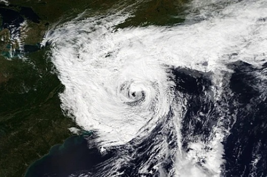 Deadly nor’easter dumps several inches of rain, strong winds in Massachusetts, Rhode Island and we aren’t done
A deadly slow-moving September nor’easter dumped several inches of rain on Fall River and the rest of southeastern Massachusetts over the weekend, according to the National Weather Service in Boston/Norton, while the…
-
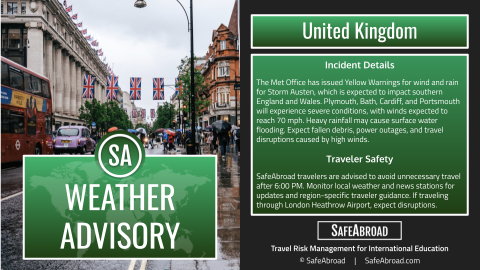 Storm Austen will produce heavy rainfall and strong winds from October 22-23 across the United Kingdom; expect travel delays.
SafeAbroad Incident Details The Met Office has issued Yellow Warnings for wind and rain for Storm Austen, which is expected to impact southern England and Wales Plymouth, Bath, Cardiff, and Portsmouth will experience…
-
 Storm Austen to batter Wales coast with 70mph winds
Delays and cancellations to public transport are likely, the Met Office said Travel disruption and damage to buildings are expected when Storm Austen, the first named storm of the autumn, hits south Wales later this…
-
 Exact time Storm Austen will hit the South West as 24 hours of rain forecast
The South West is expected to be battered by heavy rain and strong winds as the first named storm of the autumn of 2026 rushes in from the Atlantic. The Met Office has issued a yellow weather warning for strong winds as…
-
 'I'm a DIY expert - make sure to check these 5 things before turning on your heating'
Have you put your heating on yet? While many people will have already turned their central heating back on after the record heat of this summer, others will insist it's not cold enough yet. The Met Office says homes…
Sun & moon
Nearby
Forecasts, observations and alerts in the United States come from the National Weather Service (NOAA); radar from NOAA's Multi-Radar Multi-Sensor system; satellite imagery from NASA's Global Imagery Browse Services (GIBS) and NOAA's GOES satellites; the map from the U.S. Geological Survey's National Map; air quality from AirNow (EPA and its partners); hurricane information from the National Hurricane Center; climate normals and records from NOAA's Regional Climate Centers (ACIS). Forecasts outside the United States and the UV index: MET Norway (CC BY 4.0); observations outside the U.S.: airport reports via NOAA's Aviation Weather Center. Place names: GeoNames (CC BY 4.0). Data are copied on a schedule and may lag the sources; for warnings that affect your safety, follow your local National Weather Service office and emergency officials. Weather news is drawn from the 4Conservative index and reflects what the press published. Terms of use.