Install
Gray, Bourgogne-Franche-Comté, France Weather
Current conditions
Forecast for this hour (no station report in the last two hours)
Forecast
10-day-
Wednesday
Heavy rain. High 11°. Precipitation 6.6 mm for the day.
-
Wednesday Night
Heavy showers. Low 7°. Precipitation 6.6 mm for the day.
-
Thursday
Cloudy. High 14°.
MET Norway forecast updated 18 hrs ago.
Hourly
Hourly forecast- Now9°0.6
- 20:008°
- 21:008°
- 22:007°
- 23:007°
- Thu00:007°
- 01:006°
- 02:006°
- 03:006°
- 04:006°
- 05:006°
- 06:006°
- 07:006°
- 08:006°
- 09:006°
- 10:008°
- 11:009°
- 12:0011°
- 13:0013°
- 14:0013°
- 15:0013°
- 16:0014°
- 17:0013°
- 18:0013°
Daily forecast
DetailsRadar
Full mapWeather news near Gray
More weather news-
 A gray and calm Monday starts your Inland NW work week
KXLY.com Local news coverage from KXLY+ Your Monday will be cloudy and fall like for the Spokane region Clouds will roll in for your Spokane Monday with calm conditions throughout A gray and calm Monday starts your…
-
 😶🌫️Gray Monday starts a quiet week before rain and colder air arrive in the Spokane region- Jason
KXLY.com Local news coverage from KXLY+ Your Monday will be cloudy and fall like for the Spokane region Clouds will roll in for your Spokane Monday with calm conditions throughout A gray and calm Monday starts your…
-
 Leeds weather forecast: sunny intervals with a chance of rain today, October 18, 2026
The Times of India Leeds, October 18, 2026 - Today, residents of Leeds can expect a day characterized by sunny intervals, bringing some much-needed brightness after a spell of gray weather The maximum temperature is…
- Honolulu Weather Forecast For A Breezy, Showery Weekend
Honolulu is starting Saturday mostly clear and warm, with temperatures near 78 degrees at the airport. The city should reach about 85 degrees, though isolated rain showers and brisk east-northeast winds will keep the…
-
 Tokyo spent 35 days “drowning” in rain and NASA satellites watched every drop fall over Japan
For 35 days straight, Tokyo woke up to rain. From the final days of August through the last week of September 2026, the sky over central Japan simply refused to clear — a gray, unbroken stretch that turned the season’s…
-
 DC-area forecast: A few morning raindrops and a cool, breezy start to the weekend
Always a human at the helm: Updated around-the-clock by Capital Weather meteorologists. Happening now: Lingering light showers are possible this morning before partly cloudy skies return midday and into the afternoon…
- Capital Weather Live
Always a human at the helm: Updated around-the-clock by Capital Weather meteorologists. Happening now: Lingering light showers are possible this morning before partly cloudy skies return midday and into the afternoon…
-
 What the clouds can tell you about the forecast
The foundation of Earth's water cycle, which can help drive both short-term weather and long-term climate patterns, is clouds. Clouds form when water vapor rises into the atmosphere, cools and eventually condenses into…
-
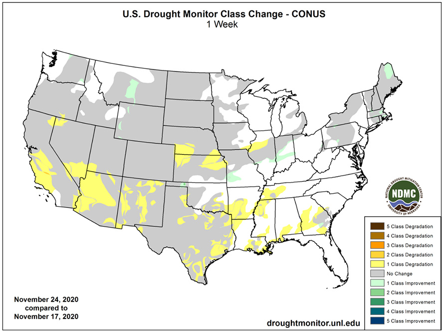 U.S. Drought Monitor Change Map
The U.S. Drought Monitor (USDM) is a map that is updated each Thursday to show the location and intensity of drought across the country using a five-category system, from Abnormally Dry (D0) conditions to Exceptional…
-
 Drought, heat wave leaves Mount Hood barren by early fall
On Oct. 8, 2026, the Palmer Snowfield below the Palmer Express chairlift was almost completely bare. Timber Lodge had to close the lift on July 19, its earliest closing day. Cameron Nielsen / OPB A towering white Mount…
Sun & moon
Nearby
Forecasts, observations and alerts in the United States come from the National Weather Service (NOAA); radar from NOAA's Multi-Radar Multi-Sensor system; satellite imagery from NASA's Global Imagery Browse Services (GIBS) and NOAA's GOES satellites; the map from the U.S. Geological Survey's National Map; air quality from AirNow (EPA and its partners); hurricane information from the National Hurricane Center; climate normals and records from NOAA's Regional Climate Centers (ACIS). Forecasts outside the United States and the UV index: MET Norway (CC BY 4.0); observations outside the U.S.: airport reports via NOAA's Aviation Weather Center. Place names: GeoNames (CC BY 4.0). Data are copied on a schedule and may lag the sources; for warnings that affect your safety, follow your local National Weather Service office and emergency officials. Weather news is drawn from the 4Conservative index and reflects what the press published. Terms of use.