Install
Santa Cruz de Tenerife, Canary Islands, Spain Weather
Current conditions
Forecast for this hour (no station report in the last two hours)
Forecast
10-day-
Monday
Light showers. High 28°. Precipitation 1.0 mm for the day.
-
Monday Night
Rain. Low 22°. Precipitation 1.0 mm for the day.
-
Tuesday
Cloudy. High 25°.
MET Norway forecast updated 1 day ago.
Hourly
Hourly forecast- Now23°
- 20:0022°
- 21:0022°
- 22:0022°
- 23:0022°
- Tue00:0022°
- 01:0022°
- 02:0022°
- 03:0022°
- 04:0022°
- 05:0022°
- 06:0021°
- 07:0022°
- 08:0022°
- 09:0023°
- 10:0024°
- 11:0024°
- 12:0024°
- 13:0024°
- 14:0025°
- 15:0024°
- 16:0024°
- 17:0023°
- 18:0023°
Daily forecast
DetailsRadar
Full mapWeather news near Santa Cruz de Tenerife
More weather news-
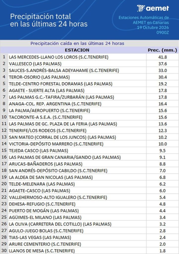 Rainfall in the Canary Islands: Aemet Records Over 40 Litres in 24 Hours
Heavy rainfall in the Canary Islands over the past 24 hours has led to accumulations exceeding 40 litres per square metre in various locations. According to the State Meteorological Agency (Aemet), the highest total was…
-
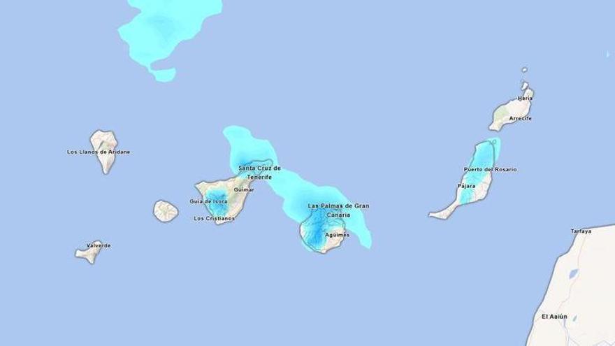 Will it rain this Sunday in Tenerife? Aemet forecasts persistent afternoon rainfall.
Tenerife is set to experience a cloudy day on Sunday, with occasional light rain expected. According to the State Meteorological Agency (Aemet), the weather may shift in the afternoon, particularly in the northern…
-
 Change in the weather in the Canary Islands: Aemet forecasts cooler temperatures and some rain
Weather conditions in the Canary Islands will begin to change this Saturday, 17 October, as the calima gradually weakens and temperatures fall across much of the archipelago. According to the State Meteorological Agency…
-
 Aemet announces the return of calima to the Canary Islands: areas affected
Calima will return to the Canary Islands this Thursday, 15 October, accompanied by a rise in temperatures that will be most noticeable in inland and mid-altitude areas, according to the State Meteorological Agency…
-
 Spain’s DGT urges drivers to check dashboard brightness as clocks go back
Spain’s DGT shares driving advice ahead of darker evenings. Credit : revista.dgt.es Drivers in Spain are being urged to check their dashboard brightness as the clocks go back this weekend, with the DGT warning that…
-
 El Niño winter forecast: a region-by-region guide to wetter, drier and milder odds
This El Niño winter forecast guide breaks down how the Pacific warming pattern tends to shift rain, snow and temperatures across U.S. and Canadian regions A shift of half a degree Celsius in the surface waters of the…
-
 It’s a bit windy out at Edinburgh Airport
Storm Boelo has taken its toll on transport all weekend, and heavy winds are expected to continue until 9pm on Sunday evening. Out at Edinburgh Airport there are cancellations and delays on many routes, with one Ryanair…
-
 Did the clocks change last night?
IF your night felt unusually long and you were surprised it was light when you got out of bed, you may not be keeping track of the time. British Summer Time (BST) has ended and Greenwich Mean Time (GMT) is here until…
-
 How and why do we name storms?
The UK is braced for its second storm of the season just more than 24 hours after the first passed. Here is everything you need to know about why storms are named and how a name is chosen. – Why do we name storms? In…
-
 This Spanish TV reporter got a bit too close to the extreme weather and it’s a salutary lesson for us all
Poke Reporter. Updated October 23rd, 2026 It’s getting stormy out there, not just in the UK but across Europe and in this particular instance Spain. It’s a weather reporter who went out to the coast in Ondarroa…
Sun & moon
Nearby
- La Laguna 7 km
- Arona 59 km
- La Orotava 28 km
- Granadilla de Abona 50 km
- Los Realejos 33 km
- Realejo Alto 34 km
- Puerto de la Cruz 30 km
- Candelaria 17 km
- Icod de los Vinos 46 km
- Tacoronte 15 km
- Guía de Isora 59 km
- San Isidro 53 km
Forecasts, observations and alerts in the United States come from the National Weather Service (NOAA); radar from NOAA's Multi-Radar Multi-Sensor system; satellite imagery from NASA's Global Imagery Browse Services (GIBS) and NOAA's GOES satellites; the map from the U.S. Geological Survey's National Map; air quality from AirNow (EPA and its partners); hurricane information from the National Hurricane Center; climate normals and records from NOAA's Regional Climate Centers (ACIS). Forecasts outside the United States and the UV index: MET Norway (CC BY 4.0); observations outside the U.S.: airport reports via NOAA's Aviation Weather Center. Place names: GeoNames (CC BY 4.0). Data are copied on a schedule and may lag the sources; for warnings that affect your safety, follow your local National Weather Service office and emergency officials. Weather news is drawn from the 4Conservative index and reflects what the press published. Terms of use. How to use Weather