Install
Granollers, Catalonia, Spain Weather
Current conditions
Observed at Sabadell Arpt · 1 hr ago
Forecast
10-day-
Tuesday
Showers. High 19°. Precipitation 1.6 mm for the day.
-
Tuesday Night
Light showers. Low 13°. Precipitation 1.6 mm for the day.
-
Wednesday
Partly cloudy. High 20°.
MET Norway forecast updated 5 hrs ago.
Hourly
Hourly forecast- Now15°0.4
- 20:0014°
- 21:0014°
- 22:0013°
- 23:0013°
- Wed00:0012°
- 01:0011°
- 02:0011°
- 03:0011°
- 04:0012°
- 05:0011°
- 06:0011°
- 07:0011°
- 08:0011°
- 09:0011°
- 10:0013°
- 11:0015°
- 12:0017°
- 13:0019°
- 14:0020°
- 15:0020°
- 16:0020°
- 17:0019°
- 18:0017°
10-day forecast
DetailsRadar
Full mapWeather news in Spain
More weather news-
 Clocks go back on 25 October, giving Spain an extra hour of sleep
The change is set out in the Official State Gazette (BOE), which confirms 25 October as the official end date for this year’s summer time period, happening “at three in the morning (two in the morning in the Canary…
-
 Canary Islands on alert for a cold low-pressure system: Aemet extends rain warnings
The Canary Islands are experiencing another day of unstable weather this Tuesday, 20 October, with yellow rain warnings in place for La Palma and El Hierro as a mass of humid, unstable air moves across the archipelago…
-
 Mainly Sunny Days Ahead: Dry Pattern Holds Through the Week | October 19, 2026
High temperatures this week will be in the 70s and 80s, generally near or slightly above normal for mid-to-late October. No rain is expected in East Texas through the end of the week. Sunny to mostly sunny skies are in…
-
 Mainly sunny days ahead, dry pattern holds through the week
High temperatures this week will be in the 70s and 80s, generally near or slightly above normal for mid-to-late October. No rain is expected in East Texas through the end of the week. Sunny to mostly sunny skies are in…
-
 Weather alert: Rain, lightning, hail, and storms in Moldova
Meteorologists issued a Yellow Code for Atmospheric Instability for Wednesday, August 6. The warning is in effect for the northern and central regions of the Republic of Moldova. Heavy rainfall, lightning, hail, and…
-
 Moldova Braces for Cold Snap & Heavy Rain
Moldovan temperatures will reach a maximum of 11 degrees Celsius (51.8 degrees Fahrenheit) on Thursday, April 18, according to meteorologists. Nighttime lows will dip down to 4 degrees Celsius (39.2 degrees Fahrenheit)…
-
 Moldova issues nationwide yellow alert for heavy rainfall
Moldova’s weather authorities issued a nationwide yellow warning on Sunday, forecasting heavy rainfall across the country with accumulations reaching up to 49 liters per square meter. Twenty-four hour weather warning…
-
 Hurricane Trudy approaches Mexico’s Pacific coast
Three Mexican states are expecting up to 200 mm of rain, with some areas seeing up to 300 mm. Forecasters warn of dangerous flooding and landslides. According to the U.S. National Hurricane Center, Hurricane Trudy has…
- UAE advises Emiratis in Spain to stay vigilant of approaching weather system 'Adam'
Gulf Today UAE advises Emiratis in Spain to stay vigilant of approaching weather system 'Adam' Gulf Today, Staff Reporter The UAE mission in Madrid advises UAE citizens presently in Spain to be cautious and stay alert…
-
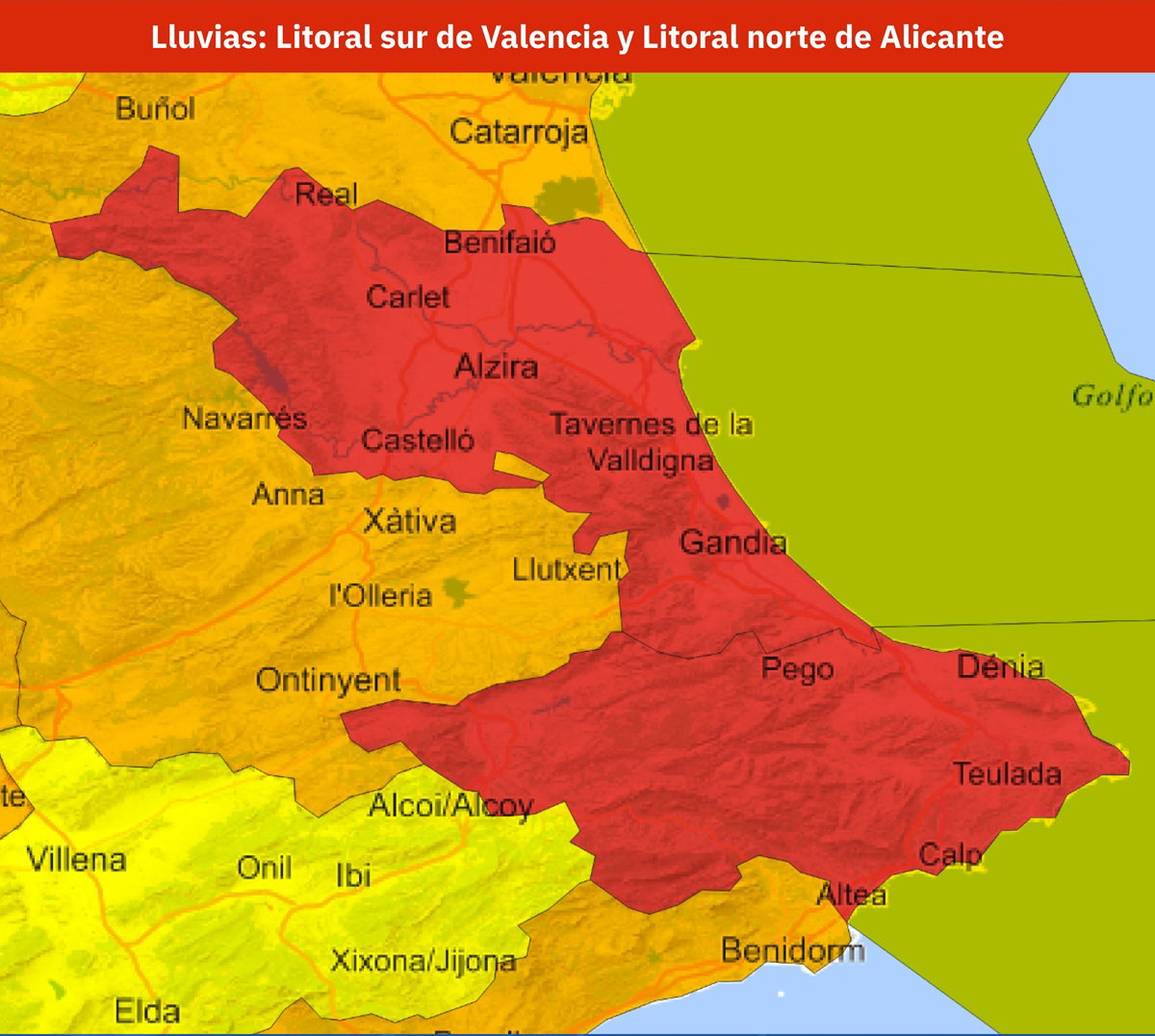 Spain issues red weather alert as up to 300mm of rain threatens Valencia and Alicante
AEMET has issued a red weather alert for parts of Valencia and Alicante, with rainfall potentially reaching 300mm in 24 hours. Credit: X- AEMET The warning is for the southern coast of Valencia province and the north…
Sun & moon
Nearby
- Barcelona 27 km
- L'Hospitalet de Llobregat 32 km
- Terrassa 23 km
- Badalona 18 km
- Sabadell 16 km
- Mataró 15 km
- Santa Coloma de Gramenet 19 km
- Cornellà de Llobregat 33 km
- Sant Boi de Llobregat 36 km
- Sant Cugat del Vallès 23 km
- Manresa 41 km
- Rubí 25 km
Forecasts, observations and alerts in the United States come from the National Weather Service (NOAA); radar from NOAA's Multi-Radar Multi-Sensor system; satellite imagery from NASA's Global Imagery Browse Services (GIBS) and NOAA's GOES satellites; the map from the U.S. Geological Survey's National Map; air quality from AirNow (EPA and its partners); hurricane information from the National Hurricane Center; climate normals and records from NOAA's Regional Climate Centers (ACIS). Forecasts outside the United States and the UV index: MET Norway (CC BY 4.0); observations outside the U.S.: airport reports via NOAA's Aviation Weather Center. Place names: GeoNames (CC BY 4.0). Data are copied on a schedule and may lag the sources; for warnings that affect your safety, follow your local National Weather Service office and emergency officials. Weather news is drawn from the 4Conservative index and reflects what the press published. Terms of use.